Ellen’s Walk For Reconciliation
The following notes were provided via the EventBrite site to all pre-registered Walk participants on 15 July 2018. They are being made available more widely post the event to those interested who were not able to participate, or who registered on the day.
NAIDOC Week Public Walk: Mount Franklin to Clarke’s Pool, Franklinford
Presented by the Shire of Hepburn, the Dja Dja Wurrung Clans Aboriginal Corporation & Great Dividing Trail Association, Sun 15 July 2018, 9am-2.30pm
Acknowledgement
We acknowledge the people of the Dja Dja Wurrung Nation whose traditional lands we walk on, including their elders past and present.
Welcome!
Thank you for joining this 2018 NAIDOC Week event, Ellen’s Walk for Reconciliation. The NAIDOC theme for 2018 is “Because of her we can’, celebrating the invaluable contributions that Aboriginal and Torres Strait Islander women (including Ellen) have made – and continue to make – to our communities, our families, our rich history and to our nation. In 2018 we are focusing on reconciliation in the Hepburn Shire, including the role of the former Loddon Aboriginal Protectorate originally based in the area around present day Franklinford.
Rationale
This and other Hepburn Shire RAP (Reconciliation Action Program) activities aim to lead to a better understanding of, and reconciliation between the Dja Dja Wurrung Aboriginal Nation and other Aboriginal and Torres Strait Islander Australians who now live in and beyond the footprint of the current Hepburn Shire.
While this walk concentrates on many confronting things that happened locally in the three tumultuous decades following first contact with Major Mitchell in 1836, it acknowledges and celebrates that around 2,000 Dja Dja Wurrung descendants have survived and are also keen to share and learn about our shared history.
Sincere thanks to:
- Hepburn Shire Council, staff, Community RAP Committee & Coordinators.
- Uncle Ricky Nelson for the traditional Welcome to Country.
- Dja Dja Wurrung Clans Aboriginal Corporation
- Great Dividing Trail Association and members.
- Parks Victoria
- all others who have contributed or volunteered in any capacity.
Registration
All walkers must be registered at the start and wear the participant identification provided. The $5 donation requested goes towards the cost of the walk organization: half goes as a donation to the Dja Dja Wurrung Clans Aboriginal Corporation.
Approximate Walk Schedule (# explanation points: themes)
- Before 9.15am: Registration in the crater, Mt Franklin Reserve.
- 15am: ‘Welcome to Country’ in the Crater by Uncle Ricky Nelson.
- 30am: Brief Welcome by Shire Mayor, John Cottrell, and short safety briefing before the walk to #1 Top of Mount Franklin: Country and People pre-1836 Optional: if you want to avoid a steep climb … but miss the explanation and great views!).
- 00am: walk down along the crater rim road (View towards Kooroocheang # 2: Early Squatting and initial Protectorate at Nerreman 1838-1841), then out of the crater.
- 30am: Cross Midland Highway: TAKE EXTREME CARE.
- 00am: top of Carroll’s Lane # 3 Loddon Protectorate story 1841-49.
- 30am: Morning tea, Carroll’s Lane.
- 00 midday: Old Mill Stream on Hepburn Franklinford Road: # 4 Protectorate Era Flour Mill.
- 30am: # 5 Aboriginal School, Ellen’s story, closure and removal to Coranderrk (previous Protectorate Main Site) South Street, Franklinford.
- 00pm Franklinford Cemetery # 6 Original Protectorate Cemetery.
- 30pm: walk past the original ‘Franklin Ford’ to BYO lunch at Clarke’s Pool Franklinford Streamside Reserve.
- From 2.00-3.00pm: Transport provided for drivers only back to cars at the crater (two trips), who will return to Clarke’s Pool for any passengers: we suggest via Powell Connection (bitumen) Road.
Toilets
The toilets are few and limited to:
- at the start in the Mt Franklin crater
- a Portable Toilet provided approximately half way (near where we will have BYO morning tea) on Carroll’s Lane.
- the Franklinford Cemetery
- there are also trees in places along the way …
Safety
Once we depart the Mt Franklin Crater we are walking on or beside public roads. Please follow the instructions of Walk Marshalls (wearing bright vests). When on bitumen roads please keep to the LEFT side of the road, giving way to car and other traffic. The walkers will likely form into three groups: faster, medium, and slower). Take particular care and follow instructions when crossing the Midland Highway.
Take care walking on the loose surface of the scoria road down from Mt Franklin, and well as on steeper parts of Carroll’s Lane.
Where do we walk?
We walk 12km from the top of Lalgambook / Mount Franklin through important and fascinating parts of the former Loddon Aboriginal Protectorate (and later Aboriginal Station) 330 metres down hill to Clarkes Pool on the nearby Jim Crow Creek (see note p.10, below).
The intention is to enable local people to walk and learn the story of Dja Dja Wurrung people in the footprint of the current Shire of Hepburn in the three tumultuous decades following first contact with Major Mitchell in 1836.
Why do we walk here?
Mount Franklin (Lalgambook, also called Lalgam-burrk or Laldjam-burrp) is a remarkable volcanic crater close to the south end of Dja Dja Wurrung country. Its beauty, resources and surroundings have drawn people for thousands of generations. (A detailed history of Mt Franklin is provided below, pages 9-10).
Our walk from the crater along roadsides through the former Loddon Aboriginal Protectorate through present day Franklinford enables the story to be told of what happened in this landscape from the 1830s, including to Ellen, her family and also to the Dja Dja Wurrung peoples.
It is notable that we undertake this walk with some of the 2,500 Dja Dja Wurrung descendants who have survived to celebrate NAIDOC week and the ongoing important roles Aboriginal and Torres Strait Islander women play in Australia in 2018.
NOTES: The extra notes that follow (written by Barry Golding) are based on available written historical sources, with a brief Reference list at the end.
Who was Ellen?
Ellen was a Dja Dja Wurrung woman who was born at the Loddon Aboriginal Protectorate in 1849, the daughter of Yerrebulluk (Dicky) and Brebie (Eliza). She was taught to read, write and do needlework at the Aboriginal school.
When the Prince of Wales and Queen Victoria married in 1863 the Dja Dja Wurrung people sent the Queen two letters written by Ellen and a collar she had crocheted.
The Queen replied with her thanks, particularly asking Ellen to make it known to her people that she was concerned for their welfare. The Queen’s concern was warranted. Twenty-five years of contact with white people had already led, directly and indirectly, to the death of large numbers of the Dja Dja Wurrung people across central Victoria.
Ellen was removed, with six other Aboriginal children and five adults (including her mother, Eliza) when the Aboriginal Station at Franklinford closed, to the new reserve at Coranderrk, near present day Healesville, in April 1864. Ellen herself died in 1874 at the age of 35, following the deaths of her three children from tuberculosis.
Ellen’s life as well the lives of her parents is illustrative of many of the tumultuous changes that occurred to the Dja Dja Wurrung Nation and peoples in the three decades following first contact with Major Mitchell in 1836.
Walk participants will receive more information about the history of the area and the Protectorate at six scheduled stops during the walk.
The explanations at our stops along the way highlight:
- The way volcanoes and basalt flows shaped the local landscapes.
- The notion of ‘contact’.
- The local Dja Dja Wurrung Nation and Clans.
- The initial contact period and arrival of overlanders and squatters, 1838-1841.
- The Loddon Aboriginal Protectorate 1841-1849, and role of E. S. Parker.
- Post-Protectorate era, 1850-64
- Removal of most remaining people to Coranderrk, 1864
- Survival of Aboriginal Nations, the continuing legacy of successive Stolen Generations, Missions and Central Stations from 1865, Children’s Homes in Ballarat and Bendigo to the 1970s.
The volcanoes
The ‘Newer Volcanics’ erupted from over 100 eruption points including Mount Franklin crater as recently as half a million years locally.
- The basalt flows filled most large valleys (covering their gold bearing gravels).
- Soils developed on the basalt, systematically burnt and maintained as grasslands over millennia by Aboriginal people, since exploited for agriculture.
- Many of the eruption points like Mt Franklin are scoria cones or lava hills that form prominent features on the now cleared basalt plains.
- ‘Tuff rings’ form low relief hills on the volcanic plains, containing swamp deposits or lakes in the craters, with rich aquatic food resources.
- Wherever there is no basalt the rocks are very old tightly folded sedimentary shales and mudstones, weathering to very poor soils and generally unsuitable for agriculture (therefore still mostly forested).
- Granite peaks protrude through the bedrock to the north, including Mt Beckworth, Mt Tarrengower and Leanganook (Mt Alexander), and in the distance other peaks including Mt Kooyora. Again, the peaks are rocky and generally not suitable for agriculture.
‘Sovereignty … assumed over their Ancient Possessions’:
The Aboriginal Protectorate System
… which the North West Protectorate (1840-1849) and Loddon Aboriginal Station (1853-1864) in the Mount Franklin area formed part of …
- Was set up as a result of a British Parliament Select Committee Inquiry into the Condition of Aboriginal Peoples during 1837. Lord Glenelg, then Secretary of State was one of the chief initiators of schemes to protect the inhabitants of British colonies, and ordered that the protectorate be confined to the Port Phillip District (then part of NSW).
- The underlying basis of the Protectorate lay in the refusal of the British Government to recognize prior ownership of Australia by Aboriginal people. In effect Aboriginal people were regarded as being under British sovereignty from the outset (though with almost no legal or constitutional rights). The Protectorate system was a gratuitous offer of ‘protection to which they derive the highest possible claim from the sovereignty which has been assumed over their Ancient Possessions.’ [Glenelg to Bourke, 1837].
- The idea was hatched at a time of increased hostility and conflict between invading European settlers and the Aboriginal traditional owners. The instigation of the Protectorate was widely and sometimes savagely criticized by the popular press.
- Four Assistant Protectors were appointed in Britain in December 1837 (Thomas, Seivwright, Dredge and E. S. Parker). Edward Stone Parker had been a Wesleyan minister and teacher. None had any prior experience of Aboriginal people.
- The Chief Protector George Augustus Robinson, most recently from the Flinders Island Aboriginal Station, was appointed Chief Protector in Port Philip. He had played a pivotal role in the previous decade in ‘successfully’ coercing and removing Indigenous Tasmanians from several Nations to Flinders Island to be Christianised and civilized, and out of harm’s way from other recent invaders of their lands. The Protectorate system was a variation on the previous tragic theme.
- The stated aim of the Protectors was to ‘… watch over the rights and interest of the natives and endeavour to gain their respect and confidence … protect them from any encroachments on their property and from acts of cruelty, oppression and injustice’.
- The Assistant Protector’s specific brief was to attach themselves to the tribes of the District (in Parker’s case, the area about Mount Macedon ‘and the country to the northward’) until they could be persuaded to settle in one location. Once ‘settled’ they were to be taught European agricultural, technological, social and religious practices.
- It was assumed that the Assistant Protectors would learn Aboriginal language and customs but achieve their aims by moral and religious (Christian) instruction.
- All Assistant Protectors arrived in Sydney in August 1838 and in Melbourne in January 1839. Parker left Melbourne in August 1839 but proceeded only as far as Jackson’s Creek near Sunbury where he built a hut for his young family.
- By 1843 the Protectorate system was in disarray: hampered by colonial bureaucracy, a legal system that gave Indigenous people minimal rights and violent and often deadly hostility between squatters and Aborigines. It was, in part, Parker’s favourable reports on the Loddon River Protectorate Station in 1843 and also in 1845, which saved the Protectorate system, at least until a NSW Parliamentary Select Committee recommended its abolishment in 1849.
Temporary compensation for declaring terra nullius ….
Brief settlement at Neereman near present day Baringhup, and later selection of the ‘Jim Crow’ (= Mount Franklin) site
- Parker briefly occupied a site at Neereman (on the Loddon River downstream of Baringhup and upstream of O’Brien’s Crossing) from Nov 1840 to June 1841.
- Parker noted in 1840 that ‘I deem it my duty respectfully but firmly to assert the right of Aborigines to the soil and its indigenous productions, until suitable compensation be made for occupation by reserving and cultivating a sufficient portion for their maintenance’.
- Each Assistant Protector was to create an inner reserve of one square mile for cultivation purposes and a station, and an outer reserve of five miles in radius for ‘the hunting ground of the natives’, with no squatters stations and as far as possible from the major lines of communication’.
- In June 1840 Parker was asked to set up a proposed reserve on the Loddon River ‘near a hill called by the natives Tarrengower’.
- Though the site was already occupied and the reserve was disputed by squatters Dutton and Darlot, by February 1840 twelve permanent Aboriginal dwellings had been built at Neereman.
- For a range of reasons, including the Neereman’s perceived unsuitability for agriculture, a new site was decided on: ‘… an old sheep station of Mr Mollison’s called Jim Crow Hill’ (also anglicised to Jumcra. (Jim Crow was a derogatory term for African Americans. Mt Franklin was referred to as Jim Crow Hill by John Hepburn in his 1841 diaries, Lalgambook by the Dja Dja Wurrung people and Salus by Major Mitchell).
A brief history of the Protectorate at Franklinford:
Loddon Aboriginal Protectorate Station 1841-1849
- Located at Larnebarramul (‘House of the Emu’) near Lalgambook, later named Mount Franklin after the visit to the area of the former Governor of Tasmania, Sir John Franklin and Lady Franklin in December 1843).
- At the time of the Station’s establishment the land was owned by the Gunangara ginditj clan of the Dja Dja Wurrrung Aboriginal Nation, though occupied by Mollison, one of the invading squatters.
- The boundary of the reserve around the Protectorate Station was proclaimed by Governor Gipps in 1840. The original cemetery boundaries (now contained within the later Franklinford Cemetery) were surveyed by Howe in June 1848.
Post-1850
- ‘Following abolition of the Protectorate in 1849, Parker applied for and was granted a Pastoral License to the Protectorate Reserve under an arrangement with [Governor] La Trobe.’
- Parker was ‘… allowed to depasture his own stock and cultivate sections of the land for his own use and that of the Aboriginal School, subject to him giving ‘… employment, both pastoral and agricultural, as far as possible, to the Aboriginal natives.’
- By 1854 the Aboriginal Protectorate had been dissolved and all that remained were an enclosed paddock which continued to be used as an Aboriginal School (closed by the Central Board for the Protection of Aborigines in 1864, and the remaining four Aboriginal adults and six children moved to Coranderrk near present day Healesville), some of the outlying huts and a stockyard.
- The Township of Franklinford was subdivided in 1858-59. The other sections of the former Protectorate Reserve were increasingly taken up by miners’ rights and land sales during the 1850s.
- The Aboriginal people who were forcibly moved from Mt Franklin to Coranderrk in 1864 died within 12 years except Beernbannin who live until 1880. Alienation from their land and insanitary conditions at Corankerrk were among the major causes of death. Dja Dja Wurrung descendants have survived through the family of Thomas Dunolly (1856-1923) who was brought to Coranderrk from Mt Franklin in 1863.
- There are as many as 30 apical ancestors from whom around 2,500 present day Dja Dja Wurrung people have descended.
- Thomas Dunolly’s daughter, Ivy Sampson visited Mount Franklin and was photographed in Franklinford at the Aboriginal School site in Edgar Morrison’s booklets, published in Daylesford during the 1960s and 1970s. Ivy Sampson died in the 1980s.
- A Corroboree took place near the top of Leanganook (Mt Alexander) as part of the Black Gold Conference in 2005, facilitated by a range of Victorian Aboriginal organisations through Parks Victoria that included Dja Dja Wurrung descendants.
Tommy Farmer
Edgar Morrison, in The Loddon Aborigines (1971, p.69) records that Thomas Farmer, who ‘had been ‘brought up by white people’, was transferred from Neereman to Lan-ne barramul (present day Franklinford). While there he cleared land and fenced it, erected residences, borrowed a plough and cultivated 21 acres of land with wheat, which he carted to Castlemaine to be ground into flour.
In 1853 Mr Parker transferred from the old [Aboriginal] Station site to his new residence on the western slopes of Mount Franklin, having been granted a pastoral lease on the former Reserve. …
In 1859 Parker recorded that:
…two [Aboriginal] families old land under the authority of the Government; they have been farming on their own account since the year 1852. They were the first youths I induced to say with me in the earliest periods of my experience as Assistant Protector of Aborigines.
Farmer married his first wife, Nora at ‘Jim Crow’: she died in the Castlemaine Hospital. After transfer to Coranderrk (near Healesville) in 1864, Thomas remarried (Maggie) and died there in 1880.
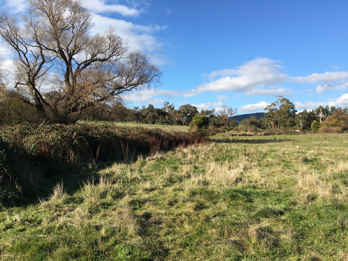
The Old Mill Spring (that we walk past)
Edgar Morrison, in The Loddon Aborigines (1971, p.48) records that:
In the horse and buggy day … each Boxing Day a group of neighbours of all ages from Franklinford and Yandoit would congregate at the old Mill Spring about half way between Franklinford and Shepherd’s Flat [under] … the spreading willow trees that grew nearby. Near by a strong flow of crystal clear water issued from the hillside, forming a pool fringed with watercress. From thence, the water gurgled down the grassy slope before plunging into the Jim Crow Creek about 20 chains to the westward. … Since the earliest colonial days it has borne the name Mill Spring. A generation ago the older citizens could remember carting wheat to an old Flour Mill, the wheel of which was operated by water from a race branching northward from the Mills Spring stream. … Fragments of the water-wheel are still discernable as well as a few crumbling walls of the mill itself. Yet before that structure was built, the spring had long borne its present name. … Gabriel Henderson (1854-1944) … attributed the name to the fact that ‘a small flour mill, operated by a water wheel was erected there by Mr Parker when he first came to the district’. An early survey map corroborates Mr Henderson’s statement. A position southward of the natural watercourse is defined as “Ruins of an old Mill”. At this time (1843-44 they used to grow wheat in what they called the Swamp Paddock – and ground it somewhere nearby. … One wonders what became of the two steel hand mills {Parker] had brought up from Melbourne in 1840. It is tempting to wonder whether the small flour mill erected on the Mill Spring race was in fact a combination of the old hand mills. …
In summary
- The history of Aboriginal stations at Franklinford spans 23 years between 1841-1864.
- There were two Aboriginal Stations: one, the Aboriginal Protectorate at Franklinford 1841-1849; a later one The Mount Franklin Station from 1853 at the base of Mt Franklin.
- It was administered by three government organisations (the Aboriginal Protectorate 1839-49; the Office of the Guardian of Aborigines (1850-59 and the Central Board for the Protection of Aborigines 1860-1870).
- Most of the voluminous Protectorate records are preserved in State and National archives.
Dja Dja Wurrung
Originally consisted of around 20 clans sharing the same wurrung (speech name) with a degree of political and economic association.
form part of a larger group of clans sharing religious and social ties. The Kulin have two moieties: bunjil (eaglehawk) and waa (crow)
- the traditional owners of land in Central Victoria between Kyneton, Creswick, Boort, Donald and the Pyrenees.
- Parker’s Loddon Protectorate census of 1841 listed 282 Aboriginal people. This number was far from ‘pre-contact’ as a consequence of well documented conflict with Europeans, deliberate killing, post-contact European diseases and evidence of one or more major smallpox epidemics which originated and were spread from the vicinity of Sydney soon after the arrival of the First Fleet.
- Important elements of Dja Dju Wurrung culture and people survive today in cities, towns and communities of central Victoria, including in Castlemaine and Bendigo.
Mt Franklin History
The mountain was created by a volcanic eruption about 470,000 years ago. It is fine example of a breached scoria cone. The breach in the south-eastern rim (through which the road now enters the crater) was caused by lava flow breaking through the rim. The caldera is one of the deepest in the central highlands area. Earlier flows extend to the north and west. The coarse ‘ejecta’ exposed around the summit includes red and green olivine and shiny crystals of (white) orthoclase and (black) augite Lumps of Ordovician sedimentary and granitic bedrock. On the western slope is the parasitic scoria mound known as “Lady Franklin”.
Some volcanic eruptions (though likely not this one) would have been witnessed by members of the Dja Dja Wurrung Aboriginal Nation who called this country the ‘smoking grounds’. The clan that occupied the country around Mount Franklin were the Gunangara Gundidj who called it Lalgambook. Mount Franklin and the surrounding area is a place of considerable religious significance to Aboriginal people. Ethnographical, archaeological and historic evidence indicates that frequent large ceremonial gatherings took place in the area. Lava from Mount Franklin and other volcanoes in the area filled valleys and buried the gold bearing streams that became the renowned ‘deep leads’ of the gold mining era.
Reports from Major Thomas Mitchell’s third (1836) expedition took him as close as Guildford and Newstead. He reported ‘fertile land waiting to be claimed’ prompting a minor rush by squatters including John Hepburn, who called the mount “Jim Crow Hill”. Charles Joseph La Trobe, superintendent of the Port Phillip District of New South Wales named the mountain after Sir John Franklin after they climbed the hill together in December 1843. (Franklin had been Lieutenant-Governor of Van Diemen’s Land [Tasmania] from 1837 to early 1843 when he was removed from office). The Franklin River in Tasmania also bears his name. During 1843 Franklin visited Victoria. Franklin disappeared on his last expedition, attempting to chart and navigate a section of the Northwest Passage in the Canadian Arctic. The icebound ships were abandoned and the entire crew perished from starvation, hypothermia, tuberculosis, lead poisoning and scurvy. He was last seen by Europeans on 26 July 1845: a note recovered in 1851 confirm he died on 11 June 1847.
During the Aboriginal Protectorate era (1842-9), the Mountain was within the five mile reserve radius.
In 1866, the crater of Mount Franklin was set aside as a recreation reserve, and the remainder reserved as State forest. Owing to the high demand for land in the district, two areas of the reserve were excised and sold for agricultural settlement. This galvanised popular support for the permanent reservation of Mount Franklin.
During the 1870s and 80s, scenic qualities of natural bushland gained popularity as recreational venues as compared to formal parks and gardens. In 1875, a meeting asked the Victorian government to reserve all the land at Mount Franklin for public purposes and a reservation of 157 acres was gazetted the following year under shared management of the surrounding local government areas. In 1891 the Shire of Mount Franklin was given sole control of the reserve.
From the 1880s, parts of the reserve were being leased for grazing, providing much-needed revenue for the committee of management. By the 1920s, rabbit infestation was a major problem. Nevertheless, during this period the crater was still a popular destination for picnickers and pleasure-seekers. Mount Franklin was promoted as a local beauty spot within easy reach of Daylesford and Hepburn Springs mineral springs resort. A shelter shed and rainwater tank were erected.
In 1944, a devastating wildfire destroyed most of the native vegetation on the mount. As a result, the inner and outer slopes of the crater were planted with exotic species, mainly conifers, to prevent erosion and to provide revenue through commercial harvesting. The caldera was planted with ornamentals such as silver birch, white poplar, sycamore and Sequoia sempervirens (Californian Redwoods).
Not everyone approved of the scheme. The late Edgar Morrison from Franklinford remarked on Mount Franklin’s “pine-clad heights”: “One feels that when the Forest Commission, a generation ago, draped this foreign garb around its shoulders, the old mount …. resented the indignity.”
‘Jim Crow’ Creek
Our walk finishes at what is currently called ‘Jim Crow Creek.’ The Jim Crow laws were racial segregation laws enacted after the Reconstruction period in Southern United States, at state and local levels, and which continued in force until 1965, which mandated racial segregation in all public facilities in Southern states of the former Confederacy. The separation in practice led to conditions for African Americans that were inferior to those provided for white Americans, systematizing a number of economic, educational and social disadvantages. These Jim Crow laws followed the 1800–1866 Black Codes, which had previously restricted the civil rights and civil liberties of African Americans with no pretence of equality. Jim Crow was the derogatory name for a black person at the time. Lalgambook / Mt Franklin (called ‘Salus’ by Major Mitchell, after the ancient Roman God of health and prosperity) was dubbed ‘Jim Crow’ by John Hepburn in 1841, perhaps anglicised from Mollison’s outstation in the area, briefly called ‘Jumcra’. The derogatory connotation of the term Jim Crow is a good reason to consider its future renaming, as has recently been done to a similarly named mountain near Rockhampton.
Some Useful References
Attwood, B. (2017) The Good Country: The Dja Dja Wurrung, the Settlers and the Protectors. Monash University Publishing, Clayton.
Clarke, I. D. (Ed.) (1998) The Journals of George Augustus Robinson, Chief Protector, Port Phillip Aboriginal Protectorate, Volume 1: 1 January 1839 – 30 September 1840. Heritage Matters, Melbourne. (pp.163-185 in Robinson’s diary of 11 to 29 February, 1840 was within southern Dja Dja Wurrung country).
DDWCAC: Dja Dja Wurrung Clans Aboriginal Corporation (2014a) Families of Dja Dja Wurrung, with Jessica Hodgens, Djuwima-Djarra: Sharing Together: Dja Dja Wurrung : Our Story. DDWCAC, Bendigo.
DDWCAC: Dja Dja Wurrung Clans Aboriginal Corporation (2014b) Dhelkunya Dja: Dja Dja Wurrung Country Plan 2014-2034, http://www.djadjawurrung.com.au/wp-content/uploads/2015/11/Dja-Dja-Wurrung-Country-Plan.pdf.
Haw, P. & Munro, M. (2010) Footprints Across the Loddon Plains: A Shared History. Boort Development Incorporated, Boort.
Morrison, E. (1965) Early Days in the Loddon Valley: Memoirs of Edward Stone Parker 1802-1865. Yandoit.
Morrison, E. (1967) Frontier Life in the Loddon Protectorate: Episodes from Early Days, 1837-1842. Yandoit.
Morrison, E. (1971) The Loddon Aborigines: “Tales of Old Jim Crow”. Abco Print, Daylesford.
PROV: Public Records Office, Victoria (1983) Victorian Aborigines 1835-1901: A Resource Guide to the Holdings of the Public Records Office. PROV, Victoria.
Quinlan, L. M. (1967) Here my Home: The Life and Times of John Stuart Hepburn 1803-1860, Master Mariner, Overlander, Founder of Smeaton Hill, Victoria. Oxford University Press, London.
Rhodes, D. (1985) An Historical and Archaeological Investigation of the Loddon Aboriginal Protectorate Station and Mount Franklin Aboriginal Reserve, Occasional Report No. 46, Aboriginal Affairs Victoria.
Tully, J. (1997) DjaDja Wurrung Language of Central Victoria, including place names. Australian Print Group, Maryborough.
