Join Great Dividing Trail Association (GDTA) Walks to six iconic Mountains
United Nations International Mountain Day (IMD) is celebrated each year on 11 December. Its goal is to raise awareness about the role that mountains play in the lives of people and their importance to our planet. Barry Golding and Clive Willman made reference in their 2024 book, Six Peaks Speak (Chapter 9) to the serendipitous origins of Mountain Day in the US in Autumn 1838, the exact same time that peaks in the Central Highlands of Victoria were being unsettled.
In 2024, DJAARA, for the Traditional Owners generously invited the community to share their very successful IMD celebration, see https://djadjawurrung.com.au/projects/imd/ in the stunning and culturally significant volcanic crater at Lalkambuk / Mt Franklin.
In 2025, during the week leading up to IMD, the GDTA is organising six interpretive loop walks to the summits of six diverse and special mountains in Victoria’s Central Highlands, within three adjoining First Nations. Here are GDTA’s planned 2025 walk offerings celebrating IMD:
Sat 6 Dec:Mount Kooyora / Guyura (486m) including Melville Caves in Mt Kooyora State Park, near Dunolly, in central Dja Dja Wurrung Country. Stunning granite landscape. Leader: Barry Golding. 8 km. Medium.
Sun 7 Dec:Mount Buninyong / Bonan Youang (745m) in Mt Buninyong Scenic Reserve, south of Ballarat in Wadawurrung Country. Amazing volcanic craters, messmate forest & views. Leader: Tim Bach. 10 km. Medium.
Mon 8 Dec: Mount Steiglitz / Kal Kal Karrah (637m) and the glacial deposits at nearby Pykes Creek. The seldom visited Mt Steiglitz Scenic Reserve north of Ballan in Wurundjeri Country accessed via private land. Overlooking extensive First Nations volcanic plains. Leader: Arie Baelde. 2 km. Steep but Easy.
Tues 9 Dec (dawn walk): Mt Beckworth / Nyaninuk (629m), within Mt Beckworth Scenic Reserve near Clunes in southern Dja Dja Wurrung Country. Diverse granite landscape. Leader: Barry Golding. 6 km. Medium.
Wed 10 Dec:Wombat Hill (670m), a town walk around historic Daylesford in Dja Dja Wurrung Country. The walk will start with a launch of the Lerderderg Track Walk or Ride Guide and conclude with a picnic in Wombat Hill Botanical Gardens. Leader: Tim Bach. 7 km. Medium.
Thurs 11 Dec (IMD)Blue Mountain / Wuid Krruirk (871m), little known mountain within the proposed Wombat – Lerderderg National Park south of Trentham: on the forested Great Divide, between Dja Dja Wurrung, Wadawurrung & Wurundjeri Country. Leader: Arie Baelde. 10 km. Medium.
Registration will be available for any of these IMD walks two weeks prior to each walk via https://www.gdt.org.au/events . Non-walking club members are welcome, but will bring $10 cash on the day to cover GDTA walker insurance.
Barry Golding and Clive Willman are delighted that our book, Six Peaks Speak: Unsettling Legacies in Southern Dja Dja Wurrung Country, published in Dec 2024 in hard cover, has recently been published in soft cover as well (Sept 2025). This not only makes our book more accessible (soft cover author price AUD$55), but allows us an opportunity to make a few small improvements, as well as adding some positive ‘reader feedback’ notes inside the front cover.
We are really pleased with the high quality of printing in both versions of our book. If you want to order author copies of either version at $55 soft cover; $89 hard cover, please email Barry Golding: b.golding@federation.edu.au (add $12 if required for postal delivery within Australia). NOTE: Paradise Books in Daylesford has both hard cover and soft cover books for sale at retail price [NOTE: ordering copies via the US-based publisher CGRN, including delivery to Australia, will cost $US61.50, approx.= AUD$93 for soft cover, US$86.50, = approx. AUD $131 hard cover).
Presentations about Six Peaks Speak
Since our book was launched, we have undertaken lots of local public talks: in Daylesford, Castlemaine, Bendigo, Maryborough, Maldon, Clunes, Kingston, Creswick, Trentham, Harcourt and Baynton. Here are some forthcoming options in 2025, if you or others are interested.
• Fri 7 Nov 7.30pm: Newham Landcare Group: Newham Mechanics Institute. • Sat 22 Nov 2pm: Connecting Country AGM: Castlemaine.
A compelling storytelling journey in southern Dja Dja Wurrung Country through the eyes of six iconic mountains in central Victoria, Australia.
The featured mountains are today called Mt Kooroocheang [near Smeaton], Mt Beckworth [near Clunes], Mt Greenock [near Talbot], Mt Tarrengower [near Maldon], Mt Alexander [near Castlemaine] and Mt Franklin [near Daylesford].
An interdisciplinary and intercultural story across time, cultures, contested histories and unsettled relationships, uniquely traversing First Nations and unsettler, history, geology, ecology, anthropology and reserve management.
Hardback book of 432 pages, with 98 full colour images, including 26 maps (15 new maps created by Clive Willman, and 11 historic maps), 60 contemporary photographs, 11 historic photographs and six line drawings by local artist, Belinda Prest.
Researched by Professor Barry Golding AM during 2023 as a State Library Victoria (SLV) Creative Regional Fellow. Meticulously referenced with over 1,100 footnotes.
Fresh, new insights into Deep Time with significant contributions to the text and to the geological history, including maps and images contributed by Clive Willman as supporting author.
Assistance from Uncle Ricky Nelson, Harley Dunolly-Lee, & Rodney Carter for the Dja Dja Wurrung traditional owners (DJAARA), with research access to the Victorian Aboriginal Heritage Register via a Cultural Heritage Permit.
Incorporating new information from Crown Reserve files, SLV, Public Records Office Victoria, local museum libraries and over 70 local and expert informants.
Aside from a comprehensive introductory chapter and conclusion, the book includes one chapter about each of the six mountains.
Both authors live on southern Dja Dja Wurrung Country.
Barry Golding AM is an Honorary Professor of Federation University in Ballarat, and lives in Kingston [near Creswick].
Clive Willman is a geologist based in Castlemaine.
Published by Common Ground Research Networks (CGRN) in Champaign, Illinois, US, printed in Melbourne, Australia
Available as a hard cover book or as a pdf.
Hard cover version available now from Barry Golding for AUD$79; add $10 for postage within Australia(order via b.golding@federation.edu.au ).
Purchase in store (RRP approx. AUD$99) at: Stoneman’s Bookroom (Castlemaine), Paradise Bookshop & Tourist Information Centre (Daylesford). BOOM Clunes, Collins on Lydiard (Ballarat) or order online, including via Readings, Carlton.
Best online purchase option in Australia via Booktopia.
‘This is a captivating journey, highly timely in national discourse and knowledge gap-filling, in that it brings together lenses rarely seen before. We can benefit from the many vantages and vistas in this book. It reminds us of the importance of place and a desired future where we respect Country and respect one another in it.’ Professor Tony Dreise, Pro Vice-Chancellor, Indigenous Engagement, Charles Sturt University & Gamilaraay First Nations person.
‘The deep and painstaking research undertaken to bring this book together is significant and impressive. The narrative style, interweaving history of the locations with geology make this book unique, quite beautiful and accessible to a broader audience. It involves a discussion about deeply unsettling legacies, highly relevant today in Australia. It is indeed powerful and disquieting at the same time.’Professor Annette Foley, Professor of Vocational and Adult Education, Federation University
‘Professor Golding presents a cultural and environmental history of landscape in central Victoria, Australia. His vision is for a reconciled relationship on Country. He extends First Nations people respect that has been missing until recently in Australian historiography, providing an important model of how non-Indigenous Australians should engage with traditional owners in research and writing projects.’ Dr Stephen Carey, Senior Research Fellow, Federation University
‘Barry Golding speaks with care and an enduring need for us all to be at our own peaks, not just the hills in this book, their geology, flora and fauna. … Thank you for choosing these Six Peaks that are special to me also, and for being their friend, for they could not ask for anyone better. Dhelkup Murrupuk, we give you good spirit.’ (in book’s preface) Rodney Carter, Dja Dja Wurrung Group Chief Executive Officer
‘Golding and Willman’s thought-provoking book furthers our understandings of land and landscape. The complex legacies, uncomfortable truths, shared heritage and lessons for land management in the present day are explored in this book. In it peak specific stories of the Southern Dja Dja Wurrung Country are revealed in conjunction with a deeply personal and immersive response to this historically and geologically significant region.’ Professor Keir Reeves, Director for the Collaborative Research Centre in Australian History, Federation University Australia
It’s now seven weeks since my 7 May ‘Six Peaks Speak 3’ update. This has been a very intensive and time consuming writing phase. At least one day each week has been spent at State Library Victoria researching new leads and tying up the many loose ends. Another day each week (when winter weather permits) has been spent in the field, walking on each peaks and talking to people in the local community.
My Draft Chapter Contents for the book, whose working title is Six Peaks Speak: Unsettling Changes in Southern Dja Dja Wurrung Country, is as below.
Chapter 1 Grounding
Chapter 2 Home Ground: Gurutjanga / Mount Kooroocheang
Chapter 3 Common Ground: Nyaninuk / Mount Beckworth
Chapter 4 Grazed: Durt Burnayi / Mount Greenock
Chapter 5 Mined: Dharrang Gauwa / Mount Tarrengower
Chapter 6 Quarried: Leanganook / Mount Alexander
Chapter 7 Erased: Lalkambuk / Mount Franklin
Chapter 8 The ‘Good Country’ in Between
Chapter 9 Reconnecting Peaks, People and Place
Chapters 1 to 5 have been completed in early Draft with a target length of 10,000 words each. My plan is to complete Drafts Chapters for the other two peaks, Mount Alexander and Mount Franklin, by 8 July (in two weeks).
Below is the content template I am using to structure and write each peak-specific chapter. Some headings will change.
Setting the Scene
Behind the Scenes
The Peak, People and Places
Peak
People
Places
Ground Up
Big Picture
Rocks
Ecology
Community
Unsettling
Legacies
Legacy Theme 1
Legacy Theme 2
Legacy Theme 3
Legacy Theme 4
Managing
Exploring
I previously identified four possible ‘Legacy Themes’ for each of the six peaks in my ‘Six Peaks Speak 2’ post. Most of these have been adopted unchanged. Several will change as writing and editing progresses.
Clive Willman’s assistance has been invaluable in the past six weeks, including reading and critically commenting on draft chapters. Clive provided LiDAR for Mount Kooroocheang and Mount Beckworth. He has also provided a valuable and insightful, big picture, Digital Elevation Model map inclusive of all six peaks, overlain by the main geological units and the footprint of both Protectorates.
Clive has actively participated in some of the fieldwork and is contributing his geological expertise and experience to help write up and edit the sections about the rocks for each peak. My intention, as already flagged with SLV, is for Clive to be properly acknowledged as a second author on the final book manuscript by virtue of his significant anticipated contribution.
I am taking a four week, midyear, winter break from 18 July. I plan to resume work refreshed after the break on 19 August, to start to write Chapters 8 & 9. My next update is planned for 3 September. During September 2023, I plan to have a sufficiently polished draft manuscript comprising two Chapters, with Contents and Synopsis, to approach a prospective publisher.
I have made lots of positive progress since my second (late February 2023) blog: via on Country immersion, First Nations liaison, community presentations, serendipitous connections as well as at the State Library Victoria in the past two months. Exploratory writing of the first book chapters is now underway.
On Country immersion:
The enervating and challenging South Coast Track 86km backpack walk in remote Tasmania; 260km supported Great South West Walk, a remarkable immersive symphony in four parts in remote western Victoria). Importantly, these walks during March took me away from my own landscape to reflect, think and plan in other inspiring places and First Nations landscapes.
Two ‘Six Peaks Peek’, by invitation on Country walking tours with invited friends, local landholders, colleagues and other SLV Fellows to all six peaks; on 26 March, to flank of Mount Kooroocheang, and summits of Beckworth & Greenock with 16 participants; on 6 May with 17 participants to summits of Mounts Tarrengower, Alexander & Franklin, ‘bookended’ by visits to nearby Neereman & Franklinford 1840s Aboriginal Protectorate sites. Intended to field test and get feedback on interpretive themes and options.
Franklinford Protectorate Township walk with Kyneton U3A on 21 April (18 participants).
•Several exploratory field visits, including previewing sites for the Six Peaks Peek Tours and visits to 10 very recently identified oven mounds in the Mount Beckworth and Kooroocheang areas.
• CresFest interpretive walks for GDTA on Creswick Heritage Walk 1 & 2 April (total 24 participants).
First Nations liaison
Meetings with Elder, Uncle Ricky Nelson, in Castlemaine on 13 April & 4 May, also planned on Country for 9 May.
Meeting planned 10 May at SLV with Harley Dunolly Lee, Project Officer, Language Repatriation, Dja Dja Wurrung Clans Aboriginal Corporation & PhD Candidate at Monash University.
On Country filming with Uncle Ricky Nelson planned for 9 May at Neereman & Franklinford, to contribute to a First Nations themed Reconciliation Week display at Daylesford Historical Society.
Community presentations
On an ‘Unsettling’ theme, to Newstead Landcare Group (150 participants, 18 April).
On a ‘Six Peaks Speak: Unsettling changes in southern Dja Dja Wurrung Country’ theme to Ballarat Bushwalking and Outdoor Club (40 participants) on 4 May.
Serendipitous connections
Castlemaine-based friend & geologist, Clive Willman after my Newstead Landcare presentation, alerted me to the availability of LIDAR (an acronym for “light detection and ranging”) imaging data for both Mount Beckworth and Mount Kooroocheang inclusive of their flanks. Clive has since, very generously, put huge time and effort into creating and sharing LIDAR files, overlain with historic map layers. With the software and LIDAR files loaded on my laptop, I am now able to ‘remove’ the vegetation cover and zoom in to search for signs of what might have happened and where.
Related to the above, Clive found an 1890s geological plan for Bullarook (inclusive of Mount Kooroocheang) made by James Stirling with 8 ‘blackfellows ovens’ marked, seven of which have likely not since been recorded. Follow up with the two current private landholders to ‘ground truth’ and formally record these oven mounds is underway.
Several recent productive meetings, conversations and field visits with Clive Willman have confirmed the likelihood of Clive assisting me further, in a currently open-ended manner.
At State Library Victoria
Second stage on site searching, including SLV Newspaper collection.
Helpful conversations with Suzie Gasper, Senior Programmer, Audience Engagement on ‘where to next’ with researching, writing and publishing and well as with possible SLV themed presentations or fields trips (my Fellowship Liaison Librarian, Sarah Ryan, Senior Librarian, Victorian and Australian Collections has been on extended leave).
Writing and editing
Working through my files, distilling and pulling together the many possible themes for each of the six peaks, on the computer screen and in words, is a very big undertaking. I have started, in between the above, to attempt to write. In the process, I find out what is missing, what is superfluous and what themes might ‘sing’ best in my book, and in what order they might be introduced to the reader.
This intensive time consuming writing and editing process will be my main focus for the next few months. I’ve summarised below how far I’ve come.
Where to beyond the fieldwork? 3,500 words. This is my attempt to sort out, in my head and in words, what it is that I am most interested in communicating in my book and how I might tell the story, ideally in a fresh, engaging, accessible and authentic way.
Chapter 2 Mount Kooroocheang, First Draft 80% complete; reorganizing and editing is underway in Draft 2; Chapter 3, Mount Beckworth, writing has commenced.
Four Week Reflective update on my State Library Victoria Fellowship to 27 January 2023
One month into 2023 and it’s time for me to reflect and take stock. I’m penning what follows for several good reasons. Firstly, it helps me keep track and record progress and think about ‘where to next’. Second, it helps inform the many stakeholders in this Six Peaks Speak research and writing project who are keen to advise and assist me about where some of the the missing bits or ‘lacunae’ currently are.
In case you’re not familiar with the Six Peaks Speak Project, you’ll find my ‘big picture’ plan for the State Library Victoria Fellowship during 2023 at https://barrygoanna.com/7-2/
If after reading this update you have ideas and suggestions in relation to any other the six peaks, please contact me!
Two days each week during January I’ve spent ferreting through whatever resources come to the surface, by searching the names and obvious thematic connections to the six mountains (Kooroocheang, Beckworth, Greenock, Tarrengower, Alexander, Franklin), mainly in the State Library Victoria (SLV) collection but also the Public Records Office of Victoria (PROV) in North Melbourne.
I’ve also accessed the available historic Crown files for the five mountains surrounded by public reserves. These files are mostly held in the Ballarat ‘Glass House’ and Epsom (Bendigo) regional land manager’s offices. And I’ve put out feelers to eight local historical societies and people with a local knowledge of and interest in each of the Peaks, including the Dja Dja Wurrung traditional owners.
Importantly, I’ve also had time to think while travelling up and down to Melbourne on the train, and particularly riding my bicycle and walking along quiet backroads in the vicinity of the two Peaks closest to home, Mounts Beckworth and Kooroocheang. In the process, I’ve sought distant lines of sight from elevated spots along the way to the other four peaks, Franklin, Tarrengower, Greenock and Alexander. In the process, I’ve come up with tentative new ideas for introducing others to each of the six Peaks.
I penned this reflective note offline in the Top Deck Lounge of the Spirit of Tasmania in Bass Strait heading north for home via Geelong. Being at sea without the internet, my notes or my usual references was actually quite liberating. I’m reminded of one of the 1850s Eureka Rebellion heroes, Raefello Carboni who began penning his Italian opera, Gilburnia, inspired in part by his First Nations experiences near Mount Tarrengower in Dja Dja Wurrung Country. It was amongst the flying fish in the Bay of Bengal on the way back to Italy that Carboni’s acknowledged that his ideas for the opera actually started to take shape. There were no flying fish in Bass Strait.
Getting my head around the practicalities of searching for and extracting original records, as well as sifting through and storing the evidence I’ve collected, including via online searches, have been challenging. Given it takes at least 4.5 hours of travel each day from home in southern Dja Dja Wurrung Country to and from Melbourne, working out efficient ways of preordering and accessing resources via libraries and archives online was an essential first hurdle. So too was starting to understand the vagaries of the rabbit warren of offices and collections that comprises SLV, and also the rules and regulations for safe handling that underpin original document accessibility.
At this early stage, my search strategy is deliberately wide. While I know several mountains and their crosscutting themes, particularly Franklin and Kooroocheang pretty well already, others, particularly Tarrengower and Beckworth, are much less well known to me, and the Crown files available to me are far from complete. As might be anticipated, some leads have proved fruitless. Others, like the 1870s photo of old growth eucalyptus forest within the Larnibarramul Crater (at Mt Franklin) and the PROV file about the former Victorian Ladies Sericultural [silkworm] Association reserves in Mount Alexander, are serendipitous, highly informative and insightful.
Beyond the uneven and inevitably patchy evidence that is emerging about each of the mountains themselves, there is the important question of what is of interest and importance to me and also to prospective readers. How might others use my book to gain new insights and to explore more? How might the evidence I find be ordered and presented? Why am I interested in peaks? What is distinctive about each peak? What should I put in and to leave out? Whose story and voice is more important? In what circumstances should the narrative become autoethnographic? What is different about my book and other product dissemination strategies that has not already been attempted?
I have had several timely and important practical breakthroughs. Procuring and setting up a laptop after eight years in ‘retiremen’t without one (I’ve previously used an iPad when on the move) was made easier with advice from our son, Karri. So too was the usefulness of the OneNote application made clear via sound advice from our daughter, Tanja. The wisdom and experience of Sarah, my SLV mentor librarian has gently and ably steered me to several new and positive sources, places and in new directions.
Aside from copying, note taking and transcribing, I have taken lots of photos on my phone and scanned images of original documents, maps and historic photographs. I sense that these images have the potential to lift’ and illuminate my book as well as critically inform the historical narrative. Photos and maps in particular have the potential to subvert the dominant paradigm about what the country was like as well as how and why it has changed. In a similar way that Von Guerard’s painting of Tower Hill helped restore and revegetate the iconic crater, there is the potential for images and maps of all peaks in this project to reshape the way we perceive, revegetate and acknowledge First Nations people’s Voice and ongoing contributions to our own peaks and landscapes. Importantly, they will also point to better and more sustainable ways of managing them, inclusive of First Nations values, interests and imperatives.
So what do I know or perceive after one month of researching that is new or different from what I originally proposed? First, I have become acutely aware that the six peaks I have chosen to feature circumscribe a broad and relatively fertile oval, volcanic plain, previously grassland or woodland, and that what has happened within the oval below the peaks is also an important, relevant and interesting part of my narrative. Second, there are at least a dozen other secondary peaks within ‘the oval’ whose presence in the landscape might also form part of the story. The oval and these secondary peaks might sit in a separate additional book chapter, and provide waypoints relevant to my book’s invitation for people to come and explore and make sense of the remarkable area themselves.
What follows summarises how I anticipate each Peak Chapter might be shaped and the order they might be introduced, moving in an anti clockwise direction around the oval commencing with Kooroocheang.
Kooroocheang is qualitatively different to the other five peaks. Being in private ownership it is much less well known or interpreted. Its physical presence, status and importance as a Dja Dja Wurrung ceremonial site encircled by nearby oven mounds and the swift and brutal nature of dispossession and unsettling by John Hepburn and others will lie at the heart of the Kooroocheang narrative. This chapter will paint a picture of and emphasise the disconnect between what was a diverse, productive and complex ecotone (juxtaposition of different ecosystems) in Southern Dja Dja Wurrung Country, inclusive of the uncomfortable and unsettling legacy of Hepburn.
Mount Franklin’s story which will follow is tragic on a number of levels. It is a narrative about loss of a classic and relatively young volcanic crater, its flanks and crater stripped bare, commencing with loss of its original status as a First Nations gathering and ceremonial site, the development and demise of the genocidal Aboriginal Protectorate on its flanks following Alexander Mollison’s brief unsettling, the creation of a Town Common, the loss of a nearby unique and ancient Mineral Spring, and the recent invention of Mount Franklin as an iconic Australian brand once the spring had been destroyed.
The loss of Mount Franklin’s original vegetation will be about ‘death by a thousand cuts’, from grazing, timber removal, wildfire and rabbit infestation, to the final 1950s Forest Commission indignity: being totally and deliberately replaced by exotics including pines. Being high, like several other peaks in the set, Franklin also has communications and fire spotting towers on the summit.
Mount Alexander, with its similarly rich First Nations connections, unlike its nearby, eponymous, incredibly rich gold diggings, was relatively fortunate to be spared the indignity of mining, only to be completely cleared of trees for fuel and mine timbering by the 1870s. Over the next century it was a dogged battle, initially between local farmers using it as a Common for grazing and timber removal, granite quarrying in at least eight sites, pine and other plantations, attempts by an 1870s women’s collective to create a sericultural (silk) industry, and later land managers attempting to encourage alienation, grazing or palm it off to other government agencies. More recently, the mountain has become a tourist destination for an ill fated koala park, bushwalking and rock climbing, with its highest point now bristling with communication and other towers.
Mount Tarrengower I plan to link by physical and historical association to the nearby Neereman Aboriginal Protectorate on the Loddon, a largely untold story of colonial folly which preceded the better known Protectorate story near Mount Franklin. Tarrengower I know less about, mainly because the land manager file in Epsom is only partial and recent. I’m planning on leveraging next off local and district long time friends and experts. Peter Skilbeck lives nearby at Joyces Creek and knows heaps from his summer fire spotter experiences on the summit for 26 years until 2022. I’ll also tap into the deep local knowledge of mining archaeologist and friend, David Bannear about the associated Tarrengower diggings. Similarly, Clive Willman, a friend and geologist knows lots about the mountain and its very ancient history. I do know the steep road up to the summit intimately, from riding to the top on a bicycle, but there is a lot more to learn, as for all the Peaks, from discovery on ground and on Country with local experts.
Mount Greenock is in the six peak set largely by virtue of its serendipitous history. Major Thomas Mitchell stood on and renamed the summit in 1836 as he waxed lyrical about his ‘discovery’ of a well managed Aboriginal grassland he took to be a biblical and unpeopled biblical Eden and called it ‘Australia Felix’. The volcanic mountain and breached crater straddles a once rich deep lead which was mined for gold into the 1900s, and later became a Town Common for Talbot and District. Fast forward to the present day Geological Reserve, appallingly managed largely in the vested interests of local cattle graziers. By virtue of all these associations, the evidence base about Greenock and the former township of Dunach on its flanks is relatively extensive.
Finally, Mount Beckworth whose distinctive lollypop tree (Aleppo Pine) in its summit tells its own story and tale of survival, on a weathered granitic range also subject over decades to licensed and unlicensed grazing, tree and woodland removal, wildfire and rabbits, extensive mining of its sand aprons, and numerous attempts at private alienation. In the process, bird observers and orchid lovers aware of the peak’s many other values resisted many of these incursions.
Originally renamed by Mitchell as he passed by, the Mount Beckworth peak and area also lost its original trees to service the nearby Clunes Goldfields mines and boilers from the 1850s. More recently, the mountain and particularly its relatively low granite cliffs and boulders have quietly become regionally important for rock climbers, walkers and picnickers. As with Tarregower, the available Crown files forMount Beckworth are relatively thin and recent. Thus much effort will go during February into finding local people in the Clunes area who know and love and enjoy the mountain and its former community and settlement of Glendaruel on its southern flanks.
My intention is to pen a second update in late February, just before I disappear, mostly ‘off the radar’ for a month until resuming work on the Fellowship from 27 March. First, I head to Tasmania with friends for an 85km, 8 day backpack walk along Tasmania’s remote south coast. This will be followed soon after by walking the 260km Great South West Walk in far western Victoria. It’s a symphony in four natural acts: the Cobboboonee forest behind Portland, the languid lower Glenelg River, the wild sandy beaches east of Nelson along Bridgwater Bay, and the rugged coast around several capes back into Portland.
These notes are in two parts. The first 2,000 words, headed ‘1840s Aboriginal Protectorate Walk Notes’ provide interpretive notes for walkers who register for the Great Dividing Trail Association’s (GDTA) Members or Public Walks around the Franklinford Township during November 2022. They will also be also useful for anyone embarking on the ‘1840s Aboriginal Protectorate’ self-guided Walk Number 11, pp.34-35, published in 2021 GDTA ‘Walk and Ride Circuits’ guide. Localities marked on the map in the Circuits guide (p.35) are shown in bold.
The second part headed ‘The Evidence Base: Loddon Aboriginal Protectorate History’ (8,000 words) includes the lesser known back story of the foundation of Neereman Aboriginal Protectorate on the Loddon River in 1840, which preceded its relocation to the Franklinford site by mid 1841, operating on its new site until Protectorates were abolished in late 1849.
As with all of my work, I look forward to critical comment, including telling me what I may have got wrong.
1840s Aboriginal Protectorate Walk Notes
Whilst the GDTA guided walks on November 12 & 13 in 2022 follow the marked 6.2 km route in this guide, the longer member’s walk route on 12 November adds a 5 km (approx.) extension incorporating access (with one off permission) across Eric and Joy Sartori’s private property, ‘Truro’ including along part of Larnibarramul yaluk (formerly Jim Crow Creek) with an historic weir from the 1930s. The interpretive notes for this additional loop beyond the Franklinford Cemetery (which cuts out the section along Ligar Street) follow the main notes.
Clarkes Pool on Larni barramul yaluk is a delightful and picturesque pool on a tight bend of a billabong in the creek within the Franklinford Streamside Reserve. It was formally surveyed in the 1990s as an important Aboriginal site. The late Frank Powell from Mount Franklin wrote in the late 1960s that this ‘billabong on Jim Crow Creek at Franklinford … was a known corroboree site’. There is a detailed account of an Aboriginal Corroboree held in Franklinford in November 1843 though its exact location is not specified.
The bitumen access road down to the Streamside Reserve is via Clarkes Road, which heads SW from the main Franklinford intersection until it veers south, becoming gravel as it crosses the top of the very tight meander, with steep drops to the creek on either side, before ending at a parking area beside the billabong pool under the ancient River Red Gums short of a disused road bridge.
In summer, if the water is flowing gently this is a delightful, popular and safe place to picnic and swim. Platypus have been sighed in the pool. Clarke’s Pool has been featured as the backdrop to several videos produced by Hepburn Shire with the Dja Dja Wurrung traditional owners as part of the community consultation process leading to the creek’s formal renaming during 2022.
The first part of the walk leads back along Clarke’s Road. Franklin Ford, marked in the GDTA guide to the south of the gravel road, was the original crossing point on the creek for an 1840s road that originally led from the Protectorate station south west through the forest via a bridle track to John Hepburn’s run. The ford is visible as a basalt pavement in the creek off the road easement.
The walk route turns left into the Franklinford Cemetery along Cemetery Road. Immediately to the left there is a grassy track that leads down to Thomas’ Spring. The fact that this public freshwater spring runs all year round and fills the pool in even the driest seasons was one of several features which made the Franklinford site attractive as an alternative Protectorate site in 1841. You will notice the grey basalt rocks around the pool are stained with a white precipitate, indicative of high calcium carbonate levels in the water and some possible association with a mineral spring at depth. The pool is often fringed with the floating aquatic plant, Water Cress (Nasturtium officinale), one of the oldest known edible leaf vegetables native to Europe and Asia, with a distinctive piquant taste.
Cemetery Road cuts out at the Franklinford Cemetery. If you walk into the Cemetery along the paths between the old and more recent graves towards the back of the cemetery, you will come across a much older cemetery on a different alignment enclosed within the larger and more recently surveyed cemetery. The boundaries of the older rectangular Protectorate era cemetery (first surveyed in 1843, but where several burials took place earlier) are marked by a low ditch. The four corners of the older cemetery are marked with wrought iron corner posts and native trees, thoughtfully selected by the late local historian Edgar Morrison during the late 1970s and planted ‘by four visiting Aborigines’. The most prominent marked gravestones in this area commemorate Assistant Protector Edward Parker, his first wife Mary, his second wife Hannah, some of their children and their extended family. PRACTICAL NOTE: This picturesque and historic public cemetery is the only place along the walk route with a (basic) toilet.
The original cemetery records and the mostly wooden original grave markers were lost long ago in a bush fire. As a consequence, it is impossible to know how many people were buried here inclusive of the Aboriginal Protectorate, Aboriginal Station and Aboriginal School eras between 1841 and 1864. Given the hundreds of Aboriginal people and White who lived and died in the area during that interval, the actual number of unmarked burials in this historically significant site is likely to be large. Because the area has been fenced from stock and also regularly and lightly burnt, the cemetery area retains many significant volcanic grassland and woodland species otherwise missing in the surrounding privately owned and intensively grazed paddocks.
The self-guided walk route in the booklet heads back to Cemetery Road and up the grassy and largely disused LigarStreet, named after surveyor, soldier and grazier Charles Whybrow Ligar (1811-1881). Whybrow Street to the east is similarly ‘a nod ‘to Ligar, who became surveyor general in Victoria in 1858 following 15 years working as New Zealand surveyor general. At one time, Ligar and his family invested heavily in livestock. With partners, at one stage Ligar was lessee of three million acres (1,214,070 ha) in the Riverina.
If you to the south from the top of Ligar Street you will get a good view over the paddock south of Clarke’s Road (which includes the marked ‘Aboriginal School Site’. This paddock was the epicentre of the Franklinford Protectorate settlement for over two decades from 1841. If you look towards the southern horizon towards Wombat Hill above Daylesford, and the western horizon you will get some sense that the relatively fertile volcanic soils of the inner main Protectorate area set aside for cultivation (radius one mile) was then conveniently protected, surrounded and bounded (as now) on most sides of the five mile (8km) Protectorate radius by forested land on the older shales. This forested area then deemed as ‘unsuitable for stations’ by Parker, was nominally preserved for Aboriginal hunting within the Protectorate.
TAKE CARE turning right into the relatively busy Hepburn-Newstead Road. For safety, walk well off the road edge before walking east along Stuart Street *** to the marked ‘Former Franklinford Store’ on the street corner, now a private house. Mary Parker’s sister, Charlotte, was in transit to Australia when Mary died. Charlotte stayed on and married Mr W. Bumstead, later operating the Franklinford Store. A Post Office operated in Franklinford for 110 years from 1859 to 1969.
Walk to the marked stone ‘Monument’ southeast of the intersection, acknowledging Edward Parker’s contribution to the Aboriginal Protectorate. An explanation from Edgar Morrison of the symbolism he built into the Parker Memorial Cairn (unveiled in 1965) incorporating carefully chosen rocks was published in Morrison’s Frontier Life (1967, p.v) booklet, as summarised below.
The base of the monument incorporates rocks taken from an early settlers home, which Morrison took to symbolise ‘the sturdy endurance of the district pioneers’. The body of the cairn comprises ‘volcanic boulders from the site of the Aboriginal Station’ as well as some ‘dressed pumice which formed part of the chimney of Mr Parker’s later station homestead on the western slope of Mount Franklin’, embodying what Parker took to be ‘the influences of hearth and home and [Parker’s] devotion to aboriginal welfare and education’.
Morrison symbolically incorporated stones of ‘special significance’ into the three sides of the cairn. To the south, are hand-made bricks in the form of a cross, symbolising Parker’s ‘spiritual aspirations’. On the west are stones from the old Tarrengower Station founded by Lauchlan McKinnon, frequently visited by Parker, perceived to symbolise Parker’s ‘cordial relationships with neighbouring settlers’. The eastern aspect incorporates a white quartz rock whose whiteness ‘may remind us of the high reputation’ which Morrison suggested Parker ‘earned in every situation’.
Behind the monument you will see a sign with ‘Larnebarramul: Home of the Emu’ supported by an axle erected by the late Edgar Morrison. This and several similar metal signs and markers we see on this walk were officially opened at a celebratory Field Day in 1968. First Nations people invited included Ivy Sampson, daughter of Thomas Dunolly (a former schoolboy at the Aboriginal School) and the late Pastor Doug Nichols.
Standing at the Monument intersection, if you were to take a ‘helicopter view’ you are at the centre of a township laid out in the shape of a Union Jack. Early survey maps of Franklinford township included not only the main existing cross roads which run on the diagonals, but also a network of back streets running east-west and north-south, bounded by South, East and North Streets. Many of these named suburban streets, some lined by stone fences, are now disused or incorporated into surrounding properties.
The marked walk includes a ‘dog leg’, SE down (and back) Powell Connection Road towards the ‘Seat Under Pines’ opposite Larnebarramul Lagoon. This is a busy road: walk well off the road with care. In the 1840s this was the main road to Melbourne to the north of Mount Franklin via present day Glenlyon.
On the south side of Powell Connection Road, look out for a metal sign erected to mark where Edgar Morrison believed the Aboriginal Protectorate Station buildings were located. David Rhodes’ 1997 survey and report confirms that while the sign overlooks the actual site below in the far distance, it does not mark the site itself. If you look over the forest to the west, in the distance you will see the outline of the now bald Mount Kooroocheang.
The paddock that includes the lagoon opposite the roadside seat is private property. Do notenter the paddock. The late Frank Powell noted that what he called ‘Strawhorn Lagoon’ in 1967 was a ‘known corroboree site’. David Rhodes’ survey identified and recorded several significant pre- and post-contact Aboriginal sites around this lagoon. Several of the huge Red Gum trees nearby include evidence of ancient strap grafting preserved in their upper branches, as well as pre- and pos- contact habitation spaces within their burnt out trunks.
Walk back along the side of Powell Connection Road, then walk down a steep minor road that trends west before the marked ‘Former Church’, then head south with care along the side of busy Hepburn Newstead Road, turning right (west) along South Street to the marked ‘Aboriginal School Site’. The sign including the outline of a symbolic school bell reads ‘Aboriginal School Site 1849/1864’. The paddock behind the sign is where most of the original Protectorate buildings were clustered including what became the Aboriginal School. The foundations on main site and school approximates a clump of ancient Robinia (Black Locust) trees approximately 100 metres inside the paddock. Do not enter the paddock.
Additional GDTA Member’s Walk Notes (NB: private property, no entry without permission)
Beyond the Franklinford Cemetery on the GDTA members walk on 12 Nov 2022 (see notes above ***), we walk west following a disused (and sometimes boggy) gated laneway across private grazing property. The laneway is lined in places by collapsing historic stone walls. This was one of the early, once busy goldfields-era roads which would have provided access to and beyond Larni barramul yaluk to the German Gully goldfields to the south west and on through the bush to Kooroocheang.
At the creek we turn north along the east bank, initially following a combination of cattle tracks and goldfields era water races. After a few hundred metres we come to a still intact Weir across the creek. The weir and an associated large channel heading north along the eastern bank were constructed with Sustenance (‘Susso’) labour during the 1930s Depression, taking water all the way north to Newstead. The water system was abandoned by 1980s.
Heading north we pass an outcrop of columnar basalt. The vertical columns run perpendicular to the upper and bottom horizontal cooling surfaces, formed by shrinkage as the basalt flow slowly cooled. Nearby are the eroding mullock heap of a deep lead mine, which originally included tunnels that would have tapped into the gold bearing gravels beneath the basalt flow.
The farm road leaves the creek and heads east up the hill past Eric and Joy Sartori’s orchard and farmhouse along a steep gravel road. Please respect their privacy. As you walk up the hill you get excellent views back down the creek valley. From the top of the hill several peaks come into view including nearby Larnebarramul / Mount Franklin to the east, and in the distance to the north, Tarrengower and Leanganook / Mount Alexander.
Where Sartori Road meets the marked, busy, bitumen Hepburn – Newstead Road, turn right and walk safely on the roadside, NOT going south down marked Ligar Street as in the GDTA booklet, but rejoining the marked walk, interpreted by the notes, above ***, by heading east along Stuart Street.
———————————————
The Evidence Base: Loddon Aboriginal Protectorate History
The history of first contact in southern Dja Dja Wurrung Country has traditionally tended to focus either on a heroic narrative about a small number of White male ‘explorers’ and squatters conquering and ‘settling’ a hostile environment, or the frenetic pace of change during the many gold rushes from the 1850s.
This account of what happened before 1850 is more unsettling. It focuses on a government intervention that sought to coerce and remove First Nations peoples from Country in the Port Philip Colony during the 1840s and concentrate them in small ‘Aboriginal Protectorates’ for their own safety. The plan was to create four Aboriginal enclaves five miles in radius, not only for Aboriginal peoples’ own protection away from widespread squatter violence, but also as a way of expediting the White ‘settlement’ process.
Unbeknown to many present day residents, present day Neereman (north of Baringhup, in the Mount Alexander Shire) and Franklinford (north of Daylesford, in the Hepburn Shire) were epicentres of an Aboriginal Protectorate ostensibly designed to cover what is now north western Victoria during the 1840s,then defined as ‘the Mount Macedon area and country northwards’.
What follows relies heavily on candid accounts from the personal diaries of the ‘Chief Protector’ George Augustus Robinson, as well from ‘Assistant Protector’ Edward Stone Parker, who was responsible for the establishment of Protectorates on both sites. It is supplemented by other information from Edgar Morrison’s three booklets, David Rhodes’ 1995 on ground historical and archaeological investigation, supplemented by original Protectorate records.
In brief, Parker initially set up his Protectorate at Neura Mong (literally ‘hide here’ in Dja Dja Wurrung language, today’s Neereman) on the Loddon River 6 km north of Baringhup in October 1840. He relocated it to the better known Protectorate west of Mount Franklin on Larnibarramul yaluk (previously known as ‘Jim Crow Creek’) in June 1841.
This section focuses mainly on the evidence and back stories behind Parker’s establishment of both the initial Neura Mong / Loddon Aboriginal Protectorate and the relocated Mount Franklin Protectorate that operated in the area within a 5 mile (8km) radius circle of present day Franklinford from June 1841 to the end of 1849.
This account includes only brief mention of the later temporary Aboriginal Reserve, the Mount Franklin Aboriginal Station of 640 acres established at the foot of Mount Franklin in 1852 where Edward Parker acted as a Guardian of Aborigines, built a house and where several Aboriginal people farmed. In 1864 the Aboriginal School operating on the former Protectorate site at Franklinford was closed and the remaining Aboriginal people living on the Station were removed to the Aboriginal Station at Coranderrk near Healesville. When it also in closed in 1924, many Dja Dja Wurrung descendants were moved on to Lake Tyers Mission.
The Back Story of the Aboriginal Protectorate System
Turning the clock back to 1837, a British Committee of Inquiry into the Condition of Aboriginal Peoples set up in the wake of the previous shameful treatment of and armed resistance from First Nations peoples in Van Diemen’s Land, recommended a Protectorate System be attempted in mainland Australia, confined initially to the Port Philip District. The system was premised on the refusal of the British Government to recognise prior ownership of Australia by First Nations peoples.
Four Assistant Protectors were recruited from England and appointed in December 1837. None had been to Australia before, all had previously been schoolmasters and none had ever met Aboriginal people. Edward Parker had been earlier been apprenticed as a printer, then had to give up candidacy as a Methodist Minister when he violated the condition for ministerial candidates by marrying. The Assistant Protectors arrived in Sydney in August 1838, but because of administrative delays did not reach Melbourne until 3 January 1839. For the first few weeks they were camping in tents with their families (including their wives and a total of 22 children) on the Yarra River a mile out of Melbourne with no definite instructions.
On 27 Feb 1839 they met the Chief Protector, George Augustus Robinson, appointed on the basis of his ‘success’, previously employed to cajole, deceive, remove and concentrate most First Nations Tasmanians to Flinders Island during the 1830s. Robinson appears, from his frank and critical diary entries, to have been instantly underwhelmed by and intolerant of the four men that were to be in his charge. His particular and ongoing dislike of Assistant Protector Edward Parker, who by March 1839 had been allocated to ‘the area around Mount Macedon … and the country to the northward and eastward’, saturates many of the accounts cited in this account taken from Robinson’s personal diaries.
For context, by March 1839, John Hepburn and family had been on southern Dja Dja Wurrung country for almost a year and had established a sheep station at the foot of Mount Kooroocheang to the west of the Larni barramul (‘home of the emu’) crater, today’s Mount Franklin. Mollison was by then firmly established in the Kyneton area and Ebden was at Carlsruhe north of Woodend. Many other ‘unsettlers’ had come overland from Sydney following Major Mitchell’s 1836 ‘Line’. By 1839 they had ‘taken up’ (forcefully and violently seized) much of southern Dja Dja Wurrung Country, and other squatters had pushed north through Wadawurrung Country over the Great Dividing Range into some of the most fertile and densely settled inland First Nations estates in Australia.
Understandably, there was resistance to forced removal from Country by the traditional owners in the process of setting up ‘runs’, including by John Hepburn on the Smeaton Hill run. George Robinson first mentions ‘Captain Hepburn’ in his diary whilst in Melbourne on 15 March 1839, writing that Reverend Gill, the first Anglican Minister in Melbourne, had told him that Hepburn said that ‘… the blacks had frequently attacked his station, generally in his absence. Said the natives had guns with them’. By the time Robinson first met John Hepburn in Melbourne six months later, Robinson recorded Hepburn saying (on 25 September 1839) that ‘… the blacks are very numerous in his neighbourhood. They had killed his sheep and all but strangled a shepherd. Believes they were Port Phillip natives. … Said the native women and children fled to his station for protection.’ In the same diary entry, Robinson writes that Hepburn also mentioned that the ‘Names of settlers beside him were Pettit [W. H. Petit managing ‘Dowling Forest’ run north of Ballarat for W. J. T. Clarke], Coggle (sic.) [the Coghill Brothers at ‘Glendonald’ run near Clunes], and Birch [on the ‘Seven Hills’ run near present day Kingston]’.
In 1839, the government instructions as to how the Aboriginal Protectorate system might work in practice were rather vague. Given the extent to which the best country had been so quickly carved up for sheep stations by this time, Edward Parker’s prospect of selecting a Protectorate site which ticked all the boxes was almost impossible. Robinson suggested that the four Assistant Protectors should do what he had done in Tasmania during the 1830s, and begin to move with the Aboriginal groups in order to learn their languages and culture, in the process devising the best means of civilising and protecting them. By March 1839, this suggestion had become a direction from Robinson.
All four Assistant Protectors were ill equipped, with very limited resources, support or budgets and were understandably reluctant to move far away from Melbourne, each with wives and large families. In Parker’s case, his wife Mary already had six children and was pregnant with their seventh. By mid 1839 Parker had begun to comprehend the impossibility of his task in the face of concerted pastoralist and press opposition to the Protectorate idea. As the failure to prosecute those responsible for the murder of 28 unarmed Aboriginal men, women and children in the infamous Myall Creek Massacre (near present day Bingara in northern NSW) in June 1838 had shown, the Aborigines then had no rights to give evidence in court and the many well documented cases of pastoralist murders of Aboriginal people pursued by the Assistant Protectors were unable to be prosecuted.
To make matters worse, by the late 1830s, desperate and starving Aboriginal people on the pastoral frontier in the Port Phillip District had most contact with convict shepherds and hutkeepers in the virtual absence of police or of the rule of law. Many were moving desperately between the early settlements that had taken their most productive land and food resources, now grazed by sheep. Some had resorted to coming to town, particularly Melbourne, some involved in begging, prostitution and the use of force against the invaders.
It was Parker who believed that the Assistant Protectors needed some inducement to encourage Aborigines to be concentrated on the proposed Protectorate Stations, in the form of clothing, food and shelter, quite apart from the medals and trinkets which Robinson often employed. Like Robinson and the other Assistant Protectors, Parker also fervently believed that his responsibilities included civilising Aboriginal people and that this was best achieved by Christianising them.
By September 1839 Parker and his family had moved out of the small town of Melbourne but only as far as Jacksons Creek near Sunbury. Not far from the current Emu Bottom’ property, he erected a wattle and daub hut for his family. Parker’s request that the Protectors be allowed to form Protectorate Stations was finally approved by Governor Gipps in April 1840. The idea was to have an inner reserve of one square mile for cultivation, and an outer reserve with a five-mile radius for hunting and gathering. This proposal meant that 25 large and diverse Aboriginal Nations and peoples in the Port Phillip District, including the Dja Dja Wurrung, were to be concentrated into four arbitrary areas comprising a total of only 200 square kilometres, representing only 0.08 per cent of the land area of Victoria. In modern terms it might have been called a concentration or refugee camp.
Whilst the four Assistant Protectors had been awaiting Gipps’ approval to form Protectorate Stations, they undertook reconnaissance for where the four Protectorate stations should actually be located. With this task in mind, Robinson travelled extensively including to ‘the Loddon District’ with Parker between 9 January and 11 March 1840. Robinson’s extensive diary records whilst in southern Dja Dja Wurrung country on this reconnaissance trip with Edward Parker provide one of the best first hand, written records of many aspects of the southern Dja Dja Wurrung Country and people in the landscape at that time. Gary Presland’s timely self-published book, ‘Riding with Robinson’ (2022), provides a detailed, annotated account of Robinson’s personal diaries during this trip.
Robinson’s diary entries relating to this reconnaissance indicate that Robinson and Parker’s journey approximated the current Western Highway through the Pentland Hills between Melbourne and Ballan, then diverging west to travel in an arc close to present day Mount Edgerton, Scotsburn, Buninyong, Yuile’s Swamp (Lake Wendouree) and Mount Hollowback (which they climbed). At this point they were on the edge of southerd Dja Dja Wurrung country. Thence, on 13 February 1840 they passed through ‘fine open downs’ surrounded by ‘numerous ball topped hills crowned with grass and below grassy plains and open forest, passing Pettit’s [Dowling Forest] and Birch’s ‘comfortable house’ [near present day Kingston] before arriving at John Hepburn’s Smeaton Hill station.
The initial Protectorate site at Neereman 1840-41
One of the main reasons for Robinson and Parker’s eight week trip was to identify a site for Parker’s Protectorate station. Climbing in 14 February 1840 to the top of Mount Kooroocheang just behind Hepburn’s station gave them a splendid view. According to Robinson, John Hepburn: ‘Pointed out the [proposed] place for Parker’s station distant 9 miles NE by N. on the Major’s Line and where he encamped.’This would have placed it on the Loddon River in the vicinity of present day Newstead.
Robinson continued:
There are large water holes here and plenty of fish, and kangaroos in abundance. And its (sic.) on the border. Nor will it be required. Hence a better site for an establishment could not be selected for the district. It is accessible from Melbourne, 90 miles by the road through the ranges, and could easily be found, being on the Major’s Line. There is a hill Mr Hepburn calls Salus [Mount Tarrengower] N and E to the right of Major’s Line. It’s a good object for travellers. Also a hill Mr Hepburn calls Jem Crow [Mount Franklin] because of the numerous small hollows around it.
The next day Robinson had clearly talked about their options with Hepburn and Parker, noting that Hepburn had offered every assistance in showing him the way over the ranges to the proposed Protectorate site, shortening the route from the 120 miles via Geelong to 80 miles via Mollison’s (near Malmsbury) and Mount Alexander. By then Hepburn had also identified a shorter road from his station to Steiglitz’s (today in the Ballan area) on an ‘almost level road’ impeded only by large fallen timber. This route described was likely past the current Clarke’s Hill and south through the former Bullarook Forest, now prime potato country on the well-watered Great Dividing Range.
On 20 February 1840 Robinson and Parker headed north from Hepburn’s station at the foot of Kooroocheang towards the Loddon River, by following what is now known as Joyces Creek. Robinson wrote that day in his diary that:
This is certainly a good situation for the head station of the Macedon district. It is guarded from the encroachment of squatters, provided the government do not assign them any country, and is accessible at all points. The Major’s Line runs through the centre and it is open at the N and S end and can be approached by the natives without interference. Its length, extreme, is four miles and average breadth one mile. The two ponds are nearly united; by opening up the reeds course of the [Loddon] river runs through. The average length of these ponds is 400 yards, breadth 100 feet. The natives have made Mitchell’s highroad their road. Their track is well beaten upon it.
In reality it was the other way around. Mitchell had been following a well-trodden, ancient Dja Dja Wurrung highways through intensively managed aboriginal grasslands and along the rich Polodyul / Loddon River Valley. On their reconnaissance expedition along present day Joyces Creek, Robinson (on 20 Feb 1840) was at first ‘at a loss to account for the wheel [tracks] and immense number of cattle tracks we now met with’. Later he realised they had crossed Mitchell’s now well-worn ‘Line’. The ‘encroachment of squatters’ alluded to above was already well underway.
Parker returned on 12 March 1840 to his home base near Sunbury, after this tour of reconnaissance with Robinson. This tour ‘into the interior’ of his allocated north west area led Parker to write to Robinson on 18 March 1840 that ‘I wish to station myself and family immediately in a central situation about the Loddon River’, seeking permission ‘to occupy a suitable tract of country in the situation I have indicated’.
Parker’s rough sketch shows an extensive area between the Pyrenees (‘Pilawin’) to the west, and Mount Macedon (‘Terrawait’) to the east, bounded on the south by ‘Bunninyong’, ‘Warrneip’ (Mount Warrenheip)andMurniyong (Mount Blackwood) and to the north by the granite range comprising Leanganook (Mount Alexander) and Mount Byngh (Mount Tarrengower). By that time in March 1840, there were already nine named squatters marked on his map north of the Great Dividing Range. Elmes, Lynot, Coghill and Hepburn were towards the west, and Ebden, Mollison, Thornloe, Monro and Hutton were towards the west.
The forested country now comprising the then conjoined Creswick, Wombat Upper Loddon and Lerderderg forests plus the then ‘Bullarook Forest’ on the Great Divide around Dean and Mollongghip were marked as ‘Broken Forest Country unavailable for stations’. Parker’s map suggests that the Loddon River valley north of the forest between Mollison and Hepburn’s stations in the vicinity of what is marked as ‘Mitchell’s Line’ had in March 1840 apparently not been taken up. It was this area that Parker set out to return to and examine more closely in mid 1840.
Edgar Morrison (1966, p.16) cites Parker writing (no date given) that he had narrowed down his choice ‘to a particular section of the river in the vicinity of the hill called by the natives Tarrengower’, where he had found a site ‘which seemed to be particularly eligible for the aboriginal establishment’. Parker was clear about his motives and asserted Aboriginal rights not otherwise established until the Mabo decision over 150 years later in 1992. He noted in 1840 that: ‘I deem it my duty respectfully but firmly to assert the right of Aborigines to the soil and its indigenous productions, until suitable compensation be made for occupation by reserving and cultivating a sufficient portion for their maintenance’.
The Neereman Protectorate site on the Loddon River actually chosen by Parker had, unbeknown to Parker, recently been occupied by squatters Dutton, Darlot and Simson, who challenged its establishment. Despite strident public opposition for the Protectorate’s establishment during 1840, aired in the pages of the Port Phillip Herald (which was co-owned by Dutton), by February 1840 twelve Aboriginal dwellings had been built at Neereman. Parker returned to Melbourne from Nerreman on Christmas Eve, 1840 and arrived at Robinson’s office on Christmas Day, 25 Dec. By then Parker had compiled a list of hundreds of named individuals in twelve Dja Dja Wurrung clans, then called ‘Jajowrong sections’ also listed in Robinson’s 25 December diary. The number of people in each clan was also estimated, ranging from ‘about 50’ Galgalbulluk to ‘only two survive’ of the Wonangabulluk.
Aside from the squatter resistance, the less than ideal sandy site and the poor timing of its establishment in a hot summer of an extremely dry year had by then become obvious. The many problems Parker faced during this period are comprehensively covered in Bain Attwood’s The Good Country (pp.100-101). By 5 January 1841 Parker was writing to Robinson seeking permission to relocate the North West Protectorate site. By then an inspection of the Neereman site by overseer, Robert Bazeley , confirmed that the cultivation proposed as part of the civilizing and Christianising project at the Neereman site was not feasible. Bazeley identified a preferred alternative site ‘about three miles above the point where Major Mitchell’s Line crosses the Loddon’. Edgar Morrison in 1966 concluded that this would have placed it ‘on the river flats in the vicinity of the Strangways Railway siding’. However Lachlan McKinnon, then owner of the nearby Tarrangower run wrote on 7 Jan 1841 to Governor La Trobe strongly objecting also to the Strangways site.
As an aside, overseer Bazeley’s daughter died at the Franklinford Protectorate site in June 1842. Being one of the first recorded white settler deaths she was buried, in Parker’s words (cited in Morrison, 1971, p.43) at a ‘suitable place for a burial ground’. This burial preceded the formal survey of the Franklinford Protectorate Cemetery by approximately 18 months, likely on the same site, as Parker’s first wife, Mary was later buried there in October 1842.
Parker called on Robinson in Melbourne several times in early January 1841. On 14 January 1841, Robinson wrote that ‘Mr Parker called p.m., brought a letter explanatory in reference to his proceedings in reference to the native locality on the Loddon River’. However from early February to mid-August 1841, Robinson was distracted by his insatiable travel bug and conveniently distracted from the impossible task of managing all four Associate Protectors. From 4 Feb to 23 Feb Robinson was away on a tour to the Ovens River district. From 21 March to 14 August Robinson 1841 was on tour again, this time undertaking reconnaissance for the southwestern district Protectorate station briefly based at Mount Rouse. By the time Robinson returned, the Protectorate had already been relocated.
The move to Larnenebarramul in 1841
Robinson first visited Parker’s new station site centred on present day Franklinford on 19 Nov 1841, that he described as being:
… on one of the sources of the Lodden (sic.), at a place called Willam.be.par.re.mal [‘place of the emu’], a short distance from Lal.gam.book. The appearance of the place on approaching is rather pleasing; it is however surrounded by broken forest ranges containing abundance of game.
Robinson observed that Mrs Parker was ‘in general dirty’ in appearance, and he ‘first rode around the station to give Mrs Parker an opportunity of cleaning’. Robinson stayed there only one night, sleeping in Parker’s office but did not actually meet Edward Parker. Robinson also reported that ‘few natives’ were present, before heading off instead towards Le Soeuf’s Protectorate Station on the Goulburn River via Mollison’s station, close to present day Malmsbury (where he did finally meet Mr Parker).
Robinson’s explanation for the absence of ‘blacks’ at the Franklinford Protectorate, was that the day he had arrived, ‘… the blacks went off to the north for more blacks’. The next day, 20 November 1841 he suggested another explanation, when he wrote that ‘Nearly all the natives were leaving the station. The natives say too much sick[ness] at the station at Willam.be.parramul’, that he later (23 Nov) calls ‘Jem Crow Hill’. That day Robinson included a tally of the fluctuating number of Aborigines at the station between 8-19 November, from a peak of 79 men to a low of 29 men when he arrived. On 9 November 1841 there were 132 Aboriginal people present: 60 men, 24 women, 30 boys and 18 girls.
Robinson noted that ‘The Aboriginal station here commenced June 1841’ and listed all of the buildings, paddocks and crops. The buildings included Parker’s four-room slab house and the overseer’s split slab, two room hut. Robinson, in his typically critical fashion, also painted a fairly grim but perhaps honest scene in his personal diary on 20 Nov 1841. Such scenes were deliberately missing from the gilded descriptions both Robinson and Parker provided which were incorporated into government reports of the time.
I saw no signs of a school. … The natives much diseased. … It may be considered an establishment for prostitution. … Natives described how poor men, i.e. settler’s servants drove them away when their masters come. The hill at Loddon station is called Wil.lam.be.par.ra.mal (emu house). The creek or branch of the Lodden is called Lulgambook.
Robinson noted in his diary two months later, on 20 January 1842, on his way to what he described in detail and referred to as a distressing and tragic hanging of two condemned Aboriginal (Tasmanian) men, that on the previous day in Melbourne, he gave ‘Mr Parker medals for the Lodden station and appointed Boardman to his station’. Boardman was employed as a carpenter.
There were many goon reasons why being taught discipline and punctuality and voluntarily tilling the soil alongside paid White overseers, bullock drivers and farm hands on Protectorate Stations was never going to work, aside from the First Nations need to fulfil ongoing obligations to Nation, Clan, family and Country. The main ‘carrot’ to come to the Protectorate and stay was the provision of food and medical help, which by then was desperately needed. By late 1841 Parker estimated that 90 per cent of Dja Dja Wurrung people in his Larnibarramul census were debilitated by syphilis. A more complete account of the many reasons why the Protectorate also failed on this new site is found in Bain Attwood’s The Good Country, Chapter 6.
Momentous family pressures during these first five years also began to surface publicly for the Parker family. Mary Parker had spent almost five years raising a large family on the frontier swelled by many apparently ‘orphaned’ children they had ‘taken in’, much of the time whilst her husband, Edward was absent for long periods. On 2 Sept 1842 Robinson wrote in his diary that Assistant Protector Dredge had made an affidavit that he saw Assistant Protector Sievwright kiss Mrs Parker (Edward Parker’s wife) and had gone ‘into her cabin at all hours of the night’. Parker arrived in Melbourne on 24 Sept 1842, meeting with Robinson on 26 Sept to provide Robinson with another shocking revelation. Robinson in his diary of 29 Sept 1842 wrote that Parker had told him ‘that they saw Sievwright, fastened the tent and have connection with [Sievwright’s] daughter that the latter struggled but that he effected his purpose.’ In effect Parker was alleging Seivwright had committed incest.
Evidence from other sources confirms that colonial authorities and squatters already had a hatred of Sievwright because of his dogged attempts to try and bring the many murderers of Aborigines in the western district that he was responsible for to justice. They then judged him to be ‘of dubious moral character’ with claims [alluded to above that] he had committed adultery with a fellow Assistant Protector’s wife, and most serious of all, that he had committed incest with his 16 year old, eldest daughter, which promptly ended Sievwright’s commission.
It is highly pertinent to note here that Parker’s first wife, Mary, died tragically and ‘unexpectedly’ (age 35 years) less than a fortnight after the last of these diary records of Robinson which mention this conversation with Edward Parker on 11 October 1842. What happened and what was said in the Parker household in that fortnight can only be guessed at. Morrison suggested in Early days in the Loddon Valley (1966, p.64) that Mrs Parker’s life in the previous four years before her suicide had:
… been one of privation, hardship and solitude. So acute was her feeling of loneliness, occasioned by her husband’s frequent and prolonged absences on official duties, and by the dearth of female friends and companions, that she pleaded with her younger sister Charlotte to join her [which she did, but arrived after Mary Parker’s death].
Edward Parker was away in Melbourne the night his wife, Mary died at the Franklinford Protectorate site. The six young Parker boys were then in the household, age between six and 14 years, had actually been in the home at the time and were left without a mother. One of Parker’s children, writing years later recalled, ‘a distressing noise in mother’s room’ at ‘the midnight hour’ the evening she died.
A young convict at the station, a constant companion of Parker’s on many of his expeditions, volunteered to ride the 80 miles (130 km) to Melbourne in the dark to fetch Parker, which he did on a series of horses in only six hours. Remarkably, he was back at the station by 9pm the next evening with Parker, despite taking two hours to finally locate him once he got to Melbourne.
Robinson next visited the Loddon Aboriginal Station for a few days in late November 1842. When he arrived on 26 Nov 1842, Robinson was unusually upbeat, recording:
Natives present 47 men, 33 women, 41 youths and boys, 22 girls, total 143. But as they kept coming in I should suppose there were 200. There was a good church and school and much fencing done since I was there last [almost exactly one year before]. Crops looked well. Gave the natives a treat. The Ma.le.conedeets [literally ‘men of the Mallee country’] were there.
As an aside, a detailed and independent 1883 recollection of a corroboree that included the visitors from the Mallee appeared in the Daylesford Advocate, held in ‘a camp … close to the station’, recalled as involving 300 participants in November 1843.
In late November 1942 Robinson write that he ‘gave [the natives] a blanket to two chiefs and a meddal (sic) each’. On 27 Nov Robinson noted that:
‘All the natives and whites attended [church] service a.m. and were very attentive. Mr Parker spoke to them, part in native dialect and part English. I also addressed them … Mr Parker had service to persons in his own house and prayers morning and evening.’
On the day before he headed back to Melbourne, Robinson wrote on 28 November 1842 that he:
… visited the crater at the mount called Willum-parramul, otherwise JemCrow. It is an ancient crater of large dimension. … Had a fine view. This morning visited the spring at the establishment a mile and a half distant [presumably the ‘Old Mill Stream’ towards Shepherds Flat]. In the evening attended corrobery (sic) of Malle condeets … At the conclusion both men and women singing together … After viewing … I went to the house. The Jajowrong had remained to a late hour.
In early 1843 Parker filed a Loddon Protectorate census dated 5 January 1843 of Jajowrong (Dja Dja Wurrung) Tribal Groups by clan. Twelve clans were listed with a total of 251 people, including 53 Galgalbulluk people and 37 Wornarra-gerrar people. By then, some clans listed had only two or three living individuals.
On an extended trip between 18 March and 29 April 1843 to the north east, northwest and Western Districts, Robinson again explored parts of the northern Dja Dja Wurrung country including parts of the northern Loddon River, along parts of Mitchell’s ‘northern’ Line. On his way back from this six week trip via the western district in late April, Robinson again entered southern Dja Dja Wurrung country. On 24 April Robinson makes mention of passing the cattle station at Mount Misery, lunching at McCallum’s station at Mount Greenock (where Campbell was visiting), being ‘well entertained’ at ‘Cameron’s out station 10 miles west of Hepburn’. The next day, 25 April 1843, Robinson wrote that he:
… proceeded to Hepburn [at Kooroocheang] and then to Wilam.e.parramul, over the range and by a bridle path. Natives at the station. Men 59, Women 46, Boys 35, Girls 28, [Total] 168. A large barn completed and 800 bushels wheat. … Mr Parker is building a pisa [pise: rammed earth] house.’
On 26 April 1843 Robinson wrote ‘No school at Parkers’, before leaving the next day for Melbourne.
There is evidence here and elsewhere that by this time in 1843, despite Robinson’s optimistic report, the Protectorate system generally was in disarray: hampered by colonial bureaucracy, a legal system which gave Indigenous people minimal legal rights and hostility from both squatters and Aborigines. It was, in part, Parker’s favourable reports on the Loddon River Protectorate Station in 1843 (and later in 1845), which saved the Protectorate system, at least until a NSW Parliamentary Select Committee recommended it be abolished in 1849.
Parker next visited Robinson in Melbourne on both 6 and 8 June 1843. From June 1843 Parker was also given ‘surveillance’ responsibility for the Goulburn (NE) District of the Protectorate. Parker was still in Melbourne visiting Governor La Trobe on 26 June in a dispute about Le Soeuf’s bullocks at the Goulburn station, irritating Robinson because he thought Parker had already returned to his station.
On 1 Nov 1843 Robinson again visited the Loddon station on the way back from the Goulburn. ‘Powlet and Hunter’ were at the station and not all was in order. Robinson records that:
One black prisoner Buckly (sic.) stealing sheep all the natives absent. A little boy present. Mt Parker’s natives out marauding in Pyrenees. Mr Parker 30 pigs … a little fencing done, barn unfinished. Plenty wheat left, Carpenter not wanted. … Slab building unsightly. Four white prisoners with Powlet (sic.) are women.
Robinson headed west, staying with the Hepburn family on 7 Nov 1843, noting he had seen ‘a Mill at Bitches [Birch’s]’, presumably Hepburn’s flour mill then powered by water from Hepburn Lagoon on Birch’s Creek.
As an aside here, it is pertinent to note that a few weeks after this diary entry by Robinson, Edward Parker remarried in Melbourne on 27 Dec 1843. His second wife was Hannah Edwards. Hannah had previously been employed as a seamstress on the Aboriginal station. When they married, Edward Parker was 41, and Hannah was 25. They went on to have six more children, three boys and three girls, but two of their daughters died in infancy. Their youngest son, George Alfred Parker, was born in 1858.
By Nov 1844 Robinson was facing calls to do away with the Goulburn station, noting that there were reports via Governor La Trobe of no natives being there or at the Loddon station. During 1845 the NSW Legislative Council appointed a select committee to assess the Protectorate system which heard highly critical accounts from its witnesses, but did not publish what would likely have been a damning report, as its Chairman died and it ceased its work. Increasingly, flocks from neighbouring pastoralists had impinged on the poorly defined and unfenced Protectorate boundaries, and Parker’s priorities progressively shifted towards advancing his own interests.
Robinson next visited the station at Franklinford for a week from 21-28 March 1845, this time travelling via Mollison’s outstation and Kangaroo Hills. Whilst he found ‘Parker at home’, Robinson wrote: ‘Few natives, Establishment an unsightly appearance’. Robinson attended a Sunday service in the chapel, noting on Monday 24 March that ‘Mr and Mrs Edwards [Hannah Parker’s parents] at Parker’s’. On 25 March two drays came to station, carrier from ‘Moone Ponds’ (sic.). Robinson left the Loddon Protectorate station on 28 March 1845 ’accompanied by Dr Campbell and Native Police’, staying overnight with John Hepburn’s family that night and with McCallum at Mount Greenock the next night on his way north.
It seems Robinson next visited the Protectorate in mid-November 1845. Arriving before sundown, Robinson wrote: ‘Mr Parker there. Ellen Edwards, Bricknell. Mrs Parker’s family away. Some fine natives’, on 13 Nov also noting Parker’s census for that day: there were 30 men, 31 women, 15 boys, 12 girls, total 88 at the Protectorate.
Robinson became bored with the Protectorate administrivia and life in Melbourne as the Protectorates slowly disintegrated. He went on a long and totally unauthorised grand tour between 26 March 1846 and 8 Aug 1846, which included parts of South Australia, stopping off briefly on the way at the Loddon Protectorate. Robinson wrote on 29 March 1846 that ‘Mr Parker at home, unwell, had intended to go to Goulburn, said got to me with 30 blacks, station dilapidated.’ Robinson stayed at the Franklinford Protectorate for almost two weeks but recorded less than two pages of diary in total, with some unusually brief, single sentence entries. Clearly, he had totally lost his interest in the inevitable decline of the Protectorates and was anxious to get away.
In that fortnight, some of very few highlights he wrote in his diary as he impatiently waited to move on included: ‘Mr Birch called’ (3 April 1846), ’Forty natives on station when I arrived. Forbes writing against Protectorate in March newspaper’ (4 April), ‘attended morning and evening service. Building and fences all dilapidated’ (Sunday, 5 April), ‘I am anxious to go already, all ready’ (6 April), On 7 April ‘Mr Coghil (sic.), Miss Hepburn, Thom and Mr [blank] teacher’, played ‘Blind Man’s Bluff’ in the evening, dismissing Edward Parker as ‘an old worrier’. Of all the scenes which epitomise this pitiful colonial scene and which I would like to be ‘fly on the wall’ for, Robinson being totally bored enough to play Blind Man’s Bluff with Edward Parker’s family and John Hepburn’s young daughter and the Protectorate teacher as the decaying and dilapidated Protectorate system unravels around them just five years after it was established at Franklinford sits right up there.
On 9 April 1846 Robinson wrote ‘Parker going home, is in a fright about going, quite alarmed’. Presumably Robinson had pressured Parker into coming along for Robinson’s intended and extended junket, a pressure that Parker had come to detest and understandably resist. The evening before Robinson left the Protectorate and headed further north into Dja Dja Wurrung country, Robinson bitterly recorded that that ‘Parker never came, a liar’.
On his return from his 18 week interstate ‘tour’, Robinson was chastised by Governor La Trobe and ordered not to travel away again, other than to the Port Phillip Protectorates. On 10 August 1846 Robinson was again railing in his diary, that Mr Parker ‘wants to take stock on terms I won’t listen to … I seen what it will result in. The mission is all a farce’. Parker visited Robinson in Melbourne next on 16 Oct 1846 and again on 18 Dec 1846. Robinson was losing patience with Parker, who claimed he had come to town and lost his horse:
Fudge! [‘Rubbish!’] As usual he was full of complaints, would not attend to much, had two stations to manage &c. and has work to do. Saved government this and that advanced moneys … yet cannot carry on impossible.’
Robinson went on to suggest that his own interstate jaunt had cost the government very little compared to what resources Parker had wasted.
When Robinson next visited Parker at his Mount Franklin station, again for just a few days between 21-24 Sept 1847, it was a very mixed report. He wrote during that interval that there were:
30 natives on station … expecting Mr La Trobe. Mr Parker at Goulburn last [between 15-19 Jan 1847]. Wheat sown, Footrot in sheep … [flour] mill out of order and wheat sent to Hepburn’s to grind. … 2,560 sheep Lodden (sic.), Parker got 1,1000 sheep with Bicknell on the station. Miserable place … orphan children. Parker plenty pig, geese and cattle … Parker sells stone instead of lime. Parker to account for money for lime …. The first Presbyterian church at the Lodden is a barn and shearing shed.
This mention of ‘lime’ refers to private lime kiln business Parker was evidently conducting on the side, mining and roasting lime from the limestone deposit within the Protectorate boundaries at what would later become Gilmore’s Spring, and which by the would become 1970s Coca Cola’s eponymous ‘Mount Franklin Spring’.
As he left the Protectorate in September 1847, Robinson cuttingly wrote:
Parker tells of what might have been and might be a school, why the mission as the Barwin (sic) has no school !!! Mr Parker all in prospect or else, the time is past [sic.] by, the government have lost the opportunity &c.
Robinson was in new offices in Melbourne in a room in John Batman’s old house at the junction of Spencer and Flinders Streets by June 1848. Soon after, on 11 August 1848, Robinson’s wife, Maria died after becoming chronically ill and in severe pain. George and Maria had grown apart during the Port Phillip years after frequent prolonged absences, and Robinson had also developed very strained relationships with his children.
By 19 Oct 1848, Robinson wrote that Parker had written to Governor La Trobe about ‘Hunter’s encroachments. Said he had approved of a fence for burying ground. Said Parker if he wanted a school should have employed his family. We had no business to keep his family’. Hunter was likely William Morrison Hunter, who had been on the Tarrrengower run on the Loddon River adjoining Newstead since 1842, previously run by Lauchlan Mackinnon 1839-41, and the encroachments referred to Hunter’s stock encroaching on the Loddon Protectorate boundaries. Some of these issues about the Protectorate boundaries and encroachment by Hunter are dealt with in C. C. Culvenor’s (1992) The boundaries of the Mount Franklin Aboriginal Reserve that includes excellent maps.
On 12 March 1849 Parker visited Robinson’s relocated office on Queen Street in Melbourne, having previously visited Governor La Trobe and convincing him to ‘have a schoolmaster &c.’ at Franklinford. Robinson noted in his dairy that day that Parker ‘is in a bad state of health.’
Closure of all Port Phillip Protectorates, December 1849
By 1849 the government authorities including Governor La Trobe were unable to ignore the abject failure of the Protectorate project, and an official investigation was ordered. A decade before a similar inquiry into Robinson’s work on Flinders Island had, in Vivienne Rae-Ellis’ (1988) Black Robinson book (p.226) judgement, exposed Robinson as ‘a failure, liar and cheat’. However as for the Van Diemen’s Land (VDL) inquiry, neither the personal roles of Robinson nor the Port Phillip Assistant Protectors roles were critically examined.
The Select Committee concluded that whilst the Protectorate system had failed totally, it was unable to recommend a substitute for it. In Parker’s prophetic words, the Aborigines had been ‘restrained but not reclaimed’. The Protectorate system in the Colony of Port Phillip was formally abolished in December 1849. Unfortunately Robinson’s candid personal diaries between 10 June 1849 (when he opened the official letter confirming the closure) and 31 Dec 1849 have not survived.
As an aside, in 1851 Robinson returned briefly to VDL and visited the 20 remaining VDL Aborigines at Oyster Cove south of Hobart, where they had been transferred from the Flinders Island’s similarly failed and deadly resettlement ‘experiment’. Within 20 years most were dead. With Truganina’s death in 1876.
Following abolition of the Protectorate in late 1849, Parker applied for and was granted a Pastoral License to the Protectorate Reserve under an arrangement with Governor La Trobe. Parker was allowed to depasture his own stock and cultivate sections of the land for his own use and that of the Aboriginal School, subject to him ‘giving employment, both pastoral and agricultural, as far as possible, to the Aboriginal natives.’
Joseph Parker sometime after Parker’s death (in Morrison, 1971, p.51) summarised his perception of the way his father managed to secure more than a golden handshake.
When the Aboriginal Station was abolished, Father was offered a licence for the reserve (sixty two square miles), which he accepted. We then moved our quarters to the foot of Mount Franklin, where we established our homestead, and commenced farming and grazing. We got on fairly well for about three years, but the discovery of gold on the Run brought a number of bad characters into the district and then our trouble began.
Robinson next visited the Loddon station on a hot day in 27 Jan 1850 noting, ‘Parker at home. Is to remain at station Jem Crow to be called Mt Franklin and station Franklinham (sic.). Parker to run 8,000 sheep.’
The next day Robinson covered a lot of ground in his diary entry of 28 Jan 1850, reproduced in full to give some idea of what Robinson was seeing on the former Protectorate, as well as what he was most interested in and thinking about. Robinson wrote:
Hot day. At station, some natives there getting in wheat. Benevolent Society. Paddock is full of drakes. A black named [blank] died at the Loddon and the Loddon natives went and killed some Murry (sic.) natives in revenge and mustering at Simson’s [at Charlotte Plains, near Carisbrook] to fight it out, it is to be a grand affair the natives say.
The natives should be treated [as] men, they work as men and should be treated as men, a fair day’s wage for a fair day’s labor but this is never accorded them. It is thought if they get food it is enough for blacks.
The natives have a feeling that they are men and they evince that [they are] higher beings. The settlers all abuse them, men great scoundrels &c.
Loddon: Mrs Judkin [Mrs Margaret Judkins, with her husband Charles were teachers at the Aboriginal School with Parker] said her girls would not read before the men, what men I asked, oh sir, the native men they are all men and so it turned out and the four native females I saw one married woman and one elderly lubra had a child with her.
The run and compensation would be equivalent to 3000 [pound], ewes cost 4/1 licence run 10, difference for run 6/1. Look in the map of Ireland for unpronounceable names, so much for sarcasm. Wool left Loddon on Wednesday p.m. Buildings dilapidated. His Honor [Governor La Trobe] stopped three hours at the station.
The next day it rained, and Robinson wrote that in the afternoon ‘Capt. Hepburn returned from Melbourne, Called at station. Mrs H[epburn]. at Mr Budds for three months. John H. gone to VDL then to England to meet Sir J. Franklin’. On 30 January 1850 Robinson wrote: ‘Could not get the natives to attend school until the dogs was at work. Mrs Judkins [the school teacher] said girls travelled with them would only come when they choose.’
Robinson wrote down the names of 14 males and four females at Franklinford on that date in 1850, one of whom was recorded as ‘Eliza, Babine, Dicky’s lubra, one child with her’. Eliza, born around 1833 was a Daung Wurrung woman and would have been approximately 18 years old. The unnamed child was very likely Ellen, born in 1849, after whom ‘Ellen’s Walk for Reconciliation’ was named as part of the July 2018 NIADOC week celebrations. Ellen’s father ‘Dicky, Yerrebulluk’ was amongst the men listed, a Dja Dja Wurrung man likely then aged approximately 24 years. Robinson indicates in his diary that eight of the Aboriginal children at Franklinford were requested to read, five of whom ‘Attempted’, Three of whom ‘Read’.
Robinson completed the 30 January 1850 diary entry with ‘Bates said the total number of [blank] were 20’. Likely this refers to 20 Aboriginal people then at the station. William Bates had been employed at the station since January 1848, having previously worked as an overseer at the Goulburn Protectorate from Oct 1845.
The European rediscovery of gold in the Port Phillip District (that would certainly have been found in nugget form by Aboriginal Australians across goldfields Country for millennia) took place in Clunes in 1851 and at many other sites in the years and decades that followed. It is notable that during this time almost nothing was done officially by colonial governments to intervene on behalf of First Nations people during this second and much bigger invasion, until the ‘Mission and Central Station era’ policies and programs during the 1860s and 1870’s.
The bald and rounded ‘volcanic fire fountain’ now called Mount Greenock looms large in central Dja Dja Wurrung country on the north side of the highway between Clunes and Talbot. While it remains in public ownership it has been battered by change and neglect since Major Thomas Mitchell climbed and renamed it in the verdant spring of 1836. Hopefully today’s overgrazed cow paddock will fare better over the next 185 years.
Today, on paper at least, Mount Greenock is a 120 hectare ‘Geological Reserve’ specifically and primarily reserved four decades ago (in the February 1981 via the Land Conservation Council, North Central Area, Final Recommendations (p.95). It was listed by and reserved by virtue of its significant scientific value, ‘to preserve its geological features … for the public’s education and enjoyment’, on the understanding that ‘… it also has recreation, nature conservation scenic and landscape features in addition to geological features’.
In reality the reserve, in my view, has become a very degraded, dreadfully managed and poorly interpreted site. The area has been leased over many decades under grazing licences in an opaque and arguably inappropriate arrangement via a small, unrepresentative, local committee, many of whom have actually been the lessees. While there is some ageing and inappropriate interpretation through a closed gate off the highway at the Union Mine Site within the reserve, members of the public visiting the site will have no idea of its extent or boundaries. Almost no one driving past will realise this is a significant area of public land which they have a right to access for recreation, education and enjoyment, including to freely climb to the summit on its eroding flanks, dodging cow pats along cattle tracks to the 1936 ‘Centenary of Major Mitchell ‘monument on the summit.
I have posted this blog to provide some publicly available evidence, information and an informed opinion to place on the table in the negotiations in June 2022 between the Upper Loddon and Avoca Landcare Network and Parks Victoria, for the Network to take over the license of the Mount Greenock Geological Reserve. Anyone with other information to add or who wants to correct any of what is in my account is welcome to contact me and I will consider editing it accordingly.
Why is this information timely in June 2022?
A document circulated on 2 June 2022 by the Landcare Network to inform the negotiations alluded to above includes the following useful background information about the reserve and what might be envisaged. The following in italics is taken close to verbatim from that document.
The reserve [is] predominantly covered in native grasses, with an assortment of broadleaf (Capeweed, Erodium) weeds and limited Clover. Significant numbers of Tree Violet still remain, but without any other supporting species. In some places (around 2-5%) there is good European perennial pasture. The site is predominantly treeless, and has minor infestations of woody weeds (Blackberry, Boxthorn and Gorse) as well as Bathurst burr.
The involvement of the Network in the Reserve has the potential to deliver:
a range of simple environmental improvements, namely weed and rabbit control
a significant opportunity to leverage endangered species resources for the reserve and similar private land parcels in the area
to improve the environmental values of the reserve itself and potentially similar land in the area
to be a place of Landcare demonstration and learning, and
to produce a regular source of income for the Network to undertake its broader activities.
How might it work?
We would need to:
make a plan and strike an agreement with Parks Victoria as to the ongoing management of the reserve and the environmental outcomes we are both seeking
find and manage a suitable lessee to graze the reserve for a commercial return
make a number of improvements to the property (as agreed with Parks Victoria) so as to leave it better than when we took it over. Such improvements could either be done with the lease fees we receive or built into the lease and undertaken by the lessee.
These works could include all or some of the following:
Weed and rabbit control,
Some pasture enhancement and or fertiliser,
Strategic revegetation on site of around 5% of the area (3,600 trees)
Protection works for key sites like McCallum Creek (1,200 trees).
My opinion
What is proposed above is a positive and overdue move towards proper, public, inclusive, responsible and transparent management, including weed and rabbit control and strategic revegetation of this important ‘parcel of public land’.
It is timely to find a way to end a century of public neglect, opaque local private appropriation, mismanagement and overgrazing, given this is public land and it has formally designated ‘Geological Reserve’ status.
Given this public land is on Dja Dja Wurrung Country it would seem to be wise, timely and also essential to consult and involve the traditional owners from the outset.
Given this is a designated a ‘Geological Reserve’ it would also make sense to involve and seek the expert opinion from geologists and geomorphologists about what is of particular scientific and geological value and interest here (aside from its obvious heritage and ecological status) and how those values might be protected, enhanced and interpreted though proper interpretation and management.
Grazing cattle for commercial return is totally inconsistent with the preservation and interpretation of the reserve’s geological features, for the public education and enjoyment or enhancing and protecting the reserve’s recreation, nature conservation scenic and landscape features. Using any profits from grazing of the reserve to fund the work of the Landcare Network elsewhere would be like ‘Peter robbing Paul’, and ‘a bridge too far’.
It would be sensible and timely during the 2022 negotiations to apply very similar management principles to the nearby geologically similar 8 ha ‘Scenic Reserve’ P6 on and surrounding Mount Glasgow (whose scenic features are similarly severely compromised by grazing, and which is currently devoid of signage, proper fencing, public access or interpretation).
Post Contact History
Previously within the southernmost edge of Dja Dja Wurrung country within the Loddon River catchment draining north from the Great Dividing Range, after 1838 the area surrounding the mountain was to become part of the Mount Greenock pastoral run first ‘explored’ and squatted on by John Hawdon in 1837.
Rita Hull notes in her 1989 book Alexander McCallum and the Dunach Forest Run that sometime in late 1837, the Hawdon Brothers, John and Joseph organised a second journey back to Melbourne with cattle, and that sometime after that John Holden sent sheep to the creek that ran past Mount Greenock and the plains the other side of it. Joseph Hawdon along with Hepburn and Gardiner had previously made a similar trip to Melbourne with cattle in late 1836. John Hepburn records buying a horse from John Hawdon on 16 Oct 1837, likely whilst he was waiting for his family to arrive from at Coghill’s Strathallen station, in the spring of 1837 near Braidwood in NSW.
‘Ebenezer Oliphant’ had taken charge of the Mount Greenock run by June 1841. David and Ebenezer Oliphant had arrived in Port Philip (via Adelaide) on 9 April 1840 on the barque India along with an ‘A. McCallum’. The barque had departed Greenock in Scotland on 5 Oct 1839. Oliphant’s hutkeeper was later murdered near Mount Greenoch in early 1841 by the brothers of Gonduirmin, an Aboriginal man, by some of Dutton, Simson and Darlot’s assigned men on Glenmona station to the west of Maryborough on 7 Feb 1841.
The Mount Greenock run later transferred to Alexander McCallum. McCallum, born in Oban, Scotland, 1811, had arrived in Australia 1839 with his brother Kenneth, who was killed by Aborigines ‘in unknown circumstances’ (recorded in Mount Hope Station, The squatting era, C. Spowart, 2006). By 1848 the run was formally leased by McCallum as the 63,000 acre ‘Dunach Forest’ Run’. Alexander McCallum also ran the Mount Hope Run on the Tragowell Plains until 1853.
In the summer of 1840 when George Robinson crossed Kone-de-bit (today McCallum Creek) below Mount Greenock, he remarked on the already barren, eaten out appearance of the surrounding plains caused by sheep and cattle. In Robinson’s 3 March 1840 diary entry he noted that ‘Mount Greenock is covered with scoria, very thickly grassed. This is the hill Mitchell lavished his praise on.’
Being on the ‘Majors Line’ between present day Portland and Sydney, the area including along Kone-de-bit had by then become a convenient transit point on the early major overland stock routes between Sydney, Portland and Adelaide, with convenient connections also to stock disembarkation ports on the southern Port Phillip coast at Corio.
The mountain survived the worst of the nearby Talbot gold rushes from the late 1850s including the Scandinavian Rush of 1859, acting as a Town Common reserve, but later became the focus of extensive deep lead mining under both its northern and southern flanks. From 1981 it was formally zoned as a Geological Reserve, and remains in public ownership. While theoretically managed by Parks Victoria, the reserve has in reality been heavily grazed by cattle in an opaque leasing arrangement with (and by) a very small number of local landholders called the ‘Talbot Common Committee’.
This woefully managed public reserve on a former, goldfields Township Common would be unremarkable except for Thomas Mitchell’s single-minded obsession with reading what he wrongly perceived in 1836 as an ‘empty Eden’ ripe for the taking when he stood on its summit and declared it as the heart of Australia Felix (‘happy Australia’).
By the time the Chief Protector of Aborigines George Robinson visited the area less than four years later in February 1840, he alluded to shepherds seeking ‘sanction to commit aggressions on the natives’ and observed ‘eight old native huts at one encampment, and mussel shells where their fires have been’.
Had Mitchell not blundered into, summited and renamed this now bald, rocky volcanic peak on his militaristic route march home towards Sydney in spring of 1836, Mount Greenock would be unremarkable and more poorly known than it is today.
Mitchell and the pastoralists that followed his tracks dubbed it and the many similar bald hills he saw on the fertile plains beyond it to the west as ‘mammeloid’ (breast-like). No one bothered to record the Dja Dja Wurrung name for Mount Mitchell and the other peaks on the surrounding plains that were largely devoid of trees. Mitchell missed the obvious and uncomfortable reality that these rich grasslands had actually been created and named by the people already in the landscape.
As an ‘explorer’ and expeditioner, Mitchell’s mission had been to open what he perceived as an unopened an empty country, as well as to chart and make scientific sense of what was perceived as an alien and empty landscape. His diaries confirm he was interested in everything except the people whose land he was intruding on.
Mount Greenock: A pen picture
Mount Greenock is today a seldom-visited and poorly known Geological Reserve. Its only public access is via a nondescript gravel track and a roadside gate north of the Clunes – Talbot Road. The Parks Victoria sign says, ‘Union Mine & Mount Greenock Geological Reserve’. Access to the mountain flank and what looks like a cow paddock beyond is via an indistinct series of meandering tracks beyond a stile. The only obvious native vegetation that survives the cattle grazing on the ‘reserve’ are the few ancient (perhaps 180+ year old), scattered, remnant,Tree Violet bushes (Melicytus dentatus) amongst the lumps of scoria, volcanic boulders and cow pats.
There are no signs or tracks to encourage or guide visitors onto the peak. Beyond the dated and faded interpretive signage about Major Mitchell’s conquest of the mountain located adjacent to the former mine site, it is possible to clamber to the top of the mountain for the same sublime 360 degree view that Mitchell gushed about. A high stone cairn including inscription celebrating Mitchell’s ‘discovery’ was placed on the windswept summit by the Talbot community as part a re-enactment of its discovery during the mountain’s 1936 ‘centenary’.
The reserve is skirted by Kone-de-bit (McCallum Creek) to the east, in the 1840s known at Mount Greenock Creek. Beyond and east of the creek is the similarly volcanic Mount Glasgow, perhaps known to the Dja Dja Wurrung as Tout-bor-nay (Brough Smyth, 1878, The Aborigines of Victoria, Vol. 2, p.180). Mount Greenock and its broad volcanic crater to the north west towards the historic gold town of Talbot, is by mid-summer razed to the ground by grazing and in winter dominated by introduced grasses and weeds. To find out where it all changed, it’s necessary to go back to the spring of 1836.
At that time no Europeans had been into Dja Dja Wurrung Nation. The headwaters of the Kone-de-bit which flowed north off the Great Dividing Range comprised the home range of the Korerpongerlite gunditj Clan. Within five years squatting runs including those claimed by Learmonth, Coghill, Cameron, and Simson had encircled the southern, eastern and northern ends of the Mount Greenock Creek catchment. Several well-documented killings of Dja Dja Wurrung peoples occurred on properties owned by Learmonth, Simson (with Dutton and Darlot) and Oliphant between 1838 and 1841. By the time Parker set up the first Loddon Aboriginal Protectorate at Neereman in late 1840, these same squatters actively undermined his best efforts and by mid-1841 had forced its removal back to Larni-barramul (then referred to as ‘Jim Crow’ by Hepburn, later renamed ‘Mount Franklin’).
What were the volcanic grasslands like before 1836?
From the accounts of Mitchell (1836) and Robinson (1840), the grasslands and woodlands on and around the mammaloid volcanic hills before the introduction of sheep was thick with Kangaroo grass (Themeda triandra) on which herbivores including kangaroo thrived. Sheep quickly ate and removed the Murnong or ‘Yam Daisy’ (Microseris lanceolata), previously the staple food of many Aboriginal people and nations on volcanic grasslands across southern Australia.
The ‘honeysuckle’ (Sliver Banksia: Banksia marginata), ‘oak’ (Buloke: Allocasuarina luehmannii) and ‘myrtle’ (Sweet Bursaria: Bursaria spinosa) were observed by Mitchell in 1836 and later by Robinson when exploring the same area in 1840. These characteristic emergent trees and shrubs within the grasslands and woodlands came close to extinction locally within living memory. When in the area between present day Miners Rest and Sulky on the volcanic plains in 1840, Robinson (9 Feb, p.166) noted in his diary that the ‘myrtle’ [Sweet Bursaria] was then the ‘dominant shrub … 3-4 feet [1m] high with a white flower and a scent resembling the hawthorn’.
The discovery of rich alluvial gold in Clunes in 1851 spread to other gold fields including Talbot on the roughly circular margin of the volcanic plains, leading to a greatly increased need for wood as fuel, for miners but particularly for the mines. Present day towns that boomed during the gold rush and led to almost complete decimation of all trees in forests and woodlands during by the end of the century included (in clockwise order) Talbot, Maryborough, Newstead, Castlemaine, Daylesford and Creswick.
The need for timbering underground gold mines around the edges of the plains increased during the 1870s with the development of a huge network of deep lead mines underneath the plains such as those right under Mount Greenock, west of Smeaton and around Carisbrook. The rapacious need for wood for timbering, fueling quartz batteries and driving steam pumps to dewater these mines was taken from the former extensive messmate, peppermint, box and ironbark forests growing on Great Dividing Range, on the ‘older rocks’ exposed beyond the edges of the plains as well as on ‘windows’ of very old (Ordovician) rock exposed along the river valleys. The forests on the elevated and highly erodible granitic peaks of Mount Beckwith to the south of Mount Greenock and Tarrangower were particularly hard hit.
Importantly for this account, most of the box ironbark forests in the landscape in 1836 bordering Mount Greenock are forests today, albeit younger, considerably fragmented and diminished in extent and diversity after five decades of intensive mining, a century of intensive logging and firewood extraction and more recently removal for pine plantations on wetter sites. The most productive volcanic grasslands which are currently intensively farmed were actively managed as grasslands and woodlands by Dja Dja Wurrung people to maximize their own food production.
‘Breasts’ in the landscape: The Mammaloid Hills
Scientists tend to focus on identifying single phenomena or species. Mitchell’s 1836 efforts to classify and name the many new and curious plants and distinctive landforms he encountered was no exception. The many other breast-like, ‘mammaloid’ (also spelt ‘mammeloid’) hills Mitchell could see clustered together on the plains to the west of Mount Greenock had a particular fascination for him and later for Robinson and continued to be important waymarks before roads were created across the Polydul (Loddon River) plains.
In Mitchell’s original meteorological journal Mitchell collectively called them the ‘Mastoid Hills’. Thomas Mitchell encountered and climbed to the summit of the mammeloid hill he renamed ‘Mount Greenock’ in 1836. From its summit towards the east he could see the patchwork of woodlands and grassland on an elevated, broad plain. Punctuating these plains like huge cherries on an enormous fruitcake, he saw a whole raft of similar other, rounded, grassy peaks, that he collectively dubbed the ‘Mammeloid Hills’.
The rounded hills whose summits were then topped by grasslands are densely clustered in a broad arc around Creswick, bounded within an area within the area of an approximate circle including Ballarat, Clunes, Glengower, Blampied and Newlyn, with one outlier as far northwest as Mount Moolort near Carisbook. Importantly, the summit of Mount Greenock is the only one of these hills still in public ownership aside from the tiny (8 ha) ‘Scenic Reserve’ close to the summit of nearby Mount Glasgow.
Breast-shaped hills, some with volcanic origins, have usually been placed in a family of ‘mamelons’. Such hills are known by a range of terms as part of a sub-set of other anthropomorphic geographic features recognised (and sometimes venerated) in landscapes and cultures across the world.
A mountain was called ‘Didthul’ (woman’s breast) by Aboriginal people on the South Coast of New South Wales by virtue of its distinctive conical shape. Unlike all of the Victorian mammaloid hills, it was replete with a prominent ‘nipple’ on its second tier, and was renamed ‘Pigeon House Mountain’ by Captain Cook in 1770.
Mansfield in Victoria has a lookout on one of the breast-like hills 10km west of town officially known as ‘The Paps’. ‘Maiden Hill’ is the current name of a scoria cone 8km east of Lexton on the former ‘Maiden Hills’ run briefly taken up by Henry Bowerman to the south of Mount Greenock in 1838. ‘Paps’ or ‘Maiden Paps’, rounded, breast-like hills located mostly in Scotland would have been familiar to Mitchell as he was trying to both make sense of this new landscape and impose his own, homely, Scottish order.
‘Mamelon’, from the French word ‘nipple,’ is a geological name for a breast-shaped hill, and came to be used in vulcanology during Mitchell’s era to describe a rock formation of volcanic origin where the ‘stickiness’ of the lava causes the lava to congeal around the vent and form a hill or mound at the surface. Hanging Rock in Victoria was previously regarded as a Victorian example in Bernie Joyce’s second edition of Geology of Victoria. It is possible that Mitchell would have had access to the use of the term ‘mamelon’ by the French naturalist Jean Baptiste Bory de Saint Vincent (1778-1846) exploring and publishing in the same era. However Mount Greenock was not strictly a ‘mamelon’, as the basaltic lavas it extruded were relatively fluid.
Later pastoralists sometimes called then ‘maiden hills’ or ‘bald hills’. Where similarly shaped hills south of Kingston gave way to ‘scrub’ and ‘forest’ towards the Great Dividing Range we now have ‘Scrub Hill’ (between Newlyn and Dean) and ‘Forest Hill’ (between Kingston and Creswick), though both are now devoid of their original trees.
Mitchell was so taken by the apparently bucolic scene and the hills beyond, an image was reproduced in a lithograph ‘Mammeloid Hills from Mount Greenock’ in his subsequent book about his expeditions first published in London in 1839.[1]
The lithograph image was actually created several years later from field notes after his return to the UK in this pre-photographic era. Whilst the lithograph suggests more exaggerated peaks than a photograph, it accurately confirmed that the summits of these hills were covered in relatively open grassland. What Mitchell missed was that these hills were deliberately created and maintained as grasslands by regular and systematic Aboriginal burning.
Within five years several other mammaloid hills shown in the lithograph, then without European names, would instead bear names with Scottish squatter and geographic connections, including nearby Mount Glasgow (409m), beyond that Mount Cameron (414m), Fawcett Hill and Duntulm Hill (373m). Only the most prominent of these hills, Kooroocheang (678m) and Moorooklye (609m), both north of Smeaton, retain a public name similar to the original Aboriginal names. For most of these other distinctive hills the original Aboriginal names are either unknown or uncertain.
Mount Greenock and other ‘mammaloid’ hills, first described by Mitchell were not strictly ‘mamelons’ in the vulcanological sense though they are of volcanic origin. Some retain breached craters, but most are largely composed of a complex ‘mess’ of once fiery, fragmental material that accumulated, typically thrown through the air. Most of the rocks on Mount Greenock are highly vesicular (with many cavities), replete with now frozen gas bubbles and flow structures, sometimes with large and distinctive (phenocrystic) crystals, typical of those found adjacent to the throat of now extinct, once extrusive volcanoes. Much but not all of the material thrown up around Mount Greenock, now making up the crater is scoria: technically it is a ‘composite scoria cone’.
The now familiar narratives about vulcanicity and its association with the fertile basalt plains in Victoria began very early. As early as 1846 William Westgarth’s Australia Felix book (W. Westgarth, Australia Felix, A transcription, 1846)documented what Westgarth called ‘the symptoms of extensive volcanic action … displayed over a large area of Australia Felix’ (p.13):
Numerous extinct volcanoes, having well-marked craters, are scattered over this extensive region, and give a picturesque variety to the well-grassed plains, the clumps of timber on hill and dale, and the long lines of gum trees that mark the courses of winding creeks. The scenery is in general pleasing and beautiful. So promising a country has been quickly occupied and overspread by the colonists, in rapid progress of their departure goes settlement. (p.13)
The significance of Mount Greenock in the early identification of the role of volcanicity in Australia is acknowledged in Intraplate volcanism: In Eastern Australia and New Zealand (R. Wallace-Johnson, 1980). Wallace-Johnson considered that ‘A better understanding of the Cainozoic [66 million years to the present] volcanicity of eastern Australia began with the expedition of Thomas Mitchell to western Victoria in 1836 where very young volcanism could be seen’ (p.5).
Having previously observed the relatively young form and nature of Mount Napier, Mitchell (1838, vol. 2, p.249) rightly concluded that the volcano was relatively young. In Mitchell’s words, it ‘had been in activity in no very remote period’. When Mitchell later came across and collectively named the ‘Mammeloid hills’, including and beyond Mount Greenock consisting completely of vesicular lava, he considered them relatively old. Within a decade, ‘knowledge of the physical extent of the western Victorian lavas was well established by 1846.’ (Wallace-Johnson, p.5).
The lava typically flowed away like honey from successive eruptions, often for many kilometres away from the crater, filling and solidifying in the lowest points in the surrounding landscape, including the former north to south river valley right under Mount Greenock’s present peak and crater.
In other places on the vast nearby volcanic plains the volcanic action was even more violent and explosive. Instead of resulting in hills and craters built up over months and years, lakes and wetlands formed in vast holes in the earth blasted in seconds, when the pent up pressure beneath the earth, or lava in contact with ground or surface water, caused huge eruptive explosions. There are good examples surrounded by low tuff (consolidated volcanic ash) rings north of Lawrence, on Tourello Creek and at Hepburn Lagoon near Kingston.
Contemporary Victorian geological map sheets colour basalt, typically found on the extensive, flatter volcanic plains and that flowed from each of these volcanoes, in pink. The mammeloid hills of Mitchell punctuating the plain appear on the same maps as distinctive coloured circles of brown in a sea of pink. These brown areas including Mount Greenock are geologically identified as:
fire fountain deposits: near vent accumulations of basaltic, pyroclastic ash, lapilli and bombs forming prominent cones; highly vesicular, partly welded, massive to layered; occasional blocks of country host rock.[2]
Their steep, outer slopes, as well as those inside their craters, like those today within and outside the Mount Franklin volcanic crater, would once have been very steep and close to the angle of sliding friction.
While the age of the few volcanoes in western Victoria that have been accurately dated ranges from thousands to a few million years, most of the mammeloid hills in the Polydul catchment have not been dated. The conventional wisdom (mostly guesswork) has been that most are likely older than half a million years: old enough to have some of the roughest edges and steepest slopes smoothed over. The youngest of these Victorian volcanoes are certainly contemporaneous with Aboriginal occupation.
Most of those on the rich Polodyul volcanic plains, extending north from the Great Dividing Range as far a Mount Moolort near Carisbrook, west to Mount Greenock and east to beyond Kooroocheang had been fire managed for the past 50,000 plus years as Aboriginal grasslands. Areas of excellent soil developed on the weathered basalt were regularly and carefully burned to create grasslands or open woodlands, to encourage the breeding of kangaroos and emus and the growth of murnong (Yam daisy) and other edible plants.
Was Mount Greenock a gateway to a ‘God-given’ Eden?
The narratives of white explorers and pastoralists ‘discovering’ Australia Felix abound with religious imagery from the Christian Bible about Adam discovering the Garden of Eden, a veritable fruitful, well-watered, paradise garden created by God and ‘empty’ before Adam and Eve were placed there.
This was certainly no God given or empty Eden. These mammaloid hills and the plains around them had been cultured, shaped and named by Dja Dja Wurrung people for around one thousand generations prior to several lifetimes of subsequent white pastoralists, miners and other residents who now also call the Upper Loddon catchment home.
Most of the dozens of the hills on the volcanic grasslands have since Mitchell’s 1836 expedition been stripped of their individual Dja Dja Wurrung names. Most have been replaced, either by descriptive names (Mount Hollowback, Forest Hill, Springmount), by names of squatters (Mount Cameron; Coghill, Birch’s Leishman, Kelly and Powlett Hills) or names that link back to where white explorers and squatters came from and pined for (Mount Greenock, and Mount Glasgow). (Mounts) Kooroocheang (676m) and Moorookyle (609) are notable exceptions, though the former was renamed ‘Smeaton Hill’ by John Hepburn after his family’s Scottish (East Lothian) family Estate.
Greenock in Scotland is a town of 46,000 and administrative centre in the Inverclyde council area located in the west central Lowlands of Scotland. It forms part of a contiguous urban area with Gourock to the west and Port Glasgow to the east.’ There is no ‘Mount Greenock’ but Lyle Hill (130m, which I have been to the top of by car in Scotland) provides an excellent panoramic view over Greenock and the Firth of Clyde.
These hills aside, most of the basalt plains around them are relatively flat, since the basalt, having filled the pre-existing, north-trending river valleys with lava, spread north right across the pre-existing landscape. Where these now buried river gravels had flowed across gold bearing quarts reefs in Ordovician (around 450 million year old) bedrock, the alluvial gold was trapped and hidden beneath the basalt plains.
The volcanic hill and plain ecosystems provided critically important water, plant and animal resources and relatively high population densities for Dja Dja Wurrung peoples, and also for the squatter’s sheep and cattle that followed hard on Mitchell’s tracks. However it what was mined as surface, alluvial gold, often in ‘lateral streams’ developed along the margins of the basalt flows that (like McCallum Creek to the east of Mount Greenock) provoked the great Australian gold rush, beginning in 1851 in Clunes.
A second rush occurred in the Allendale area near Creswick once miners realised, by around 1876 that some of the richest alluvial gold actually extended under the basalt, which was mined for the rest of the century in huge ‘deep lead’ mines tapping into the sometime nuggetty sub-basaltic gravels. The legacy of this second rush can be seen in the pointy piles of mullock and quartz gravels where the mines were rich, as in the ‘Berry Deep Lead’ system west of Smeaton. The more extensive the tailings are, the richer the mine was.
Within 50 years of Mitchell’s ‘naming’ of Mount Greenock, the volcanic landscape and plains ecosystems had been fundamentally transformed: between 1838 and 1851 mainly by squatters, and from 1851 for the rest of that century by every conceivable form of gold mining. First it was alluvial mining where gold was literally at the surface in existing rivers and creeks. Next it was the relatively shallow subsurface deposits associated with stranded prior stream courses such as at Majorca. Miners sometimes followed gold to its source in the quartz bearing veins in the tightly folded Ordovician shale and slate bedrock via deep shafts, as well as via shafts driven through the basalt into the deep lead gravels.
What about Mount Greenock today?
The current boundaries of the ‘Mount Greenock Geological Reserve’ are most obvious in mid-summer when the whole reserve is seriously denuded by overgrazing on the steep, rocky slopes as well as in the crater. The current management regime for the reserve certainly encourages erosion and very effectively exposes the rocks. However it raises serious questions about the many other more sustainable values that might be enhanced though management practices other than sheep or cattle grazing at intensities far higher than those in surrounding privately owned paddocks.
‘Agriculture Victoria Online’[3] notes on Mount Greenock provide a concise contemporary geological description.
This is a tall scoria cone with a broad shallow crater open to the northwest. In the crater are blocks and bombs of scoriaceous basalt. Long lava flows extend both north and south from the cone. The flow to the north has been eroded by McCallum Creek, which is a lateral stream. On the eastern base of the cone, the stream valley exposes a lava flow and underlying sedimentary rocks. The lava flow and the scoria cone overlie the Greenock lead (a buried valley with auriferous gravels). A line of mine tailing and abandoned mining relics occur on the margins of the lava flow.
This is an outstanding example of a volcano and lava flow associated with a deep lead. It is one of the few large scoria cones on public land and contains abundant outcrop and morphological evidence of its volcanic origin. It has the potential for extensive educational use in earth and social science study.
The ‘Mount Greenock Geological Reserve’ in 2022 includes the summit, most of the breached crater and part of the McCallum Creek frontage. The reserve also includes some of the late 1800s alluvial and sub-surface mines north and south of the mountain that tapped into the gold bearing gravels running right under the mountain within the Mount Greenock deep lead.
The buried, pre-volcanic auriferous (gold-bearing) gravels run north south right under the crater. Today the white, pointed ‘mullock’ heaps and quartz gravels mark previous underground mine sites that are visible from the Mount Greenock summit. They form two lines dotted across the volcanic plains: to the south towards Mount Beckworth and north toward Red Lion and Majorca. At the southern foot of Mount Greenock, incorporated into the same Geological Reserve, is the former Union Mine site.
A tall, tapered monument on the summit was erected in 1936 to celebrate the centenary of ‘Mitchell’s journeying’ in 1836. The monument originally held a marble tablet, quite recently replaced with a less jingoistic inscription.
The Age (28 Sept 1936) recorded the 1936 celebrations which included a recreation of the present monument’s erection.
TALBOT, Monday. — The celebrations in connection with the centenary of Major Mitchell’s journeyings to Mount Greenock took place on Saturday afternoon though a bitterly cold wind was blowing, with sleet falling at intervals, some 300 persons were present. … From the summit of the mount a representation of the progress of Major Mitchell’s party was watched with interest, twelve horsemen making a spectacular sight. At the conclusion of the proceedings visitors from Melbourne and other centres were entertained at the A.N.A. [Australian Natives Association[4]] Hall.
Whilst there are few obvious signs in 2022 welcoming the public into or onto the Mount Greenock Reserve (and zero likelihood of a similarly jingoistic 200th celebratory recreation in 2036), members of the public are able to access the reserve by vehicle at one point and on foot (through the fence) at two other points. There is reasonable public vehicle access via a gate on the Ballarat Maryborough Road between Dunach and Talbot. It leads via an all-weather gravel road to a parking area next to the former Union Mine site. There is some basic, dated, mainly Mitchell-related interpretation at the Union Mine but no services.
A stile over a fence above the interpretive sign leads to a series of (mainly cattle) tracks that lead up a steep and sometimes rocky slope to two separate stone cairns on the Mount Greenock summit. The previous inscription on the tallest cairn towards the south commemorating Major Mitchell has recently been removed.
There is also road access (albeit through the fence) from the north along Greenock Road as well as via the creek that flows out of the crater on Mitchell Road to the west. A smaller Parks Victoria ‘Scenic Reserve’ (again with zero notice about legitimate public access to the similarly spectacular summit views) is located NW of the end of the Mount Glasgow (summit) road.
The steep climb to the Mount Greenock summit from the Union Mine site begins with a climb over a stile just uphill of the mine site and is basically across a hillside through a grazed paddock strewn with cow pats and rocks, some of which are scoriaceous and light enough to float in water, but affords magnificent views from the summit in all directions. Typically it is windy on top and on a cold day (as experienced, above, in late September 1936), freezing.
With all of the above in mind, it should also be a place beyond 2022 for deep thought, evidence based management, reflection, reconciliation and renewal.
[1] ‘Three expeditions into the interior of eastern Australia’, Vol. 2, Adelaide, Library Board of South Australia, 1965.
[2] Geological Survey of Victoria, 1: 50,000 Geological Map (2000), Stratigraphic legend. Most mammaloid hills are found on the Maryborough, Waubra, Creswick and Campbelltown map sheets.
[3]Eruption Points of the Newer Volcanic Province of Victoria, N. Rosengren (1994), report prepared for the National Trust of Australia (Victoria) and Geological Society of Australia (Victorian Division). The review of eruption points was based on an earlier unpublished manuscript Catalogue of the post-Miocene volcanoes of Victoria (O. P. Singleton & E. B. Joyce (Geology Department, University of Melbourne, 1970).
[4] ANA was formed as a mutual society in Melbourne in 1871 with membership being restricted to white men born in Australia. The ANA was one of the last Australian pressure groups to support the White Australia Policy. While this policy was wound down in the decades after the Second World War and totally abolished by 1970, a few members continued to support it until the 1970s. In 1993, it merged with Manchester Unity IOOF.
As a part of CRESFEST 2022, the Great Dividing Trail Association (GDTA) presents the ‘Creswick Heritage Walk’ led and interpreted by Barry Golding. This 8.5km walk is rated medium difficulty, with some steep slopes. The loop walk includes the historic Creswick Forestry School arboretum and grounds, the La Gerche Trail, excellent regional views of the volcanic plains from Brackenbury Hill and the picturesque St Georges Lake and Creswick Creek.
NOTE: PRIOR REGISTRATION IS REQUIRED
The URL registration addresses for the two GDTA Heritage Walks as part of CRESFESR are as below:
DETAILS: Those registered will meet at 7.45am to sign in, and will require reasonable walking fitness, suitable walking footwear and dress for the predicted weather. Non-GDTA members who pre-register will need to bring $5 cash on the day to cover the cost of walker insurance as GDTA guests. Registrants will meet at the Creswick Tourist Information Centre at 7.45am for an 8.00 am departure. The loop walk includes the historic Creswick Forestry School arboretum and grounds, the La Gerche Trail, excellent regional views of the volcanic plains from Brackenbury Hill and the picturesque St Georges Lake and Creswick Creek. Participants will require reasonable walking fitness and sturdy footwear for a route which includes several hills and will need to dress for the predicted weather on the day.
Notes for Slower or Time-poor Registrants
We anticipate a diverse range of walkers will register, and some will be slower and less fit than others. The most likely completion time for the whole 8.5km walk is before 10.30am. Anyone who is slower and/or needs to get back by 10am will have the option (after around 3km of walking) to take a guided short-cut back to the start.
Additional Interpretive Notes
We’ll stop briefly a couple of times along the way to chat about what we are seeing. These additional notes are for people who’d like extra information or later reading about several interesting heritage features and sites, in the order we experience them on the walk.
Copies of the ‘Creswick Heritage Walk’ brochure (produced by GDTA with a Hepburn Shire community grant), which includes an excellent map and other useful information if you want to later independently explore the same walk, will be distributed to registrants on the day. The map is available for download via the GDTA website: https://www.gdt.org.au/circuit-walks-rides/creswick The entire walk is marked by distinctive gold-topped wooden posts. It can be walked in either direction by following the arrows on these posts, but having a map is highly recommended.
Dja Dja Wurrung Country
Our walk is on southern Dja Dja Wurrung Country. We pay our respects to Dja Dja Wurrung Elders past, present and emerging. The extensive and rich volcanic grasslands that we see to the north from Brackenbury Hill, then as now, were systematically burnt. These grassland ssupported some of the highest population densities of First Nations peoples in inland Australia before the squatter invasion across the volcanic plains from 1838, after Mitchell’s ‘exploration’ and discovery of this already mapped, named and cultured landscape he dubbes ‘Australia Felix’ in 1836.
The southern Dja Dja Wurrung boundary approximates the Great Dividing Range to the south. Most of the Dja Dja Wurrung Nation centres on the catchments of the north flowing Loddon, Avoca and Coliban Rivers, extending north to Boort, west to Avoca and the Pyrenees, and east to Bendigo and Mount Macedon.
1980s Laminated Timber Bridge
We pass beyond the IGA carpark over Creswick Creek via one of the first laminated timber bridges, designed by the former Creswick Shire Engineer, Brian Schreenan and lowered onto its concrete footings in the 1980s. The fact that is made entirely of wood is a nod to Creswick’s rich forestry heritage.
Former Victorian School of Forestry
We walk up the hill through the picturesque and historic grounds of the current Creswick Campus, University of Melbourne, School of Ecosystem and Forest Sciences. Previously the ‘Victorian School of Forestry’ from October 1910, the main building was built almost 50 years before in 1863 as the Creswick Hospital during the peak of the alluvial gold rush. The School grounds include an extensive, historic Arboretum and the Victorian era Tremearne House, built by the Hospital’s resident medical officer Dr John Tremearne in 1881. For most of its life, the Forestry School accepted only male students. Unsurprisingly, many early foresters resident as young men in Creswick, most without cars, married daughters of Creswick area families.
The expansive Forestry School site includes a range of largely under-utilised buildings from a range of eras and previous uses, most related to land, timber and forest management. For a detailed history of the Forestry School, see One hundred years of forestry education by Rob Youl, Brian Fry & Ron Hateley.
La Gerche Trail
John La Gerche (1845-1914) was a local pioneering and visionary forester, committed to reversing the almost total destruction of Creswick area forests from the 1840s to 1910 associated with gold mining. John almost single-handedly propagated and planted around 19,000 native and introduced trees, many of which were then both radical and experimental. La Gerche’s lasting legacy is an extensive mixed species forest of historic and significant trees, many of which are named and now over 140 years old.
Our walk today includes most (but not all) of the 3km La Gerche Trail, which starts at a carpark near the current Parks Victoria office (for those who wish to walk the whole Trail at a more leisurely pace on a return visit). Our walk leaves the La Gerche Trail and climbs up to Brackenbury Hill.
We pass the former Forestry School stables in Sawpit Gully, comprised of buildings relocated in 1918 from the new Australasian Gold Mine. There are many ‘Sawpit Gullies’ in the region, named after sawpits created to hand saw huge logs. The man on the top of the huge saw became what we still refer to as ‘top dog’. The ‘bottom dog’ got the sawdust.
NOTE: Those who are slower or need to get back to the start before 10am have a choice to take a leader-guided short-cut by completing the La Gerche Walk and returning the same way we set out.
Brackenbury Hill
At an elevation of 535m, Brackenbury Hill provides excellent vistas over the surrounding Creswick State Forest and the plains beyond. The hill was a feature of an effort (a century ago) to encourage ‘hill climbs’ by cars up the nearby ‘Tourist Road’ as part of early local tourist promotion. A brass pointer on the cairn indicates the direction of some visible peaks on a clear day.
The PeakFinder app (available on line for approx. $8, which works internationally and is highly recommended for those who want to explore landscapes) identifies 63 theoretically ‘visible peaks’ from Brackenbury Hill (assuming no line of sight obstructions). Some of these visible peaks are to the west towards the Mount Cole range, but most are to the north, including the Pyrenees and several significant, now bald, volcanic ‘mammaloid’ [breast-like] hills.
Dozens of these former volcanoes and the fertile, well-watered plains and wetlands around them provided valuable food resources in southern Dja Dja Wurrung Country, particularly the Myrniong (Yam Daisy). The southern forested horizon approximates the Great Dividing Range: thus, Mount Buninyong and Mount Warrenheip on northern Wathaurung Country near Ballarat are not visible.
Nearby to the cairn, you will see that the ancient, weathered bedrock outcropping in the road (including the associated quartz veins) are aligned very close to [5 degrees away from] north-south. This is a fascinating characteristic of much of the bedrock in Victorian goldfields country. This orientation is because the ancient (400-500 million year old) sedimentary rocks were deeply folded into north-south ‘sets’ by east-west pressure along the eastern Australian tectonic plate boundary. At this time, quartz, sometimes containing gold, was injected into the cracks, later weathering out to accumulate in streams (as ‘alluvial’ gold), some of which later became buried by lava (‘deep lead’ gold). What remained at depth and was rich enough was mined via shafts as ‘reef’ gold.
St Georges Lake
St George’s Lake is picturesque to walk around in all weather (on a 1.8km loop track). We will walk along the steeper, northern bank. On a hot day the Lake is a favourite place to swim in Creswick. The Lake occupies a former shallow and rich alluvial gold mining hole, enlarged in the 1890s to become the former ‘Govvy’ [government] Dam’, once supplying water to the Creswick State [Government Gold] Battery. We see the Battery later to the left on our way into the Creswick township along Creswick Creek. The now inundated area and current Lake boasts a recently renewed spillway as part of flood mitigation works along Creswick Creek. On 6 January 2022 (just 3 months ago) a huge storm (again) inundated much of central Creswick, including damaging around 150 houses and businesses, at which time the water was approximately 2 metres above the new spillway that we walk across. Climate change is one of the factors which has resulted in four major floods in the Creswick township in the past 10 years.
Creswick Creek
Creswick Creek rises on the well-watered Great Dividing Range near Dean, flows through Creswick and finally merges with the Tullaroop Creek near Clunes. We cross Slatey Creek (just before it enters Creswick Creek) on a footbridge which the Great Dividing Trail Association agitated for over several decades before it was finally opened in 2015. Our walk takes us along Creswick Creek behind the main street along land that has no houses on the flood plain. On our right just before the main street is Hammon Park, currently being redeveloped to become a major hub for mountain biking as part of the ‘Creswick Trails Project’.
Creswick’s Built Heritage
Creswick boasts a broad, elegantly curved main street and many grand, historic buildings, most dating from the boom times of the gold mining era between the 1850s and the 1890s. Hopefully you’ll get a chance for a later leisurely wander to also see the Masonic Lodge, State Savings Bank, Post Office and Creswick Town Hall, amongst others. Many of Creswick’s historic venues are CRESFEST performance sites in 2022.
The inherited legacy of British slavery in Dja Dja Wurrung Country
Barry Golding, 5 September 2021
b.golding@federation.edu.au
Please contact me if you are able to correct me & fill in any of the gaps
This account focuses on the family origins of several of the earliest squatters who arrived in the Colony of Port Phillip and ‘took up stations’ north of the Great Dividing Range on Dja Dja Wurrung Country in central Victoria before 1842. In particular, it asks what brought many these British refugees to Australia, and where they might have gained the considerable capital necessary to quickly establish such vast pastoral enterprises.
John Hepburn’s cousin, Robert Hepburn, whose mother was a Jamaican slave
The men involved (mostly White, with some exceptions, including Robert Hepburn, above, and also the Birches at Seven Hills and Bullarook who have Indian ancestry) are now commemorated as heroes in the landscape they invaded by mountains, towns, monuments and streets. The women are seldom mentioned.
Some men later penned deliberately sanitized words in Letters from Victorian Pioneers in 1853 (published in 1898) which conveniently glossed over the aggression and considerable capital necessary to seize land and ‘set up stations’, and also their prior backgrounds. It is still more convenient in 2021 not to know. Local histories typically start with Mitchell, identify the heroic legacy of these first White squatters and briskly move on to gold.
This account looks specifically at the legacy of British slavery in the lives and families of Alexander Mollison, Charles Ebden, John Hepburn, the Simson Brothers and Lawrence Rostron, much elevated local squatters in the Kyneton, Carlsruhe, Smeaton, Maryborough and Glenlyon areas respectively.
Researching ‘Legacies of British Slavery’, has recently become much simpler via the ‘search the database’ tab on the University College London website by that name. In summary, when British slave owners released slaves with the legislated abolition of slavery, the slave owners were richly compensated. The website documents who had slaves in British colonies and what compensation they actually received.
Some of this new information comes from that site. Searching your own family backgrounds by surname might prove surprising and interesting …
Alexander Mollison & Charles Ebden
The official Kyneton website kyneton.com.au ‘History’ page proudly claims ‘Kyneton comes with good baggage’. It specifically celebrates the first two European squatters in the Kyneton district, Charles Hotson Ebden (1811-1867) and Alexander Fullerton Mollison (1805-1885) who established ‘… enormous grazing properties on the lush landscape sitting on the local mineral rich volcanic soils’. Zero mention of prior occupation. This account confirms both came with and left considerable baggage.
Ebden, after whom Ebden Street in Kyneton is named, ‘sent 9,000 sheep from his Goulburn station to arrive in May 1837 at nearby Carlsruhe to form the first sheep station’. Kyneton’s main street was also named after Alexander Mollison.
By 1839 squatter Alexander Mollison was writing to his sister, Jane noting that ‘there are now Stations all the way to Sydney’, vainly boasting that the settlers were calling the mountain Mt Alexander not after the King of Macedon [as renamed from Leanganook by Mitchell] but in ‘honor of [him, Alexander Mollison] having first occupied it’.
Both Mollison and Ebden inherited and brought with them huge family wealth from colonial enterprises involving large scale slavery in the Caribbean and southern Africa. This capital was essential to set help up their huge pastoral enterprises on the Coliban and Campaspe Rivers from 1837. In addition, Mollison was effectively the beneficiary of the state subsidized slave labor of 49 servants (including 22 ex-convicts) and Ebden 32.
Alexander and his brother William Thomas Mollison (1816-1886) had both inherited considerable wealth from George Fullerton (Alexander Mollison was his great-nephew). George Fullarton had been compensated for the loss of 415 enslaved people in Jamaica and a total of £9,325, a sum equivalent to approximately 2.2 million Australian dollars in 2021 value.
Jenni Cromie, a Mollison descendant generously corrected information in my 2021 version of this post in February 2024, noting that:
George Fullerton was Alexander Mollison’s great-nephew, to whom he left his estate, having been compensated handsomely by the British government. However Elizabeth did not see saw any of it. Alexander Mollison did have enormous wealth as Elizabeth hadn’t spent any of her real father’s (Alexander Fullerton’s), inheritance but divided it between her sons. So Alexander Mollison and William Mollison were reasonably wealthy. Crawford and Elizabeth never owned any slaves or land in Jamaica, they only lived in the UK, it all went to her cousin’s son, George Fullerton. Alexander Mollison was given an allowance to go inland and explore grazing country for the government and was given the use of ex-convicts. They weren’t slaves as he paid them, in lieu of a part sentence.
Elizabeth and Crawford never owned slaves in St Ann in Jamaica, that was her father Alexander Fullerton, and Elizabeth left Jamaica at nine years old and never went back. The bulk of fortune was inherited by his great nephew George Fullerton who was the one who was compensated by the British . Our line never saw any of that money. She just had a bequest left to Elizabeth on Alexander’s death.
Mollison was involved in three well documented incidents locally involving violent conflict with Aboriginal people between 1838 and 1842, and Ebden with one in July 1839. And yet violently seizing land from the Dja Dja Wurrung people on unjust terms was not enough.
In November 1839, Mollison wrote to his father complaining that‘all the advantages which [New South] Wales afforded to her woolgrowers are taken from us [in Port Philip]. Grants of land, cheap labor, unlimited pasturage and no taxation. So great is the change that many are turning their eyes to New Zealand and the islands of the Pacific.’ Writing to his sister, Jane, in his Christmas Day letter in 1840, Alexander confirmed he was looking for somewhere else to go on more ‘easy terms’.
Charles Ebden, the Carlsruhe squatter was the son of John Bardwell Ebden, a prominent merchant, banker and politician and slave owner in the British Cape Colony. In 1836 John and his wife Antoinette received £825 as British compensation for the release of 22 enslaved people at the Cape of Good Hope.
Charles overlanded to Melbourne a few days after John Gardner, Joseph Hawdon and John Hepburn in early 1837. By March 1837 had moved a substantial flock of sheep to Carlsruhe. Charles Ebden’s scale of operations confirmed he had considerable colonial capital behind him.
John Hepburn
Not all local squatters in late 1830s had huge prior wealth, but many including John Stuart Hepburn (1803-1860) of Smeaton Hill quickly amassed considerable fortunes. In fact, his father, Thomas Hepburn, was a fisherman and laborer. John’s mother, Alison Stewart died when he was four years old. John had a very limited education and went to sea as a cabin boy age only 13 years. His father remarried, and they had eight more children. The headstone commemorating John’s parents was actually paid for by John but does not mention his birth mother.
Existing accounts of John inaccurately play up his links to inherited wealth and Scottish aristocracy, including to his Tasmanian squatter cousin, Robert Hepburn. There is evidence that several other Scottish Hepburn ancestors had large slave holdings, and some others like John rose up through the ranks, to become ship captains in the West Indian slave trade and the Royal Navy. In fact a photo of Robert early on in this article clearly confirms Robert’s Black ancestry. Robert Hepburn’s mother, Mary Ann Roy, was actually born in Jamaica in 1766, daughter of slave owner Gregor MacGregor and a Jamaican sugar plantation worker enslaved, from West Africa, Isabella Diabenti.
The ‘Roy’ surname appears to have been taken from MacGregor’s forebear, Rob Roy MacGregor, a Scottish outlaw (1671-1734) in the ‘Robin Hood’ mould who became a Scottish folk hero. John’s cousin, Robert and his present day/2021 Aboriginal Tasmanian ancestor, Robert Hine, is the subject of one of Barry Golding’s extended blogs in collaboration with Roobert: see https://barrygoanna.com/2020/04/05/the-long-tail-of-dispossession-in-australia-captains-john-robert-hepburn . Robert Hine’s ancestry, from my account, includes English, Scottish (slave owner Hepburn & MacGregor & outlaw), Black African, English convict and Palawa (Aboriginal Tasmanian) connections along with several adoptions.
The Simsons
John, Hector and Donald Simson were pastoralists involved in Charlotte Plains run near Carisbrook from the 1840s, celebrated on the 2021 ‘ Simson’s Pantry’ bread wrapper as ‘the first pioneering settlers’ in the Maryborough area. Contrary to existing histories, I suggest here for the first time that the name ‘Carisbook’ likely has Simson family slave colony origins going back to Jamaica.
Many members of the British Simson family (Ann, Charles, Christian, Colin, James & John) were beneficiaries of a significant slave owner payout mainly as a consequence of slaves originally held in British Guyana. How this family is associated with John Simson (1799-1848), Hector Norman Simson (1819-1880) and Donald Campbell Simson (1808-1851), regarded as the White founders of Maryborough is unclear and yet to be proved. Donald married Jane Charlotte, eldest daughter of John Coghill (John Hepburn’s business partner) on 15 March 1839.
The ‘Victorian Places’ website in 2021 suggests that: Reputedly Carisbrook’s name came from ‘Carrie’s Brook’, named after Caroline Bucknall, the daughter of E. G. Bucknall, an early local pastoralist. However, before the town was surveyed in 1851 there was a police camp and lock up named Camp Carisbrook, implying that the name could have had another origin. There were pre-existing Carisbrooks in New Zealand and the Isle of Wight.
E. G Bucknall, a native of Stroud, Gloucestershire did not come to the Port Phillip colony with his wife and family until 1843, in 1844 leasing a tract of land from the Crown at Rodborough, a property he subsequently purchased. It seems a big stretch to imagine Bucknall’s daughter’s nick-name would transfer to an area already well-established for at least five years as a pastoral run called ‘Charlotte Plains’. And the town in question is not ‘Carries Brook’. It is called and spelt ‘Carisbrook’.
There is no ‘Carries Brook’ evident in the UK. There is a ‘Carries Brook’, a seasonal river in northeastern Tasmania. The Isle of Wight village in England is spelt ‘Carisbrooke’. The New Zealand ‘Carisbrook’ is named after the estate of early colonial settler James Macandrew (itself named after Carisbrooke Castle on the Isle of Wight).
The Goldfields Guide website in 2021 notes that when Urquhart, the district surveyor came to survey Carisbrook in August 1851, there was already a police camp and lock up called “Camp Carisbrook”. It seems possible, indeed likely, that the police contingent, camp and log jail at Carisbrook perhaps and instead got its name from ‘Carisbrook’ sometimes also (Carrisbrook), a former sugar and rum slave plantation in the region of St Elizabeth, 104km west of Kingston in Jamaica. Approximately 100 enslaved people were enclosed in the ‘Carisbrook / Carrisbrook’ ‘Pen / Penn’ growing sugar, rum, cattle, yams, plantain, sheep, corn and mules from 1780 until at least 1832.
Until 1821 the slaves at Carisbrook were registered to ‘Donald Cameron’. A ‘Donald Cameron’ was buried at Carisbrook, St Elizabeth, Jamaica on 13 September 1820 age 46 years. When he died, the Carisbrook slave ownership transferred to Alexander Campbell, Duncan Cameron and Allan Cameron.
An ‘Allan Cameron’ is described in the slave registers (on the Legacies of British Slavery website) as an absentee slave owner of the plantation #407 at Carisbrook, Jamaica (also spelt ‘Carrisbrook’). John Cameron was paid out £1,717 in 1833 as an heir to Donald’s slave estate when compensated by the British government for releasing their slaves. It is not clear what the relationship might have been, if any, between John and Donald Cameron, early White colonists in Clunes, Victoria.
It seems on balance, to be much more likely that Carisbrook in Victoria got its name as a downstream legacy of British slavery though the Simson family, which likely enabled them sufficient cash to come to Australia, hire men, buy stock and set up stations.
Lawrence Rostron
The Hepburn Shire Riding of Holcombe is named after a squatting run by that name set up in 1840 in the Glenlyon area by Lawrence Rostron, today described in local histories as a ‘pioneer pastoralist’. He found the Holcombe run too small and passed it on the the Clowes Brothers in 1844 to take up 160,000 acres on ‘Tottington’ and ‘Ramsbottom’ near Stuart Mill.
Lawrence Rostron, originally from Lancashire England, disgraced the family by falling in love with a cotton mill worker, and spent approximately 20 years banished to Rio de Janeiro running the Brazilian end of the family cotton trade that involved company ships. As cotton farming in Brazil was linked to the Portuguese slavery trade, it is likely that the Rostron family was implicated in parts of the same trade.
However the Legacy of British Slavery tells us nothing about Rostron as Brazil was not a British Colony. Rostron’s diaries have recently been placed in the State Library Victoria. We will know more once they become accessible post the 2020/21 COVID lockdown.
Meantime there is evidence that Lawrence Rostron carried on the family tradition. In later life he imported guano on his ships for use as a fertiliser from Malden Island (now part of the nation of Kiribati) in the Pacific Ocean. The work there between 1860 and 1927 was overseen by a handful of European supervisors and undertaken by indentured ‘native labourers’, a form of bonded labour developed after outright slave ownership was abolished. Rostron later became an important figure in Melbourne with investments in fertiliser and property development.
Why bother about this?
The short answer is that is is important to be truthful about our past in oder to reconcile our present. The five examples above are not exceptions. Other local colonial heroes with direct and significant family links to and beneficiaries of slavery include the Scotts after whom Scottsburn is named, as well as the goldfields era British politician, colonial governor and patron of the sciences, Sir Henry Barkly.
It was not just the money they brought, but the born to rule racism that tended to accompany such backgrounds, that arguably extended to the shameful way Australian First Nations people were treated by most (but not all) squatters on the frontier.
It matters because we keep perpetuating these myths. The Simson brothers were not ‘pioneers’ as is claimed when marketing their (excellent) bread made in Maryborough in 2021, since they were not ‘the first to explore or settle a new country or area’. Nor were Rostron, Hepburn, Ebden, Mollison or my ancestors in the St Arnaud area ‘pioneers’. The Country was comprehensively settled, named and cultured for over a thousand generations before, and in one two generations most had made their fortunes and moved on.
And they were not ‘settlers’. ‘Unsettlers’ comes closer to the mark. That many of the earliest invaders such as Mollison came to Australia demanding, in his words, ‘unlimited pasturage’ on ‘easy terms’, some moving on later to do similarly in New Zealand, and in Rostron’s case to the Pacific, is deep unsettling.
For all of these reasons, the Frontier Wars Memorial Avenue officially opened in 2021 on Daylesford’s outskirts, below, and the local renaming process underway with Jim Crow Creek, are significant small local steps, but large steps in remembering, for Australia, First Nations peoples and humankind.
History of the Aboriginal Protectorate on the Loddon River at Neereman:
Review and transcription of original documentary evidence
Protectorate established November 1840, abandoned June 1841
Barry Golding, 26 May 2022: b.golding@federation.edu.au
What is new in this account?
This extended account provides:
new information as to where the Neereman Protectorate was located
new and comprehensive transcription of original 1840/41 Protectorate documents
new insights as to how and why the site was selected and why it was abandoned
a new evidence as to why it was called ‘Neereman’ by the Dja Dja Wurrung and the ‘fishponds on the plains’ by squatter, John Hepburn in 1840
a case for closer attention from authorities concerned about acknowledging, protecting and accurately interpreting the site.
Remarkably, very little of this story has been told before. If the 2020-22 COVID-19 pandemic has one upside for me, it has provided the opportunity to write and publish off the back of much of what I’ve collected. As with all histories, this is just some of the story based on partial evidence. I look forward to being told what I might have missed and got wrong.
I have deliberately left in most of the detail in my transcripts of original documents so the information is available for summary and analysis by others in the future. I am 72 year old as I write this and am concerned that what I have learnt is not forgotten again and passed on to future generations. In future I hope that this remarkable and important site will become better recognised, interpreted and protected with the involvement and support of the Dja Dja Wurrung traditional owners and the local landholders.
Context for this historical account
In June 1841, just one hundred and eighty years ago, an attempt by the Colonial government to create what might today be called ‘a concentration camp’ for several hundred First Nations people in the ‘northwest’ of the then Colony of Port Philip on the Loddon River at present day Neereman was abandoned.
Established in November 1840 in the heart of the Dja Dja Wurrung Aboriginal Nation downstream of present day Cairn Curran Reservoir, only a handful of people know where this former, pre-Franklinford, 1840-41 ‘Aboriginal Protectorate’ site is or what actually happened here. In brief, several hundred Aboriginal people were forced by the Colonial government to seek refuge on and beyond their own Country in the face of a brutal and deadly squatter invasion, organised resistance from the colonial newspapers, raging pandemics, a harsh summer, protracted El Nino and hunger.
The huge penalty for the relative safety briefly provided to Dja Dja Wurrung and people from other First Nations by the Protectorate was the loss of Country, language and culture. Promised permanent solace and safely at Neereman, the families who reluctantly ‘took the bait’ were moved six months later to a new ‘permanent’ site at Franklinford (north of Daylesford), itself abolished in late 1849, and by 1864 to the Coranderrk Mission near Healesville until it too was closed. In the process the people were deliberately exposed to a warped form of missionary Christianity, that as historian Robert Kenny wrote in The lamb enters the dreaming, placed suffering at its core, and sought to console people living amongst sickness and death.
Almost every part of this tragic story about Neereman, one of the oldest Aboriginal Protectorate sites in south eastern Australia had been lost. Using original documents and maps, this blog, for the first time in 180 years, confidently identifies the original 1840-41 ‘Neereman’ site. It sits on a high sandy bank above a stunningly beautiful but rarely visited, wide and deep section of the Loddon River 6 km north of Baringhup.
This account reveals why this section of the Loddon River was tantalisingly described to Chief Protector George Robinson by John Hepburn in February 1840 as the ‘fishponds on the plains’. It also provides a new and alternative explanation as to why it might have been called ‘Nirriman’ ‘by the Dja Dja Wurrung, other than Edward Parker’s son, Joseph’s, 1916 translation of ‘Neura Mong’ as a ‘place to hide’. Dja Dja Wurrung descendant and linguist Harley Dunolly-Lee confimed in 2022 that ‘nyura mang’ indeed means ‘hide here’.
As Harley Dunolly-Lee explained in 2022, ‘one of the Protector’s main roles was to learn the language for the purpose of concentration. Renaming the place was part of delivering that message to the Dja Dja Wurrung ancestors.Robinson records in his journal in 1841 that he made contact with he Dja Dja Wurrung and told the Burung Balak and Gal Gal Balak clans that Parker was going to “sit down amongst them”.So naming the place reconfirmed this because many Aboriginal people who arrived there already knew who Parker was (see Attwood 2019, 117)‘.
It was here on a flat and sandy area north of the river still known as ‘Parker’s Plains’ by some local old timers, that Aboriginal people were being encouraged by Edward Parker to plant English seeds in the middle of the scorching El Nino summer of February 1841. The river banks show no sign of the many wood and bark huts that were constructed for over one hundred Aboriginal people, Protectorate staff and families during the eight months of 1840/41 that the Protectorate operated, nor any evidence of the former 1840 Protectorate ‘cultivation paddock’.
The banks close to the waterline on this wide and deep section of the Loddon River today are lined with huge and ancient River red gums. On the elevated sandy banks are a few remnant Buloke trees and there is an old peppercorn tree on a sandy ridge where a Protectorate homestead might have been.
Readers should note that the site is in 2022 on private land south of the Baringhup-Eddington Road. The public road that crosses the Loddon River downstream of the site are at Hamilton’s Crossing, today an attractive streamside reserve on the Baringhup–West Eastville Road. Until steps are taken to protect the site, visitation to the area is discouraged other than on public roads, river bank easements or Hamilton’s Crossing Crown Reserve.
Neereman: The Big picture
The Neereman area, according to Parker in 1840 was particularly important to Dja Dja Wurrung people. This section seeks to ascertain why this might be so. If one takes a helicopter view of Dja Dja Wurrung Country it is close to central. The site is ecotonal in that provided access to a range of pre-contact ecosystems and therefore food resources within relatively close proximity. The Myrniong-rich Moolort volcanic grasslands and Casuarina woodland are immediately to the south. A geological map of surrounding area, below (Dyson, 2010, extracted from the Bells Swamp Management Plan, 2015: the westward ‘kink’ in Loddon River close to the Protectorate site is just north of what is marked as ‘Chalk Lead’ towards the southern edge of the map) shows that much of the surrounding area is weathered ancient bedrock, with quite different woodland vegetation associations. To the east is the very different granite country and vegetation west of the Tarrengower range. The green hashing delineating the Loddon Deep Lead is inclusive of the thick clay layer which the Loddon cuts through at the Neereman site. The riverine plain sediments in the area marked as white are relatively fertile. Then there is nearby Bells Swamp itself, an important ephemeral wetland.
Identifying exactly where the site is took some effort, as Yandoit local historian Edgar Morrison found in the 1960s. Morrison left some useful clues after locating the approximate site in Early days in the Loddon Valley (1966).
Morrison noted in 1966 that the site was ‘a mile or so upstream’ of the current ‘Hamilton’s Crossing Crown Reserve’ on the Baringhup-West Eastville Road. In 1966 it was then on a property owned by the ‘Jennings Brothers’ (Morrison, 1966, page 23). Morrison was guided to the site by Claude Jennings’ oral history about ‘Parker’s Plains’ as well as descriptions of the locality and the width and length of the deep pools in the Loddon River written by Edward Parker’s son, Joseph Parker, in 1916. These notes were recalled from Joseph’s early childhood over 70 years before whilst living at the original Protectorate site for over six months in 1840/1.
My initial search for the site focussed on the relatively wide section of the Loddon River, within the northern border of the Parish of Baringhup and the southern part of the Neereman Parish. It was assisted by the excellent aerial view available of the huge pools, see my photo below, along the Loddon River provided by Google Map.
The Loddon River at the Neereman Aboriginal Protectorate site
The aerial images confirmed that the land north of a distinctive, long and wide east west section of the Loddon was today being irrigated by three huge ‘centre pivots’ on land that turned out to be still owned and farmed by the Jennings family. Paul Jennings and family still live nearby in 2022. Given Paul’s father only bought the nearby ‘Red Banks’ property in 1943, all Paul knew about the Protectorate site was contained in Geoff Morrison’s A successful failure, a trilogy: The Aborigines and early settlers, consolidating Edgar Morrison’s previously (1966) published works in 2002.
I met the landowner and have since made several trips to the site during 2019-22 with the land owners advance permission. I have subsequently located new documents and maps to confidently locate the site and better inform this story.
Background to creation of Aboriginal Protectorates in the Port Phillip Colony
The contact history of Indigenous people in Australia was from the earliest times of colonisation until relatively recently, strongly shaped by Christian missions and government reserves, the breaking up of families and removal of children from their parents. Christian missionaries played a prominent role in modelling and managing such regimes. Unsurprisingly, the history of Aboriginal Missions and the Aboriginal Protectorates that preceded them in the footprint of present day Victoria is conveniently forgotten.
While the Aboriginal Protectorates in the Colony of Port Phillip during the 1840s provided some government sponsored protection and shelter from the worst settler violence, they were totally missionary in terms of their intent, staffing and operation. It was about Christian preaching and teaching, with the aim of civilizing and Christianising First Nations peoples.
Two Aboriginal Protectorate Stations were established in the Port Phillip Colony north of the Great Dividing Range. The ‘north east’ one on the Goulburn River near present day Mitchelton (later relocated to near present day Murchison) was established by James Dredge and overseen by him in incredibly difficult circumstances between May 1839 and June 1840. The other, ‘north west’ Protectorate was at what has sometimes been called ‘Neura Mong’ on the present day Neereman site.
The brief story is that the site, with Assistant Protector Edward Parker in charge, was quickly deemed as unsatisfactory for the agricultural purposes originally intended as an important part of the perceived ‘civilizing’ process. It was relocated to what was deemed a more suitable site adjacent to Mount Franklin close to present day Franklinford, operating there from June 1841 for the rest of the decade until 1849.
Some aspects of the foundation and operation of the site at Neereman and the reasons for its relocation by Parker were first examined by Edgar Morrison in Early days in the Loddon Valley (1966, pp.16-32), and again quite (recently 50 years later) in Bain Attwood’s (2017) book, The Good Country (2017, pp.110-114).
Where did the Protectorate idea come from?
The Protectorate system in the Port Philip Colony of New South Wales was a poorly planned, hopelessly managed and dreadfully executed experiment. The rules and plans were created by the Colonial government ‘on the run’ and were amended in response to rapidly changing circumstances and feedback on the ground from the Aboriginal Protectors. The original ideas came top-down from afar in London (the UK) and its Colonies in Sydney (NSW) and Port Phillip (now Melbourne). It was in part informed by experience of the then recent experience of missionary failure dating back to the 1820s in the Wellington Valley (east of present day Dubbo) 350km inland from Newcastle.
Harley Dunolly-Lee generously provided the following useful background in 2022 as to where the idea originated.
A report was dispatched in 1837 among the colonies that about the mistreatment towards Indigenous people such as the unfair seizure of land, settler violence and murder and the introduction of alcohol, disease and prostitution (Christie 1979, 85; Edmonds & Laidlaw 2020; Elbourne 2003).
The report came in three editions. The initial report was the official Parliamentary Papers sent to the British Parliament. The second report was published and printed by the Society of Friends (Quakers). Lastly, the Aborigines Protection Society (APS) published Report of the Parliamentary Select Committee on Aboriginal Tribes (British Settlements) reprinted with comments by the Aborigines Protection Society. However, it was the APS report that had influenced the British and its colonies (Edmonds & Laidlaw 2020).
The report emphasized that Indigenous people were subjects of the Crown and needed protection under the British law. The report made suggestions to the Imperial Government for Protectors to be placed in each colony (Attwood 2017, 79).[1] It pointed out that in order for Indigenous people to cope with the forthcoming effects of colonization, they needed to be ‘civilized’ and convert to Christianity. They viewed this as a way of reparation for the British who were committing sins against the Indigenous people (Elbourne 2003).
The Secretary of State for the Colonies, Lord Glenelg had carried this through to the Governor of New South Wales, Sir George Gipps. However, only five Protectors were to be appointed within the Port Phillip District (Attwood 2017, 79-80). The Protector’s main duties drawn from the report were:
To guard and protect the rights of Aboriginal people from further settler invasion and violence.
To represent the requirements and complaints of Aboriginal people reported to the government
To Christianise Aboriginal people.
To convince Aboriginal people to relocate to one area.
Once relocated; Aboriginal people would be civilized, educated and learn to cultivate the land.
To learn the language of the Aboriginal people for the purpose of communication. (Attwood 2017, 79; Cannon 1983, 374-375).
The protectors needed to learn an understanding of the language in order to have make duties 1-5 possible.
The four Assistant Protectors including Edward Parker and family had arrived in Australia from the UK in late 1838. It was an almost impossible task trying to select a site and implement the Colonial government’s poorly-defined plans in practice, interpreted through their own largely missionary lenses, in a landscape in which the best land and water had already been seized by squatters.
On 4 June 1840 Chief Protector Robinson communicated the Governor’s directions in relation to the Protectorates to his four Assistant Protectors. They were required to select a suitable site for:
‘… a reserve of one square mile of land for a homestead, for each of the Assistant Protectors. [There will be] no stations within five miles of the Assistant Protector’s residences. … The square mile or 640 acres forming the inner reserve is intended for cultivation, and the outer reserve of five miles radius (or a circle of ten miles in diameter) for the hunting grounds of the natives, but as every effort is to be made to induce them to engage in Agriculture or regular industry, the extent of their hunting grounds is to be gradually curtailed instead of increased, and it is for this reason that his Excellency intends to make the inner reserve Permanent and the outer only a Temporary one’.
It is of some interest 180 years later that the word ‘permanent’ was underlined given the very temporary nature of what transpired.
The Governor’s plan in the Port Phillip Colonies, while based ‘… on the same principle for those provided for the Wesleyan Missionaries in the County of Grant’ (in the Wellington Valley, NSW, near present day Dubbo), stressed prophetically that:
‘Great care however is to be observed in selecting the site; which especially is to be remote from the settled Districts, otherwise similar difficulties to which the Missionaries as Wellington Valley have had to contend with may again recur.’
Here Robinson was referring to the Wellington Valley Mission, initiated by Wesleyan missionaries in 1824, and later taken over by the Anglican Church Missionary Society in 1832 with the financial support of the NSW Colonial Government, to later become the first of many missions in Australia to employ ordained Germans.
The rush to take up country in New South Wales in the early 1800s had previously resulted in deadly clashes with the local people. In the Bathurst area, after seven shepherds were killed, Governor Brisbane declared martial law in 1824 for all land west of Mount York (in the Katoomba area 150 km west of Sydney). The subsequent ‘dispersal’ (often brutal murders and massacres) of Indigenous people by soldiers and settlers became standard practice and resulted in many deaths.
Meanwhile calls were mounting for renewed efforts to ‘civilise and Christianise’ those whose lands were being rapidly expropriated. Since early ventures such as Governor Macquarie’s Native Institution at Parramatta and Blacktown had had very limited success, it was felt that new missions should be founded as far as possible from settled areas.
Two Wesleyan missionaries, William Walker and John Harper, had suggested the Wellington Valley as a possible site, because of its then relative isolationat the limits of legal settlement. Harper travelled to Wellington Valley in 1824 and stayed there for almost two years while he waited for the government to make the Wesleyans a land grant of 10,000 acres (40 square kilometres) for a mission.
The information cited about the Wellington Valley experience (1832-43) that follows is quoted from research on German missionaries in Australia undertaken between 2011 and 2015 by Professor Regina Ganter of Griffith University.
In summary the Wellington Valley Mission’s success was zero, based on the targeted number of Christian conversions, as below:
… history was marred by internal strife, first between the Englishman William Watson and his co-labourer Johann Handt, and then between Watson and Handt’s successor, Jakob (James) Günther. After Watson was dismissed from Wellington Valley in 1840, he and his wife began a new, rival mission nearby, known as Apsley. The original mission closed in 1843 and is generally considered to have been a complete failure, since it made no lasting conversions.’
Fast forward to September 1840, by which time the Colonial Office in Port Phillip had agreed to appoint ‘Agricultural overseers’ as part of the Protectorate plan, again with the caveat that the perceived mistakes in the Wellington Valley would not be repeated.
‘Assistant Protectors of the Goulburn and Mount Macedon districts [including Parker will] be allowed to make a choice of Agricultural or Government Overseers to Superintend the Agricultural Establishment to set on foot for the benefit of the aborigines, with Governor’s concurrence … with salary at the rate of one hundred pounds a year cash, with an allowance of one shilling a day in lieu of rations. …
I am however to remark that in sanctioning these appointments the Governor cannot but feel apprehensive that results may follow similar to those which at Wellington Valley have rendered the Missionary Institution nearly, if not altogether useless. His Excellency also desires me to request that you will earnestly caution the Chief Protector, and also his Assistants, that the Establishment of a Homestead for each of Assistant is not intended to exempt him from the duty of itinerating amongst the Tribes under his protection: and also that the whole of the produce raised at each Homestead or Establishment is to be for the exclusive use of the aborigines, and that any appropriation of the same to the use or for the advantage of the Protectors, or any white persons, will be considered an abuse, calling for the Governor’s instant and most effective interference.’
The missionaries in the Wellington Valley had experienced many difficulties in their work with the local Wiradjuri people. At the end of his first official report for the years 1832 and 1833, former schoolmaster Watson who was dedicated to the teaching part of the Mission’s ‘preaching and teaching’ function, made an enumerated list of these difficulties as follows. Most if not all of these difficulties, summarised below, would later be experienced by Edward Parker and the Dja Dja Wurrung people on the Loddon River Neereman site in 1840-1.
The prevalence of Wiradjuri women living with European men. [Watson commented that women in this situation were kept away from the influence of the mission, and their minds were ‘poisoned and prejudiced against the motives, persons and labours of Christian missionaries’. He also believed that their unwanted children were often murdered, although proof was hard to obtain].
The Wiradjuri’s ‘avoidance rules’ such as the refusal of young Indigenous men to be in the same room as an Indigenous woman. This added to the difficulties of conducting church services and a school.
The Wiradjuri’s unwillingness to settle down in one place.
The Wiradjuri’s ‘remarkable aversion to labour’.
The cost of purchasing provisions, and the difficulty of growing crops.
The Wiradjuri’s ongoing prejudice against missionaries, for which Watson blamed the settlers’ tales mentioned previously.
How Edward Parker selected the Neereman site
Edward Parker had arrived in Australia in September 1838 with his young family from England to take up the task of Assistant Protector of Aborigines, never having been outside of England and never having seen an Aborigine. He was subordinate to a much more experienced (and arguably duplicitous) Chief Protector George Augustus Robinson, who had done such a ‘good job’ rounding up Aboriginal Tasmanians and having them all removed to be concentrated on Flinders Island by the 1830s.
On this basis, the Colonial government gave Robinson the task of managing the four Assistant Protectors and concentrating people from more than 20 Aboriginal Nations across the present state of Victoria into just four relatively small Protectorate stations roughly on the four compass Directions, NW, NE, SW and SE.
The map reproduced, below, from ‘Victorian squatters’ compiled by Robert Spreadborough and Hugh Anderson. in 1983 indicates in black shading the position of three of the four 1840s Protectorates: the SW one at Mount Rouse, Mount Franklin towards the ‘NW’ and the Michelton Protectorate towards the NE. The map usefully shows ‘Mitchell’s Line’, his track from Portland back towards Sydney. The key confirms that these three Protectorates and the land taken up earliest (by 1840) approximately coincided. The Protectorate not shown is the one in the SW at Narre Warren.
If they were created today, Protectorates might be properly be called refugee or concentration camps. Aborigines were to be coerced and encouraged to leave their traditional lands, to be herded together regardless of language and culture to be protected from the violence and removal associated with squatting, to settle down, convert to Christianity and practice agriculture. On top of all other indignities, there was a belief that removing people from Country, preventing people from practising their traditional cultures, speaking their own languages and removing their children would make this transition (and their eventual demise) quicker and more efficient. This process would today be called genocide.
Parker was given responsibility for the ‘north west’ area, then called the Mount Macedon District, as this prominent landmark was close to the limits of colonial inland settlement north west of early Melbourne at the time of his arrival in Australia. Nearby Jackson’s Creek near present day Sunbury became the Parker family’s temporary base while Edward tried to work out where his Protectorate might be most effectively based.
Parker’s protracted excursion with George Robinson in early 1840 north of the Great Dividing Range into Dja Dja Wurrung country in present day north central Victoria was intended to help identify where that site might be. The trip included a four-night stay by Parker and Robinson with Captain John Hepburn on his Smeaton Hill run from 13-17 February 1840 and an exploratory trip with Hepburn’s cart north to the Loddon River in the vicinity of present day Newstead from 18-22 February and as far north as present day Gough’s Range, today north of Cairn Curran Reservoir. Where they actually went on this five day trip is documented here for the first time.
On 14 February 1840 Robinson accompanied Hepburn and Parker to the summit of what Robinson wrote as Korertanger (Mount Kooroocheang). He noted in his private daily journal, that from the peak ‘Mr Hepburn pointed out the place for Parker’s Station, distant 9 miles NE and by N on the Major’s [Mitchell’s] Line where he encamped’. This description corresponds approximately to the Loddon River close to the site of present day Newstead. The detailed description of the site alluding to its attractiveness as a Protectorate site that follows was presumably suggested by Hepburn, since neither Robinson nor Parker had previously visited it when it was written in Robinson’s diary.
‘There are large water holes there and plenty of fish, and kangaroos in abundance. And it’s on the border. Nor will it be required. Hence, a better site for an establishment could not be selected for the district. It is accessible from Melbourne, 90 miles by road through the ranges and would be easily found, being on the Major’s [Mitchell’s] Line.’
Robinson’s description of it being ‘on the border’ and ‘not being required’ presumably refers to it being close to the then northern edge of the extent of pastoral stations in the Port Phillip District and not being required for existing stations. The next day Robinson learned from Hepburn that the ‘90 mile road through the ranges’ to Melbourne [from Smeaton via Mollison’s run near present day Kyneton] could be considerably shortened to 80 miles by going via Stieglitz’s [near present day Ballan] ‘instead of 120 [miles] by Geelong’.
Robinson also recorded that Mr Hepburn had pointed to a hill he ‘calls Jem Crow [Mount Franklin], because of the numerous small hollows about it’. Each of these sites feature prominently in the landscape and subsequent Aboriginal Protectorate history. Fortuitously, while later camping on the Loddon River near present day Newstead, Robinson met two Dja Dja Wurrung men who identified Jem Crow as Lul.gam.book, Mitchell’s ‘Salus’ as Tarengower and the Loddon River near present day Newstead as Pul.ler.gil yal.oke.
On 18 February 1840 Robinson diarised that while he was ‘undecided whether to go to Jem Crow Hill [Mt Franklin] or the fish ponds [on the Loddon River] on the plains’, they nevertheless took the latter option and headed north across the plains towards the Loddon River. My careful examination of Robinson’s diary shows they went over the Stoney Rises near the present Tuki Trout Farm, close to present day Campbelltown and north along Joyce’s Creek to the series of large ponds in the Loddon River immediately downstream of present day Newstead.
On 21 February Robinson’s detailed description of climbing up onto on ‘an eminence SW and by S of Tarengower’, including his description of the rocks and other peaks visible in the landscape, placed them on the metamorphosed stony ridge on the edge of the western edge of present day Gough’s Range, owned by Duncan and Julie McGinty in 2022. This was as far north as they ventured on this trip. At this point they were still approximately 15 km from the soon to be selected Neereman Protectorate site, but the site would have been visible from Gough’s Range.
By mid-1840 Parker, having returned to his temporary base near Mount Macedon, had seen and heard enough evidence of what was happening to Aborigines in Melbourne and on the relatively lawless frontier into which he was required to somehow embed himself, to come to some firm, strong and evidence-based conclusions.
Parker’s Periodical (six monthly) Report for 1 March to 31 August 1840 was informed by his time consuming and impossible work within and beyond the current site of Melbourne unsuccessfully seeking justice for the many Aboriginal deaths and indignities regularly being reported to his office. What follows is verbatim, in full, taken from his written report. The words replaced by ‘XXX’ in this and the other transcripts in this account were unclear to me or uncertain in the handwritten original.
‘During the months of October, December, January and February [1840] I was in contact communication with various parties of aborigines of the Jajowrong, Taoungurong and Witowrong and XXX tribes. These tribes either partially or entirely range the District under my charge. From them I have obtained much information illustrative of the aboriginal statistics of the district. This information, when properly matured and confirmed will be remitted in a district communication.
Several important facts materially affecting the condition and prospects of the aboriginal population, as well as the security of the persons and property of the colonists have been forcibly brought under my notice. I beg most respectfully to submit them to the consideration if Her Majesty’s Colonial government.
The first is the rapid occupation of the entire country by settlers and the consequent attempts made to deprive the aborigines of the natural products of the country and to exclude them from their native soil. The entire country of the Waverong and Witowrong tribes, with scarcely any exceptions is now sold or occupied by squatters. A considerable portion of the country XXX by the Jajowong and Taoungurong tribes is also taken up by sheep or cattle runs. The very spots most valuable to the aborigines for their productiveness – the creeks, water courses and rivers – are the first to be occupied. It is a common opinion among the settlers that with the possession of a squatting licence entitles them to the exclusion of the aborigines from their runs. Lately Mr Monro, having pushed his stations on both sides of the Coloband [Coliban River] and up the tributary creeks to Mount Alexander [Leanganook] complained in a public journal that “the blacks are still lurking around the creeks – that they seem determined to act as lords of the soil”, etc. etc. The plain fact is their ordinary place of resort, as furnishing them with the most abundant supplies of food. Precisely similar is the relative situation of the native and colonial population in other parts of the district – both parties mutually regarding each other as intruders. Are the territorial rights of to aborigines to be set aside by violence? Appointed as I have been by Her Majesty’s Government specially to “watch over the rights and interests of the natives” and to “protect their property and from acts of cruelty, oppression and injustice”, (vide Letter of Instructions from Sir G. Grey, Feb 12th 1838) I deem it my duty respectfully but firmly to assert the right of the aborigines to the soil and its indigenous productions, until suitable compensation be made for its occupation by reserving and cultivating a sufficient portion for their maintenance.
Another fact consequential upon the foregoing is the diminution of the natural food of the aborigines. Having in a formal communication asserted to this (vide Letter dated June 20th 1839), I need only now state that the facts then asserted have been fully corroborated by subsequent observation and enquiry, and that I am prepared with ample evidence to substantiate these assertions. The common result of this is that the natives resort to the outstations to procure bread, and too frequently under the excitement of hunger or cupidity, to take by force denied to their importunity. They have acquired universally a taste for the whiteman’s food – they tell me invariably they prefer it to their own wild productions. This acquired taste might and ought to be employed as a secondary means of their civilization.
I have seen in my recent intercourse with the aborigines considerable numbers of children and I invariably find among them a great quickness of apprehension and evident XXX for instruction. It is my duty therefore respectfully to urge the necessity and importance of having the children as much as possible concentrated and at once brought under Christian instruction. Every moment lost in this matter is a postponement of the hope of their ultimate civilization. Then old may be restrained, but the young will certainly be reclaimed if suitable means be at once employed.
It is my duty also to assert to the fact that I find it impossible to attach myself to entire tribes, from the circumstances that the tribes are most usually broken into small parties often ranging widely from each other in search of food. The only occasion when they assemble in any considerable numbers is when they resort to particular spots where some kinds of food may be abundant for a season, as to places abounding in fish or the mernon [Myrniong] root; and when different tribes meet to settle disputes by conflict or otherwise; this appears to be almost invariably in the vicinity of Melbourne. As these occasions are not of frequent recurrence, it is becoming daily more necessary that the Protector should possess some point of concentration – some fixed station to which he may invite and bring the aborigines.
Although indolence and dislike of constrained labour are, in common with all savages, characteristic vices of the aborigines I am connected with, I am happy to state that many instances have come to my knowledge where they have employed themselves to the satisfaction of the settlers and to their own advantage. I have found a man and boy, natives of an adjoining District, employed by Mr Piper as shepherds; they are both described as faithful and efficient servants. Several others have been named to me as occasionally employed in shepherding, washing sheep, packing wool etc. I have not found among those who have visited my station any insurmountable repugnance to cook, when properly encouraged and rewarded, and not barely commanded, but having no permanent station, no means of cultivation, and indeed up to the present time no direct authority to issue provisions as a reward for labour, I am not in a situation to employ this method of promoting their civilization.
In conclusion, I beg respectfully to express my solemn ands deliberate conviction that the present relative position of the aboriginal and colonial population must undergo a decided and speedy change, to prevent the increase of predatory attacks on colonial property on the one hand, and the continuance of a system of illegal punishment and indiscriminate slaughter on the other. While I find it next to impossible, from the desultory [meaning: lack of plan, purpose or enthusiasm] nature of my present official duties to employ the only official means of permanent civilization, i.e. Christian instruction, I am painfully conscious that the wandering aborigines are sinking to a lower degree of moral degradation by the promiscuous intercourse which they have with the vitiated portion of the lower classes in the colony. I cannot persuade the younger females to resist the importunities of the white man while I am unable to offer a counter-inducement in the shape of food, clothing or shelter. I cannot draw away the men from the stations when they can obtain more liberal supplies than I can furnish, by pandering to the lusts of those who occupy them. The results of this vicious intercourse, disease, jealousy, brutal quarrels both with whites and blacks, are rendering the condition of the natives more deplorable, and the property of the colonists more insecure. Unless prompt and efficient measures are taken to concentrate and provide for the aborigines, I look forward to the approaching winter as a period of aggravated outrage on both sides. It is universally acknowledged to be a time of privation to the natives – that privation must increase with every successive season. Concentrated and their wants provided for, they might soon be brought under such restraints as would guard them against injury, and secure the property of the colonists from deprivation. But left in their present state to be beaten back by “the white men’s foot”, to be excluded, perforce, from lands which they unquestionably regard as their own property, and from scenes as dear to them as our own native homes to us – despoiled, denied the rights of humanity classified with and treated as wild dogs, I can entertain no other expectation but that they will be driven to more frequent depredation, and exposed to more rapid and certain destruction.
Despite the understandable frustration evident in Parker’s above report, after his return to his Jackson’s Creek home base after his tour with Robinson, Parker had written to Robinson on 18 March 1840 confirming that he wished ‘to station myself and my family immediately in a central situation I have indicated’. It is unclear as to which if any map or more detailed description was appended.
Until September 1840, Parker’s attempt to set up his Protectorate was further delayed by his need to respond to even more ‘outrages’ against Aboriginal people, this time on the Upper Werribee in Watharung country.
Insights from Parker’s Quarterly Journals, late 1840 to mid 1841
Much of what follows is detailed verbatim transcription of online records housed in the Public Records Office in North Melbourne. It relies very heavily on extracts from Parker’s Quarterly official Journal. While I have provided some other evidence to help establish context and place, I have attempted to leave most of the rich detail in with minimal commentary. My purpose is to allow Parker to give a firsthand account of what he was thinking and doing: first by identifying a likely Protectorate site during mid-1840, then moving onto the Neereman site by November 1840, attempting to ‘make it work’ over a scorching El Nino summer, and finally moving the Protectorate back to near Mount Franklin in mid-1841 when the original site proved to be totally unsuitable.
In his Quarterly Journal (September 1-November 30, 1840), Parker wrote that he was, on 1 September 1840:
‘… at the station, Yeerip Hills near Mount Macedon preparing to proceed to the Loddon to select a site for a homestead and aboriginal reserve. A small party of aborigines are camped close to my hut.
Received this evening from Melbourne the Port Phillip Herald of the previous day in which I found a report of no less than six outrages said to have been perpetrated by the aborigines at different stations on the Upper Weirabee [Werribee River] in the course of three days last week. I have lately received intimations from some of the aborigines who have been staying with me that the tribes were greatly irritated by the violent measures taken to exclude them from Melbourne as well as the treatment they receive from many of the settlers. I have been plainly told that the natives would “by and bye” take to the mountains and try to drive the “white fellows” from their country. I have done all in my power to appease this feeling and show them the danger and folly of such a step; and at the same time convince them that their exclusion from Melbourne was for their good. With those I have had access to, I believe I have succeeded. But fearing that these reported outrages on the Weirabee might be the first outbreaking of this general hostility. I deem it my first duty then before proceeding to the Loddon.
On September 4, 5 & 6th Parker proceeded on to:
‘Bacchus’s, Clarkes’, Campbell XXX’s, Steiglitz’s and Grays’ stations [squatters in the vicinity of present day Bacchus Marsh and Ballan] and took further depositions from squatters and their employees. All of this activity investigating outrages, though urgent and necessary, encouraged and sanctioned by Robinson, took Parker away from his primary role of establishing his Protectorate station somewhere ‘in the northwest’.
Robinson was nevertheless losing patience with what he perceived as Parker’s delaying tactics. Robinson wrote to Parker on 21 September 1840 requesting that Parker:
‘… transmit to this office with the least possible delay a clear description of the locality selected for the homestead and Agricultural Establishment for the exclusive benefit of the Aboriginal natives of your district in order that instructions may be immediately furnished to the Crown Commissioner to carry into effect His Excellency’s commands in prohibiting all Squatters within the prescribed limits.’
Parker’s Quarterly Journal (September 1- November 30, 1840) confirms that as a result he returned to Dja Dja Wurrung country on 22 September, proceeding:
‘… to Mollison’s outstation near Lalgambook or “Jim Crow Hill” [Mount Franklin] to examine the country with reference to its fitness for the proposed aboriginal homestead and reserve, also to investigate alleged robbery of some articles from a watchbox by the aborigines of which I had received information at the head station.
[On 23 Sept Parker] Continued the examination of the country up the creek and around the hills Lalgambook [Mount Franklin] and Moorootah [present day Mount Stewart, 3 km NW of Mount Franklin]. I obtained also much valuable information from my native attendant Yerrebulluk.
On 24Sept I proceeded this day down the Loddon to [Lauchlan] Mackinnon’s station [south of Mount Tarrengower] having heard that one of their outstations had been attacked and robbed by the aborigines. In the evening I took the depositions of two men in reference to this transaction.
25th & 26 Sept I continued the examination of the banks of the Loddon from Mackinnon’s [downstream] to a spot some miles below the Tarrengower mountain where I found a site which seemed to be peculiarly eligible for the aboriginal establishment, but finding that the whole vicinity to have been recently occupied by Messrs Dutton & Darlot I deemed it advisable to postpone taking possession till I had received the sanction of his Honour the Superintendent. Returned therefore to Mackinnons.’
For context, James Monckton Darlot had arrived in Sydney in 1834 from Portsmouth in England. By September 1840 he was in partnership with William Hampden Dutton and Donald Campbell Simson, later called ‘Dutton, Darlot & Simson Bros.’ Darlot and Dutton had set off from Sydney in early 1840 with sheep and cattle, originally intending to take up country at Portland Bay. The overlanders had problems with sheep dying of ‘catarrh’, so they drove them around the north end of Mount Alexander to ‘avoid stations’, setting up ‘boughyards’ for their sheep on the Loddon and Deep Creek north of Simson’s Charlotte Plains run.
Lauchlan Mackinnon (1817-88) was the first owner of the Tarrangower pastoral run from 1839-42. In 1840 the run of 61,209 acres extended from Mount Tarrengower to Mount Franklin including a southern outstation at present day Yandoit Creek. A stone shepherd’s hut still inhabited in 2022 by Duncan McKinnon on Cockatoo Gully in Yandoit Creek is one of the few outstation buildings still standing from this era.
The Tarrangower run was sold in 1842 to another Scotsman, William Hunter. Mackinnon had migrated to Tasmania in 1838 from the Isle of Skye, Scotland, later moving to Sydney, before overlanding stock to Adelaide for Campbell & Co, and then with more stock from Sydney to Port Phillip. Mackinnon later became co-editor of the Argus newspaper.
Yerrebulluk, who Parker mentions above, was described as his ‘native attendant’, was then approximately 15 years old. He was a Dja Dja Wurring man from the Wurn Balug Clan centred on present day Talbot, according to Parker orphaned age eight in 1833. He recalled hiding in the bushes in 1836 as Major Mitchell passed through, likely in the vicinity of Mount Greenock (see monument, below). He adopted the European name ‘Dicky’ and later became a bullock driver ferrying supplies from Melbourne to Parker’s Protectorates at the Neereman and Franklinford sites. When the Franklinford Protectorate closed in 1850, Yerrebulluk obtained land and became a farmer. He died on 16 October 1862. The pace of change in Victoria in the 26 years of his life between sighting Major Mitchell and his death was massive. Six months before Yerrebulluk died, the Geelong-Ballarat railway was officially opened.
Monument commemorating Major Mitchel’s traverse, summit of Mount Greenock near Talbot
Parker had stumbled into a veritable newspaper ‘hornet’s nest’ by attempting to set up an Aboriginal establishment on the Loddon. Aside from being a squatter, Dutton was a co-owner of the Port Phillip Herald newspaper, one of the principal organs of the critics of the Aboriginal Protectorate, along with the Sydney Herald. Part of Bain Attwood’s account of the founding of the Neereman Protectorate in his The Good Country book draws on correspondence and editorials critical of Parker published in the Port Phillip Herald during December 1840 and January 1841. In its pages, fellow squatter Darlot threatened to sue Parker for serious loss as a consequence of what Darlot ironically saw as illegal occupation by the Protector and the Aborigines.
Returning to Parker’s late 1840’s Quarterly Journal, he recorded that on:
‘29th & 30th (Sept) Leaving the articles I had brought up at Messrs Mackinnon’s, who had kindly engaged to store them till my return, I proceeded this day with the drays to Major Mitchell’s Line to “Expedition Pass” [close to present day Chewton]’
The articles Parker actually left at Mackinnon’s station (on the southern slopes of Tarrengower) were likely to have included most of the agricultural materials detailed in the Protectorate 1840 schedule. The hand written list of what was procured by Parker on 16 July 1840, with cost in Pounds (£) shillings (s) and pence (p), is fully transcribed in Table 1 below. It is reproduced to confirm the intention was inclusive of working with wood and gardening, including the ‘seed potatoes’ and the ‘English seeds’.
The supplementary articles procured for ‘sewing’ at the base of the table were obtained just before finally Parker set off for the Neereman site in late October 1840. The medical equipment obtained in late December 1840 when Parker returned to Melbourne for Christmas would have been required for the medical officer on the site.
Table 1 Goods procured in Melbourne for the Neereman Protectorate, 1840
Date in 1840
Articles
Amount (£.s.d)
July 16
Blankets, Red Shirts, Woollen Shirts
6 Bullocks @ 20 Pound and Commission
126.00
1 Plough
10.00
2 Harrows @ 70 shillings
7.00
24 Spades @ 5 shillings
6.00
6 garden Rakes @ 2/6
6.15
12 Garden Hoes @ 4/3
2.11
12 Grubbing hoes @ 6 shillings
3.12
1 Dray and Tarpaulin 35 Pounds, (commission 5 per cent 1.15)
36.15
3 grind stones, handles and spindles @ 20 shillings
3.00
2 mortice (= mortise] axes @ 4 shillings
0.8
12 falling axes @ 5/6
3.6
2 American Augurs @ 7/6
0.15
1 pair maul rings 7 ½ pounds @ 8 pence
0.5
1 set wedges 15lbs@ 8 pence
0.10
2 Cross cut saws, 12 ½ foot @ 5/3
3.5.7
2 Hand Saws @7/6
0.15
2 Wheel Barrows @ 45 shillings
4.10
1 Steel Mill
5.15
1 Ton seed potatoes
17.00
1 Paling knife
0.7
3 spoke shaves assorted @ 3/9
0.11.3
6 pair files assorted @ 8 pence
0.4
2 saw setts @ 2/9
0.5.6
12 XXX assorted @ 9 pence
9 shillings
28 pounds bottom nails @ 9 pence
1.1.0
3 pounds shingle nails @ ¼
0.4
14 pounds two shilling nails @ 8d
14 pounds twenty shilling nails @ 1 shillings
0.14
1 Vice
2.0
3 iron tripods 99 pounds @ 6 pence
2.9.6
1 claw hammer
0.5
2 pick axes @ 5/6
0.11
3 Morticing Chisels @ 2/9
0.8.3
2 Pails @ 7/7
0.15
3 assorted Augurs @ 10 shillings
1.10
A Lot English seeds
3.10
6 Sets Bows & Yokes
5.8
Government duty on 6 bullocks 1½%
1.16
1 Dray Chain 15 pound
0.10
1 Bullock chain 30 pounds
1.00
October 29
100 needles
2 pair scissors
4 combs
6 razors
1¼ pound of thread
December 24
2 oz Alum
4 oz Tincture of Camphor [for skin rashes]
3 pounds Epsom salts
2 pounds Senna leaves [= a laxative]
1 oz Comp Extracts of Colycynth [a herb for diabetes]
4 oz Mercurial ointments
1 oz Sulphate zinc
4 oz Emplasture Cantharides [burn agent]
2 Sponges
1 Old linen sheet
1 Pestle & Mortar
1 Graduate glass measure
1 Syringe
On 1 October 1840 Parker ‘sent the [presumably empty] dray homeward … directing the men to proceed with the cart across the country to the Campaspe near Monros’. He then returned home to his temporary family base at Yeerip Hills.
The list of food supplies provided to Parker for the calendar year 1840, also reproduced in the Table 2 below, includes a large quantity obtained a few days later on 5 October, presumably for carting up to the planned Neereman station, as well as for the large number of Aborigines then camped at his temporary home and station at Yeerip Hills. The even bigger extra quantity of food (in pounds: lbs) was obtained to bring back to the Neereman station on 21 December 1840, since the crops planted in the sand of the ‘cultivation paddock’ in mid-summer during the severe El Nino had, understandably, not produced the food Parker had anticipated, and starvation had set in.
Table 2: List of supplies provided to Parker for the calendar year 1840
Date 1840
Flour lbs
Meatlbs
Tea lbs
Soap lbs
Sugar lbs
Tobacco lbs
Ricelbs
Saltlbs
April 10
400
300
14
7
Oct 5
2,000
1,400
28
14
400
100
Dec 21
4,000
2,000
56
28
500
As an important aside, for much of October 1840, Parker had been stymied from getting out of Melbourne to Neereman, this time by his desperate need to intervene when several hundred Aborigines were locked up in a stockade in Melbourne in an incident generally referred to as the ‘Lettsom Raid’. At dawn on Sunday 11 October 1840, Major Samuel Lettsom, accompanied by 58 soldiers and police, rounded up 400 Aboriginal people who were camped near Melbourne and marched them to town, ‘pricking them with their bayonets and beating them with the butt end of their muskets’. Two Aboriginal men were killed in the process and others were wounded.
Major Lettsom had been dispatched from Sydney to apprehend Aboriginal leaders alleged to be responsible for attacks against settlers on the Goulburn River, but followed them to Melbourne after learning that they had gone there for a ceremonial gathering. Lettsom demanded that Assistant Protector William Thomas hand over the Goulburn ‘troublemakers’ ,but he refused, arguing that there were no warrants for their arrest. Lettsom then gained permission from Superintendent La Trobe to make the raid.
Edward Parker finally managed to free all but 30 of the Goulburn men, ten of whom were put on trial on 6 December 1840. They were tried without the benefit of a defence lawyer or interpreter and nine were sentenced to ten years transportation for theft.
On 15 October 1840, amongst all of the above chaos, Parker found time to write to Robinson in response to his request for a report on possible Protectorate sites in the Mount Macedon (north west) district, confirming that during September 1840 he had:
‘… carefully examined the country on both sides of the River Loddon for above 25 miles along its course and am of the opinion that the most eligible locality for the aboriginal reserve is that indicated in my letter of July, viz. in the vicinity of the hill Tarrengower. The neighbourhood contains at present much game – is abundantly watered by the lagoons of the river in which there are plenty of fish – and is evidently a favourite place of resort with the natives with the almost innumerable indications of their occasional presence which I have observed. It is in the Learkabulluk [Clan of the Dja Dja Wurrung]. The land has been recently occupied by Messrs Dutton …[XXX last words not readable in original].
The most eligible situation for the homestead appears to me to be an alluvial tract about 3½ [5.6 km] miles WNW of the peak of Tarrengower, and about 12 miles [19 km] down the Loddon from Major Mitchell’s crossing place. The country to the westward is mostly an arid plain. To the eastward it is open forest. It would much enhance the value of the location as an aboriginal reserve if its westernmost limit were made three miles and its eastern seven miles from the central station or homestead. The distance from Melbourne by the present line of road is 105 to 110 miles.’
The description of the preferred homestead station described by Parker to Robinson would place it on the Loddon River close to the present day 2022 township of Baringhup. While the final site actually chosen at Neereman later in 1840 is around 6km further north and downstream of Baringhup, Parker’s distances are necessarily estimates in a then formally unmapped landscape.
Moving to the Neereman site
Parker records his activities in moving to the Loddon River site in detail in his Quarterly reports. In this section, most of the detailed history of the approximately eight months in total spent on the Neereman site is retained in Parker’s own words.
Between 1 to 14 November 1840 Parker was:
‘Travelling with my family and the aboriginal establishment under my charge to the locality on the Loddon approved by His Honour the Superintendent. Five orphan children and seven other aborigines accompanied me. We were detained on the 5th by one of the drays getting bogged and breaking the pole [on the dray]. On the 8th the pole of another dray … snapped in two, and it became necessary to cut and fit a pole. This, as there was no timber at hand caused the loss of the whole of the next day. On the 14th I camped on the Loddon one mile above Dutton and Darlot’s station.’
On 15th November 1840 Parker:
‘Proceeded with [Agricultural] Overseer Bazeley to the spot for a homestead four miles lower down the river. Found the aspect of the country entirely XXX since the end of Sept. The ground was parched – the grass mostly dried up. Bazeley looked over the whole of the ground in the vicinity and pronounced it an unfavourable spot of for agricultural purposes.’
The photo below taken in mid summer 2019 confirms how dry the country and sandy soil might have been in the extreme El Nino summer of 1840. The Loddon River course is where the trees protrude over the mid horizon. This is precisely where the Neereman Protectorate briefly and unsuccessfully attempted to establish a garden and produce food for as many as 200 people.
Approximate site of the 1840/41 Protectorate cultivation paddock. Mount Tarrengower & Goughs Range on the horizon, pivot irrigator in mid-ground. Photo taken in mid summer, 2019.
On 17November Parker ‘removed to [selected] the site for the homestead’. The next day, 18November, Parker:
‘Sent Overseer Bazeley to look at the ground between McKinnon’s and Lalgambook – as I felt some uncertainty as to the course I should pursue in the faithful discharge of my duty to the government. On his return he reported that the soil above Mackinnon’s was much superior to that conveyed yesterday. Still, as I had obtained the sanction of His Honour the Superintendent expressly for the lower station, as it was desirable that the station should be as low down the river as possible, as in every respect the lower station was more eligible, and the overseer thought that crops might be raised if there were sufficient falls of rain – I determined on placing the establishment on that [Neereman] site and fairly testing its capabilities.
Having learned, somewhat to my surprise that Dutton & Darlot had received no notice from the Crown Commissioner as to the occupation of the establishment of the aboriginal station, I sent this day a forma, notice of my arrival to the head station.’
On 19 November, Parker ‘Commenced the erection of a bark store for the goods under my charge’. Between 19-30November 1840, Parker:
‘… was occupied in building temporary huts for my family and the establishment, and the various labours usually connected with the formation of a new station in the bush. On the 23rd a party of aborigines of the Jajawrong tribe, numbering 41 men, women and children came to my station. Two other men came in on the 27th making with those who have travelled up with me a total of 55. They appear to welcome my arrival in their country with great warmth. The men immediately proceed to strip bark for the store and huts we were then building. Most of them were previously known to me.’
Parker’s separate, detailed list of Aborigines at the Protectorate on the Loddon during November 1840 confirms five ‘orphans’ and seven other children had travelled with him to the Neereman site, to be joined on 22 November by 43 Dja Dja Wurrung people in family Clan groups. One of the ‘orphaned male’ youths listed was previously mentioned Yeerebulluk. Parker’s census shows that most of the Dja Dja Wurrung people were either from the local Liarga bulluk Clan (including Dja Dja Wurrung ‘leader’ Manangabum and his family), or from Clans to the east of the Protectorate site.
On 2 December (1840):
‘A party of 3 men and two boys came to the station this morning from the northwestward. As they appeared to march in with some degree of ceremony I received them in a similar manner. They spontaneously separated themselves into their respective sections [Clans] and were formally introduced by some of their number who reminded me that I had met them in different places on former occasions.’
From 3 to 12December Parker reports that he:
‘… was employed among the aborigines congregated at my station in the collection of statistical information, the direction of their labour and the various arrangements XXX to the formation of a new station. The number of aborigines assembled continued to increase till XXX the 14th. They numbered about 170 men, women and children. There are many circumstances connected with this tribe worthy of special note. They have no firearms, nor can I learn that they ever possessed any. They are miserably destitute of clothing, a few very old, ragged garments being all they possessed of European attire. They appear to be generally peaceable and willing to work and I learn from neighbouring settlers that in many instances made themselves very useful. Nor can I learn that any charge of robbery against any of those now concentrated at my station. It is universally acknowledged that they have never attempted life. They have not been, however, without provocation. One man was shot by some of Dutton’s people four months time – if the aborigines are to be believed – almost wantonly. The perpetrator is not now to be found. Other lives have been sacrificed within the last two years by white people. A very large portion of their country was simultaneously occupied with stock last winter [i.e. mid-1840] and they are now ordered away from places where they have been accustomed most frequently to XXX for food. On the whole, the character and condition of this tribe present more hopeful circumstances than most others I have met in this colony, They are by no means inveterate [= ingrained] beggars as some of their neighbours. Nearly 80 children are now at the station.
For the week of 14-21December, Parker:
‘… was variously occupied among the aborigines. It is the subject of great regret with me that I have not a school master on the station as an excellent opportunity is now furnished for the communication of the benefits of Christian Education to these people. My multifarious occupations connected with my office give me no XXX for the work and there is no person on the establishment who can be employed in this way. Another subject of regret is that I cannot fully employ the people for their own advantage, as it is now evident that the site is unfavourable for an agricultural establishment and permission must be obtained to occupy another situation.’
Between 22-24December, Parker travelled back to Melbourne for Christmas and New Year. On 20 January 1841, Parker left Melbourne to return to his station. The 1841 list of extra stores, in Table 3 below, includes a large amount of clothing and other provisions collected on 12 January ‘required for barter, not intended to be given way unless in cases of sickness or old age’, as well as extra hardware procured for the Neereman station the day before his departure, on 19 January 1841.
Table 3 Stores procured in Melbourne by Parker for the Protectorate, January 1841
Dates 1841
Articles
January 12
30 tin plates
30 tin pannikins
50 blankets
50 blue shirts
36 tomahawks
24 pocket knives
25 combs
January 19
1 steel mill [for grinding flour]
2 adzes
2 dressing sieves
2 sickles
Ration scales & weights, 7 oz and upwards
1 Box lock for store
3 pair XXX hinges
6 pair butt hinges
2 butcher knives
1 butcher steel
2 Branding Irons C.P. XXX
On 22January 1841, Parker diarised that:
‘I found this morning at Mr Mollison’s station a party of the Jajowrong tribe numbering about 30 who had left my station about a XXX. I endeavoured to induce them to return. I regret to observe that disease is spreading amongst them.’
On 23January Parker notes that he returned to his station at Neereman:
‘I find still a large body of aborigines assembled. They have generally conducted themselves well during my absence, A few individual quarrels have occurred but they have been appeased by the overseer without any serious result. One of these quarrels was occasioned by an individual named Mokilte (Wertunarramin) who was accused by the other blacks of having attempted to carry off sheep from a station of Darlot’s. Most of the tribe evinced great indignation and threatened to XXX him.’
On 25January:
‘The Crown Commissioner visited the station this day to consult with me respecting the most suitable [alternative] site for the aboriginal reserve. He suggested the vicinity of Lalgambook [Mt Franklin]- to which on behalf of the aborigines I concurred. I took the opportunity of complaining to Mr Darlot who accompanied him of the conduct of his men in decoying the native women and girls for the basest of purposes. The remainder of the week [26-30 January] was occupied with official correspondence and returns, and the ordinary duties of the establishment. The overseer proceeded with the drays to Melbourne on the 27th.
Many of the men attended Divine service in the morning [of Sunday 31 January]. Feeling deeply anxious for the communication of some kind of instruction for the aboriginal youth now about the station, I commenced this day a kind of Sunday School attended by 20 boys who seem ready and willing enough to learn. Being without any school paraphernalia I have had recourse to the moveable letters of a child’s toy, known under the name of “Wallis’s Spelling Games” [NOTE: E. Wallis produced a number of popular board games, published in London in the early 1800s, including ‘The Wonders of Nature’].
Parker continues on February 2 as things were getting increasingly desperate at Neereman:
‘A number of the aborigines left the station this day – stating that as my flour was nearly gone and there was too many of them there, they would go away and return in 10 days. The means of conveyance at my disposal have not been sufficient to enable me to bring up supplies fast enough to meet even the limited XXX I make. I had only two or three days supply on hand and could not expect the drays up in less than 10 days. I did not therefore oppose their temporary absence particularly as some serious personal quarrels had occurred during the last two days, in one of which a man and in another woman were badly speared. I warned them as earnestly as possible against hanging about the sheep station. As, however great numbers of sheep are dying at one of Darlot’s stations, I fear they will be induced to remain about there till my supplies come up. Between 40 and 50 remain at the station. Among those who have left are four men from the Goulburn who arrived on the 30th [January].’
On 3-6 February 1841 Parker:
‘… was chiefly occupied in completing a census of the Jajowrong tribe, which has engaged my attention for some time past. A number of youth who have been at the station have within the last few days built themselves permanent habitation of saplings and reeds. They commenced them of their own accord in imitation of one of them built by the government men.
In the latter part of this [6 February] one of the men who left the station on Tuesday returned and informed me with great concern that one of the Goulburn blacks had speared a sheep. I immediately rode over to Mr Darlot’s head station of the overseer [to see] if a thing of this kind had occurred at any of his outstations. He said he did not think any depredations had been committed – that it was possible or likely sheep might have strayed the flocks and had been picked up by the aborigines. He wished to keep the natives [away] from the stations, but the men (and one in particular) encouraged them to come, and constantly had the women about them. At the lower station 200 sheep had died from XXX XXX since the 1stof January, and had given the men ample means as of alluring the aborigines around them. I subsequently ascertained that the sheep was speared at a new station belonging to a Mr Cato lower down the river by a Tanne-bullar black named Maitegurra. The shepherd being asleep, did not observe the theft, but was immediately apprised of it by Moorin-weila, a remarkable well-conducted Borum-bulluk black who took charge of the sheep while the shepherd got his gun, and afterwards assisted in endeavouring to trace the thief, and recover the sheep.
[On the morning of Sunday 7 February] I sent a black on whom I could rely on to bring all the blacks back to the station. In the evening he returned with a few of them and brought information that Darlot’s people at the same outstation to which they had so frequently been decoyed had fired on them, that one (Gou-du-wurmin) was dying and another (Mu-nang-abum) very badly wounded.’
For context, Manangabum (also called ‘Abraham’) was then regarded as the most important Elder of the Dja Dja Wurrung and a man possessing great spiritual power. Parker later gave him the title of ‘Abraham ‘in recognition of him being a father of the nation’. George Robinson first met him in January 1840. Manangabum had been attacked by squatter Munro, after seven of his men and three mounted troopers had accused several Aboriginal men of sheep stealing. Munro brutally murdered several of them on the Campaspe River and arrested Manangabum, who was arrested on a sheep stealing charge and locked up in the Melbourne Gaol from late January 1840. He was eventually released in March 1840 after strong petitions from many Aboriginal people via the Aboriginal Protectors. Manangabum accompanied by other Dja Dja Wurrung people returned to Country via Parker’s Jackson’s Creek Station on 11 April 1840.
Manangabum and 42 other Dja Dja Wurrung had arrived at the Neereman Protectorate station soon after it was established and stayed there until November 1840. They had moved away to Bet Bet Creek (near present day Wareek) as the Protectorate rations ran out. By February 1840, Donald Simson at Charlotte Plains had placed James Darlot as his manager on his nearby Fourteen Mile Creek run, whose heavy handedness with Aboriginal people was then well known. Manangabum’s wounding took place in an altercation between Darlot’s convict shepherds.
Parker continued in his 1841 diary:
‘[On the morning of 8 Feb] … more of the aborigines returned. Their version of the affair of yesterday was that a number of armed men came to the station – that they enquired for the Goulburn blacks – that they accused the two blacks who were shot of sending them away, that Mu-nang-abum fearing from their threats that they intended to shoot him, clasped the shepherd round the body, and cried out to the foremost of the white men “Borack shoot Nenne-nenne” (Neddy Neddy) – that they then fired at him and Gou-du-wurmin was then dead. They gave me the names of nine blacks from the Goulburn who were at the station. Four of them had been at my station on the 31st of January. I went over to the station expecting in my way to find the dead body which had been placed in a tree; the boys who accompanied me, however, could not find it. On arriving at the station the convict hutkeepers were at first disposed to be very indolent. I took their depositions and afterwards in search of the shepherd whose deposition I also succeeded in obtaining before he could have any communication with the others.
Returning to my station in the evening I found Munangabum had been brought in with a large wound in his shoulder evidently inflicted by a gun or pistol fired close to his body.’
Edward Parker’s son, Joseph Parker, writing in the Mount Alexander Mail (21 June 1891, p.2) vividly and independently recollected during his childhood that two Aboriginal people with gunshot wounds were brought in to the Protectorate. He recounts, below, fifty years later his recollection of an intimidating, heavily armed posse of mounted men challenging his father about protecting them.
One fine morning, early in 1841, a party of men— nine in all— mounted, and armed to the teeth came, expecting to find us all killed and eaten, but their surprise was great when, they found us all safe and happy, save and except the result of their own actions. The leader of the party, in addressing my father, wondered how he and his family survived in the midst of so many savages, as he termed them. My father replied by saying that he resorted to acts of kindness and proper treatment. I may state that while this con- versation was going on, there were a large number of natives crowding behind my father foremost among them being one with a charge of slug shot in his back, and another with a broken arm — the result of a bullet wound. I use, said my father, weapons more convincing than those carbines which you are carrying, and with which you have been shooting these unfortunate creatures pointing to the wounds of the men at his feet. Here is my ammunition, said my father, drawing from his pocket a small bible. There is my “convincing element,” and up to date it has not failed me. The heroes of manslaughter retired convinced they had called at the wrong shop for sympathy. A recent traveller speaking of his inability to find the dusky skin of the original inhabitant of the soil, gives us the assuring homily that the cause is not hard to explain, for, he says we as a progressive and Christianising public, have fed them with whisky and clothed them with bullets.
The above account very likely relates to this incident documented above involving Darlot in February 1841.
On 9 February 1841, Parker:
‘Went over to another station of Mr Darlot’s 8 miles distant with the overseer and took the depositions of four men.’
On 10 February, Parker:
‘Sent a policeman and one of my men with two aborigines to search for and try and identify the body of Gou-du-wurmin. They returned in the afternoon having found the body, but in such a state from the heat of the weather as to preclude further identification.’
On 12th & 13th Parker wrote that
‘… having carefully collated the evidence I had obtained I signed warrants for the apprehension of Edwin Collins & Robert Morrison who were brought up on the 12th, and the evidence being repeated I committed them for trial in Melbourne. At the same time I went for further police aid to apprehend three other men implicated in the affair.
[Feb 14th-28th] During this period I was occupied principally in preparing Returns – copies of the aboriginal Census – copies of the depositions and proceedings in the late affair with Darlot’s people. … On the 19th two policemen arrived, and on the 20th the XXX Martin and Jenkins were apprehended, examined and committed for trial.
During this month several of the natives, seeing the improved dwellings erected by the boys, constructed good seed tents for tomatoes under the direction of one of my men, so that the station now [Feb 28th] XXX 12 permanent aboriginal dwellings affording comparatively comfortable accommodation for about 50 people.
On the two last Sabbaths of the month nearly all the natives on the station attended Divine Service. Their deportment was serious and orderly; they spontaneously followed the example of the whites in standing up, kneeling, etc. They appear ready to acknowledge the existence of a Great and Good Being, but say that black fellows know nothing about him.
On March 1 to 6,
‘[Parker] remained on the station. The number of aboriginal assembled was about eighty. Since the fatal encounter at Darlot’s on the 7th Feb they have remained generally quiet. A very strong impression has been made upon them by the prompt apprehension and committal of the men who first decoyed them to their huts, and then, when they became XXX, fired on them.
On the 8th I proceed to the Pyrenees to investigate the circumstances connected with the slaughter of several aborigines by a Mr Francis. On the 9th and 10th I fell in with different parties of natives. From the last of them I obtained some distressing statements as to the slaughter of the blacks. They have me the names of several individuals shot by Mr Francis within the last six months. I found, however, no legal evidence attainable. The only persons present in the last and most serious affair with the aborigines, which took place in December last year, were Francis, a person named Downes and a stockkeeper, all of whom were concerned in the slaughter. Downes is in another part of the colony, Francis absent at Portland and the stockkeeper in Melbourne. No other admissible evidence of the death of these poor people can be obtained than what Francis’s written statement conveys. In that he reports that he and the persons before named in consequence of seeing the bush on fire, and fell in suddenly with some natives, on whom they fired and killed four. The natives say six were slain and the information as to that it is more to be depended on. Owing to the legal disabilities of the aborigines cannot be added to the many others which have passed without judicial notice. I cannot, however, but wish that squatting licences were withheld from persons who manifest such utter disregard of human life as Mr Francis, even on his own thievings have done.
March 12th I returned to my station.
March 15th One of the Jajowrong natives came in this day from Melbourne. He proved to be a messenger from the Port Phillip aborigines sent to bring the natives now at this station to Melbourne. Several attempts had previously been made to get them there, but hitherto I had successfully opposed their going: a few only had strayed away about three weeks time. They now, however, appeared determined to go. For the persons have imposed on a story that another governor had arrived, and wished to see all black fellows in Melbourne to give them blankets and other things. Nothing I could say would convince them of the contrary. “White gentlemen” in Melbourne had had told the blacks and therefore they had sent a letter to their Jajowrong friends to come and see them. The “letter” which was treated with great respect and shown to all was merely a dirty piece of an old copy book. This was accompanied with two or three knives and handkerchiefs and other items of good will.
March 16th This morning all the men with the exception of three left the station to proceed to Melbourne. I succeeded in inducing them to leave their women and children. I warned them that I should follow them and watch their conduct.
On the 19th I left my station to proceed to Melbourne and next day came up with the aborigines at Messrs Cumming and Smyth’s station. They were joined here by another party. They stated it to be their intention to proceed to Karkanamoom (late Howie’s cattle station) and there await the arrival of their Port Phillip friends to have a great Yepene (corrobory) and then return to Nirriman.
On the 29th I received information that Mr Oliphant’s station in the Pyrenees had been attacked on the 19th instant, the hut keeper killed, and the hut nearly stripped. From what I had previously heard of the character of some of the natives on the Western side of the Pyrenees, belonging to the Nilangboum tribe I concluded that the trouble had been committed by them.
On the 1st April the Jajowrong natives came to Melbourne and a very formal kind of meeting took place between them and the Port Phillip aborigines. On this and the following days they danced their corrobory. Only two or three of my people who had been in Melbourne went into the town, the remaining on the south side of the river. They had provided me before leaving the station they would only remain two days with the Melbourne blacks. In fulfilment of this promise, on the morning of the 3rd they expressed their willingness to return, at the same time their wish to see “the Governor”. His Honour the Superintendent was pleased to gratify this wish and had an interview with them near the signal station. After receiving a supply of flour they proceeded on their journey.
On the 6th I came up with the aborigines at the Police Station. They had been retarded, like myself, by the heavy rains. I found that a few of them had strayed back with Tolloorabulluk and Marpeanbulluk people to Melbourne.
On the 8th [April] I returned to my station. I found that a number of natives from the lower parts of the river Loddon had come in making the number at the homestead upwards of 100. Between this date and the 12th the men who had visited Melbourne returned in small parties.
On the 21st visiting Mr Mackinnon’s station I received information of a dreadful outrage by the aborigines on the person and property of Mr Grice of Mount Alexander on the 15th instant. Mr G was reported to be so badly speared, as to be near death, and 500 of his sheep were said to be missing.
On the 22nd I proceeded to Mr Grice’s station about 12 miles North-West of Mount Alexander. Found Mr Grice received three spear wounds and two of his men had been severely wounded. A large body of natives suddenly rushed upon Mr Grice and one of his men while they were getting a flock into the fold. Their intention was evidently to kill them, but Mr Grice succeeded in forcing his way through them and getting to the hut he took out a gun on which they ran away. In the meanwhile another party intercepted one of his shepherds returning with his flock, speared him in the arm and took away the sheep: the next day a horse was found dead with many spears sticking in him. The sheep were recovered two days after, with the exception of about 50. Most of them were in possession of the blacks at a spot about 20 miles east of the station. This outrage appears to have been of a more determined and hostile character than any that has come within my observation. As I can account for most of the people belonging to the Jajowrong tribe on the day this was committed, I can readily acquit them of any participation in it. It has doubtless been perpetrated by some of the “Goulburn” blacks as they are usually termed – the people occupying the country between the lower parts of that river and the Yerrin or Campaspe. Their periodical visits to the neighbourhood of Mount Alexander are frequently attended by depredation and outrage.
On the 24th [April 1841] I returned to the station. I found there two blacks belonging to the Taongerongs named Jille jille and Neraboop. An earnest request was made by the other aborigines that they might be allowed to remain. These men spontaneously stated that the Moonoom goodeet, Netterackbulluk, Nerabulluk and other Taoungurong blacks had been “spearing white fellows and stealing sheep”: and that in consequence they had left them.
On the 26th [April] I proceeded to Melbourne in expectation that the trial of Darlot’s men would come on. While in Melbourne I received information of another dreadful outrage, doubtless by the same people at Mr Bennett’s on the Campaspe. A shepherd had been killed and his flock had been taken away, but subsequently the sheep had been recovered.
I was detained in Melbourne some days to attend the examination of two mounted policemen charged with having caused the death of “Harlequin”, a native black who was apprehended in December last on the Murray. He had been made to travel on foot about 220 miles in seven consecutive days. When brought into Melbourne he had a chain around his neck, and in this manner had been compelled to walk or run by the side of the trooper’s horses – and this in the hottest season of the year. He died on the second day after arrival of a violent fever. The men were committed to trial.
On the 5th May [1841] I returned to Nirriman where I remained till the 13th. During this interval I found among the natives some blankets from the marks I inspected came from Mr Oliphant’s. This led to further enquiry and at length I obtained the following statement from some of the aborigines who had been with me in Melbourne and were much concerned by the attack on Mr Oliphant’s. After the slaughter of Gondu-urmin by Darlot’s people, his immediate relatives the Galgalgoondeet roved around the country in a state of great irritation, Coming unexpectedly upon Mr Oliphant’s station, which had been recently formed, and finding the hut open and the hutkeeper at a little distance shifting the hurdles, they determined on revenging the death of their companion and attached the poor man as he was coming up to the hut, after killing him they took all the provisions, clothing and guns. The murder was committed by Wowingnap and Beristgoodeet, brother of the deceased Gondu-urmin and Maitejurra, a Larnebullar black. These men are now at the station. I find they are in great alarm for the consequences of their wild revenge, my two native policemen having threatened that they would fetch the “white fellow policeman” to take them away. The blankets bearing Mr Oliphant’s marks had passed through many hands before I had discovered them and were in possession of people who I knew to be in Melbourne at the time of the outrage was committed. No legal evidence of their having been in the possession of the murderers could be obtained. Two of the three guns taken from the hut were left in the bush (these men not knowing how to use them) and two men at my request went out and brought them to me. They were absent on the journey three days.
On the 13th May I proceeded to Melbourne to attend the sitting of the Supreme Court.
On the 18th five men were put on their trial for shooting at Munangabum with intent to kill. The Crown Prosecutor deemed the evidence insufficient to put them on their trial for killing Gondoo-urmin, The first witness, one of their companions, swore that there were 150 blacks throwing spears at them and the men were immediately acquitted. The witness had stated in his disposition of the first investigation of the case that no spears had been thrown. Thus there is no chance of justice being obtained for these unfortunate people, while their evidence is rejected. The witnesses are sure to be hostile and have only to swear hard enough, as in the present case, and the cause of the aborigines is put out of court,
On the 22nd [May] Tarrick-munnin one of the nine aborigines convicted of the robbery at the last January XXX, and the only one of the number who was recaptured when they made their escape from a lighter in the river, was discharged from prison, and by the judges order given over to my charge, the whole of the convictions having been illegal, and the prisoners therefore pardoned. The remaining three days with the Rev McXXX and then joined his tribe.
On the 27th [May] I returned to my station at Nirriman where I found still about 130 aborigines. Three infants have died within the last six weeks. One apparently from carelessness on the part of the mother, combined with the severity of the weather. The second was a half caste belonging to Yeepburneen, one of Manangabum’s women and reported by all the blacks to be the offspring of Clarke, one of Darlot’s assigned servants. Fearing this child might have been killed, I made very minute inquiries into the circumstances of its death, but found no reason to conclude that it died form other than natural causes. The third was the child of Boongarrapurneen and according to the concurrent testimony of all the women was killed by the mother the morning after its birth. It is said to be the third child she had murdered. The reason assigned is that by suckling their children they become old looking and wrinkled and therefore disagreeable to their men. The event took place in my absence. I spoke to the people strongly of the wickedness of the action and as the woman became dangerously ill I took occasion from that circumstance to warn them of the certainty that the “Great Father” would be angry with them and punish them. I do not think the crime of infanticide is common amongst them. One other woman only was spoken of as having done the like. But it is deeply painful to observe the callousness with which this atrocious deed is regarded.
[On Sunday 30th] The Aborigines continue to attend Divine service with scarcely any exception. Having however no place large enough to contain even half of them, considerable difficulty occurs in bringing them together. This is greatly advanced by the singular custom designated the “Knalloin”. By this the mother of the female child is interdicted from even looking upon the person to whom the child was betrothed; and this betrothing frequently takes place as soon as the child is born, the women who have children are almost always under the influence of this custom.’
Moving to the new Station
Unfortunately the first part of Parker’s detailed next Quarterly Journal, June 1, 1841, to August 31, 1841, is missing. It resumes with the final pages in mid-July 1841. A ‘Precis of Journal, March 1, 1841- August 31st, 1841’ confirms that during the missing interval, in June 1841, Parker spent ‘Five days travelling between the new and old stations, removing the to the permanent situation [at Franklinford]. The rest of the month [he was] occupied in the laborious duties of my station’.
Under the heading ‘General results’, Parker summarises the six months ending 31 August 1841 as below. From March to May 1841 just the Neereman site was operating. During July and August 1841, the new station at Mount Franklin was in operation. Parker reported:
‘I have been in contact communication with the aborigines. The average number daily at the homestead was 100. Of those several have remained for the whole period. Many others have continued at the station from three to five months.
With the single exception of the revengeful attack on Oliphant’s station by a small party, no charge has been made against the Jajowrong people who are not less than 300 in number. Two other outrages which have occurred have been distinctly traced to another tribe.
During the last three months of the half year a new station has been formed at Willam-e-barramul [place of the emu]on the river Loddon [in fact this was on a major Loddon tributary, to 2021 called ‘Jim Crow Creek’]. About 35 acres of land have been enclosed and 13 acres prepared for cultivation, and five acres sown with wheat. A dwelling house, store and two cultivation huts have been put up. In these operations the aborigines have fully participated. Amongst other work done by them they have furnished the establishment within the last 2 months with 300 sheets of bark & 350 trees and saplings for building materials, have broken up [cultivated] 250 perches [= 1.56 acres] of ground, felled 100 trees and completed 150 rods [approx. 750 metres] of fencing.
Partial instruction has been afforded on the average to about 20 boys. The unsettled state of the establishment has unavoidably interfered with this department of the work but the clear continuance of a number of aboriginal youths at the homestead and their increasing alienation from the habits of the tribe authorize a hope permanent good will result from future efforts of this kind.
Eight orphan children have been maintained during the half year, and the average number of XXX daily attended to during the same period has been about twelve.’
Post script from the Protectors
In leaving this detailed account from Parker on the upper Loddon in August 1841, it is useful to briefly consider Chief Protector Robinson’s understanding of what was happening in 1841, when he observed that the squatters were not allowing Aborigines to stop at their home or outstation. Robinson posed the valid question in his personal journal, ‘Where are the natives to go?’ His response is as follows.
‘As many squatters claim from 2, 3 or 400 square miles of country, the home station and out stations, in many instances in a bad water country, secure all the water and the sheep and cattle graze the intermediate space. Then where are the natives to go? … are they to throw themselves in the mercy of other tribes because no British humanity exists in the hearts of British Australian squatters towards the original occupants of the soil?’
It is of some interest as a postscript to note that the Chief Protector George Robinson apparently never visited the Neereman Protectorate site during its operation. His daily Journal confirms he was in Melbourne from November 1840 when the Protectorate was established until early February 1841, aside from a two day visit to Narre Warren from 19-20 December 1840. Robinson was in the Ovens River district for much of February and was in the Western District for almost five months between March 21 and August 14 1841, by which time Parker’s Protectorate had been relocated back to near Mount Franklin.
Robinson makes only several brief mentions of Parker in his Journal during late October 1841 as Parker was readying to move to the Neereman site. On 29 October 1840, he writes that Le Seuf (sic.) ‘is to send his cart for the invalid Aboriginal natives at Parker’s station’, and agrees that Parker can have a loan of Le Souef’s cart for two weeks. Robinson also notes that he had bought some articles ‘for the blacks of Parker’ including shirts and flour. On 11 December 1840 Robinson wrote: ‘Noland gone to Parker’s Loddon. Papers complain of Parker at Loddon’. [Note: Noland was an ex-employee of overlander and pastoralist Peter Snodgrass: the depression of the 1840s had led Snodgrass into insolvency. It is not clear what Nolan’s role was]. The next time Parker is mentioned by Robinson is when Parker returned to Melbourne on 24 December 1840, providing Robinson with his requested Dja Dja Wurrung census. On 15 January 1841, Robinson wrote about La Trobe’s annoyance at Parker for writing to the newspapers in defence of his Protectorate.
Several brief mentions are made of in the official records of Parker’s agricultural overseer, Robert Bazeley. On 30 October 1840 he writes that ‘Parker’s overseer Bazeley started on Sievwrights’s cart’, presumably referring to his overseer borrowing Protector Seivwright’s cart to set begin the journey up to Neereman. Another mention is when Bazeley returns to Melbourne from ‘the Loddon’ (Neereman) on 2 Feb 1841. As a relevant aside, Bazeley would later employed by squatter Rostron, initially at Holcomb near Daylesford (inclusive of the recently opened ‘Manna Gums Frontier Wars ‘site) and later at Tottington homestead near Stuart Mill. A Bazeley descendant, Richard Bazeley, lives in St Arnaud in 2022.
How did Parker reflect on this era?
It is illuminating to reflect on what Edward Parker said four years later about this tumultuous time on the Loddon River frontier. His written perception was that ‘a very considerable expenditure of the public money’ had led to ‘but little real improvement in the condition of the condition of the aborigines’. This led to a Select Committee of the Legislative Council being appointed in 1845 ‘to consider the condition of the aborigines, and the best means of promoting their welfare’.
The Maitland Mercury (27 December 1845) reported the following testimony of Edward Parker to the inquiry, as he reflected on ‘the results of his five years’ labour among the aborigines’.
‘When I took charge of the first district assigned to my care, I found everything in a state of the greatest confusion; aboriginal outrages, involving extensive loss of property, and in some instances, of life, were of frequent occurrence; the most deadly feelings of hostility existing on the part of the Europeans, which in all probability would have led to a war of extermination on both sides. A respectable settler (now a magistrate of the colony), told me in the latter end of 1840 that he considered the existence of two races in the same country incompatible. Another (also a magistrate), about the same time, avowed it as his opinion that one-half of the aboriginal population must be shot, before we could subdue and keep in order the other half. On the other hand, after the measures adopted by the police authorities under Major Lettsom, in October 1840, some of the most influential men among the aboriginal tribes frequenting Melbourne declared to me their intention of retiring to the mountain and forest ranges, and killing every white man they could find unprotected; and it is my firm belief that this threat would have been executed, so far as lay in their power, but for the efforts and officers of this department. ‘
It is pertinent to note that Parker, by 1845, was battling to save the Protectorate system including his own relocated Protectorate station, at Larnebarramul below Lalgambook (Mount Franklin), from being wound up. For this reason, he concluded with the most optimistic Christian gloss in the face of evidence of a fairly comprehensive failure, concluding that any shortcomings were for the want of adequate religious instruction.
‘Yet now, without any such exterminating measures, the whole of the eastern and central parts of this district are at peace, life and property are considered to be secure, remedial measures are applied for the improvement of their condition; and if more marked results have not been obtained in the improvement of their condition, it has been from the want of additional agency in carrying on the work of religious instruction.’
Why does all this matter?
What happened on now comprehensively ‘settled’ land in Dja Dja Wurrung country on the frontier in conflict with our colonial ancestors in 1840-41 remains both unsettling tand also unsettled over 180 years on. Though I’ve added some brief commentary to the shocking official record, I sense that Edward Parker has perhaps, amongst the inevitable government self-censorship, said it all, though I acknowledge that there are almost no Aboriginal voices here.
The question I ask as an Australian citizen in 2022 about what British humanity could have done differently is not only an historical question, but a current moral one. As Inga Clendinnen wrote the following in her Quarterly Essay in 2006, ‘Who owns the past?
‘Daily we enjoy the fruits of what those hard men did. Our present comforts drive from their past actions. … [S]urely it is a crucial part of the historian’s duty to uncover how it was that some settlers were killers and some were not? It is only by establishing the span of choices open to these men that we can hope to understand why individuals made the choices they did.’
I am motivated to research and write about these things as a person who has lived within and enjoyed the fruits of Dja Dja Wurrung country, from my home town of Donald in the north west to Daylesford to Kingston in the south east for over 40 years, in total spanning much of my seven decades to 2022. As Clendinnen so eloquently put it:
‘I do feel a connection to the country and what has happened here, which manifests as an intensifying impulse to acknowledge and redress past injustices, and to attempt restitution.’
But I have to ask, how will history judge our own generation for locking up innocent refugees, including children, for many years on Pacific islands, to deter others from arriving on boats? But I forget, as John Howard recently confirmed in a television interview, Australia and Australians are not racist.
The Neereman Protectorate site today
Edward Parker came to what was to become the Neereman Protectorate site with his family of seven in November 1840. In the next eight months, around 200 Dja Dja wurrung and other First Nations people came to the Protectorate Station there to seek his protection. The records I have transcribed in detail above give just a small flavour of a highly contested, deadly and dangerous frontier, particularly for Aboriginal people on their own Country.
There are few signs of what happened ‘on the ground’ after 1840. Some of the scarred and strap grafted trees remain, but there is no contemporary signage, memorial, buildings or post contact artefacts to mark the site of this first failed attempt at a Protectorate on the Loddon River. Neereman’s existence and history has been erased almost as completely as that of the Dja Dja Wurrung traditional owners.
An ancient Aboriginal fire hearth on the northern Neereman river bank. The original carbon has been leached, out leaving only the fireclay
What does remain is its presence and natural beauty. Its still massive river pools on the Loddon River run much of summer from environmental and irrigation flows from Cairn Curran Reservoir above Baringhup. Its elevated aspect, and the huge remnant river red gums and straggly remnant Buloke trees remain on its high northern bank. One ancient peppercorn tree and the possible fragment of a granite fireplace are all that might have been there since the 1840s. Seasonal floods and fires, the sludge and sand from mining and dredging, shifting sands of drought and erosion combined with intensive agriculture and grazing down to the river’s edge leave the privately owned site in a degraded and vulnerable state. The farm access road along the river’s edge cuts into an extensive stone scatter site. Some of the deep erosion scars on the sandy northern bank are filled with domestic and farm rubbish, rolls of wire and tyres in an attempt to slow this erosion. Sheep have access to the steep and eroding cliffs. Indeed, extensive bite marks towards the base of the cliff confirm that sheep are actively eating the likely saline horizon of clay wherever it is in reach. The site urgently warrants proper acknowledgement and care.
I have recently found two early maps that together accurately and definitively confirm where the Protectorate site actually was. The first map I found was an early (1856) Parish Plan map (Country lands, Parish of Baringhup on the river Loddon [cartographic material] / Thomas Couchman, Assist. Surveyor; lithographed at the Surveyor General’s Office, Melbourne, Oct 9, 1856, (by James B. Philp)).The 1856 subdivision plan is superimposed over the dotted outline of some of the pre-1856 survey (likely 1848) features, including an original track along the north bank of the Loddon River, and tantalisingly, an ‘Old Cultivation Paddock’ is marked with a ‘hut’ to the west of the paddock on a ‘sandy bluff’. It seemed possible, indeed likely, that this former cultivated paddock area, and perhaps the former hut dated back to the 1840s.
I later found the ‘smoking gun’ above on an obscure microform map in the State Library, Victoria, simply titled ‘Loddon 66’. In microform it was very small and white on black and the north point had been placed unconventionally towards the north east. The version above has been reoriented, greatly enlarged and converted to black on white.
The map was almost certainly made by Surveyor Urquhart in 1848. On the same, distinctive bend high north bank of the Loddon River, are the words ‘Parker’s original site for the Protect. Estab. NEREMAN’. The surveyor describes the northern bank as ‘light grassy land, lightly timbered’. Just downstream on the opposite bank, ‘D. C. Simpson’s Hut’ is marked.
Loddon River immediately downstream of Newstead, near where Robinson & Parker camped in Feb 1840 on the way to Gough’s Range
In 2022 the area north of the Loddon River is on Paul Jennings’ family property, seasonally cultivated with lucerne watered by large pivot irrigators north of the Loddon River. An area under the westernmost pivot irrigator seems very likely to have been included with the ‘one square mile’ within the ‘permanent core’ of the briefly cultivated ‘Cultivation Paddock’ area of the then Protectorate in 1840-1. This area formally known as Neereman came to be referred to as ‘Parker’s Plains’ in oral history within the Jennings family, but to 2022 is still not marked on any map.
The 1848 survey of the Loddon River confirms that by that time, the northern part of the original Neereman Protectorate site had become part of Donald Campbell Simson’s Charlotte Plains run. The extended Protectorate south and east of the Loddon River had become part of E. Bryant’s Cairn Curran run. By 1848 the land to south of the site had become part of smaller runs operated by Hunter (Tarrengower), Joyce (Plaistow), Bucknall (Rodborough), McCallum (Dunach) as well as McNeil and Hall (Glenmona).
Approximately 50 years after the Neereman Protectorate site was abandoned, an area to the north of the river is clearly labeled ‘Parkers Flat’ on an unpublished geological map of the Parish of Baringhup (below). The area south of the Loddon River where it bifurcates is labelled as ‘Bryant’s Island’. [NOTE: I only became aware of the existence of this map via Castlemaine friend and geologist, Clive Willman during the 2022 GDTA NAIDOC Week Neereman Walk].
This geological map also helps explain why the cliffs are so high at the Neereman Protectorate site. South of the site, the Loddon River approximates the eroded pre-volcanic course of the former Loddon River, labelled on the map as the probable course of the Loddon Deep Lead (outcrops coloured in pink or orange). The Loddon’s course then trends west as it cuts through the ancient (Ordovician) bedrock (coloured in blue) downstream of Hamilton’s Crossing before trending north in the eroded pre-volcanic course of the probable Deep Creek Deep Lead.
Returning to detail evident in the 1848 map, the area east of the Loddon near present day Baringhup was in 1848 ‘timbered with box eucalypts’. To the west of Baringhup towards Carisbrook were ‘open grassy plains’. To the south on the Loddon near present day Baringhup ‘E. Bryant’s Homestead’ is marked. Edmund Bryant had previously farmed and operated businesses in Hobart and the Tasmanian Midlands from 1824 but arrived in Melbourne on 31 October 1845. He was first at ‘Charlotte Plains’ station with H. N. Simson (who later married Bryant’s daughter, Janet) before acquiring ‘Cairn Curran’ in 1848. It was there that he died on 21 April 1849.
The Cairn Curran Reservoir has since inundated the original Bryant homestead. Two closely adjacent pointed (granite) hills are named to the south and just east of the river as ‘Baringup’ and ‘Goomit’, with E. Bryant’s [Cairn Curran] Hut and D. C. Simpson’s [Charlotte Plains] Hut located nearby. The Loddon River upstream marks W. M. Hunter’s ‘Tarrengowar’ homestead near where Joyce’s Creek then flowed into the Loddon, now also inundated.
As an aside to be explored by me elsewhere, it seems very likely that the present day township of ‘Carisbook’ within the Charlotte Plains station footprint may be named after the ‘Carisbrook Pen’ Simson family slave colony by that same name and spelling in Jamaica, which had produced sugar and rum. In the 1830s the Simson family, like several other squatter families (such as Mollison, Ebden, Barkly and Scott) had been handsomely paid out by the British government for releasing their slaves.
The more common belief from a 1950 source (Royal Australian Historical Society, Journal & Proceedings, 36(6), p. 358) is that the Caribrook township (Surveyed June 26 1851) ‘… is named after Caroline Bucknall (1834-1898, later Caroline Joyce), daughter of Edward G. Bucknall of Rodborough Vale (Mrs Alfred Joyce). Part of Charlotte Plains run, held by Donald C. Simson 1841)’. A report about the first election to the NSW Legislative Assembly in 1843 appears in the same journal above, noting (pp.347-48) that ‘the Carisbrooke Creek’ was then the dividing line between the counties and the Loddon District. Given the 1843 election necessarily took place in its own district, it was held ‘just outside the solitary hut in the place, occupied by a local constable and used, where required, as a court house’. Electors present in 1843 included candidate William Campbell of Strathloddon, Alfred Joyce of Plaistow (later Caroline’s husband, engaged to Caroline August 1851 when she was age 17) & his father, William Joyce, as well as Edward Gittins Bucknall of Rodborough Vale (Caroline’s father).
On site where the former cultivation paddock was marked on the 1856 map is an exceptionally high northern bank. An online search for ‘Neereman’ revealed very little, but I found an entry to the word, spelt the same way, in an Aboriginal dictionary list from Coranderrk. Coranderrk was a government Aboriginal mission that operated in the post Aboriginal Protectorate era from 1863 and 1924, and to which several Dja Dja Wurrung people were forcibly taken from the Mount Franklin Aboriginal Station in the 1860s. The entry read:
‘Neereman (high bank; bend in river), Coranderrk, Vic.’
[Science of man and Journal of the Royal Anthropological Society of Australasia, 1909, p.140].
This and Edwards Parker’s spelling of ‘Nirriman’ in April 1841 suggests to me that Neura Mong almost certainly refers to the site with the distinctive high bank.
Joseph Parker, Edward Parker’s son, writing in the Mount Alexander Mail (22-24 June 1916) left some other clues confirming this site as the Protectorate station’s location, picked up on by Edgar Morrison in the 1960s. Joseph Parker recollected that in January 1840, his family had moved to ‘the large waterhole’ on the Loddon at ‘Neura Mong’, that he understood to be ‘the Aboriginal word for ‘hide here’, which also ‘proved to be the home of codfish’. Joseph noted in 1916 that ‘The locality is called Parker’s Plains to this day and is north of Baringhup about four miles’.
The ‘codfish’ refers to the huge Murray Cod and Macquarie Perch that were once plentiful in the deep pools along this stretch of the Loddon River that John Hepburn had described to Robinson as ‘the fishponds on the plains’.
Joseph Parker, writing in the Mount Alexander Mail (1 Sept 1910, p.2) six years previously had noted that the Parker family,
After nine months in tents at Melbourne … moved to Jackson’s Creek (now Sunbury), and erected a wattle and daub hut, with a thatched roof, and mother earth for a floor. After eleven months here, we moved to Neereman, on the Loddon, north of Baringhup. We were the farthest north of any homestead at that time. A bark hut was erected. After residing there for ten months, we left Neereman, which was the aboriginal name for a large and permanent waterhole on the Loddon, which abounded with cod fish a dried ton of which we took with us. This locality bears the name of Parker’s Plains to this day.
Some possible insights into the Aboriginal context for siting the Protectorate
Aborigines of Central Victoria (2015) by John Tully provides some possibly insightful data into the likely Dja Dja Wurrung context in which the 1840 Aboriginal Protectorate was sited and established at Neereman.
The map of Dja Dja Wurrung Clan areas in Tully’s book suggest that the Loddon River at the Neereman site was the Clan boundary between the Liarga balug Clan (to the north of the river) and the Bane bane balug Clan (south of the river). The river in the vicinity of the early Protectorate station later also formed the boundary between the Charlotte Plains run and the Cairn Curran run. To the south of the river, the rich flat, open country comprising the Bane bane balug Clan home range had by November 1840 been invaded and totally overrun by a least four squatter runs: Hepburn on Smeaton Hill, McLachlan on Glengower, McKinnon on Tarrengower and Campbell on Clunes.
Whilst the Neereman Protectorate Station was operating, Parker made careful notes of who visited and when, as well as their age, gender and Clan associations. Tully has separately prepared a list of Aborigines at Neura Mong Protectorate, Loddon River, November 1840 to June 1840. In total, the list includes 193 named Dja Dja Wurrung individuals. It is striking that whilst 31 Liarga balug men, women and children as well as diverse groups of people from five other Clan groups visited the station, no Bane Bane bulluk people are recorded as visiting the Station in the 1840-1 Census. In Tully’s opinion, the rich plains that comprised Bane ban balug Clan country:
‘… were their downfall, not having hills or thick undergrowth to hide in they suffered appallingly on the arrival of the Europeans. By 1840 there were only two members left of this clan, a young man and a girl [who] could not survive on their own and so crossed the Loddon and joined with their neighbours, the Liarga balug clan.’
Acknowledgements
I acknowledge the Dja Dja Wurrung peoples as the traditional owners of the lands on which I live, write and research. I sincerely thank Gib Wettenhall for his advice and assistance with this research. I am astounded and ashamed that what happened on the Neereman Protectorate site is so poorly known or understood 180 years later.
I acknowledge that while the Neereman site and its epic failures have been conveniently forgotten by the victors, they have not been forgotten by the vanquished.
I acknowledge the ‘hard yards’ done by countless previous historians and archivists in helping make this material accessible and visible. In relation to the Neereman site, these particularly include the late Edgar Morrison from Yandoit, the late Wendy French from Maldon, Vic Say and the late Felicity Say from Castlemaine, as well as to present day historians Bain Attwood and John Tully. I am indebted to Vic Say of Castlemaine for the generous loan of materials from his document and book collection. I acknowledge and thank the late and charismatic Uncle Brien Nelson and his son Uncle Ricky Nelson for their generosity of time, insight and spirit in sharing what they know and have inherited. Most recently, I am indebted in 2022 to Dja Dja Wurrung descendant and linguist Harley Dunolly-Lee for unravelling some of the complexity in terms of Dja Dja Wurrung language and also clarifying the roles of the Aboriginal Protectors, as included in this account.
Countless landholders across Dja Dja Wurrung country have in recent years, almost without exception, showed an increasing willingness to share what they know and open their hearts and properties for closer examination. Paul Jennings whose family owns the former Neereman Protectorate site has been very generous and trusting, and more recently also Mark Cossar who owns the property to the south and west towards Hamilton’s Crossing.
I urge others to respect that the core of the original Neereman site is privately owned. Until the site is properly surveyed and secure for its heritage value, it is best to acknowledge where it is and anticipate that in the future an appropriate plan of management and signage will be developed with the traditional Dja Dja Wurrung owners.
The 3 July 2022 Great Dividing Trail walk ‘The Forgotten Fishponds on the Plain’ coinciding with 2022 NADOC Week provides a one-off opportunity, with landholder Paul Jennings and Mark Cossar’s generous permission, to lightly walk on Country inclusive of the Neereman site.
The best way meantime to get a taste of the area with all weather access is on public land, by visiting the Hamilton Crossing Crown Reserve approximately 2 km downstream of the original Neereman site on the Loddon River. It is possible to walk upstream along the northern river bank to visit the huge, sprawling strap grafted River red gum tree several hundred metres upstream of the river crossing on the Loddon’s northern banks. All of this short walk (as far as the electric fence beyond the huge tree) is on public land.
I acknowledge it is time in this country for these stories to be told. The Hepburn Shire Reconciliation Action Plan (RAP), its Community Reference Group members and staff, particularly Reconciliation Officer, Donna Spiller have provided invaluable advice and support. All of these people have combined to provide an incentive and opportunity to finally synthesise and make sense of material and insights that I have been collecting in my mind and in filing cabinets for several decades. I admit to feeling sort of like a bowerbird, making visible a nest to share from all I have collected, seen in the landscape, gleaned from oral histories and sought out in public records across a lifetime.
I acknowledge that as with all histories, if I was not writing this as an old ‘pale, stale male’, if I’d picked up other documents, arranged it in a different way or viewed it though a different theoretical, historical or moral lens, it would be a different story to the one I tell here.
Dugald McLachlan and the Massacre at the ‘Bloodhole’
Barry Golding July 2021
‘For many settlers and their families, Australia was a country which broke them on the wheel. Nature was regarded as dangerous and capricious. Men could be ruined in a season by drought, fire or flood. The British had dispossessed the Aborigines, but they had yet to learn how to master the land.’
(Pounds and pedigrees: The upper class in Victoria: 1850-80, Paul de Serville, 1943, p.222)
Dispossession and Violence
Dispossession and the violence typically associated with it occurred in every place across Australia, from the first time the British flag was raised and terra nullius was declared in 1770. Contact and the dispossession that ensued happened in different places and at different times for the following 150 years. Indeed the last known, officially sanctioned massacre of Aboriginal Australians on the contested frontier occurred on the Coniston cattle station in Central Australia in 1926, only 24 years before I (Barry Golding) was born in 1950.
Appropriately, Hepburn Shire recently supported the creation of a ‘Frontier Wars’ memorial to such conflicts locally in the form of a Manna Gum Avenue, officially opened in July 2021 as part of its commitment to Reconcilation.
I have chosen to write in some detail about the Glengower run and its owner Dugald McLachlan, because the property and its owner features prominently in a local Aboriginal massacre that occurred on Middle Creek just 15 minutes north of where I live in Kingston in central Victoria. The Bloodhole Massacre (Massola, 1968 ‘Journey to Aboriginal Victoria’ & Ian Clark, 1995, p.97) suggest that the massacre most likely took place sometime between 1 December 1839 and 31 January 1840.
This was immediately prior to Chief Aboriginal Protector, George Robinson’s February 1840 visit to John Hepburn with Assistant Protector Edward Parker in the process of choosing a suitable site for an Aboriginal Protectorate in north western Victoria. As with many such massacres, whilst a lot was deliberately not written down or shared, several primary as well as local oral histories shed considerable light on this event.
The main firsthand oral account of the massacre at a location locally referred to as the ‘Slaughterhole’ or ‘Bloodhole’ goes back to a shepherd at Glengower station in 1840, Donald McDonald, known familiarly as ‘Donald Ruadh’ or ‘Red Donald’, passed down to and reported by local Daylesford historian, Edgar Morrison in Frontier life in the Loddon Protectorate (pp.12-13) published in 1967.
The process, nature and perpetrators of dispossession are rarely acknowledged, talked or written about. It is far easier and less confronting to call the process by the more benign term, ‘settlement’. In the process, the men involved are usually regarded as ‘pioneers opening up the country’ rather than closing down a First Nation whose roots go back one thousand generations. No matter what they were involved in, they and the places they come from are still memorialised in our local towns, streets and geographical features.
Bain Attwood lists 26 ‘incidents of conflicts between settlers and Aboriginal people in Dja Dja Wurrung country’, some of which were massacres, in just four years between March 1838 and March 1842. The Bloodhole massacre that is the subject of this blog is not included in Attwood’s list, but referred to in just one paragraph as ‘an oral tradition recounted by local historian’ (p.49), described in part as follows, based entirely on Edgar Morrison’s account.
A group of Jardwadjali [from the Grampians area] murdered a former convict who was the cook on the Glengower station. … The leaseholder, Lachlan [sic.] McLachlan is remembered as a hard and ruthless exploiter of men and it believed he led an armed party who overtook the murderers on the banks of a creek several miles to the west and killed them as they sought shelter in a large waterhole there. The place consequently came to be known as the ‘Blood-hole’.
In the present account I seek to unpack this one massacre on one pastoral run, Glengower, not because it is unusual, but because its disturbing circumstances are illustrative, and because the events, timing, location and setting are local and reasonably easy to reconstruct and locate.
The local, rapid and violent dispossession, removal and exclusion of Aboriginal people from their traditional lands by huge interlocking squatting runs from 1838 left traditional Dja Dja Wurring owners with few safe places to turn to. It was certainly not safe on Dugald McLachlan’s Glengower run in the vicinity of present day Campbelltown in the four year window between 1838 and 1842.
Where did the events that led to the massacre take place?
For those unfamiliar with the area, much of what took place occurred in central Victoria within 10km of present day Campbelltown, in 2021 a tiny rural locality on the Midland Highway between Newstead and Creswick, now with only a delicenced ‘Black Duck Hotel’, a fire station and public hall.
A Google search for Glengower suggests that
… the pastoral run of 44,000 acres was originally owned by W. Kirk who briefly occupied it before abandoning it in 1838. It was then taken up and named (after a location in Argyllshire) by Dugald McLachlan (1801-1855) in early 1839. … The run was gazetted on 4 October 1848 at 41,280 acres with 10,000 sheep.
The huge, former Glengower home station and rambling outbuildings sits decaying in 2021 under some ancient Washington palms in the paddock opposite the hotel. Joyce’s Creek running seasonally alongside flows north though Campbelltown, a ‘lateral stream’ following the boundary between the ancient folded sediments and the recent basalt flow. The Campbelltown forest still clothes the rocky ridges to the east, and the expansive and still fertile Moolort Plains and wetlands stretch west to Clunes and Carisbrook, and north to the Loddon River.
Confusingly, ‘Glengower’ is also the name of the ruins of a former township on the road 7km south west on the Campbelltown to Clunes road, approximately 2km upstream of the now privately owned massacre site on Middle Creek. The local Glengower / Campbelltown cemetery, the final resting place of many of the local Scottish ‘pioneers’, is located several kilometres south west of Campbelltown. It sits on a picturesque knoll overlooking the volcanic plains that made fortunes for many including William Campbell after whom the town was named and who is buried there. Campbell was one of three executors to Dugald McLachlan’s will.
Middle Creek, that as its name suggests, runs north along the middle of the Moolort Plains through the ruins of the former township settlement of. It flows intermittently to the north across the centre of the wide volcanic plain bounded to the east by both McLachlan’s Creek (still named after Dugald McLachlan) and Joyce’s Creek, named after Alfred Joyce who held the Plaistow run north of the Glengower run from 1843.
Middle Creek’s headwaters seasonally drain the steep slopes around (Mount) Kooroocheang and the Kangaroo Hills, eventually to join Joyce’s Creek just upstream of where it flows into Cairn Curran Reservoir. At times Middle Creek gets lost in bogs and spiny rush: in other places it runs over mainly basaltic bedrock. In only a small number of places north of the former Glengower township does it form deep pools (below) that closely match the oral history description of ‘The Bloodhole’.
The likely Bloodhole site on Middle Creek, downstream of the former Glengower settlement (not the former Glengower station site)
The Moolort Plains, Joyce’s Creek and the Major’s Line
Before 1836 the Dja Dja Wurrung people were living along a major Aboriginal highway in the rich ecotone of present day Joyce’s Creek (between the present day localities of Campbelltown, Strathlea and Joyce’s Creek). To the west were the extensive Moolort Plains grasslands and wetlands. To the east was the Campbelltown Forest.
Until September 1836 the thousands of generations of people living on and passing along Joyce’s Creek between the Loddon River and the northern foothills of the Great Dividing Range had experienced no local squatter or explorer incursions, though the people had no doubt heard from neighbouring Aboriginal nations about people and boats arriving in Melbourne the previous year and Sturt’s ‘exploration’ a decade beforehand of the already comprehensively settled, named and cultured Murray Darling River system.
The first known visitation by Europeans to southern Dja Dja Wurrung country was in late September 1836. Thomas Mitchell crossed the Tullaroop Creek at Mount Cameron Gorge, and Joyce’s Creek near present day Strathlea before camping on the Major’s Line at present day Newstead on the Loddon River. Mitchell was then two weeks ahead of the slower wagon party led by Granville Stapylton as they also rolled back towards Sydney. Whilst they were both on the homeward run between Mount Greenock and present day Newstead, Mitchell was keen to be the first to break the good news of his discovery of an inviting ‘Australia Felix’ ripe for ‘settling’, or more accurately, unsettling.
Staplyton wrote in his diary on 8 October 1836 of the view from ‘a high Forest Hill’, most likely Mount Greenock ‘… beholding a country beyond measure superb, a mixture of every terrestrial qualification desirable for a settler’. Two days later on 10 October from the Moolort Plains, Stapylton gushed that ‘… such a splendid spectacle of fine country never open to the view of explorers before, it is far beyond my power to describe it.’ By the time he reached the admittedly wide and deep pools in the Loddon River immediately downstream of Newstead he became particularly hyperbolic, describing the ‘cavity for the river the size of the Murray’.
Both Mitchell and Stapylton noted many emus on the Moolort Plains, and killed some, but both Mitchell and Stapylton were strangely silent in their diaries about the people who were then living on Joyce’s Creek. What was left behind, visible for decades, were the wheel ruts on the plains caused by their heavy wagons, that came to be referred to as ‘Mitchell’s Line’.
It was their maps, notes and particularly the wheel ruts and river crossing points that were critically important when overlanders with sheep and cattle began streaming south west, hot in the heels of Mitchell’s fresh tracks and his glowing descriptions of Australia Felix.
By the time George Robinson first came to the area and crossed Mitchell’s Line as they journeyed north along Joyce’s Creek on 20 February 1840, even Robinson was ‘at a loss to account for the wheel [tracks] and immense number of cattle tracks’ that he and Edward Parker encountered.
In just over three years, Mitchell’s Line had become a veritable highway, not only to get between Portland (where the Henty brothers had settled illegally since 1834) and Sydney. Parts of the Line had also been used by overlanders taking sheep and cattle from Sydney, swinging west to Adelaide and south to Melbourne, as well as to set up runs and move stock through the southern Loddon Valley between 1837 and 1840.
By 1837 at least two parties of current and intending pastoralists from both the Geelong area and Melbourne had gone ‘exploring’ beyond the edge of country already ‘taken up’. One party went clockwise from Corio to Buninyong via the Loddon past present day Newstead and back via Mount Aitken. The other party approximated the same route anticlockwise. It is very likely that both parties passed through or close by this area of interest. We have no record of the people they encountered. They were looking for land to settle, and any people in the landscape were an incumbrance to settlement.
What was the environment like along Joyce’s Creek before 1840?
By 1840, George Robinson had become an incredibly experienced and astute observer and recorder of places, landscapes, vegetation and people, including Aboriginal people, wherever he went. He described people and features Mitchell and most of his explorer contemporaries either dismissed or ignored. It is possible to use Robinson’s diary observations and reconstruct precisely where he went. His return trip with Parker from John Hepburn’s homestead beyond the Loddon River and back has not previously been described. It is described here to give a hitherto hidden window into ‘being on country’ in February 1840, likely just weeks after the Bloodhole massacre.
In a landscape where only the major rivers and mountains had then had names able to be recognized or reconstructed in 2021, and where to most other colonial observers, all Aboriginal people were wrongly regarded as one people and denied their traditional names, national or clan affiliations, Robinson’s diary is invaluable.
In brief, it is evident from Robinson’s February 1840 diary records that Robinson and Parker ventured past Mount Kooroocheang, across the Smeaton Plain, past the Stony Rises, north past Glengower and Campbelltown, along Joyce’s Creek to the Loddon River and finally up onto Goughs Range before heading back to Kooroocheang via Boundary Gully, Yandoit Hill and Pewley Hill.
We now know that the Glengower run straddled much the southern part of the traditional lands of the Bane bane bulluk Clan of the Dja Dja Wurrung people. Their Clan area covered the rich Banksia-rich Kangaroo grasslands and open Casuarina woodlands south of the Loddon River, including the well-watered north flowing catchments between Middle Creek in the west, and Jim Crow Creek (soon to be renamed larnebarramul yaluk) in the east, including much of the Joyce’s Creek and the Green Cully catchments.
In the vicinity of present day Campbelltown, Robinson described the ‘timber’ vegetation in the tongues of forest on the verge of the plain. The plain was ‘as usual: the oak [Buloke: Allocasuarina luehmannii], gums [Eucalypts], cherry [Native cherry: Exocarpus cupressiformis], honey suckle [Silver banksia: Banksia marginata], with herbs amongst the grass [Kangaroo grass: Themeda triandra’.]
Travelling north on Joyce’s Creek, a valley still retaining huge and ancient river red gums, Robinson noted several recent Aboriginal campsites (with ‘bark screens’) and many oven mounds. He observed how high the creek had been in a relatively recent flood, that he estimated might have been 20-30 feet [approximately 8 metres] above its then summer level. He described ‘… numerous deep waterholes and good water. Natives had been there; saw the places where they had roasted and eaten the [Freshwater] mussel’. Like the ‘blackfish’ [River blackfish: Gadopsis marmoratus], the local freshwater mussel disappeared from Joyce’s Creek within living memory but is still present in other streams including the Loddon.
Robinson saw ducks and ‘what resembled a large white cloud … a large flight of white cockatoos’, a flock he estimated in the ‘tens of thousands’. Somewhat similar in appearance to the Sulphur-crested (‘Major Mitchell’) cockatoo and the Little corella, these were most likely flocks of Long-billed corella: Cacatua tenuirostris, whose staple food once included the then plentiful Yam daisy/ Myrniong Microseris lanceolata. Long-billed corella habitat depended on now rare, older, hollow trees for nesting. Populations of tens of thousands is indicative of copious old growth trees and extensive Myrniong grasslands. Like Staplyton, Robinson noted numerous emus, with ‘several camping places of the natives where they had been eating emu eggs’.
The ‘… grass and herbs were so thick in some of the marshes as to be almost difficult to walk through and up to the saddle girth’. This, in summary, was a remarkable, occupied food Eden without and before sheep and pastoralists.
Between where Joyce’s Creek joined the Loddon River downstream of present day Newstead, Robinson noted two huge ponds which he estimated averaged 400 (365m) yards long and 100 feet (30 metres) across. ‘It is said they abound in fish: perch [likely Golden perch: Macquaria ambigua] and cod [Murray cod: Maccullochella peelii]’.
Who was Dugald McLachlan?
Having established what the country was like, it is important to also establish some facts about Dugald McLachlan, the man who blundered into this landscape and First Nations community with sheep in 1839, and was almost certainly involved in the Bloodhole massacre soon after.
Dugald (also spelled ‘Dougald’) McLachlan(also spelled McLaughlan & McLauchlan) also self-identified as ‘Captain of the Rifle Brigade’, denoted as ‘RB’ after his surname. ‘Dugald McLaughlan’ was listed in the Colonistnewspaper as a ‘cabin passenger’ on the Strathfieldsaye that arrived in Sydney on 25 July 1839, which ‘McLaughten’ as he was also called in one of the shipping records, had boarded in Plymouth, England on 8 April 1839. Unlike the dozens of single women on board the same voyage as assisted or ‘bounty’ immigrants, McLaughlin was one of the few ‘respectable passengers’ mentioned in the account below, who had paid his own way. A ‘J . McLaughlin’, likely Dugald’s nephew (through his sister Catherine) was on the same cabin passenger list.
A contemporary record from the Sydney Herald notes that:
The Strathfieldsaye arrived on Thursday 25 July 1839 from London and Plymouth bringing 295 bounty emigrants and a great number of highly respectable cabin passengers, all of whom have arrived in a healthy state. The emigrants chiefly consist of labouring men and house servants, male and female. This vessel made a very fair passage, being about three months on the voyage … Only Two infants died and three were born during the voyage. This vessel brought out some pure blood hounds which will be a great acquisition to the colony.
While McLachlan will become better known as the story progresses, the Bloodhounds on the same voyage and the reason why they might be ‘a great acquisition to the colony’ are worthy of note here. From the earliest times the Bloodhound was used to track and kill people. There are stories written in Medieval Scotland of Robert the Bruce (in 1307) and William Wallace (1270–1305) being followed by ‘sleuth hounds’. Whether true or not, these stories show that the sleuth hound was already known as a man-trailer, and it later becomes clear that the sleuth hound and the Bloodhound were the same animal.
With the rise of fox-hunting, the decline of deer-hunting, and the extinction of the wild boar, as well as a more settled state of society, the use of the Bloodhound diminished in the UK. It was kept by the aristocratic owners of a few deer parks and by a few hunting enthusiasts until its popularity began to increase again with the rise of dog-showing in the 19th Century. The important point to make here is that while we don’t know whether the Bloodhounds that arrived on the same boat as McLachlan were actually his, we do know he was an ardent hunter and Bloodhound enthusiast.
His tombstone in the Presbyterian section of the Melbourne General Cemetery records ‘Dugald McLachlan, late Captain of the Rifle Brigade’, died on 21 January 1855 age 55 or 56. His actual birthdate and place is not certain. While a Rifle Brigade military record, below, suggests in was 12 August 1898, it was not uncommon for young underaged men desperate to enlist to put their birth date down.
The Rifle Brigade (The Prince Consort’s Own) was an infantry rifle regiment of the British Army, originally formed in January 1800 as the “Experimental Corps of Riflemen” to provide sharpshooters, scouts and skirmishers. Renamed the “Rifle Corps”, from January 1803 they became an established regular regiment and were titled the 95th Regiment of Foot (Rifles). In 1816, at the end of the Napoleonic Wars which McLachlan likely saw active service in, including the Battle of Waterloo, they were again renamed, this time as the “Rifle Brigade”. This is presumably the Brigade McLachlan belonged to and where he likely developed his love of guns and proclivity for violence and killing.
A ‘Dougall McLachlan’ born in Invernesshire, Scotland with a 12 August 1798 date of birth enlisted (as a 16 year old) in the 96 Foot-Rifle Brigade as a 2nd Lieutenant on 19 May 1814. His last listed rank a decade later on 5 August 1824 was as 1st Lieutenant (The National Archives, Kew, UK: Reference WO 25/804/178, Folio 357).
What do we know about Dugald McLachlan at the time of his death?
Remarkably little is known about McLachlan in life, though we know he spent the last months before his death in January 1855 holed up in a room the Port Philip Club Hotel in (232) Flinders Street, built in the 1840s. His will (first written on 1 May 1852), particularly his listed beneficiaries mentioning his seven sisters, are very helpful in identifying his family and closer connections during the 1850s. In 1852:
Captain Dugald Mc Lachlan was then living at Glengower.
His sister, Hughina McLachlan was then residing at Clunes (but had died by 27 December 1854 when his will was amended).
His nephew, John McLachlan of Glengower, son of his sister Catherine, was by then the widow of the late Alexander McLachlan.
His three executors were:
‘Donald Cameron of Clunes’. Donald Cameron after which the Clunes township is named was the son of Alan Cameron of ‘Clunes House, Inverness, Scotland’. Clunes is a small hamlet, located on the west shore of Loch Lochy, just northeast of Bunarkaig in Inverness-shire in the Scottish Highlands. Donald had arrived as a cabin passenger on the William Metcalfe, leaving Cromarty (north of Inverness, in Scotland) in early May 1838, arriving in Sydney on 1 September 1838, seven months before McLachlan in 1838. Donald later held the Clunes pastoral run from 1839 to1855, as well as part interest in ‘Tourello’ (with McLachlan) and ‘Strathlodden’ (with William Campbell, see below) from 1848.
‘William Campbell of ‘St Kilda near Melbourne’ (also with interests in ‘Tourello’ from 1848 and ‘Strathloddon’), and
‘James MacGregor, Fort William, Scotland’.
Dugald’s late sister, Margaret [McLachlan], was the former wife of late Captain Robert Stewart late of Kilmalin (Kilmartin?) in Scotland.
His late sister Margery [McLachlan], was late wife of the late Donald MacLean, Salochan, Scotland.
His late sister, Ann [McLachlan], was the late wife of Duncan Cameron, formerly of Pollock but then living in Rosshire in Scotland.
His late sister, Jane, was the wife of the late Alan Cameron of Clunes in Scotland.
His late sister, Margaret, was the late wife of John McMillan, Bucktoosh, New Brunswick in North America.
His sister Catherine’s late husband, Alexander McLachlan, is listed as being late of Inversanda, Scotland, perhaps the ‘Inversanda’ near Fort William in Scotland. A separate, later death notice for a ‘Mr Alexander McLachlin of Inversanda, New Brunswick, United States’records that he ‘… arrived in NSW as far back as the year 1839. He subsequently went to Victoria, where during the early days in the goldfields he assisted his uncle, the late Captain Dugald McLachlin RB [Rifle Brigade] in the management of Glengower Station. Alexander McLachlan Esq of NB’s [New Brunswick’s] third daughter Eliza married in 1872.
All this family detail aside, it appears that Dugald McLachlan had his family origins in north eastern Scotland around Inverness where most of his sisters remained, though some relatives also came to Australia and America. What happened to Dugald in the 15 years between his last military record in the Rifle Brigade 1824, presumably attaining the ranks as ‘Captain’ and his voyage to Australia in 1839 is not known. It is known that when he died on 31 January 1855, he was a very rich man including cash, Melbourne properties and guns. His estate and its distribution were as below.
£7,803 was in the Bank of Victoria,
£4,277 was in London Chartered Bank, Melbourne,
He owned property: (a ten-roomed brick house) in Brighton (sold for £850) and also Swanston Street, Melbourne (sold for £1,100)
proceeds of his guns sold for £14.03.00
He had owed £52.04.00 to Alexander McCallum, Mount Greenock since May 1846 with interest payable of 10 per cent.
equal amounts of £440 pounds were paid to:
John Cameron and Donald Cameron, late of Clunes.
John, Alexander, Flora and Joan Cameron, Stoneyfield (likely Stonyfield, just east of Inverness).
Marjory McVean, Wardy Yalloak (Woady Yaloak, McVean being an early squatter family in the area)
Jessie Smith, Scotland
Jane Stewart and Mary Bell Stewart, Edinburgh
Allan McLean, Jamaica
Margaret McLean, Melbourne
Isabella McLachlan, Catherine Horniman, and Eliza McLachlan, Sydney
David McLachlan, late of Glengower
Christina McMillan, Melbourne.
What do we know about McLachlan’s arrival?
It is clear from other accounts that Donald Cameron and Dugald McLachlan must have met up in Sydney sometime after he arrived in Sydney, perhaps with his Bloodhounds, in July 1839. They both overlanded with sheep in September 1839 following the Major’s Line, reportedly having ‘a brush with aboriginals approaching Mount Alexander’.
In the absence of accounts from McLachlan, we have firsthand accounts painted by George Robinson when passing along Joyce’s Creek in February 1840, just prior the massacre, of the landscape which McLachlan claimed from arrival as his own. It is now evident part of the cause lay in the fact that the very recently established Clunes, Glengower, Charlotte Plains and Smeaton Hill runs (of Cameron, McLachlan, Simson and Hepburn respectively) not only evicted and terrorised the traditional owners and virtually wiped out almost all members of the local clan by1840. It also cut right through a series of much travelled north-south and east-west Aboriginal highways.
Another likely cause was the known violent temperament of the brooding, gun toting, former military Scotsman, confirmed bachelor, Dugald McLachlan, who kept a pack of Bloodhounds as hunting dogs.
It is now evident that the site of secure, permanent water on Middle Creek in huge ponds the middle of a plain was regularly traversed by traditional owners as a campsite. Middle Creek was known to the Dja Dja Wurrung as Minere minne, likely in reference to its camp ovens (minne = camp oven). The oven mound still on the creek bank near to the massacre site indicates that the creek would have been fringed by sizeable native trees necessary to fuel the oven. The men in the trading party passing through from the Grampians who were brutally murdered were likely on the regularly-used, east-west trading route that included the local section between Mount Greenock and Mount Franklin.
How did the story get out?
Given the contemporary cone of silence in relation to massacres at that time, it is relevant to examine how and why the story about the massacre got out and through which sources. As recently as June 2021, I was contacted by Roy McPherson, whose Dja Dja Wurrung great-great grandmother was Martha Arnold. As Roy pointed out,
… however, much like many others at that time, as she was born in or about 1837, there is no birth certificate. She married an actor named Arthur Wellesley Arnold who performed in Mrs Hamners tent theatre at the diggings in Ballarat and was present when the Eureka Stockade happened. … Family lore says that as a baby she was on her mother’s hip as an infant at the time of the Blood Hole Massacre, and her mother along with a number of other women and children fled to Avoca, where they came in contact with white society. It’s likely here that she was given the name Brown. She then acquired the last name “Marshall”, and then married Arthur Arnold.
It is also pertinent to ask who and what is commemorated and who and what is forgotten in this story. It took a lot of research to locate the likely Aboriginal massacre site, but minimal effort to locate the commemorative gravesite on the roadside north of Campbelltown honouring the white station cook whose actions and death allegedly provoked the massacre. It was easy to access the follow-on narrative about the later (1841) death of a white traveller in the night by McLachlan’s station dogs, buried in the same commemorative grave. If this had been an Aboriginal death by mauling on the same dark night, we might never know.
Glengower and McLachlan
In 1839 or 1840 the Glengower pastoral run (2020 [photo of the later main homestead, below) was taken up and named by Dugald McLachlan, as we now know, a Scottish highlander from Argyllshire and retired army captain. The run apparently had only one prior owner, a ‘W. Kirk’, who briefly occupied it in 1838 before abandoning.
The original Glengower run was centred on present day Campbelltown. Joyce’s Creek runs south to north through the centre of the original run. McKinnon’s Tarrengower run was to the east. McLachlan’s nephew to the west beyond Middle Creek was Donald Cameron, who in 1840 held the adjacent Clunes run: his homestead was just downstream of present day Clunes’ main street on the Creswick Creek. The Plaistow and Rodborough Valeruns of Joyce and Bucknall were not established to the north until 1843 and 1844 respectively.
McLachlan and his nephew were one of many parties of ‘overlanders’ who followed Major Mitchell’s 1836 track with sheep or cattle to central Victoria and beyond. Arriving with his young nephew, Donald Cameron (born 1819) early in 1839, McLachlan reputedly named his run Glengower after a place of the same name in his native Argyllshire. The dates McLachlan actually held the run are uncertain but are likely 1839-40 to 1854. In support of a later start date than 1839, Robinson made no mention of McLachlan or his homestead being in the landscape in February 1840, despite passing through part of what became the Glengower run on the way north along Joyce’s Creek.
Donald Cameron aged only 21 had elected the northern portion of Alexander Irvine’s Seven Hills run and named it Clunes after his birthplace. Donald later became Glengower’s owner between 1856 and 1867 after Dugald died.
Glengower pastoral run’s southern boundary adjoined John Hepburn’s Smeaton Hill run, and its northern boundary later abutted the Plaistow run managed by Alfred Joyce. Joyce arrived in Port Phillip in 1843 and being self-described as ’of English nationality’ (p.65, in Joyce, 1942) became good friends with the Parker family at the ‘Jim Crow’ Aboriginal Station that they and McLachlan passed through on the way to Melbourne during the 1840s.
Dugald McLachlan, a bachelor and retired army captain, was by all accounts an uncompromising and strong personality. Known as ‘the fiery Scot’, Edgar Morrison (1967, Frontier life, p. 12) summarised historical information relating to his temperament as ‘a hard grasping and ruthless exploiter of land, stock – and men, who would go to any lengths to obtain his ends. Any respect extended to him during his life seems to have been tinged with fear’.
Alfred Joyce (pp.55-6), who actually knew McLachlan described him somewhat more diplomatically as ‘a little austere’, but typically ‘accompanied by four or five strong and lithe kangaroo hounds’ ostensibly for killing dingo. Joyce noted that McLachlan was an ardent sporting hunter and displayed all manner of trophies of his kills including dingo ‘brush’ (tails), eagle’s heads and talons, emu’s legs and feet etc.’ According to Edgar Morrison (1967, p. 12), McLachlan had a reputation ‘… for announcing his arrival at the Homestead gates by firing almost simultaneously bullets into each post as he galloped through’.
All of these attributes, to use the Scottish double negative, are not inconsistent with evidence in what follows of deadly hostility and aggression towards Aborigines on their own country but also transgressing on McLachlan’s run in 1840.
The circumstances leading up to the massacre
The only physical sign in the landscape today that all was not well at Glengower between the squatters and the Aborigines on Joyce’s Creek in 1840 is the ‘Glengower Pioneers Memorial Grave’ on the roadside approximately one kilometre north of the Black Duck Hotel on east side the Campbelltown to Strathlea Road. The graves are only a few hundred metres north of Glengower’s original front entrance on the Strathlea Road..
The memorial grave is approximately ten metres beyond the fence on private property but can be viewed and appreciated from the roadside. On the opposite (west) side of the road verge opposite the graves is a stand of unusual, distinctive and inedible Osage oranges (Maclura pomifera). Aside from being used in colonial times as a live hedge, the wood from the tree had a very high value to Native Americans for the making of bows. Perhaps this latter use had some fascination for the sporting hunter, McLachlan?
The grave features a concrete base surrounded by a low pipe and wire fence. A brass plaque displays the following text in capitals as below:
HERE LIE THREE UNKNOWN PIONEERS OF THIS DISTRICT.
A COOK ON GLENGOWER STATION
KILLED BY THE ABORIGINES IN 1840.
A TRAVELLER KILLED BY MIS-ADVENTURE BY THE STATION DOGS IN 1841.
AND A YOUNG EMPLOYEE,
DIED FROM NATURAL CAUSES IN 1841.
MAY THEY REST IN PEACE.
Erected by T. Anderson & A. Cumming in 1949
The graves were originally enclosed with a post-and-rail and brush fence that in time rotted away. The present (2021) enclosure was created in 1949 on the initiative of Colonel Tom Anderson, of Ballarat, and Alec Cumming, of Campbelltown. The plaque was donated by a ‘Captain Baldwin’. These men took on the task of identifying the location of the graves, which were apparently easily located, as the ground had never been ploughed. One local historian held that ‘for more than a century the graves were marked only by three tiny mounds disturbing the smooth grasslands’.
The veracity of the information and informants
Information about the graves and the subsequent massacre linked to the first death has been handed down through several former and current local residents. Some of these residents have been identified by new research in this paper, in order to ascertain whether the people and reported events are real and credible. There are several versions of the oral history explanation for the graves, and particularly for the alleged massacre of several Jardwadjarli Aboriginal men from the Grampians that allegedly followed the first burial. By all accounts, these men were perhaps in the wrong place at the wrong time.
Some of the very persistent and disturbing massacre story dating back at least 180 years was passed down to Edgar Morrison second hand by a ‘Peter Smith’. Peter Smith’s original informant is named as a shepherd named ‘Donald McDonnell’, (or McDonald, known locally as ‘Donald Ruadh’, ‘Donald Rhu’ or ‘Red Donald’), an employee on the Glengower run in the 1840s. What follows suggests that Peter Smith would have likely been in his teens at the turn of the century when he heard the story 60 years after the 1840s events elaborated below, and that the McDonnell informant might then have been in his 80s.
Australian War archives confirm Private Peter Oliver Smith of 44th Battalion (1886-1967) returned to Australia, 2 January 1919 then age approximately 33. Peter’s father, William Smith, formerly of Wirrate via Nagambie was listed as his next of kin, then living at nearby Sandon (between Campbelltown and Newstead) in 1918. It is of relevance here to add that Edgar Morrison himself served overseas for Australia in the same war with the 4th Battalion from 1915.
The same archives tell a tragic backstory relating to Peter Smith’s own family from the First World War. Peter’s brother, William Oliver Smith was killed in action age 27 in 1918 at Villers-Bretonneux, France, following the death in action of another brother, James Smith in 1917. As the only brother of three to return to Australia alive, Peter was not only the key to the passing on of the story about the local 1840s massacre to Edgar Morrison of Yandoit, but also a witness to the deadly carnage that killed both his brothers on overseas battlefields.
What and who do the graves commemorate?
The three European people buried in the Pioneer Memorial Graves were all associated with the Glengower run. It appears that this spot was first used as a burial ground following an initial disturbing incident and burial by Dugald McLachlan in winter or spring of 1840, and for a second time in 1841.
The third burial, unrelated to the violence associated with the first and second burials, is the grave of the son of the likely possible original informant, Donald (‘Rhu’) McDonnell. A ‘Donald McDonald’ then of nearby Kangaroo Hill, was the holder of a miner’s right according to the List of Electors of the electoral District of Castlemaine for 1855.
The general account associated with the first burial is that a cook at the Glengower station was killed by a band of Aborigines returning to the Grampians after obtaining stone axes from Mt William, near Lancefield. The Aborigines are said to have called at the station for food when McLachlan and the stockmen were away mustering sheep for shearing, and only the cook was present in the cookhouse. One version of the oral history is that the cook had added Plaster of Paris to a damper he had cooked for the Aborigines, which once ingested would have caused a horrible and painful death.
Whatever the truth of what happened at the homestead, an altercation allegedly occurred and the Aborigines murdered the cook, hanging his body in the cook house on a meat hook. When McLachlan returned, it is alleged that he immediately organised a punitive expedition comprised of Glengower and neighbouring Smeaton Hill stockmen. The Aborigines were tracked down with dogs and they hid in the waterholes on Middle Creek, a small Creek about 8km west of Glengower station, the same Creek that flows past Hepburn’s 1840 homestead site.
On seeing the approaching men on horseback with guns, the Aboriginal men jumped into the creek to swim to the other side or hide under water. The mounted men from the station including McLachlan fired on the Aborigines in the water. Some had hollow reeds to breathe through while submerged, which still grow at the site today. By the time the firing stopped, at least 12 Aboriginal men were dead and floating in the bloody water. The place is still known locally by some residents as ‘The Blood Hole’. This massacre is understood to have taken place sometime between 1 Dec 1839 and 31 Jan 1840.
McLachlan buried the cook, whose name is not known, about 800 yards north-east of the homestead at the present grave site. In expectation of a reprisal raid, McLachlan released his savage hunting dogs into the station grounds after nightfall. About a year after the cook’s murder in 1841, the dogs savaged to death a visiting itinerant White traveller, who was buried beside the murdered cook. The third grave is of George McDonnell, the son of the shepherd (and the original informant) Donald McDonnell, who died of natural causes in 1841.
The Bloodhole on Middle Creek today
The ‘Bloodhole Massacre’ on Middle Creek is one of several hundred Australian sites in which conflicts are known to have place between Aboriginal people and Europeans but remains unmarked and unknown. Whilst these sites are being documented by Jane Morrison as part of her recent ‘Australian Frontier Conflicts’ research through the University of Newcastle, the site is only approximately located on the project’s Victorian Maps.
‘The Blood-Hole’ incident on Middle Creek is briefly mentioned by Bain Attwood’s A good country (2017, p.49) but not listed in his table, ‘Documented incidence of conflict between settlers and Aboriginal people in Djadjawurrung country 1838-42’ (Attwood, 2017, p.69).
Middle Creek today flows broadly to the north across the ‘middle’ of the wide sheet of basalt bounded to the east by Deep Creek and to the west by Tullaroop Creek. Its headwaters drain the steep slopes north of Rutherford Park Country Retreat and Kangaroo Hills. Middle Creek joins Joyce’s Creek just upstream of Cairn Curran Reservoir. Middle Creek in its upper reaches is sometimes called ‘Captains Creek’ in 2021 as it flows broadly west in the vicinity of Hepburn’s original homestead, before swinging around to the north as it flows past the former Glengower township ruins.
This ‘middle’ section of Middle Creek between Glengower Road and Saligaris Road includes several deep pools (below) with fringing reeds that approximate the description and location in the various versions of the massacre narrative. A site still identified through oral history as the actual ‘slaughter hole’ by the 2021 landholder is on private land on a section of Middle Creek north of the ‘kink’ in a gravel road signed ‘Half Chain Lane’, that runs between Cotswold Road and Glengower Road. Middle Creek at that point emerges from a boggy area with spiny rush and flows for around 100 metres across exposed basalt before opening out for approximately 500 metres to form an almost continuous, deep and wide series of pools interspersed by fringing reeds upstream of a farm road crossing and concrete culvert.
This wide and deep section of Middle Creek is almost certainly the Blood-Hole massacre site from 1840. Tantalisingly, Gib Wettenhall and I located an Aboriginal oven mound on the west bank of the creek approximately 50 metres from a partially destroyed bluestone house site and foundations. The oven mound is in fair condition despite being cultivated and grazed for almost 180 years. This story is told, lest we forget.
Prepared for: Great Dividing Trail Association, Mount Buninyong Walk, 25th October, 2020
Author: Stephen Carey, Federation University, Ballarat; Additional Notes: Barry Golding
Context
These notes were prepared for an 11km Great Dividing Trail Walk from Buninyong Botanical Gardens to the Mount Buninyong summit and return. They are being shared more widely for anyone interested in undertaking a similar walk independently. We strongly recommend you obtain a copy of ‘Goldfields Track: Walk or Ride Guide’ published by GDTA. Please note that the alternative route to the summit via the ‘South Walk’ is not marked on the GDTA Guide but is reasonably well signposted.
Mt Buninyong is one of the largest volcanic edifices in the Newer Volcanic Province of western Victoria and south-eastern South Australia. Occurring in the Central Highlands, it is a landmark that is visible from the Grampians to the west and from a substantial portion of the Victorian Volcanic Plains (VVP) in the Otway Basin. The Peak Finder app identifies more than 250 (theoretically) visible peaks from the Mount Buninyong, 745 metre summit including Mount Baw Baw in Gippsland.
The shape of Mt Buninyong in the landscape is referred to as its geomorphology. The discipline of geomorphology encompasses the landscape processes that modify Mt Buninyong’s shape, such as soil development and slope failure. The formation of Mt Buninyong was by a variety of volcanic processes, whose study is a branch of geology called volcanology. To understand Mt Buninyong as a feature of the landscape, we need to consider its volcanology and geomorphology.
Geomorphology
Mt Buninyong is known as a composite lava and scoria cone. This is because it consists of both lava and scoria. The scoriaceous component is built up into a volcanic cone which is breached on the north-western side. The cone rises to a height of 745 m above sea level and has local relief of over 200 m. The flanks of the cone slope at angles up to about 35°. This is the angle of repose of loose scoria at which the latter could be supported without collapse at the time of eruption.
Covering a much larger area than the scoria cone are lava flows that emanated from the same site. One flow that is older than the cone extends to the south-east to Clarendon while another is younger than the cone and reaches westward to Buninyong township. It was the eruption of this younger flow that was responsible for the breaching of the scoria cone and opening of the cone to the north-west.
The Clarendon flow, meanwhile, had a profound effect on the geomorphology of the area it covers. The lave flowed down the valley of a forerunner of Williamsons Creek and blocked the drainage. The newly formed basalt (bluestone) was much more resistant to erosion by water than the older rocks and sediments on either side. Accordingly, new drainage lines, called lateral streams, were eroded into the older material to right and left of the basalt flow, with the modern Williamsons Creek and Back Creek being the result. Lateral streams are associated with many lava flows in the Central Highlands.
Volcanology
The scoria cone of Mt Buninyong was produced by an explosive eruption, whereas its associated lava flows are the result of much quieter, effusive eruptions. The difference between an explosive eruption and an effusive one is commonly the proportion of gas in the erupting magma (molten rock). The Clarendon and Buninyong flows had little gas – except for the initial stage of the Buninyong flow’s eruption which breached the scoria cone – and cooled to form coherent bluestone. Similar bluestone is a common material in early colonial buildings and gutters.
A large component of gas in magma increases the pressure that drives eruptions. A modest amount of gas may result in the formation of vesicular basalt (bluestone with numerous gas bubbles), but more commonly causes the magma to “fragment”, that is, the magma separates into blebs that are supported by the gas. When fragmented magma is erupted, the gas pressure sends it skyward in an eruption plume. As the plume mixes with cool air, the magma blebs may cool rapidly to form products called tephra. Tephra can be classified according to the size of the volcanic fragments, as follows: ash, <2 mm; lapilli, 2-64 mm; blocks and bombs, >64 mm. Mt Buninyong’s tephra is dominated by lapilli, as is evident from exposures in road cuttings below the fire tower.
Rapid cooling of the tephra means that most particles are themselves made of very fine crystals. In fact, in some cases, cooling may have been so fast as to preclude formation of a crystal structure, and natural glass is the result. A small proportion of the tephra is derived from the fracturing of rocks far below the surface of the earth, including from the mantle, below the Earth’s crust. At Mt Buninyong, mantle-rock fragments dominated by the green mineral, olivine, are sometimes found. Such fragments, especially from tephras of the VVP, have been critical in deducing the nature of the upper mantle.
Geology is an historical science, and it is important to determine the relative age of geological materials and events. Geochronology is the branch of geology that seeks to assign numerical ages to materials and, by inference, events. The variety of techniques that may serve to date particular materials is now immense, with very sophisticated methods and equally sophisticated instrumentation now enabling dating of materials that could not be dated before. In the case of Mt Buninyong, recent work proposes an age of about 200,000 years (200 ka). This most likely makes Mt Buninyong the youngest volcano in the Central Highlands other than Mt Franklin (Larnebarramul), near Daylesford (≤130 ka). It also means that Mt Buninyong is one of a number of cones and craters in the Central Highlands and the VVP that testify to an increase in volcanic activity in the Newer Volcanic Province between about 200 ka and 100 ka.
References
MATCHAN E., L., PHILLIPS, D., TRAINE, E., & ZHU, D. (2018) 40Ar/39Ar ages of alkali feldspar xenocrysts constrain the timing of intraplate basaltic volcanism. Quaternary Geochronology47, 14-28.
OOSTINGH, K. F., JOURDAN, F., MATCHAN, E. L., & PHILLIPS, D. (2017) 40Ar/39Ar geochronology reveals rapid change from plume-assisted to stress-dependent volcanism in the Newer Volcanic Province, SE Australia. Geochemistry, Geophysics, Geosystems18, 1065-1089, doi: 10.1002/2016GC006610.
ROSENGREN, N. (1994) Eruption points of the Newer Volcanics Province of Victoria: An inventory and evaluation of scientific significance. National Trust of Australia (Victoria) and Geological Society of Australia (Victorian Division).
Track Notes
Most of our 11km walk route is up and back to the summit on the southern end of the ‘Eureka Track’ section of Goldfields Track. Map 2 in the Goldfields Track: Walk or Ride Guide published by GDTA, (pages 34-35) covers and interprets our walk route starting from the Buninyong Botanical Gardens, within the eastern Buninyong township area past Gong Reservoir (created in 1850) and over Hastie’s Hill. Map 1 (pages 32-33) covers and interprets our walk route from the edge of Buninyong township to the summit, but does not include the ‘South Walk’, which we take to walk south of the peak before climbing up to the fire tower from the east. Our descent and return is mostly back via the walk route shown in the Goldfields Track Guide along many dry stone wall lanes, aside from part of the ‘Crater Walk’ including Blackberry Lane (which is marked in the Guide).
Vegetation & Land Status
The Mount Buninyong Scenic Area (90 hectare) retains excellent examples of tall, relatively mature, messmate stringybark forest and tussock ground cover with a very limited understorey. The Wathawurrung traditional owners called it ‘Buninyong’, alluding to its shape from a distance similar to a ‘bent knee’. The area was set aside as a Public Park in 1866, the same year the Buninyong Botanical Gardens were gazetted. The road to the top was completed in 1926. The current four level, steel fire observation tower, with public viewing platform on Level 3 was built in 1979.
Franklinford’s 1840s Aboriginal Protectorate: failed and forgotten
Barry Golding & Gib Wettenhall
It comes as some surprise to most tourists, as well as to some Daylesford locals, that an historic early ‘Aboriginal Protectorate’ operated for a decade before gold was discovered just a few kilometres north of Hepburn Springs around present-day Franklinford.
This post provides a very brief summary of what the Protectorate was about. The Great Dividing Trail Association has designed a self-guided walk around the streets of Franklinford that will be published later in 2020 as Walk 14 in a set of other interpretative local walks.
With the establishment of the Port Phillip colony in the late 1830s, the British colonial government sought to avoid the prolonged bloodshed that had already occurred in Van Diemen’s Land (Tasmania) between the Palawa people and the colonists.
The idea was to divide the Colony of Victoria into four, appointing ‘Aboriginal Protectors’ in each division, who would make contact with Aboriginal people and encourage them to leave their land and seek refuge for their own safety. They were to be coerced and concentrated to live in four small areas (near present day Mount Rouse, Narre Warren, Murchison and Franklinford) where they could be managed, civilised, settled, Christianised and encouraged to work the land for agriculture. Today we might call them refugee or concentration camps.
Overseen by Assistant Protector Edward Parker, the ‘civilising mission’ of the northwest Loddon Aboriginal Protectorate was set up within a five mile radius of present day Franklinford to the west of present day Mt Franklin (Larnebarramul, then called ‘Jim Crow’ by the squatters) in 1841. At its peak, the Protectorate had a population of 300 Dja Dja Wurrung and Aboriginal people from elsewhere. It consisted of a school, church, administrative centre, workshops, farm, medical outpost, flour mill and lime kiln. What is signposted as the Aboriginal School today was the site of most of the 1840s Protectorate-era buildings. The sign erected by Edgar Morrison higher up the slope below the Powell Connection Road overlooks (but does no coincide with) the station site/school site.
By 1849 this first experiment in the taming of other people who the settlers regarded as ‘heathens’ and ‘savages’ had failed and was abandoned. Dja Dja Wurrung people from diverse clans over a huge area from the Loddon to Avoca rivers were brought together in close proximity off Country. They were not only broken and dispirited, but also prone to disease, conflict and starvation. The Protectorate’s five miles radius was minuscule in terms of the expectation that hundreds of people could somehow eke subsistence from farming, hunting and fishing. Pressure to close down the Protectorate was relentless from politicians and white squatters, who owned the newspapers.
The only present-day memorials to the Protectorate are to be found in rustic wrought iron roadside signs and a symbolic stone cairn erected by local historian Edgar Morrison in the 1960s and 1970. While the current Franklinford cemetery encloses the older Protectorate era cemetery dating back to 1842, no-one knows where the Dja Dja Wurrung bodies are buried. There is an upstanding obelisk and fenced grave site for the Parker family.
As a sobering postscript, after forced removal to government reserves and missions elsewhere, only 14 apical ancestors of the Dja Dja Wurrung Nation could be traced by 1870. In a token gesture of reparation in 2013, the government handed back to traditional owners just one hectare containing a few foundation stones from the former Aboriginal School Site at Franklinford.
Two Dja Dja Wurrung sites of significance stand nearby, one a large swamp on private land with huge remnant red gums, now trampled by livestock; the other being Mt Franklin, a Crown Reserve fully planted out with exotic pine trees. While the cycle of acknowledgement of past wrongs, renewed respect for Indigenous heritage and meaningful reconciliation with First Nation descendants has begun, it is still a long way from closing.
This sign frames the main station site in the mid ground right of the gravel road. Kooroocheang is just visible towards the left horizon.
9 August 2020 (An earlier version of this blog was published in the ‘North Central News’, in St Arnaud, 29 August 2020)
This article is about a genocidal French Crimean War hero, after whom the Victorian township of St Arnaud was named. Jaques Leroy De Saint-Arnaud, the man, is a something of a large ‘elephant’ in the bigger ‘Black Lives Matter’ reconciliation ‘room’.
None of what follows diminishes my fondness for and deep family associations with the town of St Arnaud. The suggested renaming and reconciliation options I tease out, would if implemented, only serve to enhance to the national status of this proud and vibrant town and community.
Until recently I knew very little about the origin of the St Arnaud township name. Most people might also have thought it was something to do with a French Saint. Those who stop in St Arnaud and read the present inscription on the statue erected in the Botanical Gardens in 2005 will learn that Jaques Leroy De Saint-Arnaud (b.1796, d.1854), Marshal of France:
… although ill, commanded the French Army, combined with the British forces and a Turkish contingent against Russia in the Crimean War. In 1854, seven days after leading the victorious Battle of Alma, he was stricken by fever and died three days later on a vessel taking him home to France. This was around the time of the New Bendigo gold rush when the national spirit was running high.
This heroic narrative that lionizes the ailing Marshall and the less than decisive Battle of Alma. It goes on to claim that by 1856, ‘the residents of the goldfield had already decided on both the site and the name for a village along the St Arnaud Creek’. The inscription is at best a half or partial truth. The Battle of Alma occurred in Crimea late September 1854. Dispatches about the Battle arrived in Australia at the time of Eureka Rebellion in Ballarat two months later in December 1854. The miners at that time were actually revolting against the colonial authority and reach of the United Kingdom, including in Australia.
Saint-Arnaud, as the North Central News Editor, Sue Hynes recently revealed in the paper’s brave and timely Editorial, was no Saint. Indeed, he was a genocidal, multiple mass murderer who had absolutely nothing to do with Australia or the town. The French General Saint-Arnaud ordered the massacre of approximately 800 Moslem women, children and older people in Algeria in 1845. He boasted about herding them into a cave and asphyxiating them. He was also involved in several other later, dreadful genocidal and ethnic cleansing atrocities including burning entire villages. In the face of this evidence, the State member for Ripon, Louse Staley recently suggested that we retain the name Saint Arnaud and “learn from history, not erase it”.
My view is quite different. It is impossible to erase the past, but it is possible to learn from and acknowledge the past in order to reconcile the future. I ask whether our descendants have to live with scars like this irrelevant mass murderer (and a monument to him) in our town and landscape?
We have many options. At the very least, we need to better learn and understand who this man was and decide via enlightened and informed debate as a community what we might do about it. Closing our eyes and hoping it will go away is not an option. Might we first add the honest truth to a new inscription on the colonial-inspired brass monument in the Botanical Gardens?
Might we also approach the descendants of those massacred by Saint-Arnaud in Algeria, for example via the Northern Grampians Shire through the Algerian consulate, and apologise to the Algerian nation that we had no idea who this man was? Might we commission an appropriate memorial to those who were his victims in both Algeria and St Arnaud?
In my view, this dreadful man played no part in founding Australia or the town. His name is an obvious, unnecessary, accidental blight on our community and landscape. Changing a name does not change history, but it does change the prospects for the future.
As essential historical background, the French invaded Algeria (in north Africa) in 1830. Its brutal colonial conquest and occupation lasted over 160 years until the Algerian War of Independence in 1962. During the initial conquest, the French troops, including those led by Saint-Arnaud, were known to have looted, raped and massacred entire villages, desecrated mosques and destroyed cemeteries. In recent years this systematic organised French violence, chiefly in the form of massacres known as ‘razzias’ have come to be acknowledged not as warfare but as genocide.
My previous travels have taken me to many countries including Vietnam where Australian troops were deployed alongside US troops less than 50 years ago. Most recently in 2019 I spent one month in Iran, a proud Islamic nation demonized for its many decades of Islamic resistance to US covert military and political violence. When being unconditionally welcomed into a mosque in Shiraz in Iran, I was asked, “Why does America and Trump hate us?” All I could do was weep with shame and wonder whether Iranian Moslems would be similarly welcomed into an Australian Christian church.
In both Vietnam and Iran, I have been incredibly warmly welcomed as an Australian. Both countries respectively have had a long and deep history of enlightened Buddhist and Islamic learning and scholarship that goes back hundreds of years, well before the European enlightenment of the 17th and 18th Centuries.
Because these colonized nations and their and associated religious cultures are respectively primarily Buddhist and Islamic, and their people are largely non-white and non-Christian, they have, like Algeria, both been subject to centuries of colonial (including French) invasion, occupation, brutalization and subjugation. It is into these and other Asian and Middle Eastern wars seeking liberation and independence from colonial occupation that Australia has sometimes blundered and become hopelessly enmeshed within my lifetime.
The very recent ‘Black Lives Matter Movement’ is a moment in history where a global realization of the brutalization of non-white people has finally come to the surface. I was heartened on 11 June 2020 see the AFL football players respectfully take a knee and acknowledge that ‘Black Lives also Matter’ in Australia, particularly in relation to Aboriginal and Torres Strait Islander Australians. I could never have imagined any of this would have been possible even a decade ago. We can learn and reconcile from history.
Way beyond the brutal police murder of George Floyd in the US, Australians have also come to realise that all is still not right in Australia in terms of equity and justice. St Arnaud the township may be a long way from Algeria, but it is increasingly uncomfortable to deny the Marshall’s genocide and to retain such an odious name for the town. Closing our hearts and minds and hoping it will all go away denies that black (including Moslem) lives also matter.
Might we instead find an acceptable, alternative local name for the township used by the traditional owners going back one thousand generations? For example, Kara Kara, whose local and town associations are more appropriately with gold and quartz, and whose name subsumed the local government area including the St Arnaud township from 1861 to 1994. If an acceptable name change was negotiated with the traditional Dja Dja Wurrung owners, this would also be one appropriate and very generous act towards local and national Aboriginal reconciliation. It would be an incredible win-win.
In changing the name, we would acknowledge that some genocidal deeds against humanity, and the naming of places commemorating the people responsible, whether it be Hitler in Germany, Pol Pot in Cambodia or Saint Arnaud in Algeria, are unnecessary scars on the community and the Australian landscape. Saint-Arnaud’s now well-documented act of genocide is so abominable that at the very least, there needs to be a public reexamination and reconsideration of the name, and ideally a process leading to a suitable renaming.
It is not possible to erase history. But it is possible to learn about, reconcile and change the many things that clearly need changing. Future generations will thank us for our wisdom and bravery by acknowledging that black lives do matter, including here and in Algeria. In thinking globally and acting locally, our sustainability and lives in this violently inherited Australian Dja Dja Wurrung landscape will be further reconciled and greatly enhanced.
The real story behind Mount Franklin mineral water!
View north along the elevated area that includes some overgrown Lime Kiln foundations. Limestone Creek is to the right. The shed in the right background is part of the abandoned ‘Mount Franklin’ mineral water pumping infrastructure.
View west across the largely mined out lime tufa quarry (where the spiny rush is growing). The elevated area beyond includes overgrown stone foundations of the Lime Kilns. Limestone Creek runs south along the near side of the background eucalypts.
Early Lime Kilns and Spring on Limestone Creek:
The forgotten story behind ‘Mount Franklin’ Mineral Water
Barry Golding*, Andrew Shugg & Stephen Carey*
*Federation University, Australia
A tantalising line in squatter, John Hepburn’s diary on 5 March 1848, cited in a biography of Hepburn (Quinlan 1968, p. 145) provoked Barry Golding’s interest several decades ago. It read simply, ‘Sent Harry to Jim Crow for a load of lime’. Jim Crow in the 1840s was the name of the district around present-day Mount Franklin in central Victoria north of Daylesford. The mountain was likely Lalgambook to Dja Dja Wurrung people, but before 1843 was widely referred to as ‘Jim Crow Hill’. Given there were likely only very limited limestone bands within the Lower Ordovician bedrock, it led to questions about whether, where and how the lime used to help build Hepburn’s mansion in 1848 was manufactured locally during the 1840s, and from which local limestone deposits.
Our article seeks to bring together all that is known to answer these questions and draw some conclusions about ‘what next’ for the site. We tease out the fascinating history of the mineral spring that quite recently lends its name to the best-known bottled water in Australia, now branded ‘Mount Franklin’ and owned by Coca Cola Amatil. It also chronicles the history of the adjacent former Lime Kilns located within the footprint of the former Loddon Aboriginal Protectorate (1841-49). We also identify how the associated deposits of limestone were likely formed, mined and turned into lime for building until the 1870s.
Given Mount Franklin’s stated commitment to ‘do the right thing’, we identify an opportunity for the site’s unique history and heritage to be acknowledged and for a publicly accessible mineral spring to be restored on the site.
Acknowledgments
We are grateful for the advice and assistance of local historians, Eric Sartori, Gary Lawrence, David Bannear and David Endacott. We thank the current owners of the spring and Lime Kiln site, Frank and Linda Carroll, for giving us permission to access the privately owned site. This is a work in progress and we welcome new information and advice about any of the many gaps in our account.
Location and land status
The Limestone Creek Spring, also called ‘Gilmores/ Gilmour’s’ and more recently ‘Mount Franklin’, is one of many previously recorded mineral springs, most of which occur within 50 km of the Daylesford and Hepburn Springs region, that is promoted as the ‘Spa capital of Australia’.
The Limestone Spring and what we now confirm as the adjacent Lime Kiln site and limestone tufa deposit are in 2020 located immediately south-west of the present junction between the Midland Highway and Limestone Track in the Parish of Yandoit, within the northern part of the Hepburn Shire. The privately owned site fronts onto the west side of the Midland Highway and the east bank of Limestone Creek, 17 km north of Daylesford and 10 km south of Guildford.
Limestone Track to the east historically continued to the north west of the site, approximately paralleling Limestone Creek for several kilometres until it merged with Whitlock’s Road. The former northerly continuation of the Limestone Track is clearly visible in contemporary aerial photos. The current bitumen ‘Limestone Road’ connects Yandoit and the Midland Highway south of Guildford.
In the 1970s the mineral spring was in a privately owned paddock just west of the Midland Highway .The mineral water flowed out of a large pipe close to ground level with occasional large and audible gas bubbles, therefore also called ‘The Bullfrog’ by some locals. Locals then suggested that some of the rubble amongst the blackberries on the site was derived from the former Lime Kilns.
The Lime Kilns appear on several survey and geological maps produced between the late 1840s and the 1860s. The Lime Kilns were marked on Crown Allotment 3, Section 6A (previously section 6) of an 1862 survey map, but the mineral spring was not located. Thomas Fleming was the Crown Grantee in 1862 via purchase at a Crown Land Sale. The site was purchased by the current owners on 20 October 1987. In 2020, the site includes a shallow, hummocky depression, where the original lime tufa deposits have been mined, and the stone foundations of several former Lime Kilns. An adjacent area to the south enclosed by a high wire fence includes former mineral water tanks and associated shedding from the 1980s. This was the former site of the mineral spring.
The historical evidence base from the 1840s
John Hepburn’s 1848 diary entry about lime being obtained from Jim Crow suggested that the Lime Kilns were operating during the late 1840s. The Jim Crow district of the 1840s referred to the area around Mount Franklin, including the 50 square mile Aboriginal Protectorate that operated from 1841-49 within an approximate 5 mile (8km) radius centred on present day Franklinford.
Detailed mapping of The boundaries of the Mount Franklin Aboriginal Reserve by Claude Culvenor in 1992 confirmed that the Mineral Spring and adjacent Lime Kilns were well within the Aboriginal Protectorate when its boundaries were surveyed in 1849. This being the case, it seemed likely there would be some mention of the Lime Kilns in the voluminous correspondence of the Aboriginal Protectorate.
The ‘smoking gun’ as to how, why, when and by whom the Lime Kiln was commenced and operated during the 1840s has not yet been located in the official Protectorate records. However, when Chief Protector of Aborigines, George Robinson visited Assistant Protector Edward Parker at his Mount Franklin Protectorate Station between 21-24 Sept 1847, he expressed a frank and negative opinion of what he saw on the Station in his personal diary. In the process, Robinson alluded to Parker personally profiting from lime produced on the Protectorate.
Robinson’s diary extract, below, provides a broader context for Robinson’s general irritation, and his specific suspicion that Parker was selling but not properly accounting for the sale of stone and/or lime produced. Robinson reported in September 1847 that there were:
… 30 natives on [Protectorate] station. … Wheat sown, Footrot in sheep … [flour] mill out of order and wheat sent to Hepburn’s [flour mill near Kingston on Birches Creek] to grind. Miserable place … orphan children. Parker [has] plenty pig, geese and cattle … Parker sells stone instead of lime. Parker to account for money for lime …. The first Presbyterian [actually Church of England] church at the Lodden (sic.) is a barn and shearing shed.
A full account of the Loddon Protectorate Era Flour mill alluded to in this quotation has been separately and recently posted as a blog by Barry Golding at https://wp.me/p3nVDL-tw. It would seem that Parker was operating several ‘small businesses’ aside from the flour mill and lime kiln and was in receipt of the profits of the wool and meat produced on the expansive Protectorate and Aboriginal Station.
By 1853, not only were there were perceptions that Parker was benefiting financially in this way, but there also existed concerns that the Aboriginal Station of the 1850s was too large, given the diminishing number of Aboriginal people at the station. The pressure for land from gold-mining families in the district led by 1853 to a flurry of government surveys that divided part of the Aboriginal station area, including the Lime Kiln site, into small Crown Allotments.
An 1853 ‘Plan of Allotments Laid out at the Lime Kilns at the Aboriginal Station Mount Franklin’ (CPO E74, 1853) is reproduced in David Rhodes’ 1995 study, An historical and Archaeological investigation of the Loddon Aboriginal Protectorate Station and Aboriginal Reserve (p. 101). The plan shows two, long rectangular ‘Lime Kilns’ at the western edge of one small allotment on the eastern edge of Limestone Creek. It also confirms that the Lime Kilns, at least to 1853, were still regarded as being within the bounds of the Mount Franklin Aboriginal Station, which operated in the same area for some years after the Aboriginal Protectorate system was disestablished in late 1849.
Rhodes (1995, p. 65) reported that he had made an attempt to locate the site of the Lime Kilns by comparing the positions of the structures, the creek and road alignments on historic plans with the [1995] course of Limestone Creek and existing road alignments. Rhodes concluded that:
Although the alignments of the adjacent roads have been altered, the course of Limestone Creek has not changed significantly, making it possible to pinpoint the kiln site in relation to the creek. Limestone can be seen outcropping in the creek banks at this point, but the surrounding area has been ploughed over, obliterating any trace of the kilns. (p. 65)
Rhodes (1995) also noted that the Lime Kilns were not listed in the official Protectorate building returns. In contradiction to Rhodes, our observations show that the surrounding area has not ‘been ploughed over’, evidence of foundations of the Lime Kilns remains, and that the lime tufa crops out in the adjacent paddock and also in the base of the shallow quarry. The creek was so overgrown with blackberries in 2020 it was not possible for us to see the limestone outcropping in the creek banks though Andy Shugg recalls it in outcrop there several decades ago.
Madden’s (1976) La Trobe University Honours Thesis, The Loddon District Aboriginal Protectorate (p. 33) suggests that the Lime Kilns in question were operating as early as 1842 but were not necessarily being operated directly by the Station. Rhodes (1995, p. 33) cites correspondence from Parker to Governor La Trobe (7 February 1851: VPRS 1851/341) who stated that the Lime Kilns were, by 1851, being operated by a contractor, who was at that time applying to build another two kilns.
If the Lime Kilns were operated as a semi-private business by Parker or a contractor, they would probably not have been established earlier than 1842 and were certainly operating by 1847.
The historical evidence base from the 1850s
A ‘Plan of Country between Guildford and Mount Franklin’ dated 15 October1856 appears to show two lime kilns. A ‘Map Allotments of Land on the Jim Crow Creek near the Lime-Kiln and North of the Proposed Township, Parish of Yandoit’, dated 5 May 1855, shows an oval-shaped body of limestone then outcropping on the junction between Limestone Creek and a tributary coming in from the south-east.
A very detailed ‘Plan of Allotments Laid out at the Lime Kilns North of Section XII of Lands Laid out at the Aboriginal Station Mount Franklin’, dated 20 June 1855, shows five allotments each of about one acre, all of which extended west to Limestone Creek. Four of these allotments are rectangular and extend east onto the main north-south road. There is a hut marked on allotment 1. Two adjacent lime kilns are close to Limestone Creek on Allotment 2. No structures are marked on allotments 3, 4 or 5. Allotment 5 is roughly triangular with its north-eastern boundary forming the edge of the original Limestone Road.
An 1856 survey, ‘Country lots on the Limestone Creek, Parish of Yandoit County of Talbot’ (MAP NK 2456/258, Surveyor General’s Office, 25 April 1856, on line through Trove), clearly shows four rectangular blocks each of approximately one acre in an area marked ‘Lime Kilns’. Each allotment fronted onto Limestone Creek as well as the main Castlemaine – Daylesford Road (now the Midland Highway). These blocks are very similar to those shown in the 1853 survey, though the position of the Lime Kilns was not marked on the 1856 map.
What is known about the adjacent mineral spring?
Unlike the limestone deposit and the Lime Kilns, what became known as ‘Gilmore’s Mineral Spring’ at Limestone Creek was rarely mentioned or mapped. It is mentioned as an aside as a ‘spring’ associated with the limestone in Ulrich’s (1866) geological report. The name ‘Gilmore’ comes from a farmer who lived near the Lime Kilns before selling up and moving from the area in 1877. Exactly where the spring was located before or after 1877 in relation to the lime tufa deposit is not known.
Most of the over 100 mineral springs now recorded in Victoria were discovered and later systematically documented during an era of extensive mining activity within 50 km of the best-known cluster around Hepburn Springs beginning in the mid-1850s. Many springs were renovated from the 1920s when bores were put down and pumps were added to some springs that did not issue to the surface naturally. Beginning during the early 1900s, a list of registered mineral springs in Victoria was created, all mapped and ascribed a unique MS (Mineral Spring) number to avoid confusion about names. Gilmore’s / Limestone Creek / Mount Franklin Mineral Spring is numbered MS 009.
Until the late 1860s, what is now widely known as ‘Mineral Water’ in Australia had not been popularised or bottled in Victoria. Maund’s paper on ‘The Mineral Waters of Victoria’ (5 April 1855) noted that he had received two specimens of ‘acidulous water’, ‘one from Hepburn near Castlemaine and another from the banks of the Merri Creek’ [in 2020 the Donnybrook Mineral Spring, 1 km north of the Donnybrook railway station in the Shire of Whittlesea]. A third spring, Maund had been told, existed at Ballan.
Contrary to popular folklore, what are in 2020 collectively known as ‘Hepburn Mineral Springs’ were not the first mineral springs to be discovered, popularised and commercialised. Many, including those which bubbled naturally into creeks, such as still occurs at Deep Creek near Eganstown, would have been known and used by Aboriginal traditional owners. The first pastoralists arriving on the Bellarine Peninsula in 1837 reported the existence of mineral springs at Clifton Springs. In 1864 the ‘Clifton Mineral Springs Company, Drysdale Limited’ was set up to collect mineral water and erect baths.
A chemical analysis of water that was later bottled and marketed in Melbourne as ‘Ballan Seltzer’ is reported in The Argus (14 Sept 1867, p. 5), as taken ‘from a spring near Ballan’. The Bacchus March Express (21 Sept 1867, p. 4) noted that the spring was situated ‘… in a somewhat wild and inaccessible locality a little off the track of the old Daylesford road … 100 yards from the Moorabool River’. This ‘Ballan spring’ water was probably taken from a third spring mentioned by Maund, now called Gunsser’s Mineral Spring MS 070.
The 1867 Bacchus March Express article records that while the ‘Ballan spring’ had only very recently been ‘introduced to the public’, its existence had been known for several years. The article noted that ‘The proprietor of an adjoining station has been in the habit of bottling it in large quantities for his own use and that of his friends, and that occasional parties have visited the spring‘.
… to drink its waters, with more or less admixtures of stronger potations. Like a good many other local treasures, it has been ignored, simply because it is local. … Messrs Joske and Morton have already commenced the erection of premises suitable for bottling the water, and in the course of a week or two it will have become a recognised beverage in Melbourne.
Several of the early Geological Survey of Victoria reports including those by Taylor and Newbery refer to the existence of mounds associated in central Victoria with several mineral springs. In 1930 Foster mapped some of these mounds and undertook analyses of the tufa. Mounds associated with mineral springs were mapped on some of the Geological Map Sheets including Korweinguboora. Baragwanath’s (1947) ‘Special Report, Gold & Minerals’ (G83) also mentions ‘mounds’, called ‘lime tufa mounds’ in Shugg’s (2004) PhD thesis, which analysed and discussed these mounds in considerable detail.
Baragwanath noted in his 1947 report that:
In the neighbourhoods of Glenluce, Lyonville, Glenlyon and Spargo Creek the remains of former springs can be seen. These comprise mounds sometimes a few feet above the general level of the surrounding country. The mounds are composed of travertine [a form of limestone deposited by mineral springs, sometimes hot springs], deposited over countless ages while springs discharged normally. Eventually the springs became sealed off. In a number of cases bores were put down, and at comparatively shallow depths travertine was passed through and supplies of mineral water were available for pumping.
Baragwanath’s explanation would appear to apply also to Gilmore’s (Limestone Creek) Spring. The relatively large (approximately 100 metre) but thin (perhaps 3 metre thick) lens of lime tufa which was mined on the site was undoubtedly deposited in situ from calcium-rich waters over a considerable interval. The spring that caused the deposit may have still been seeping through the deposit or into nearby Limestone Creek before the 1840s. It is possible that locals may have used the mineral water, if a spring discharged at the Limestone Creek site during Gilmore’s time in the district (i.e. before 1877), as the Spargo Creek Spring was used prior to 1867.
Evidence of the mineral spring from the past four decades
Gilmore’s (Limestone Creek) Mineral Spring is comprehensively described by Andrew Shugg (2004) in a report to the Victorian Mineral Water Committee, along with a description of what he calls its associated ‘calc-tufa mound’. Tufa is a variety of limestone formed when carbonate minerals precipitate from discharging groundwater. Tufa can contain fossils including shells, wood, leaves and their imprints. Though no such fossils were visible in hand specimens collected from the Limestone Creek site from the limited accessible outcrop in 2020, leaf and grass impressions have been noted by Shugg (2004) from other, similar mounds. Many of the hand specimens collected from the base and margins of the quarry comprise alluvial gravel cemented with carbonate. Keppel, Clarke, Halihan et al. (2011) studied tufa-mound springs in the Lake Eyre area. They noted that despite similar formations being found worldwide, few intensive studies of the formation and ongoing evolution of these structures exist.
Andy Shugg (1996) had undertaken a comprehensive study of Mineral Spring Water in Victoria. Table 2 in Shugg’s report lists ‘Victorian commercial mineral water, the sources, location, owner, licensed and authorised extraction rates (1993)’. Spring MS 009 located within the Hepburn Shire at ‘Limestone’ then had ‘Coca Cola APD’ listed as the owner and extractor. APD, Australian Property Developments, appears to be an Adelaide-based development and construction organization.
The year of last extraction of water was 1985/6 despite 35Ml/day being the authorised extraction volume from bores on the site. For laypeople, 35 megalitres is a lot of water: equivalent to 14 Olympic-sized (50-metre) pools.
Appendix D in Shugg (1996) listing all registered Mineral Springs in Victoria confirms that seven registered groundwater bores, six of them Mineral Water (MW) bores, had then been sunk at the Limestone Creek Spring (MS 009) site to extract the water. The seventh was the number of the previous mineral spring on the site in the groundwater database.
Shugg (2004, p. 4) provides detailed hydrogeological information about the mineral water from the Limestone Creek mineral spring. He observes that:
The mineral water is a sodium bicarbonate type … although the cations calcium and magnesium also occur in significant quantities. The water has around 3000 mg/L bicarbonate, 300-600 mg/l chloride, and with a total dissolved salts concentration of 4,000-4,500 mg/l, it is one of the more saline of the mineral waters from the Daylesford area.
The gas in the mineral water was, unsurprisingly, 98 per cent carbon dioxide.
Eric Sartori contends that ‘A unique mineral water spring flowed up through the limestone to the surface, near the present Midland Highway. In the late 1980s a water bottling company purchased the land, put down a bore into a saline aquifer and ruined the spring. This was environmental vandalism’.
Sartori’s contention is supported by the evidence. It appears that during the 1970s a casing was placed in the hole of the previous mineral spring, which would have previously been flowing out naturally into a hollow or ditch. An unsuccessful later attempt was made to clear the bore and enlarge the hole. In the process, it appears that all that was achieved was enabling drainage of reflux from the evapotranspiration of the area on the mound. The deep drilling subsequently undertaken by Scalex and later by Coca Cola sealed the fate of the previous mineral spring.
Precisely what happened to destroy the spring aquifer and/or lead to its abandonment as a pumping source is beyond the scope of the present paper. However, it might be a story worth investigating and telling in the future. One possible brief explanation is that as consumer tastes changed, the relatively high salinity as well as calcium and magnesium in the Limestone Creek mineral water was less desirable, less palatable or less commercial than that of other mineral water, and particularly freshwater bores that were being developed by Coca Cola as well as Pepsi after the 1980s. It likely became more profitable to bottle tankered still water, which involved less treatment and less inconsistency in comparison to natural mineral water.
The geology of the spring
Alluvium and travertine occur at the surface overlying Ordovician bedrock at the Limestone Creek site. The travertine was formerly burnt for lime, and remains of the kilns may be seen on the alluvial flats. The existence of the spring and its accompanying limestone sinter mound was noted by Newbery (1867), while Ulrich (1866) included the lime kilns on the Geological] Quarter Sheet. The spring is located around 22 km from recharge areas at the crest of the Dividing Range.
A portion of Ulrich’s (1866) geological map shows that the general area around the Lime Kilns consists of approximately north (340 degree) trending Ordovician bedrock, with north trending quartz reefs exposed on the ridges. The Lime Kilns in 1866 are shown as a sizeable rectangle located on the alluvium on a consolidated allotment, though no mineral spring is marked. The deposits that were quarried to produce the lime are not marked on Ulrich’s map. However, a note on the map reads, ‘Small patch of freshwater limestone, its margin consists of a breccia of slate and quartz cemented by lime.’
‘Breccia’ is a rock containing angular fragments. The lime tufa at Limestone Creek incorporates variable proportions of mostly water-worn sandstone pebbles in the limestone and would not be called a breccia.
Eric Sartori notes in an unpublished report (pers. comm.) that Brough Smyth briefly mentions a limestone deposit north-east of Franklinford in his The goldmines of in 1882-3 Victoria report. It is possible that this might instead refer to ‘Murph’s Spring’ also NE of Franklinford and reportedly with a tufa mound. A geological plan of Ferguson (1911) had three kiln sites marked between the creek and the mound.
Andy Shugg (2004) summarised the known geology, hydrogeology and recent use of the Limestone Spring as follows (lightly edited).
Ulrich (1864) drew attention to the lime kilns at the mineral springs on the Geological Quarter sheet 15 SE with the note that about 70 metres around the spring there was about 3 metres of travertine consisting of fragments of slate, sandstone and quartz in a calcareous matrix with some iron oxide.
Newbery (1867) also drew attention to the spring and noted the carbonate mound deposited from the alkaline earths, and its similarity with several other spring mounds exist such as at Spargo Creek, then referred to as one of the Ballan springs. Later, Ferguson (April 1911) noted that there was a white scum on the water suggesting active deposition of travertine. Near the small alluvial flat were the remnants of old lime kilns. The tuffaceous limestone originating from the spring covered an area of 0.5 hectare and had an average a thickness of 3 metres. Ferguson (1911) considered that the spring had been flowing for about 5,000 years based on the thickness of travertine deposits.
At some stage the spring was improved, and a bore was established from which the mineral water flowed. Local people used to fill bottles from the spring.
In 1976, Scanex Minerals cleaned out the existing bore, drilled 6 further bores and conducted a testing program. [Bores] Yandoit 10003 and 10004 were sampled in between June and December 1979. Further bores Yandoit 10005, 10006, 10007 and 10008 were drilled at the site of the spring for Associated Products and Distributors P/L. Analysis of pumping tests carried out on the test bores indicated transmissivities between 10 – 110 m2/d and storativity values from 0.002 – 0.011 (Szabo, for Scanex Minerals Pty Ltd, 1979). Later AGC (Australian Groundwater Consultants) conducted further testing at the site for the Coca Cola bottling company.
The private bores … drilled at the spring … penetrated around 35 – 50 m of deeply weathered rock, before entering a sequence of hard Ordovician sandstones and graphitic shales. Later deep bores to 150 m were proposed to develop the mineral water in 1980. In May 1980, consultants to the Coca Cola Company requested a permit to extract mineral water at a rate of 100 m3/d (36.5 ML/annum). In response, the Victorian Geological Survey recommended that extraction be subject to the following conditions;
The licence should be reviewed after two years,
Three observation bores should be constructed and monitored and,
That the interference with flow in Limestone Creek be ascertained.
Landowners downstream of the spring development complained to the Department that there was a possibility of diminished creek base flow resulting from pumping from mineral water extraction from the bedrock and this would impact on their stock and domestic entitlements and environmental flow in the stream.
Mineral water from Gilmore’s (Limestone Creek) Mineral Spring was at one stage extracted and bottled by Coca Cola. The name of the spring was changed to ‘Mount Franklin’ as part of a re-branding exercise. The last water extraction occurred in the fiscal year 1985/1986. The label “Mount Franklin” has the best-known bottled water brand in Australia.
Despite the name, the product ‘Mount Franklin’ water or mineral water has no current relation to nor contains and water from the Gilmores / Limestone Creek / Mount Franklin mineral spring. Sadly, the mineral spring that used to be used by locals on the roadside until 40 years ago has been destroyed. The area where the mineral spring was and where the holding tanks and associated shedding were constructed has been fenced off.
Shugg (2004) summarised the then ‘Status’ of the Limestone Creek Spring, as below.
The spring was improved, and mineral water flows from a 150 mm bore casing. The bore was deepened and improved by Scanex Minerals (Szabo) in 1978. The bore was used for commercial purposes for only a short period till 1986. The site is no longer used for the commercial extraction of mineral water and is not developed for other purposes. In June 2004, the site [had] not been used as a mineral water source for nearly two decades. Two water storage tanks still exist, and the bores and several sheds are still maintained on site. Large amounts of spring tufa still exist at the site. It is comprised of hard dense light yellow – grey earthy or clayey calc-sinter and white porous calc-sinter with remnant structures after vegetable material.
Local knowledge suggests that during the process of ‘improving’ and deepening the spring for commercial extraction of mineral water, improper use of casing and/or pumping led the water to become contaminated by salt.
How was the ‘lime’ actually produced?
All of the above does not explain to a layperson what calcium-rich rocks were actually used to manufacture the lime on the Limestone Creek site, how the lime might have been made and how and where it might have been used.
What follows uses a number of online and published sources from other lime kilns in Victoria and elsewhere to try to address these topics. A deeper understanding may follow more detailed field work, including a proposed subsequent survey for the Victorian Heritage Register.
Much of the general information below has been gleaned from two reports.
A hand-edited, unpublished document from a talk given by Joanna McClellan in 1986 to the Royal Historical Society titled Lime burning: An Early industry in Victoria.
A 50+ page report published by Heritage Victoria in 2000 titled An archaeological and historical overview of limeburning in Victoria, by Jane Harrington.
Insights from McClellan (1986)
McClellan identifies four main sites of ‘early’ lime-burning installations in Victoria: Limeburner’s Point, Geelong; Walkerville; Coimadai and Fossil Beach near Mornington. Most of the earliest sites were on the coast where shells or shell-rich sediments provided the calcium carbonate-rich raw materials.
Coimadai north-east of Bacchus Marsh (along with the Limestone Creek Lime Kiln) being inland sites developed on deposits from freshwater springs, are exceptions. Both had lime kilns operating by the 1850s. A post with original words by Anders Hjorth, available on line via the Federation University Industrial Heritage site, suggests a possible connection between the Coimadai site and the Lime Kilns near Mount Franklin, as Coimadia’s early (1850s) lime kilns were operated by a ‘Mr Brown’ while the Lime Kilns near Mount Franklin were known as ‘Brown’s lime kilns’ in 1858. Additional interest in the Coimadai deposit derives from its associated mineral spring and reported presence of large megafauna bones within the limestone. Some of what Hjorth is included below since it identifies the context for lime making on similar, though larger, deposits during the same era the Limestone Creek deposits were being worked.
“In 1861 I had occasion to call at Coimadai, for a couple of bags of lime. Shortly after leaving Toolern I entered on a very devious track, through primeval but not dense forest; found the kilns, in the front of which there was a small cleared space, but looking west, towards Coimadai flats, the vision was interrupted by a forest of gum and box trees, undergrowth, and reeds. I have often tried to form a theory accounting for the presence of fossilised bones embedded in the rocks of the limestone quarries at Coimadai.
Through the kindness of my son-in-law (Mr. A. Allen) who has been working in the limestone quarries at Coimadai, I have obtained several fossilised bones of various dimensions, some of them being very large—big enough to have belonged to some gigantic dinosaur of the past.
From what can learn, the first white man to make Coimadai his domicile was a Mr. John Hopgood, who lived in a hut on the left bank of the creek, opposite to what is now known as the sodawater spring. That was somewhere in the [18]fifties. Mr. Hopgood was also the discoverer of the lime deposits which were at first worked in a small way by him and his sons. After a while, the Messrs. Browne, Gamble and Munroe got possession of the deposits, and worked them on a larger scale, supplying the Messrs. Cornish and Bruce, contractors for the construction of Mt. Alexander railway, which was then building, with a large quantity of lime; that would be about 1860.
Between 1860 and 1863, about 50 men were employed, in the various vocations connected with the burning of and carting away of the lime. A local squatter, (Mr. Brown) [dissolved the partnership] and Gamble sold out to his partners for £1000. Immediately after he opened up a lime deposit on a hill opposite, which is now known as Mr. Burnip’s. Mr. Gamble did not seem to have stayed long here, but meeting Mr. Burnip at Bendigo he informed him of the existence of the deposit, which, with the block it was on, was secured by Mr. Burnip. It seems that, about the middle [18]sixties, Brown and Munroe, abandoned their interest in the lime kilns, which were afterwards for some time worked spasmodically by F. Gulliver, sen., and his sons, as well as by Mr. T. Hopgood’s sons.
The output mostly went to supply local demands. In the [18]seventies, a Mr. Blair, owner of limekilns near the Heads, on the eastern side of Port Phillip Bay, got possession of Coimadai lime deposits, but from what I can learn, he did not display much activity by increasing the output. In the [18]eighties, Mr. P. Alkemade, a native of Holland, who had a good deal of experience as a builder and contractor, as well as of opening up lime deposits in other parts of the State, obtained possession of part of the quarries.
At that time things were commencing to boom in Melbourne, through the influx of borrowed money; a number of ramshackle buildings were demolished, to be replaced by palatial structures. Mr. Alkemade, being an active, energetic, man with insight to the future, managed to get capital by floating a company, increasing the number of kilns, and fronting them by what was, for the locality, an imposing structure of rubble masonry. The company was floated under the name of The Alkemade Hydraulic Lime Company and inaugurated in bumpers of champagne and other joy conducers.
As Mr. Alkemade had only got possession of part of the deposits, a Mr. Debly took up the other part about the same time, and also fronted his kilns with rubble masonry, and porches where the burned lime could be drawn in all weathers. Those porches, in after years, when Mr. Debly had abandoned his portion of the quarries, often became the abode of non-residential employees of the Alkemade’s, who were, by “Rambler,” in one of the local papers, designated as “cave-dwellers.” During the building boom in Melbourne, things were correspondingly booming at Coimadai, and a considerable number of men found employment in the various vocations required for the production of and getting away the lime, which, after being carted to Bacchus Marsh, was railed to Melbourne.
In 1892, the boom collapsed, and the output at the kilns gradually declined, and ceased altogether as far as the Melbourne supply was concerned, a few bags went weekly to Bacchus Marsh, mostly carted by Mr. P. Alkemade, sen.. … [After his accidental death] the output having now almost become nil, with no immediate prospect of mending, Mr. Alkemade’s four sons (Cornelius, Robert, Peter and John) bought all the company’s interests, price I do not know. They managed gradually to increase the output, by supplying other parts of the State, as well as Melbourne with lime, which had by this time got a good reputation. Year by year the business kept extending; production having also been cheapened by the introduction of various labor saving appliances, and the turning out of a first-class article suitable to builders.
I understand that the weekly output now averages from 600 to 700 bags. Mr. Debly abandoned his part of the quarry when the boom burst. In the quarry today, consisting of a great pit, I am informed there is yet any quantity of stone to be obtained. The first settlers to obtain land on Coimadai flats … were attracted by the opening up of the lime deposits, as, in 1861, Mr. Bennett, before he got his block, had a small store, with a wine licence, a little below where the hotel now stands. … Mr. Bower was of an energetic, if somewhat sanguine, disposition, and assisted in furthering and developing the resources of Coimadai. He opened up a mineral spring on his property, erected machinery, for the treatment and bottling of its water, and forwarded the product to Melbourne, but did not seem to have taken too well with the public, and the attempt to establish a trade in that direction was abandoned.”
Returning to the coast, before 1840, McClellan suggests most of the lime around the shores of Port Phillip was manufactured in ‘bush type’ kilns. They employed a shallow pit filled with fuel on which the broken stone (typically coastal deposits of shells or dune limestone) was placed. The whole thing was covered with sod or bricks to retain the heat, and the fuel was fired perhaps through a channel. Though the process was inefficient and the product was contaminated with ash and unburned material, it was ‘good enough’ for early use in the building industry.
According to McClellan, ‘properly constructed’ kilns, exemplified by one built at Geelong around 1847, consisted of a vertical brick -lined shaft, a vaulted tunnel and long retaining wall. The stone and fuel were laid in alternate layers and fired from below as the lime was calcined. effectively being roasted by strong heat. The lime was raked out the bottom through the draw hole at the back of the vaulted tunnel. Theoretically such a kiln could be operated continuously by adding more layers of fuel and stone, thus creating a ‘running kiln’. By the mid-1840s sufficient lime was being produced in the Geelong area for a shipping trade to develop that took lime to Launceston.
By 1841 there were ten lime kilns on the Mornington Peninsula, at least some of which were likely to have been ‘properly constructed’. By 1849 there was a special wharf for the approximately 25 lime boats on the Yarra. Despite all this activity the output of the Victorian lime burners was not sufficient to meet the huge boom in the construction industry of the 1840s and particularly the 1850s. Overseas lime however was three times as expensive as the local product.
By 1858, McClellan (p.30) notes, half of the 47 state-registered lime kilns in Victoria were around Geelong and Mornington, with ‘the rest at Mt Franklin, Coimadai, Port Fairy, Portland, Sale and Hamilton’.
In 1860 a report on the lime resources of Victoria (Victorian History Pamphlets, Vol. 16, p. 18, cited by McClellan, p. 11) ‘a team of experts’ stated that ‘new sources of lime have recently opened up inland one at Mt Franklin and the other at Coimadai’.
Insights from Harrington (2000)
Harrington systematically lists the main lime production methods and kiln types. They are summarised, below, from the simplest to the most advanced. Particular attention is given to the method we might anticipate was used at the Limestone Creek site. Given the era, the position of the lime tufa deposit ‘on the flat’ and the possible stretched rectangular form of the kilns, as suggested on one of the early survey maps, the ‘pit burning’ method seems the most likely means of manufacture at the Limestone Creek kilns.
Heap burning: burnt in a heap or pile of alternating layers of stone and wood on the ground
Pit burning: as above but in a ground pit. Typical pits are around 2.75m X 2.5m, sometimes with a trench to provide a draft for the fire. Sometimes the edge of the pit is reinforced by flanking stone. Extended versions of the simple pit excavation, called ‘pye’ or ‘clamp’ kilns in Britain, were longitudinal pits (up to 20m long) with channels in the bottom. They had the advantage of being easier than shaft kilns to construct, and more expedient if the need was temporary and more efficient in terms of fuel consumption per load of lime. Kilns of this type from the 1840s in Scotland were referred to as ‘clamp or horseshoe’ kilns, in an online article, ‘Lime burning in clamp kilns in Scotland’s Western Central Belt: Primitive industry or simple but perfectly adequate technology.
Intermittent kilns: either Flare kilns which involve burning lime over a grate or mixed-feed kilns.
Continuous kilns.
The location map and list of lime kilns in Victoria in Harrington does not include the Mount Franklin site, thought it does show the Coimadai site and another at the 1870s Ebenezer Aboriginal Mission site near Dimboola. Maps from other sources as well as oral histories suggest that possible other lime kilns may have existed north of Limestone Creek in the Carisbrook, Talbot and Joyce’s Creek areas.
Who operated the lime kilns and lived in the Limestone vicinity from the 1850s?
Several early references in newspapers dating from the 1850s make mention of the locality ‘Limestone’, the Limestone Creek kiln site and the sale of lime from the Lime Kilns, on what is sometimes referred to as the Mount Franklin (Jim Crow or Mount Franklyn) site. Several of these articles during the 1850s make reference to ‘Brown’s lime kiln’ and to ‘C. Brown’ as the lime kiln owner or operator, but later (until 1877) the kilns was apparently owned by Mr Gilmour / Gilmore.
Christopher Brown was referred to in 1864 (Farmer’s Journal and Garden Chronicle, 1 July 1864, p. 8) as ‘… an old and respected inhabitant of the [Loddon District, Mount Franklin]’. Brown was at that time leaving the district, having ‘lived on the summit of the hill above the township reserve’ in ‘Kildare Lodge’.
This following information from primary sources is placed in chronological order.
Advertisement: 28 Dec 1855: ‘Lime: Fresh from the Mount Franklyn Lime Kilns, Jim Crow, and free from either sand, loam or other deleterious matter. The undersigned will have a constant supply of the above from this date. Price nine shillings per bag of three bushels for quantities over ten bushels’ [NOTE: 1 bushel approx. 25kg] (Mount Alexander Mail, p. 1).
10 May 1858: ‘The telegraph party are at work to connect Jim Crow to the main lines, they have got as far as Brown’s lime kiln, near the Mount Franklyn’. (Mount Alexander Mail, 15 May, p. 3).
Advertisement 12 July 1858: ‘Roche Lime 8s per bag of three bushels or 6 pound per ton, Slaked [ditto]. 5 shillings [ditto]. Or 4 pounds per ton at the Mount Franklin Lime Kilns’ (more costs listed in delivered in Castlemaine)’. (Mount Alexander Mail, p. 4).
9 May 1859: ‘Transfer licence of No. 3 and No. 4 allotments of the Mount Franklin Lime Stone Quarry’. Also ‘for sale’ advertisement: ‘The Quarry, known as the Upper Lime Stone, together with four substantial kilns, stone built shed, tools and tramway for conveyance of wood and stone and every other convenience for carrying on the extensive trade already established, apply to Newcombe and Laver Timber Merchants , Castlemaine or to C. Browne Esq. , Mount Franklin 599c’ (Mount Alexander Mail, p. 1).
19 Aug 1859: ‘Mr Honey obtained a publican’s licence for the Lime Kiln Hotel on the Ballarat Road from Castlemaine. This house will, if well conducted, prove a boon to travellers between Castlemaine and Daylesford’. (Mount Alexander Mail, p. 4).
9 Sept 1859: ‘John Honey, landlord of the Mount Franklin Lime Kiln Hotel.’ (Mount Alexander Mail, p. 2)
27 June 1863: at a meeting of ratepayers of the parishes of Yandoit and Mount Franklin chaired by E. S. Parker Esq., J. P. ‘Mr Christopher Brown read the first resolution’. (Mount Alexander Mail)
7 Dec 1874: A ‘terrible accident … on the road between Franklinford and The Lime Kilns’. Death of a boy aged 11, son of My James Gilmore ‘ … a famer residing near the Lime kiln’. (Mount Alexander Mail, p. 2).
8 Dec 1877: Sale of the ‘property of Mr Gilmour of Limestone near Franklinford which consists of freehold lands with crops of wheat and oats, the limestone quarry, house, livestock farming implements, etc.’ (Mount Alexander Mail, p. 2).
In summary, the 1850s appear to have been a time of considerable activity in the Limestone area, including output from the lime kilns and the building of a hotel.
A separate ‘Clearing out sale notice’ (found on Trove) records that the sale was scheduled for 10 Dec 1877 as ‘Mr Gilmore of Limestone is leaving the district in consequence of ill health’. It included the whole farm, including ‘4 blocks of 1 acre each, known as the ‘Lime Kiln Lot’’. The improvements listed include ‘The Lime Kilns, Quarry etc’, noting that ‘its value [as a farm] is enhanced by the lime deposits and its never failing stream of water’.
What is on the site in 2020?
An of the site in May 2020 confirms that whilst much of the higher-quality limestone has been mined, there are significant, scattered outcrops of poorer-quality lime tufa within the area mostly covered by spiny rush and blackberries. There are also broken and overgrown foundations of rock walls toward the north western edge of the site which were probably part of the original lime kilns. A boundary fence separates the depressed, quarried out area from the elevated grazing land to the north. Several small outcrops of solid grey limestone crop out in the paddock. The spiny rush (Juncus acutus) on the quarry site is indicative of waterlogged and saline ground conditions.
Stephen Carey made the following geological notes after a May 2020 site inspection.
The modern expression of the limestone deposit consists of the quarry, now overgrown with spiny rush and briars, and scattered outcrops in the adjacent paddock to the north. No exposures were observed in the paddock to the south. The quarry is very shallow, being ̴1 m deep. In the quarry, limestone crops out in the walls on the northern and eastern sides, while elsewhere limestone is present as low mounds of spoil. In the northern paddock, small, low outcrops, generally <1 m across, occur across a broadly horizontal surface with numerous metre-scale depressions which stretches from the fence at the northern edge of the quarry about 60 m further north to a shallow grassy gully. At the head of the gully are the ruins of a small stone building.
The limestone is highly variable. The following descriptions are based on field examination only. The purest occurrence observed is an essentially two-dimensional exposure in the northern paddock halfway along the fence and 1.5 m into the paddock. It appears to be massive, except for common centimetre-scale pits on the surface, though the lack of vertical exposure makes this uncertain. It is a grey lime mudstone, according to the classification of Dunham (1962). Where vertical exposure is available, that is, in the quarry walls, as well as in some discarded blocks, a distinct to diffuse, centimetre-scale, horizontal stratification is present. Many of the quarry occurrences, including spoil, have a component of rounded terrigenous gravel, mostly small-pebble-sized. At the extreme, the rock is a terrigenous conglomerate cemented by lime micrite.
Conclusion
All of the above points to a poorly known geological deposit that is unusual for Central Victoria. It occurs together with the overgrown remains of several historic, very early Lime Kilns dating from the Aboriginal Protectorate era of the 1840s. The Lime Kilns were most likely established between 1842 and 1848, and initially operated to the likely benefit of Edward Parker. The Lime Kiln business operated by Brown and later Gilmour appears to have boomed during the early Gold Rush years. The site to the south in 2020 includes an abandoned mineral spring, associated bores and pumping infrastructure.
The lime kilns operated on a busy intersection under several owners or operators at least until the 1860s that at one stage included a small settlement and hotel. The formerly reasonably large but shallow, lenticular, lime tufa deposit on the Limestone Creek site was developed in situ from the surface expression of a calcium-rich mineral spring. Though the deposit has largely been mined out and the former quarry area is in 2020 overgrown with spiny rush, briars and blackberry, the remains of the several original lime kilns on the site are important historically and worthy of closer survey and formal recording.
The associated, formerly delightful mineral spring may have been destroyed by apparently botched boring and pumping associated with 1980s commercial groundwater extraction by commercial operators including the Coca Cola Company. The historic mineral spring previously called ‘Gilmours’ on the site, was renamed ‘Mount Franklin’ by the company just prior to its destruction, when pumping and water extraction ceased.
While the water associated with ‘Mount Franklin’ brand lives on under the ownership of Coca Cola Amatil and has become nationally iconic and incredibly profitable to the Coca Cola company, no water has been extracted from the original site for approximately 35 years. The ‘Mount Franklin’ mineral spring is no more and the area has become an overgrown and forgotten eyesore on the side of the Midland Highway. There is no signage on the site.
No one would know that the registered, arguably vandalised and now abandoned natural mineral spring on the site is the one today originally associated with the ‘Mount Franklin’ water brand. There is some irony that the Mount Franklin water web site in 2020 stresses it wants to do ‘… the right thing for the Australian environment now and for future generations … While we celebrate our great land, we do our part to protect it to. … We’ll stay determined to keep finding ways to lighten our touch on the environment, to protect the land dearest to our hearts.’
In our opinion, there is a case here beyond our historical narrative and anticipated heritage survey of this unique and important historic site, for a long-term recovery and site management plan. The recovery plan might involve removal of weeds and replanting of the Limestone Creek-side precinct, removal of unused or unnecessary modern infrastructure, some sensitive on-site historical and geological interpretation of the spring, the lime tufa deposit and the Lime Kilns, and reinstatement of a publicly accessible, roadside mineral spring.
Given the ‘Mount Franklin’ commitment to do the right thing, such a plan might be developed with support from Coca Cola Amatil as the most recent commercial operator on the site, in consultation with the Dja Dja Wurrung traditional owners, current land owners, the Hepburn Shire, other local landholders and community stakeholders.
Loddon Aboriginal Protectorate-Era (1840s) flour mill on The Mill Stream south of Franklinford
Preamble
One of the earliest water-powered flour mills in Victoria operated within the bounds of the Aboriginal Protectorate site south of Franklinford during the 1840s. This account seeks to consider previous and new evidence to establish where it was built, when and in what context. In doing so it seeks to distinguish between the Protectorate-era mill and a later, nearby flour mill from the Swiss Italian settler era of the 1860s. There is a case for this 1840s water-driven mill, perhaps one of the oldest in Victoria, subsequently being documented and recorded in the Victorian Heritage Register. I encourage anyone who reads this and has new evidence to support or refute my conclusions, to email me.
Other research underway on Victorian water powered flour mills
I note that Gary Vines has been actively researching all early water-powered flour mills in Victoria for a PhD at La Trobe University. Vines has been undertaking brief mill histories, mainly to try and track down where the millers came from. The main purpose of his research is looking at technology transfer in the mid 19th century. His hypothesis is that the nature of the technology introduced into Victoria was dependent in a large part to the particular background and knowledge of the individuals who came here.
It appears from Gary Vines’ research that a preponderance of Scottish settlers with experience of Lowland Manorial milling technology in Scotland influenced the form of early water mills in Victoria. In this context, the mills built by in the early 1840s by Hepburn and Joyce as well as the one on the Protectorate are a very important but poorly known part of Victoria’s white pastoral heritage.
Edgar Morrison, in The Loddon Aborigines (1971, p.48) recollected that:
In the horse and buggy day … each Boxing Day a group of neighbours of all ages from Franklinford and Yandoit would congregate at the old Mill Spring about half way between Franklinford and Shepherd’s Flat [under] … the spreading willow trees that grew nearby. Near by a strong flow of crystal clear water issued from the hillside, forming a pool fringed with watercress. From thence, the water gurgled down the grassy slope before plunging into the Jim Crow Creek about 20 chains to the westward. … Since the earliest colonial days it has borne the name Mill Spring.
A generation ago the older citizens could remember carting wheat to an old Flour Mill, the wheel of which was operated by water from a race branching northward from the Mills Spring stream. … Fragments of the water-wheel are still discernible as well as a few crumbling walls of the mill itself. Yet before that structure was built, the spring had long borne its present name. … Gabriel Henderson (1854-1944) … attributed the name to the fact that ‘a small flour mill, operated by a water wheel was erected there by Mr Parker when he first came to the district’. An early survey map corroborates Mr Henderson’s statement. A position southward of the natural watercourse is defined as “Ruins of an old Mill”. At this time (1843-44) they used to grow wheat in what they called the Swamp Paddock – and ground it somewhere nearby. … One wonders what became of the two steel hand mills [Parker] had brought up from Melbourne in 1840. It is tempting to wonder whether the small flour mill erected on the Mill Spring race was in fact a combination of the old hand mills. …
New evidence
The new evidence, below, confirms much of what Morrison wrote. However, it appears that the ruins of a stone ground flour mill powered by water from the water race branching northward from the Mill Stream that Morrison refers to is different from and two decades later than what was likely a water driven, steel flour mill operated by Parker from a shorter race to the south of the Mill Stream.
On 28 November 1842 the Chief Protector of Aborigines, George Robinson visited the Aboriginal Protectorate on the slopes of Mount Franklin. Robinson wrote that he:
… visited the crater at the mount called Willum-parramul [‘place of the emu’], otherwise Jem Crow [Mount Franklin]. It is an ancient crater of large dimension. … Had a fine view. This morning visited the spring at the establishment a mile and a half distant. In the evening attended corrobery (sic.) of Malle condeets [literally ‘men of the mallee country’]. … At the conclusion both men and women singing together … After viewing … I went to the house. The Jajowrong had remained to a late hour.
This mention of Robinson’s visit to ‘the spring’ at the Protectorate and its approximate location approximately 1.5 miles from Parker’s 1842 house site suggests he had perhaps visited the spring on the Mill Stream rather than what is now known as ‘Thomas’ Spring’ on the flat near the current Franklinford Cemetery. On a visit five years later, Robinson mentions (in September 1847) that ‘the mill’ at the Protectorate station was out of order and that wheat being grown on the Protectorate was being sent instead to Hepburn’s mill (that operated from the 1840s on Birch’s Creek near Kingston).
In a December 1848 ‘Return of the number and condition of the buildings at the Loddon Aboriginal Station’ [Appendix 4 to Parker’s 1848 Annual Report: VPRS 4410(2)64, reproduced in Rhodes (1995)], the ‘Mill house, water wheel &c’ then comprised ”Partly sawn timber, partly slabs and bark’ and had been ‘Built last year [1847] – requires about 20 slabs to complete’,
John Hepburn’s mill is reasonably well documented. He had established his flour mill around 15 km to the west below present day Hepburn’s Lagoon near Kingston in 1841.
Gary Vines’ research reveals that the Smeaton district in East Lothian, Scotland, ‘ was an important centre during the Scottish Agricultural Revolution of the mid-eighteenth century, with numerous mills on the river Tyne, although these were associated with the cloth industry rather than corn milling. The Preston Mill was on the Smeaton estate, immediately opposite the famous engineer Robert Meikle’s Houston Mill. It is believed that Meikle maintained the Preston Mill at times. Meikle is also associated with John Smeaton. another famous mill engineer, so it is plausible that Hepburn named the station and subsequent town either for his Smeaton Estate in Scotland, or in connection with John Smeaton’.
Hepburn’s flour mill was still operating on 1 March 1860 when Captain Hepburn donated most of the prizes for the local Agricultural Society Show and allowed the use of the then three storey brick and stone mill for the occasion. Hepburn died five months later, on 7 Aug 1860. The mill declined and was abandoned during the 1860s and a new, much bigger mill (the current historic ‘Anderson’s Mill’) was built on Birches Creek at Smeaton by the Anderson brothers, using the same water source from Hepburn’s Lagoon via Birch’s Creek.
The new evidence available on the Protectorate suggests that by 1850 Assistant Protector Edward Parker or a contractor was operating the flour mill as a private business. Parker appears to have been doing similarly with a Lime Kiln, also established during the 1840s next to present day Limestone Creek, again within the footprint of the Aboriginal Protectorate.
Parker was questioned in 1853 about the financial and other arrangements in place on his Mount Franklin Aboriginal Station, established after the Aboriginal Protectorate was abolished in December 1849. There was concern by 1853 that an Aboriginal Reserve of 50 square miles was ‘disproportionately large’ given that the area had become ‘very rich gold country’. There were suggestions that some portions ‘which, with the greatest advantage to the public and the least injury to the aborigines might be surveyed for sale’. Parker’s responses (reported in Council Papers, The Argus, 14 June 1854, p.6) include mention that he had:
‘… also supplied the [Aboriginal] establishment with flour and occasionally meat at prices fixed by the Commissioner of Crown Lands, being at his request, calculated merely to cover the cost of production. In 1852 the price of flour and meat was 2d [2 pence] per lb [pound] for the whole year’.
These responses suggest that flour was still being produced by Parker from a flour mill on the Protectorate in 1852, and that it was being sold back to the government. Separately, the government arrangement with Parker was that he was responsible for all of the costs associated with the sheep on his large pastoral property, but was entitled to profit from the wool he produced.
‘Mill Ruins’ downstream of the ‘Old Mill Spring’ are marked downstream of a water course and ‘Spring’ on an undated early survey map published by Morrison in 1971, approximately halfway between Franklinford and Shepherd’s Flat. The map reproduced in Morrison (p.49) clearly shows the location of the mill ruins and what appears to be a short water race leading south off the creek (marked on 2020 maps as ‘Bendigo Creek’) approximately 150 metres before it enters Jim Crow Creek. All of these features are marked within Allotment 4 of Section 6.
The site is today located west of the Daylesford to Newstead Road approximately half way between Franklinford and Shepherds Flat. In 2020 the surrounding agricultural land along the former Mill Stream (today marked on Google map as ‘Bendigo Creek’) is reportedly owned by a land developer. Bendigo Creek runs west under the road before it enters Jim Crow Creek, passing through a series of pools and a watercourse overgrown by blackberries. There is an unoccupied farm house and farm buildings on a rise south of where the water begins to pool.
A former water race to the north of the creek that originally led to a separate water driven, stone ground flour mill operated from the 1860s by Minotti and others is still visible on satellite images and on the ground. The longer northern water race appears to commence somewhat higher up the creek than a previously short water race south leading to a former 1840s Protectorate era mill.
On the ground, there is nothing exposed on the former 1840s mill site to indicate exactly where the mill might have been, though much of the area near the stream including several stone walls is overgrown with blackberries. However, some early survey maps show a sizeable pond dammed upstream of the likely early flour mill site that may have later supplied water to a north flowing water race. In 2020 the sound of water running over a rock barrier hidden amongst the blackberries is suggestive that part of the dam wall that may have fed the 1840s mill may still be in place.
Several large eucalypts are the only obvious remnants of original native vegetation. Most of the wet areas along the creek and former stone fencing are overgrown with willow trees and particularly blackberries. Watercress and other waterweeds cover part of the pool surface. The watercourse and associated pools reportedly lie within a public water reserve that extends along most of the creek west of the road. The water reserve boundaries appear to be delineated by broken down stone and wire fences. As a consequence, grazing stock (in 2020 including several horses) have ready access to the spring, pools and the creek banks. If this is a public reserve it appears that the adjacent landholder may possess or informally exert grazing rights over the area.
Eric Sartori (pers. comm., 31 May 2020) suggests that ‘Parker’s Mill was 10 chain down the flow, long before Pozzi and Minotti in 1865’. Sartori suggests, as evidence, the mention a former water powered flour mill in a letter penned by William Bumstead in the Mount Alexander Mail (8 April, 1859, p.5), which refers to a ‘Sale of Land at Franklinford’. William Bumstead then operated the store, post office and bakery in Franklinford in 1859 and was married to Charlotte Woolmer, a sister to Edward Parker’s first wife.
Bumstead’s 1859 letter expressed concern about the way gold mining, particularly the construction of water races, was adversely affecting the public interest. Bumstead was particularly concerned about the way miners had ‘… cut a race to bring them water from Allotment 4 of Sect. 6, through Allotment 3 of Sect. 6 to their claims a distance of near 2 miles, a great part of which is through solid rock.’
Bumstead proceeded to protest that:
Allotment 4 of Sect. 6 is one of the finest springs in the colony and ought not to be sold but to be preserved in perpetuity, for ever, for the public good. Think, Sir, for yourself, of a spring rising to the surface, running ten chains only, and then to drive a mill as this one has done, from whence it is named Mill Ruins Spring on Fraser’s survey, Parish of Franklin, County of Talbot.
The water-driven, stone ground flour mill known locally as Minotti’s Mill is approximately 400 metres NNW of the earlier Protectorate era mill site, powered from the same water source but coming north off the Old Mill Stream. David Bannear recorded and mapped ‘Minotti’s Flour Mill’ as a significant site associated with Swiss-Italian immigration for Heritage Victoria. The water wheel pit with remnants of the stone wheel and water race and associated buildings were recorded in some detail on allotments ‘PT21, 21A and PT58’ in 1998.
Bannear (1998) noted that this later mill was operated by Battista Monotti. The water was conveyed along a race to drive a 16 foot diameter waterwheel. Minotti operated the mill and perhaps the adjoining farm and gold mine with Guiseppi Pozzi. Bannear cites as historical information sources L. & P. Jones’ Flour Mills of Victoria: 1840-1890 and the Ballarat Courier (10 Oct 1868, p.21).
What flour milling technology might have been employed here during the 1840s?
One of the items of agricultural equipment procured by Edward Parker for use at the original Aboriginal Protectorate site located on the Loddon River at Neereman (6km north of Baringhup_ in late 1840 was a ‘Steel Mill’. Presumably this would have been a hand operated, steel flour mill. The History of Agriculture in South Australia website notes that the earliest wheat grown in South Australia was hand ground with such steel mills.
The first flour stone ground flour mill in South Australia was opened in 1840.
These early mills used stone rollers (mill-stones), imported mainly from France, with a barrel type sieving which only sieved off the bran. Steam power was mainly used, but there were some wind powered and water powered mills constructed with an isolated horse powered or bullock powered plant.
The upper and lower millstones were typically made of a siliceous rock called ‘burrstone’, an open textured porous but tough, fine grained sandstone, or a silicified fossiliferous limestone
Those used in Britain during the second half of the 1800s were usually either:
Derbyshire Peak Stones of grey Millstone grit, used for grinding barley, or more often,
French buhrstones [or burr stones], used for finer grinding, not cut from one piece, but built up from sections of rock cemented together, backed with plaster and bound with shrink-fit iron bands.
Several Millstones are mentioned amongst ship cargo coming into Australian ports during the 1840s. On 14 June 1841 (p.2) the Port Philip Patriot reported the arrival from Leith of ‘29 burr stones and one mill stone.’ On 1 Sept 1842, 28 burr stones were exported from Melbourne to Hobart amongst a cargo of sheep and flour on the schooner Truganini.
On 26 April 1841 the Port Philip Patriot reported that a very fine specimen of burr stone had been procured from Port Phillip, but that hitherto most burr stones had been procured from France. By 1844 the Maitland Mercury and Hunter River General Advertiser (4 May 1844, p.4) again reported that rock had been found near Melbourne that might suffice as a millstone:
BHURR STONE. This stone so valuable in the construction of millstone has been found in the neighbourhood of Melbourne. In texture and geological relations it is said to resemble the costly bhurr stone of France, for which, within the island of Great Britain, a magnificent reward was once offered by parliament.
During the late 1830s it appears that flour imported into Port Phillip came from mills in Tasmania or Sydney which were water or steam driven. On 29 Dec 1841 the Port Phillip Gazette noted that ‘a flour mill worked by water is in the course of construction at Coulstock’s station on the Plenty [River]’.
The best known early flour mill site in Melbourne was originally operated by John Dight of Campbell Town. He acquired portion 88, Parish of Jika Jika, County of Bourke, on 7 November 1838 on the Yarra River near Dight’s Falls. Over the next few years, he constructed a brick mill on the site and began the production of flour. In November 1843, ownership of the land passed to John Dight and his brother Charles Hilton Dight. In 1864, flour milling was abandoned and the mill was leased to Thomas Kenny. In the mid 1870s, the site was used by the Patent Safety Blasting Powder Co. The Dight family sold the mill site to Edwin Trennery in 1878 and he subsequently subdivided the land. The original mill on the river bank remained unoccupied until 1888, when flour millers Gillespie, Aitken and Scott, operating under the name of ‘Yarra Falls Roller Flour Mills’ constructed a new flour mill and associated buildings on the site.
There is a detailed account in A homestead history (pp.60-62) based on the letters of ‘Alfred Joyce of Plaistow and Norwood, 1843-64’ of a flour mill constructed by Alfred Joyce, a self-declared expert in ‘millwrighting and engineering’. Indeed Joyce completed a four year apprenticeship as a mechanical engineer and millwright. His apprenticeship indenture papers are dated 25 March 1837 (Joyce’s 16th birthday).
Alfred Joyce, whose homestead was on present day Joyces Creek, claimed in his letters that John Hepburn’s Smeaton Hill station was named ‘after the celebrated hydraulic engineer whom he greatly admired’, and that John Hepburn’s water-powered mill was powered with a ‘pair of real burr stones’ (p.60). John Smeaton (1824-92) was an English civil engineer responsible for the design of bridges, canal, harbours and lighthouses, who also pioneered the use of hydraulic lime in concrete. He also credited by some for inventing the cast-iron axle shaft for water wheels. However Hepburn’s reference to Smeaton is more likely about his birthplace by that name in Scotland.
Alfred Joyce moved to Plaistow in May 1844, setting up his run on Joyces Creek. Joyce noted that ‘turning the mill by hand was by no means a pleasant contemplation, but we had to go through it for a while until some mechanical contrivance was constructed’ (p.60). Joyce first attempted a wind-driven mill at Plaistow using ‘sails about nine feet across and fixed on the spindle of a small steel mill, fastened to a post that could be turned to the wind as required’. This contrivance worked well early on but ‘the uncertainty of the wind and its occasional violence’ led him to set up an undershot waterwheel on account of ‘little fall’. It was attached to two steel mills.
Given the likely short fall via a short southerly water race off the Mill Stream to the Protectorate mill site, the set up as described in detail by Joyce (summarised below) of a steel mill attached to an undershot waterwheel is the most likely one to have operated on the Mill Stream during the 1840s.
Two very strong posts sunk in the ground four to five feet on either side of the water races, firmly rammed round with stones
The shaft of the wheel made from dressed log 8 or 9 inches [approx. 20cm] through.
The journals of the shaft comprising the well-rounded edges of the log reduced to about six inches [15cm] and running in corresponding dry wood bearings, these moving up or down in a long slot as the water rose or fell and supported on iron bolts passed through the posts.
The lubricating material a mixture of tar or grease.
A stout chain and grooved pulleys used to connect the power with the work as no other material would have stood the splash of the wheel.
Joyce’s neighbour Mr Bucknall (on Rodborough Vale run) first copied the wind mill and later set up an overshot water wheel in a copious spring coming out of the banks of the elevated plains’, also attached to two steel mills.
Given that Hepburn (from 1841), Joyce and Bucknall (from 1844) regularly passed through the Aboriginal Protectorate at Mount Franklin and sometimes stopped there on the way to and from Melbourne, and were on good terms with Edward Parker and family, it is likely that their expertise, experience and advice in flour milling might have been useful to those operating the Protectorate era mill. In the 31 Aug 1841 Protectorate report Parker noted that ‘about 35 acres of land have been enclosed and 13 acres prepared for cultivation, and five acres sown with wheat’.
As a postscript, once gold was discovered the need for flour milling increased exponentially. The foundation stone for a steam driven flour mill (Victoria Steam Mill) in Castlemaine was laid in December 1856. Many water-driven flour mills were also established across the goldfields towards the Great Dividing Range from the 1850s, wherever water was available to drive then.
Detail of the massive and ancient strap grafted river red gum tree on Merin Merin Swamp
The tour is a Reconciliation Week initiative ofHepburn Shire Council.
Hepburn Shire Reconciliation Action Plan Advisory Committee (RAP AC)
Donna Spiller, Arts Culture & Reconciliation Officer Hepburn Shire
Uncle Ricky Nelson – Dja Dja Wurrung Elder
Barry Golding – RAP AC
Inga Hamilton, Community Development Officer, Hepburn Shire
Peter O’Mara – RAP AC
Why a virtual tour in 2020?
We originally planned to run ‘Peaks, Rivers & Wetlands’ as another ‘on Country’ bus tour during National Reconciliation Week 2002, 27 May to 3 June.
We conducted several days of planning in the field to make the experience of being on Country special. We deliberately chose three sites that participants and other members of the public would be able to later, independently access, enjoy and explore:
Mount Greenock Geological Reserve, at Dunach
Merin Merin Swamp, at Eglinton north of Clunes
Hamilton’s Crossing at Neereman, north of Baringhup
Due to the COVID-19 pandemic we were forced to come up with a Plan B at very short notice. Our filming and recording had to be undertaken with great care for the safety of those involved, with low technology, low cost and limited time frames.
Sincere thanks
Our sincere thanks to the RAP AC members and others listed above. A note of gratitude to Inga Hamilton, our filmmaker/editor for skilfully and generously collating what we were able to film on-site and overlay with studio recordings. We are grateful to Donna Spiller and Inga for the huge amount of work ‘behind the scenes’ to film, edit and get the three You Tube programs and ‘Welcome to Country’ to completion.
Barry Golding penned these notes to share with anyone who views the programs and is interested in knowing more or physically visiting the sites.
Presented by Hepburn Shire Council in partnership with Jaara Elder, Uncle Ricky Nelson and Professor Barry Golding AM. Truth telling and reconciling our shared history at contact in the three-part series ‘Peaks, Rivers and Wetlands’.
Time travel back 180 years to three seldom visited environments and events from the early contact period that marked the beginning of unimaginable loss and trauma for Dja Dja Wurrung people. Join Jaara Elder, Uncle Ricky Nelson and Professor Barry Golding as they stand together on the top of the iconic volcanic slopes of Mount Greenock. Explore the tranquil Merin Merin Wetland where kangaroos still graze and visit the deep pools on the Loddon River at Neereman, where traditional owners once camped and fished for Murray Cod.
Welcome to Country – Feel the spirit of Country as Uncle Rick Nelson welcomes you on to Dja Dja Wurrung lands, to commence your Tour of ‘Peaks, Wetlands and Rivers’. https://youtu.be/ERIkKIORQ98
Reconciliation is a journey for all Australians – as individuals, families, communities, organisations and importantly as a nation. At the heart of this journey are relationships between the broader Australian community and Aboriginal and Torres Strait Islander peoples.
We strive towards a more just, equitable nation by championing unity and mutual respect as we come together and connect with one another.
On this journey, Australians are all ‘In This Together’. Every one of us has an essential role to play when it comes to reconciliation as we collectively build relationships and communities that value Aboriginal and Torres Strait Islander peoples, histories and cultures.
When we come together to build mutual respect and understanding, we shape a better future for all Australians.
This year Reconciliation Australia marks 20 years of operations in shaping Australia’s journey towards a more just, equitable and reconciled nation. Much has happened since the early days of the people’s movement for reconciliation, including greater acknowledgement of Aboriginal and Torres Strait Islander rights to land and sea; understanding of the impact of government policies and frontier conflicts; and an embracing of stories of Indigenous resilience, success and contribution.
2020 also marks the twentieth anniversary of the reconciliation walks of 2000, when people came together to walk on bridges and roads across the nation and show their support for a more reconciled Australia. As always, we stand on the shoulders of those who came before us, and Australians now benefit from the efforts and contributions of people committed to reconciliation in the past. Today we work together to further that national journey towards a fully reconciled country.
Throughout this time, we have also learnt how to reset relationships based on respect. While much has been achieved, there is still more work to be done and this year is the ideal anniversary to reflect on how far we have come while setting new directions for the future.
What is National Reconciliation Week?
National Reconciliation Week (NRW) is a time for all Australians to learn about our shared histories, cultures, and achievements, and to explore how each of us can contribute to achieving reconciliation in Australia.
The dates for NRW remain the same each year; 27 May to 3 June. These dates commemorate two significant milestones in the reconciliation journey— the successful 1967 referendum, and the High Court Mabo decision respectively.
Reconciliation must live in the hearts, minds and actions of all Australians as we move forward, creating a nation strengthened by respectful relationships between the wider Australian community, and Aboriginal and Torres Strait Islander people.
The three sites in brief
The three sites featured in the virtual tour programs include public land that enables you to safely and sensitively access them, as below. All sites are reasonably distant from towns and none have services such as water or toilets.
Please note our safety cautions. Some notes are added, below, to help you find the sites, plan and enjoy your visit. All sites would be ideal on any mild, sunny day (not Total Fire Ban). If you visit Neereman or Merin Merin, note that both are water ecosystems and are therefore more likely to be home to snakes in season.
We include detailed access information for each site, as Google Map-type applications won’t necessarily recognise the sites and might lead you down some rough ‘goat tracks’.
The Mount Greenock and Merin Merin sites are around 50km from Daylesford (via Clunes) but only around ten minutes driving distance apart. If you have the time and interest, visiting both these sites while in the same area would make sense.
Hamilton’s Crossing at Neereman is around 40km north-east of the other sites (via Carisbrook) on the Loddon River (and approximately 60km north of Daylesford via Baringhup), but is well worth visiting separately for its beauty, giant river red gums and riverine habitat quite apart from its Aboriginal Protectorate association.
Mount Greenock summit involves a steep and rocky walk up an exposed, windswept, treeless mountain flank, but with superb views.
Merin Merin is an expansive shallow swamp ringed by regenerating tree and shrub vegetation and some ancient remnant trees.
The former Neereman Aboriginal Protectorate is located on a very beautiful section of the Loddon River. It is a great place to appreciate nature and to swim in summer.
Mount Greenock
Monument to Major Mitchell on the summit of Mount Greenock, erected in 1936.
Mount Greenock is (today) an almost bald and reasonably steep, rocky former volcanic cone. The views from the flanks of the mountain and from the top and on a good day, are superb. Anticipate a windy (sometime cold) site and a steep, strenuous, rocky walk up to the memorial cairn towards the summit without well-defined tracks. Dress accordingly and wear strong shoes with a good grip. A grazing licence currently allows cows to graze on what is classified as a ‘Geological Reserve’.
Access
Mount Greenock Geological Reserve is actually on a large, approximately rectangular block of public land that includes the mountain and its crater partly bounded by several roads: see outline in red, below.
Red outline map of theMount Greenock Reserve: the recommended access road is to the south west. The former road easement to the summit from the west is not obvious on the ground today.
However, the only recommended safe access to the mountain is via the Union Mine site just off the Ballarat to Maryborough Road.
If coming from the south, you will travel via Clunes. If coming from the north you will travel via Talbot.
There is a Parks Victoria sign on the east (right) side of the road approximately 12 km north of Clunes (or around 6km south of Talbot) that says, ‘Union Mine & Mount Greenock Geological Reserve’.
A short track off the road near the sign leads to a gate. Open the gate and drive in (close the gate behind you).
Drive approx. 200 metres along a gravel track and park under the young gum trees near where there is a Major Mitchell display (with quartz gravel heaps from the former Deep Lead mine site alongside) and Mount Greenock right in front of you.
When you arrive, you will likely ask yourself, “Am I actually allowed in? The short answer is, “Yes. It is a public reserve.” However please avoid the grazing stock (and cow pats), leave nothing behind and take only your memories of the incredible vistas away.
The walk to the summit and the Major Mitchell cairn
If the access gate is locked you will see a wooden stile up the slope to help you cross a barbed wire fence onto the huge paddock that includes the mountain (and usually the grazing cows). Keep to the right around the rocky ridge immediately in front of you, and then pick a cow track (or any route that best suits you) to head up the steep, rocky slope towards the summit. To avoid the steepest climb, we suggest you keep to the slightly gentler slope towards the left. Once onto the broad crater rim, head for the big stone Major Mitchell cairn (a smaller rocky cairn is on the furthest edge of the crater). Wander and enjoy the 360-degree views!
Take care walking back down the slope to avoid slipping. Pick your way down the gentler slopes back to your car. Take care driving out onto the busy main road and shut the gate behind you.
Like us, you will probably ask yourself whether cattle grazing is an appropriate use of a publicly owned, iconic mountain in 2020. Maybe if more people knew about Mount Greenock something might be done in the future to remove grazing, sensitively revegetate the landscape, make its steep slopes less prone to erosion and make it more accessible for people to visit and enjoy. This might include interpretation other than about Major Mitchell that includes its important Dja Dja Wurrung connections.
For those that are interested in nature
From the broad summit on a good day you can see a vast swathe of country. The areas that are volcanic grassland now were largely grassland or open woodland in 1836. The main grass on the slopes would have been kangaroo grass and there were lots of silver banksia and buloke in the slopes of the mountain and volcanic grasslands. The areas of native forest now were largely forest in 1836. There are virtually no trees and only a few hardy native species on Mount Greenock, including the thorny Tree Violet bush (Melicytus dentatus) which clings on in rocky clefts despite the grazing.
You will see a broad volcanic crater breached towards the north east. The rocks are mostly scoria and vesicular lava (with gas bubbles). Some rocks are so full off gas bubbles they will float on water. The original ‘ropy lava’ flow structures are still evident in many of the rocks at the surface.
For those who are interested in post-contact history
The deep lead (Union) gold mine where your car is parked tapped into the gold bearing volcanic gravels that run right under the mountain (the Mount Greenock Deep Lead). The water worn quartz gravels were piled up as refuse as the finer gold bearing material was processed. From the summit you will see white spoil heaps of former mines on the same deep lead heading south towards the Great Dividing Range.
The following is a brief post contact history summarised from the file on the mountain still in the Epsom (Bendigo} Crown files office.
The mountain and surrounding area would have been part of the Dunach Forest pastoral run during the 1840s.
On 9 Nov 1863 the Lands and Survey Office decreed that the area to be added to the Talbot’s United Town and Goldfield Common.
Gold mining during the late 1800s followed the Mount Greenock Deep Lead right under the mountain, extending several kilometres north and south. The white peaks on the south side of the Mount Greenock (below)are where shafts pierced the flanks of the mountain.
Signs of former gold mining on the south flank of Mount Greenock
By July 1894 it had been decreed that 360 acres be withheld from leasing and licensing.
The Major Mitchell monument was erected with huge fanfare and re-enactment in 1936 to celebrate the ‘Centenary of Discovery’.
On 17 March 1992 the mountain and 138 ha around it was declared as reserve, specifically for conservation of an area of scientific (geological) interest, consistent with the Land Conservation Council 1981 decision to zone it N1 ‘Geological Reserve’.
By 1997, the main use pf the reserve was for grazing, at which time it was described as ‘very rocky, steep country’.
A 2004 map shows Mount Greenock’s old geodetic trig (survey) point and rock cairn to north, and the Major Mitchell Monument to the south.
A 2006 Survey Report wrongly concluded that ‘There is no evidence of previous Aboriginal occupation’ on the Reserve.
There is an easement for an unused and unmade road from nearby Mitchell Road to the monument. Mitchell’s Road was not named after Major Mitchell, but after William Mitchell whose name is on a 40-acre original title to the NW of the reserve.
Merin Merin Swamp
Merin Merin Swamp is a hidden wetland gem now in public ownership around 10km north of Clunes ‘as the crow flies’, but we strongly suggest you follow the all-weather access directions, as below. Being a Game Reserve, you will definitely not take your dog.
Access
The recommended all weather access (including some gravel) into and out of the site is as follows (NOTE: other tracks in, including via the Mount Cameron Road are prone to be boggy or rocky and require high vehicle clearance). Drive slowly and safely on the gravel roads. Again, respect all protected wildlife on the site, leave nothing behind and take only your memories away. Take clothing appropriate to the forecast weather, necessary water and food. Don’t walk on a day of Total Fire Ban.
From Clunes, take the Ballarat-Maryborough Road, C287 north towards Talbot.
At the locality of Dunach, take the right fork along C288 (the Dunach-Eddington Road) towards Carisbrook.
After around 500 metres, turn right onto Fells Gully Road.
After around 500 metres, turn left along Wattle Gully Road. This gravel road takes you up to the elevated wetland along the remarkable margin between the rich volcanic plains of nearby Mount Glasgow, and the adjacent native forest growing on the much poorer soils developed on much older shales and slates.
Follow Wattle Gully Road for 4.4km until the intersection where you see the ‘Merin Merin Swamp’ sign (where Weathersons Road turns right).
Park safely off the road near this intersection and walk onto the reserve via an opening in the fence at the corner near the sign. Where you enter is on the NW corner of the Reserve [NOTE: Return the same way you came in].
The Reserve is an approximate rectangle bounded on most sides by minor roads [Please note that two blocks of land (fenced in) to the south west of the swamp are on private land]. The Reserve is bounded by Wattle Gully Rd to the north, part of Weathersons Road to the west and Middle Swamp Road to the south.
The strap grafted tree in the program might take some finding, but it’s within easy walking distance in from where we suggest you park your car: around 200 metres east of Weathersons Road and 100 metres south of Wattle Gully Road.
The wetland area is prone to be inundated in winter and spring, so wear shoes that anticipate water and mud, and long pants that anticipate snakes. It’s reasonably firm and very enjoyable walking around the shore of the swamp lined by regenerating red gums. Total distance is approximately 5km right around the edge.
For those who are interested in nature
Merin Merin Swamp together with Middle Swamp nearby, receive water via localised runoff from surrounding volcanic scoria cones and plains. Both swamps are locally important due to their high wildlife value. Previous land use had been timber harvesting during the gold rush era and beyond and grazing until the grazing licence was removed in the early 1990s and the area was properly fenced. The area is now a State Game Reserve managed by Parks Victoria. Recent extensive planting of local native species on the margins of the reserve has begun to enhance natural regeneration.
This shallow freshwater marsh contains a combination of Woodland dominated by Eucalyptus camaldulensis (Red Gum) and Open-Sedgeland dominated by Juncus (rushes), Carex (sedges), and Eleocharis (spike rushes). The swamp contains high habitat values due to the mixed age classes of Red Gums present and connection to the west with State forest. There is a very high proportion of introduced species, particularly Phalaris (Canary Grass). This is due to the swamp’s long grazing history.
For those who are interested in post-contact history
There was extensive mining in the region from the 1860s (though not close to the Merin Merin Reserve) and most original red gums were cut to supply the huge amount of firewood and timber the mines and miners consumed. The red gums were more recently used as fence posts and firewood until the area was made a reserve in 1977. Sheep grazing was phased out and ended in 1980. The area was severely burnt in the 1885 bushfires.
A 1987 Ballarat College of Advanced Education Draft Management Plan noted that an Aboriginal ‘canoe tree’ remained in the middle of the swamp, and a midden (oven mound) site and shield tree were also present on the reserve. There are other oven mounds on private land west of the reserve.
In 1989, 20 allotments totalling 202 ha were bought back by the state government at total cost of $110,800, a process that commenced in the 1976 on the basis that the area was of considerable value to wildlife, both for local and resident birds and also for migratory and nomadic species. The map below shows which blocks were bought back in 1989.
Merin Merin map. The purple shaded allotments were bought back by the government in 1989. The green area has not been alienated and is mostly wetland. Your car will be parked on the intersection just off the NW corner of this map. You will see the two privately owned blocks to the south west of the swamp.
Whilst in 2020 there are still two parcels of private land allotments towards the south west of the reserve, the original Parish Plan had 21 other parcels of private and of up to 50 acres that are now part of the 2020 reserve as well as three now closed roads.
In 2008 the area secured a Permanent Reservation of 324 ha for management of wildlife and preservation of wildlife habitat.
The current Game Reserve area was Zoned C5 as part of the Land Conservation Council zoning process along with Middle Swamp as a ‘a valuable part of a chain of swamps used by waterfowl’. Planting of native tree and shrub species in recent years has greatly improved the prospect of this being reinstated as an important wetland habitat on the elevated volcanic plains.
Neereman Aboriginal Protectorate
The images of the Loddon River at Neereman in the film show very old river red gums and long, deep pools at two sites. The site along the Loddon just upstream of the Hamilton’s Crossing streamside reserve, where the Uncle Ricky does the Welcome to Country under the huge strap grafted red gum (detail below) is beautiful. It is highly accessible and the one we provide access details for, below.
Detail of the massive strap grafted river red gum tree in the ‘Welcome to Country’. It’s on the north side of Loddon River about 250 metres upstream (east) from Hamilton’s Crossing.
Hamilton’s Crossing is well within the original Protectorate site, and regularly used by locals and visitors. The site is also an excellent and very amenable place to swim, fish or bush camp.
Please NOTE: The centre of original 1840-1 Aboriginal Protectorate site that briefly included a ‘cultivation paddock’ is a few kilometers upstream of Hamiltons Crossing. It is only accessible through private property which we obtained for some of the Neereman filming. It should not be accessed for a range of good reasons: to do with its cultural and ecological importance, the currently fragile and erodible state of its steep cliffs and remnant vegetation, as well as its private status and the need to ensure the safety of its stock and crops.
Access
In summary, you are looking for ‘Hamiltons Crossing’, (not marked on many maps), right where the Baringhup West – Eastville Road (which you will find) crosses the Loddon River around 8km NW of Baringhup.
Make you way to Baringhup via either Newstead or Maldon. It’s a very spread out small town. From the Baringhup general store at ‘Loddon House’ (the only place for local supplies), head west along Baringhup Road towards Carisbrook, but turn hard right onto Baringhup West Road. There is a right turn after a few kilometers onto Baringhup West – Eastville Road which leads you to the (signposted) Hamiltons Crossing Crown Reserve where you will cross the ford over the Loddon River.
Park on the far (north) side of the Loddon River, and east (to the right) of the road. The river up or downstream is delightful and OK to explore as long as you don’t go through fences. The Loddon runs much of summer here and the gravel banks and pools make great places to picnic or swim.
The huge multi-stemmed, strap grafted river red gum tree featured in Uncle Ricky’s ‘Welcome to Country’ is upstream just a few hundred metres on the same side that your car is parked.
For those who are interested in post contact history
The centre of the former 1840-1 Neereman Aboriginal Protectorate (nominally 5 miles in diameter) is a few kilometres upstream of Hamilton’s Crossing on private land on long, deep pools in the Loddon River. The banks close to the waterline south of this wide and deep section of the river are lined with huge red gums. On the upper banks are a few remnant buloke trees. The flat and sandy area north of the river, where the ‘former cultivation paddock’ was marked in an 1856 survey, is still known as ‘Parkers Plains’ by some local old timers and has recently been irrigated by several huge centre pivot irrigators.
The river banks show no sign of the many wood and bark huts that were constructed for up to 200 Aboriginal people, Protectorate staff and families during the eight months that the Protectorate operated. Edward Parker’s son, Joseph Parker, writing in the Mount Alexander Mail in June 1916, recollected that in January 1840 his family had moved to ‘the large waterhole’ on the Loddon at Neura Mong, that he understood to be ‘the Aboriginal word for ‘hide here’ which also ‘proved to be the home of codfish’ (the Murray Cod).
Barry Golding recently found an entry to the word Neereman, spelt the same way, in an Aboriginal dictionary list from Coranderrk from 1909. Coranderrk was a government Aboriginal mission that operated in the post Aboriginal Protectorate era from 1863 and 1924, and to which several Dja Dja Wurrung people were forcibly taken from the Mount Franklin Aboriginal Station in the 1860s. The entry read: ‘Neereman (high bank; bend in river), Coranderrk, Vic.’
Historical Post script to Neereman
Barry Golding has recently transcribed much of the original hand written Aboriginal Protectorate correspondence relating to the selection, management and abandonment of the Neereman site. Some of it was graphically written by Assistant Protector Edward Parker on site. What follows is a summary based on original records. It seeks to explain why the Neereman site failed, and why it was moved to the better known site near Mount Franklin. As a warning, it’s not a pretty story.
1840 was an unusually (El Nino) dry year. The English seeds and potatoes planted in the cultivation paddock on the Neereman site wilted and failed in the sandy soil and harsh summer of 1840. The Protectorate Overseer, Richard Bazeley quickly determined that the Neereman site was totally unsuitable for cultivation. The food that had been brought up from Melbourne by cart was running out and Aboriginal people were starving and leaving.
The Dja Dja Wurrung people from many Clans to the north had been encouraged or forced to come to the site for their relative safety, but were forced back onto Country to find food. However they were also violently forced off the squatting runs, that by the late 1840 had total encircled the Neereman site. Grazing stock were eating out their staple grassland food, the Myrniong or Yam Daisy. Aboriginal people were also hunted down, arrested or killed if they interfered with the squatter’s sheep and cattle.
The Protectorate was only five miles in radius and unfenced from stock. There was much conflict over access to land, traditional food and water. Many Aboriginal people (and some squatters and their ex-convict shepherds) died in the surrounding area in the violence and murder that followed.
It was difficult or impossible for people from neighbouring Aboriginal Nations, some of whom were at enmity with the Dja Dja Wurrung Nation, to live peaceably and in such close contact on the Neereman site in the Christian harmony envisaged by Parker.
Many deadly introduced diseases were rife amongst the Aboriginal people of all ages living on or visiting the site by early 1841. A medical officer sent from Melbourne to inspect the Neereman site found syphilis was widespread and deadly amongst the women, spread mainly through regular contact between Aboriginal women and the squatter’s employees.
Meantime Overseer Bazeley scouted around for a suitable alternative Protectorate site where the soil and rainfall were better, and where there was less deadly interaction with the surrounding squatters.
Meantime the deep pools in the Loddon River at Neereman were fished for their huge Murray Cod and Maquarie Perch, which were dried and loaded onto a waggon. Carts were dispatched to Melbourne to try and obtain desperately needed flour, rice and sugar for the people who were starving.
The Aboriginal Protectorate at Neereman was finally moved from the Neereman site (despite further vehement opposition from the squatters) to a new site deemed more suitable on the flanks the of the Larnebarramul (Mount Franklin) volcanic crater in mid 1841. The Aboriginal Protectorate with Edward Parker in charge struggled on the new site for many of the same reasons.
The perceived advantages of the Mount Franklin cite (centred on present day Franklinford) included better soil and rainfall than at Neereman. It was also closer to Melbourne and had more thick forest on many of its margins, insulating it to some extent from the surrounding squatters, whose preference was for the former Aboriginal grasslands on the rich volcanic plains.
The Protectorate System was in tatters and politically unpopular with the squatters in the Port Phillip Colony by the late 1840s, and was abandoned in late 1849.
Edward Parker gave evidence to an official inquiry about the condition of Aborigines held some decades later. it also investigated why the Protectorate system failed. In Parker’s, opinion, the system failed mainly because he was not given enough support from the government to properly implement the Christian side of his civilising mission.
Brief personal reflection by Barry Golding
Anyone who has just read the disturbing post script, above, and who is concerned about First Nations reconciliation in Australia in 2020, will likely have many unanswered questions in their heads. We all need to keep asking and answering these questions, in collaboration with the local traditional owners, the Dja Dja Wurrung people and their descendants, for many years to come.
As a non-Aboriginal person living on Dja Dja Wurrung Country for most on my 70 years, I acknowledge the Traditional Owners of this land, past and present, and pay my respects to their Elders and ancestors, past, present and emerging.
I acknowledge the generosity, knowledge and wisdom of Dja Dja Wurrung Elder, Uncle Ricky Nelson. Working with Uncle Ricky on Reconciliation initiatives with the Hepburn Shire over the past few years has been a great joy and inspiration. I am delighted that two of the film clips are dedicated to Uncle Ricky’s late and great father.
In writing and reflecting on all this, I (Barry Golding) pose just one unanswered question,.
‘Why has the Neereman site and what happened here effectively been lost or forgotten in the ensuing 180 years?
Major Thomas Mitchell is widely acknowledged for his journeys of exploration and discovery of ‘new lands’ in inland Australia, albeit ones that had already been named, mapped and cultured by First Nations peoples for tens of thousands of years.
Critically interrogating Major Sir Thomas Mitchell’s achievement as inland Victoria’s preeminent colonial explorer including calling it and what followed an invasion is sort of like putting your favourite dog down or burning the family photos. Denying and destroying something inherited and passed down through generations is simply not done.
This account deliberately restricts itself to Mitchell’s 1836 expedition across Dja Dja Wurrung country. The Dja Wurrung Aboriginal Nation was one of around 250 separate and different Nations at contact. In outline it is located in central Victoria encompassing the southern catchments of the Loddon and Avoca Rivers.
For those unfamiliar with the area referred to in this narrative, Dja Dja Wurrung country is bounded in the south by the Great Dividing Range and extends all the way to the southern Mallee. It roughly encloses an expansive oval area bounded (clockwise) by present day Creswick, Lexton, Navarre, Donald, Charlton, Boort, Marong, Malmsbury and Bullarto. Larger former gold towns included within its footprint include Maryborough, Daylesford, Castlemaine, St Arnaud and Wedderburn.
So why is it important and why does it matter?
Truth telling is an important part of any process of reconciliation. During the era of colonial exploration there was huge public interest and uncritical admiration for explorers and their deeds. One only has to see the huge monument erected on the top of the hill above Castlemaine to the ill conceived and clumsily executed Burke and Wills expedition, to understand how much the public cared for explorers, even after abject failure and death.
It is salient to recall that all of the dozens of those who followed Mitchell’s expedition’s wagon wheel tracks into and across Dja Dja Wurrung country to Mitchell’s promised land, Australia Felix, had a copy of Mitchell’s itinerary with them. Indeed Hepburn, Gardner and Hawdon’s overlanding party were fully briefed on their route south towards Melbourne by Stapylton on the Murrumbidgee near Gundagai as Stapylton was heading home and north with the expedition’s wagons.
A century after Mitchell and those that followed in his footsteps there was a rush to erect new monuments and re enact their achievements and heroism. The monuments on the top of Mount Greenock above Talbot in 1936 and to Hepburn in Smeaton in 1938 are good examples. Australian Prime Minister Joseph Lyons spoke to the three thousand assembled in Smeaton for the centenary celebrations in 1838. He used words that made the invasion of Dja Dja Wurrung lands and Australia more generally sound like a benign, bloodless coup.
Captain Hepburn, who, with his flock of sheep, his cattle, and his horses, crossed from New South Wales to the fertile land round Smeaton, where no white man had been before. … Compared with most other countries, Australia was young in actual years, it was old in experience. It was something to be thankful for that our history had been written not in blood but in the pioneering achievements of our forefathers.
A song was composed about the Dreaming Hills of Smeaton to acknowledge those pioneers who transformed ‘the pristine wilderness’ where ‘joy and peace together reign’.
The uneasy part for me, as an older white male who lives in an inherited invaded landscape of southern Dja Dja Wurrung country just five kilometres down the road from Smeaton (recently adorned by a suitably wooden statue of John Hepburn that the birds have roosted above), is to go beyond the now standard and important recognition of First Nations ancestors and Elders past and present.
My point is that we need to interrogate and recognise what actually happened here, what is officially and inappropriately acknowledged and commemorated, and also what is not. The next steps aside, from evidence-based truth telling, public education and some strategic renaming in the landscape, include one or more belated Treaties and restitution with Australia’s First Nations people.
Monuments are almost always erected to and by the victors and directed to the universally male expedition leaders, and also those first men to come behind them and seize Aboriginal land, including John Hepburn. There are almost no monuments to Aboriginal people who played often unrecognised but heroic roles leading, guiding, supporting and mediating such expeditions, and certainly none to those who were killed bravely resisting and defending their lands, families and clans.
There are few monuments to those who were typically forcefully and brutally moved off Country, killed and vanquished. Thus the use of the gentler term ‘settlement’ and the convenient fiction that people did not live on the lands we inherited or simply faded away. In fact some miraculously and heroically survived. The recent move by Hepburn Shire to support Erica Higgin’s idea of a memorial avenue of trees honouring the tens of thousands of Aboriginal people who died in this way on Country is a welcome move in the right direction.
The gravesite of Yuranigh, another of Mitchell’s Aboriginal assistants in the countryside of his ancestors northwest of Orange I visited a few years ago is a notable exception to these generalities. It the only known site in Australia where Aboriginal and European burial practices coexist and one of the few where acknowledgement is respectfully commemorated. Yuranigh joined Mitchell’s fourth expedition in inland Queensland in 1845. The tombstone, placed with Mitchell’s support after the great man’s death in 1850 acknowledges Yuranigh’s ‘courage, honesty and fidelity’.
There are virtually no monuments to the Aboriginal peoples and identities whose lives and Country were taken in the typically violent and brutal process of exploration, conquest and seizure of their lands. My hope is that the few people who read this account will share my view that even after 184 years, it is important as part of Indigenous reconciliation to honestly document what happened and to acknowledge that descendants of the losers and wounded in the battle for Country in our community are still suffering, hurting and grieving and owed dignity, respect and understanding.
My account was penned on 29 April 2020, exactly 250 years since Captain James Cook planted the British flag on the shores of Botany Bay. The celebrations planned and funded by the Australian government in 2020 to commemorate Cook’s arrival and mapping of Eastern Australia have fortunately been dealt a serious blow by the COVID19 epidemic.
Unbeknown then to the people of the Dja Dja Wurrung Nation in central Victoria, 66 years before Major Mitchell’s 1836 triumphant tramps across their country, Captain James Cook had already declared the continent legally empty and had claimed it for the British.
These expensive and jingoistic national celebrations ignore the fact that Cook actually landed in Australia several years earlier in 1777, first on Bruny Island off Tasmania’s south east coast. By 1780 when the British flag was finally hoisted near present day Sydney to ward of the French colonial intentions there had been around 60 other European landings all around the Australian coastline.
As a precursor to the first physical invasion of their lands locally, the Dja Dja Wurrung people in central Victoria had experienced several waves of a deadly smallpox pandemic that the invaders had somehow introduced to the continent.
It was far deadlier than the COVID-19 pandemic of 2020, and perhaps also arrived in one of their less well appointed overseas convict ‘cruise ships’. Smallpox was the first of many introduced deadly pandemics that decimated Australian First nations peoples. Smallpox alone is likely to have killed as many as one half of the Aboriginal people living on the Murray-Darling River system of southeastern Australia between 1789 and 1820.
Mitchell’s two transits through Dja Dja Wurrung Country in 1836
This account is based mainly around insights from original transcripts from Thomas Mitchell’s 1836 diary as well as those of Granville Stapylton, Mitchell’s second in command, published in 1986 in Stapylton with Major Mitchell’s Australia Felix Expedition 1836 edited by Alan Andrews. Mitchell’s huge exploring party plus wagons loaded with two huge boats destined for an elusive (and non-existent) inland sea lumbered twice through their country.
If one imagines Dja Dja Wurrung country to be a rough oval, Mitchell’s expedition made two roughly parallel transits of approximately 80km across the oval around 80km apart. These transits crossed the upper and middle parts of river catchments now known as the Avoca and Loddon.
Mitchell’s total entourage of 23 European men became the first of dozens of troupes of invading explorers, then ‘overstraiters’ (from Van Diemen’s Land via Corio and Melbourne) and ‘overlanders’ (from Sydney) to set foot on, transit and ‘take up’ (seize) Dja Dja Wurrung country during the next five years.
Mitchell’s first transit, essentially southwest across the Wimmera, began after they crossed the Loddon River south west of Pyramid Hill in early July 1836. They exited west of present day Paradise on their way to the southern coast via the Glenelg River to Portland. Their second transit in October 1836 went approximately northeast from Lexton to Sutton Grange in the central east.
During both transits a poorly known and tragic drama was playing out within Mitchell’s 1836 expedition. The drama does not make for easy or comfortable reading. Even though my narrative is restricted to sanitised evidence in the diaries of Mitchell and Stapylton as the two lead invaders, their own words paint a disturbing and self-incriminating picture.
Their second transit was on their journey back to Sydney. By then the expedition had actually split into two, with Mitchell’s lighter party heading home as fast as possible to break the news about the potential pastoral wealth of Australia Felix.
The rest of the party led by the second in charge, Granton Stapylton followed up with the wagons with an increasing distance between the parties, and also with his growing resentment and distrust of Mitchell and his motives. He actually called himself ‘Man Friday’ and rightly anticipated that all the credit would go to Tarzan, Mitchell.
The current narrative provides only brief contextual information from original expedition records about the country they travelled through. Instead ,it particularly focuses on the way two Aboriginal women (referred to in the original diaries as ‘gins’) and particularly one of their daughters, Balandella, were treated. Kitty was mainly referred to as ‘Pipers gin’, Piper being Mitchell’s invaluable Aboriginal guide.
came to the expedition as Piper’s wife. She joined the expedition at Lake Cargelligo after the lead Aboriginal man, Piper, temporarily left to ‘marry’ her. Kitty and Turandurey’s contribution to the expedition was huge, a fact finally acknowledged during the celebration of NAIDOC week in 2019, as below.
Kitty proved a wonderful guide, both on her own and also with Piper. She knew where to locate water and negotiated with the People they met on their way. It was she who she was tall and strong, but had a blind eye (opaque and white), likely from surviving smallpox. … Kitty and Turandurey showed Mitchell where Oxley’s earlier survey and exploration party reached the Lachlan River and pointed out that they rescued one of Oxley’s men who nearly drowned there. They also mentioned three early white men on horseback and their boats on the Murrumbidgee. This advice by Kitty and Turandurey reminded the white explorers how keenly ‘strangers’ were observed on country. It also asserted their knowledge and ownership of place. Both Kitty and Turandurey frequently went ahead to negotiate. They answered Mitchell’s questions, providing cultural explanations: for example, as to graves and birthplaces. Kitty became an important scout for gossip and intelligence, faithfully reporting back to Mitchell.
Turandurey was a Wiradjuri woman with a totally blind young daughter, Balandella, mainly referred to as the ‘Picaninny’. The records and this narrative confirm that both women were being shamefully treated before, during and after both transits.
The term ‘gin’, ‘Jin’ (or djin) retained in the original documents as it refers to Aboriginal women is now acknowledged as an offensive term pertaining to ‘having sex’.
‘Pickaninny’ is a word applied originally by people of the West Indies to their babies and more widely referring to small children. It is a pidgin word form, derived from the Portuguese pequenino and subsequently used in Canada and the US as a racial slur referring to a dark-skinned child of African descent. In Australia it tended to be used in colonial texts to refer to Aboriginal children.
A fuller account of the abduction and later separation and kidnapping of The widow and the child was published by Jack Brook in 1988. It helped me tease out some of the missing contextual detail. It is important to note that Brook was more forgiving of Mitchell’s explanation of what I regard as a shameful abduction and unconscionable child stealing in my own narrative.
The first transit, May 1836
‘Kitty’ had, by the time this narrative begins, as the expedition crossed the Loddon River north east of present day Wedderburn, become a wife to John Piper, the unpaid Aboriginal guide and mentor to Mitchell. Both women and Piper played invaluable roles safely guiding the party out and back.
All three are conspicuously missing from the officially listed party of white male expeditioners. Turandurey and her daughter, Balandella had been ‘picked up’ on the Lachlan River north east of Booligal around two months beforehand on 2 May as teased out in more detail below.
We have no record of what actually transpired from a Wiradjuri perspective. Only Mitchell and Stapylton record the circumstances in which Turandurey and her daughter had originally been abducted.
Stapylton records that while travelling down the then deep, wide but dry Lachlan River in present day western New South Wales they arrived at water, where they : … much alarmed and put to flight a small family of wild Blacks. A remarkable instance of courage and true affection was displayed on this occasion by a little girl, who while the others fled, hesitated to stay behind by the side of her sister who was totally blind’.
Mitchell’s diary on 2 May 1836 neatly flick-passes the responsibility for the abduction to an ‘old Aboriginal man: ’ … having found two ponds of water we encamped beside them. … A fire was burning near the water, and at it sat a black child about seven or eight years old, quite blind. All the other natives had fled save one poor little girl still younger, who, notwithstanding the appearance of such strange beings, as we must have seemed to her, and the terror of those who fled, nevertheless lingered about the bushes, and at length took her seat beside the blind boy … a dog so lean as scarcely to be able to stand, drew his feeble body close up beside the two children, as if desirous to defend them. They formed indeed a miserable group, exhibiting, nevertheless, instances of affection and fidelity, creditable both to the human and canine species. An old man came up to the fire afterwards, with other children. He told us the name of the water-holes between that place and the Murrumbidgee, but he could not be prevailed on to be our guide. Subsequently, however, a gin who was a widow, with the little girl above-mentioned, whose age might be about four years, was persuaded by him to accompany us’.
Three weeks later the mother and child (who Mitchell also referred to as ‘the widow’ were still accompanying the expedition. When Mitchell departed for the Darling River on 23 May he directed Stapylton, who was to stay at the depot camp, to ensure ‘the widow had rations and that every care should be taken of the child’. Furthermore, Turandurey was to be prevented from ‘going back’, for in Mitchell’s words, to move the child could prove ‘injurious’ to her.
Stapylton records that the child was soon after seriously injured when she became ‘entangled in the bullock team and was thrown down the draywheel passing over and fracturing the creature’s thigh in two places.’ Stapylton saw a ‘providential’ upside of the accident, writing that he sensed it would prevent:
… collusion between the mother and some wild tribes of which there was evident signs of commencement, with what views it would be difficult to say except to our disadvantage. The mother is now at all events now a feature and it shall be my province to keep off the Black Gentry.
The ‘Black Gentry’ perhaps refers to two young Aboriginal (Wiradjuri) men who also joined Mitchell’s party. Because both were called ‘Tommy’, to distinguish between them, Mitchell gave them chronometrical surnames: ‘Tommy Came- First’ and ‘Tommy Came-Last’.
Arrival on the Loddon River
There are only occasional brief mentions of what Stapylton calls ‘the two black gins and the picaninny’ until they absconded on the night they camped on the stream they called the ‘Yarrayne’, now known as the Loddon River.
Stapylton was actually pleased they had ‘boulted (sic) so much the better’, but noted that Mitchell ‘… seems vexed about it. Why I am utterly at a loss to conceive. They were utterly useless to us and moreover a severe tax upon the flour bag [their food reserves]’.
In the same diary entry, Stapylton waxes lyrical of the then unnamed Australia Felix. He writes that: ‘The country promises well. Distant Hills to the southward [towards Dunolly] and westward [towards Charlton] … and fine rising level land up to the base of them’.
Anticipating that a future survey of the southern Australian coast would provide ‘fine outlets to the ocean’, Stapylton prophetically sensed they had:
… discovered a paradise unequalled in New Holland, and for as much as I know superiar (sic) in point of extent and fertility of any in the world. Pyramid Hill will perpetuate the discovery it is a land mark on a vast plain that can never be mistaken and must always convey and association of ideas which will improve on the memory, the circumstance of this expedition and the name of its leader. His Man Friday will not share the same good luck.
Mitchell records that the party ‘… crossed a deep but narrow stream flowing between high grassy banks … the plains beyond it were five miles in breadth, and of the best description’. Later to be known as the Loddon River, then dubbed the Yarrayne by Mitchell, it was a name he somehow understood that the Aborigines associated with the river.
As he approached the Loddon Mitchell wrote about the ‘Black-butted gum and Casuarinae [that] extended back to the mountains and forests’. He also noted the reappearance of Xanthonia (= Danthonia: a Wallaby grass) and was particularly impressed by the appearance of Anthisteria (= Themeda, Kangaroo grass). As in much of his diary, he was more interested in the plants in the landscape than the people.
While the deliberately fire-managed native grasses were dancing alongside the Loddon, Mitchell and Stapylton’s minds were turning to Greek literature and legend to put their mark on what they saw and sought to name through Greek classical and colonial lenses.
The names he chose locally, most that are still used, commemorate a mix of Greek classical heroes (such as Macedon, Alexander, & Campaspe), Scottish places ( e.g. Grampians) and military heroes from his time serving in the war on the Iberian Peninsula in Europe (e.g. Beckwith & Greenock).
Mitchell hinted to Stapylton that he might appropriately call ‘… this beautiful little [Loddon] river Ilyssus‘. His choice was in reference to an ancient Greek narrative about Queen Dedo’s [=Dido’s] forming a new colony in Africa. Michell was well aware that as he was the first European to venture into these ‘new lands’ shortly to be colonised that had re-naming rights over the already named mountains and rivers.
Ilissos was Dido’s other name and also the name of a former stream in Athens. A fourth Century BC text refers to the Illisos as a ‘little stream delightfully clear and bright; I can fancy that there might be maidens playing near’.
Mitchell’s allusion to the Greek story of Dido refers to her flight from her father, King Pygmalion in Phoenician Tyre (today in Lebanon). Dido founded a new colony which became the city of Carthage in North Africa (today’s Tunis) around 825 BC. The back story goes that Dido’s party of exiles travelled via Cyprus and seized about eighty young women who were prostituting themselves on the shore in order to provide wives for the men in the party.
I’ve added this detail to try and illustrate how Mitchell justified the violence that was being perpetrated. Winners in war and colonisation tended to take it all, including the women . He knew the Dja Dja Wurrung people and their rich grassland would soon colonised for king and country. It was for him and his party to do what he perceived as necessary to create and mark a path for others to follow. Picking up and discarding Aboriginal guides along the way was seen as essential and de rigeur for many Australian explorers.
Back in the real world the exploring party continued their journey southward, moving well south of Turandurey’s home Country and camping on the Loddon Rivers north east of present day Wedderburn. The planned the next day to cross the river and move west into Dja Dja Wurrung country. Unsurprisingly, the mother and child figured it was time to made a break for home. Assisted by Kitty, they stealthily left camp in the middle of the night.
Mitchell and his party’s attempt to easily cross the Loddon River via a log bridge the next day were thwarted by a remarkable overnight rise in the Loddon River. Meantime Piper had been missing for a day and ‘brought back one of the Jins and the Picaninny having tracked them to our last encampment’.
Mitchell was relieved, as according to Stapylton, Mitchell sensed ‘they might have made the wild blacks acquainted with our camp arrangement and that at night an attack might be made of the most serious consequences to us’. Stapylton noted that:
These Jins took their measure [of escape] very cunningly having left in the middle of the night during a very severe frost aware … that it would prove almost impossible to track them. They are shockingly frost bitten however in the feet and the mother [Balandella] would not come up tonight. There she is alone without a fire in the bush, and her feet described as being in a most dreadful state I think she will die the poor devil. What then shall we do with the Picaninny? It would have been much wiser to let them go when they desired it and damn their collusion with the tribes. The other Jin (Kitty] returned this morning with her feet in a deplorable state. Thus we are saddled with two useless devils who must be carried on the drays.
The next day on 6 July Stapylton noted that at ‘9PM Jin and the child again joined us this is a fixture now. I suppose she must have crawled about 15 miles on her hands and knees’. Putting aside the offensive language, the lack of compassion evident in their actions leaves me gobsmacked.
By 8 July they were camped on the Avoca River just west of Logan. Mitchell was impressed by the fitness of the land (for’ taking up’) and foresaw that it would ‘eventually become part of a great empire’. The country he was crossing would by Spring 1836 on his way home, be named for its perceived fertility, a land he considered was blessed by fortune, Australia Felix.
The ‘gin’ (Turandurey) is next mentioned briefly, again in very derogatory terms by Stapylton on 17 July having passed west out of Dja Dja Wurrung country. Stapylton writes while crossing broken country near present day Callawadda, the ‘Jin capsized from the top of the dray not hurt but she truly is an unfortunate bitch. Picanniny held on well.’
During the following month the expedition headed south west including down the Glenelg River and along the coast to Portland. To Mitchell’s complete surprise the Hentys had arrived there as overstraiting pastoralists two years before and had already built houses. William Dutton had been living nearby, sealing with his Aboriginal wife for eight years since 1828.
Having resupplied, they started to head back towards Sydney, jettisoning the big boat near Mount Napier, increasing the mobility of the boat carriage and smaller boat across the swampy Western District volcanic plains.
The second homeward transit, October 1836
By 12 September 1836 whilst camping on the Wannon River towards the southern end of the Grampians, Stapylton writes that Mitchell as expedition leader had ‘resolved upon making a start home [towards Sydney] with pack horses and leaving me behind to bring up the expedition to the settlement’. By this stage the bullocks hauling the heavy wagons were starting to show the strain.
The revised plan was for Stapylton and the rest of the party to remain there ‘for one fortnight in order to give time for the bullocks to refresh then to proceed on his track’. Stapylton angrily noted he found Mitchell impenetrable in terms of his communication and guessed he might have been ‘meditating [him] mischief’.
Indeed Mitchell had decided to cruelly separate the mother and child and set off ahead with Turandurey’s daughter. Stapylton records Mitchell’s advice that ‘The Mother Jin stays with me [Stapylton] until I receive further directions respecting her’.
Mitchell writes of his arguably dubious rationalisation of the child’s abduction and separation a week later on 19 September.
When about to set out I observed that the widow ‘Turandurey’, who was to remain with Mr Stapylton’s party and the carts, was marked with white round the eyes (the natives’ fashion of mourning), and that the face of her child Ballandella was whitened also. This poor woman, who had cheerfully carried the child on her back, when we offered to carry both on the carts, and who was as careful and affectionate as any mother could be, had at length determined to entrust to me the care of this infant. I was gratified with such a proof of the mother’s confidence in us, but I should have been less willing to take charge of her child, had I not been aware of the wretched state of slavery to which native females are doomed. I felt additional interest in this poor child, from the circumstance of her having suffered so much by the accident, that befell her while with our party, and which had not prevented her from now preferring our mode of living so much, that I believe the mother at length despaired of being ever able to initiate her thoroughly in the mysteries of killing and eating snakes, lizards, rats and similar food. The widowhad been long enough with us to be sensible, how much more her sex was respected by civilized men than savages, and, as I conceived, it was with such sentiments that she committed her child to my charge, under the immediate care, however, of Piper’s gin.
By the time Stapylton’s party including Turandurey re-entered Dja Dja Wurrung country near present day Lexton on 8 October, Mitchell’s advance party with her daughter Balandella in tow were approaching the Goulburn River north of Seymour. One can only guess at the likely heartbreak involved in this tragic separation as both mother and daughter mourned their separation. The brave explorer diaries are curiously both silent during the rest of the trip towards home.
The route home for both parties was something of a route march on a bearing of approximately 60 degrees magnetic. Their journey through the already densely populated, well watered and fertile volcanic country of the Dja Dja Wurrung in the upper Avoca and Loddon River catchments took them past Mount Greenock (near Talbot) into the Mammeloid Hills beyond Mount Beckworth and on to recross the Loddon River near present day Newstead.
Stapylton wrongly understood the Loddon to be a tributary of the Wimmera, but accurately described, then as now in the vicinity and downstream of Newstead, as:
A considerable stream … running between high rocky (grass) banks bare of timber forming a cavity for a river the size of the Murray. … The river frontage and the luxuriant flats on its banks and the splendid Downs to the South and Eastwards with the forest ground immediately adjoining would render in a most desirable spot for a grant [presumably for himself after the success of the expedition, which neither he nor Mitchell received].
Beyond Newstead the traverse towards present day Castlemaine took both parties over ‘a stoney barren range’ before crossing ‘a good stream running south [Campbells Creek] good forest hills and valleys’. Mitchell’s advance party found a way over the range through Expedition Pass past the southern end of Mount Alexander. They had time to take a southern detour beyond Dja Dja Wurrung country to climb and rename Mount Macedon, the ‘Mount Wentworth’ of Hume, though not marked as such on Hume’s map.
From Macedon’s summit Mitchell was again very surprised to see that the southern coast of the Port Phillip Colony was already being settled: there were white sails of ships at harbour on the north end of Port Phillip Bay. The embryonic settlement of ‘Batmania / Bearbrass’ that was renamed Melbourne a year later had again got under Mitchell’s radar.
Mitchell realised then that it was likely that overstraiters would advance north into his fertile icon, Australia Felix from the southern coast even without news of his discovery. It was therefore timely for him to head straight home on a track largely identified by Hume and Hovell in 1824.
The back end to this tragic abduction
The next time the mother or daughter are mentioned in Stapylton’s diary is on 12 November when back in (squatter) settled country beyond the Murrumbidgee. He notes that ‘Turandurey has grown enormously fat which should speak well of the care we have taken of her & to the best on my recollection no improprieties with her as a female have ever taken place. She was married the night before to King Joey and she proceeds … to the Lachlan. The picaninny is kidnapped away to a station ten miles distant’.
Though he actually uses the term ‘kidnapping’ Stapylton seeks to distance himself from any responsibility for Turandurey’s evident pregnancy, adding, ‘With this I have nothing to do or much to say nor will I let those who projected this measure and carried it into execution be responsible to themselves and members of the public’.
In Mitchell’s later memoirs he obscures the reality of the abduction and his later action of separation, child stealing and dealing. Mitchell does not actually state that Turandurey ran away. Instead he wrote that ‘the widow was inclined to go back’ for she was ‘far beyond her own country’. He continues with an explanation that confirms that the mother, Turandurey knew all along of Mitchell’s wicked intention to abduct her child.
I intended to put her on a more direct and safe way home after we should pass the heads of the Murrumbidgee on our return, I could not detain her longer than she wished …[She] seemed uneasy under an apprehension, that I wanted to deprive her of this child. I certainly had always been willing to take back with me to Sydney an aboriginal (sic) child, with the intention of ascertaining, what might be the effect of education upon one of that race. This little savage, who at first would prefer a snake or lizard to a piece of bread, had become so far civilised at length, as to prefer bread; and it began to cry bitterly on leaving us.
For Mitchell, this abominable act that was played out over six months was capped off by this dreadful, cruel and primitive social experiment. Mitchell records that he ‘took the little picaninny’ to Sydney and ‘introduced her to his home’.
Mitchell gushed that Balandella ‘was a welcome stranger to my children, among whom she remained, and seemed to adopt the habits of domestic life … con amore’, an Italian expression meaning ‘with love, tender enthusiasm or zeal’.
Nevertheless Mitchell soon tired of the experiment and palmed Balandella off to a ‘Dr Charles Nicholson’ when he and his family returned to England on 9 May 1837. There, Thomas Mitchell waited for the accolades to flow in and wrote and published his heroic opus about finding a new and happy land Australia Felix, ripe for the taking. There is no mention of her again by Mitchell.
Major Mitchell is seldom remembered for any of the above. Instead he is comprehensively lionised and commemorated by means of countless monuments in the Australian landscape along with several peaks and a high Plateau in the Grampians. A well known Australia cockatoo (Lophochroa leadbeateri) and a lesser known rodent, Mitchell’s Hopping Mouse (Notomys mitchellii, the latter currently ironically thteatened by habitat destruction associated with European settlement in Australia, also takes his name.
Angus McMillan also named the Mitchell River in Victoria in Mitchell’s honour in 1839. McMillan went on to lead many well-documented massacres of Kurnai people in Gippsland between 1840-1845. The former electorate of McMillan named in McMillan’s honour was therefore renamed ‘Monash’ in 2018. It is never too late to remove inappropriate names. The community consultation process seeking to remove the racist Creek name ‘Jim Crow’ is underway in 2020.
Balandella later ‘fell into service’ (= became a domestic slave) as a nurse to Nicholson family members, had a daughter to a labourer in 1846, and afterwards married an Aboriginal (Darkinjung, South Coast NSW) man, John Barber in the late 1840s. Some of her descendants are still living in the Hawkesbury area.
Ballendella is a tiny rural locality near Rochester in Victoria that likely takes its name from Ballandella. Her mother Turandurey is acknowledged by one street name in Balranald, NSW and a remote surveyed locality in the County of Lowan in the western Wimmera. John Piper was rewarded for his contribution with ‘certain material possessions’. Mitchell later got a Knighthood, while Piper got a brass plate inscribed ‘John Piper, Conqueror of the Interior’.
Stapylton is acknowledged in the landscape he surveyed with a Gold Coast suburb and several mountains (one near Brisbane and another in the Grampians). He was was fatally speared by Aborigines almost five years later on 31 May 1840 while surveying in the vicinity of the Border Loop on the present New South Wales Queensland border. Two of the perpetrators, who were effectively resisting the survey and acquisition of their lands, were hung in Brisbane in July 1841.
When anyone drives around northern and western Victoria in Dja Dja Wurrung country and sees the prominent stone Major Mitchell monuments with their brass arrows pointing to the way the Major went, it would be well to remember that Mitchell was also a self confessed Aboriginal child stealer. Mitchell was also officially sanctioned for his unnecessary dispersion (massacre) of Aborigines during this same expedition on the Murray.
State-sanctioned Aboriginal child stealing and domestic slavery continued in Australia for another 150 years until the 2008 National Apology to the many Stolen Generations. Few people in 2020 know that Kitty or John Piper, along with Turanduray and Balandella also passed through this country.
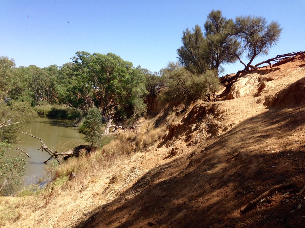
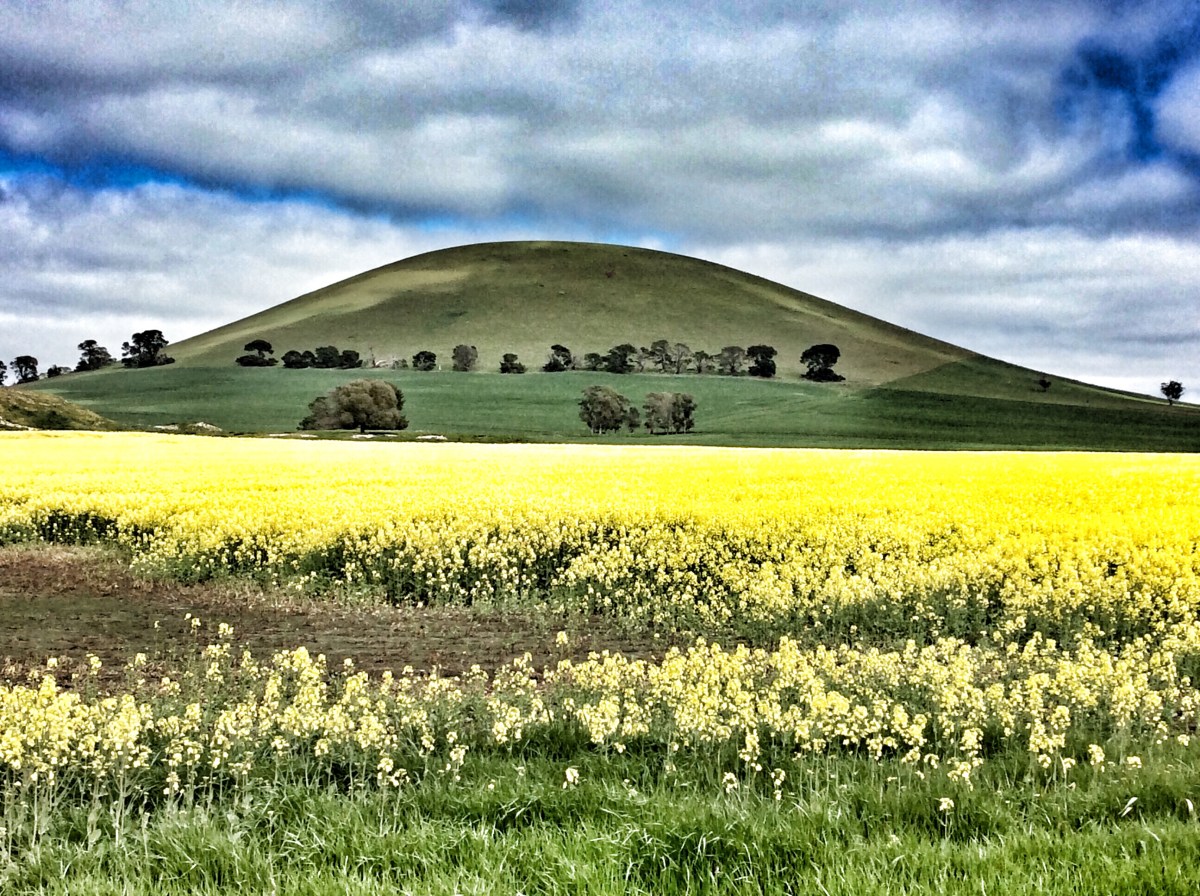
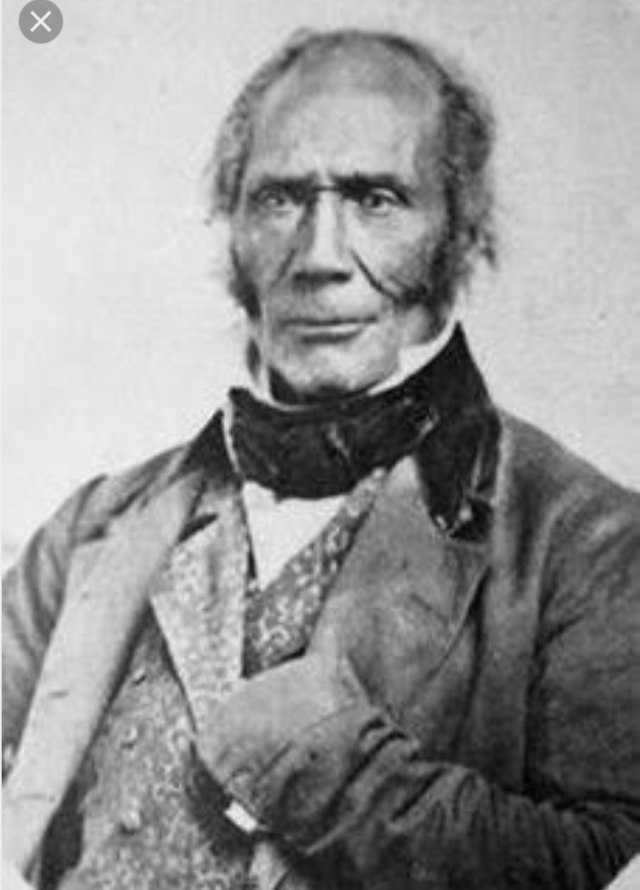
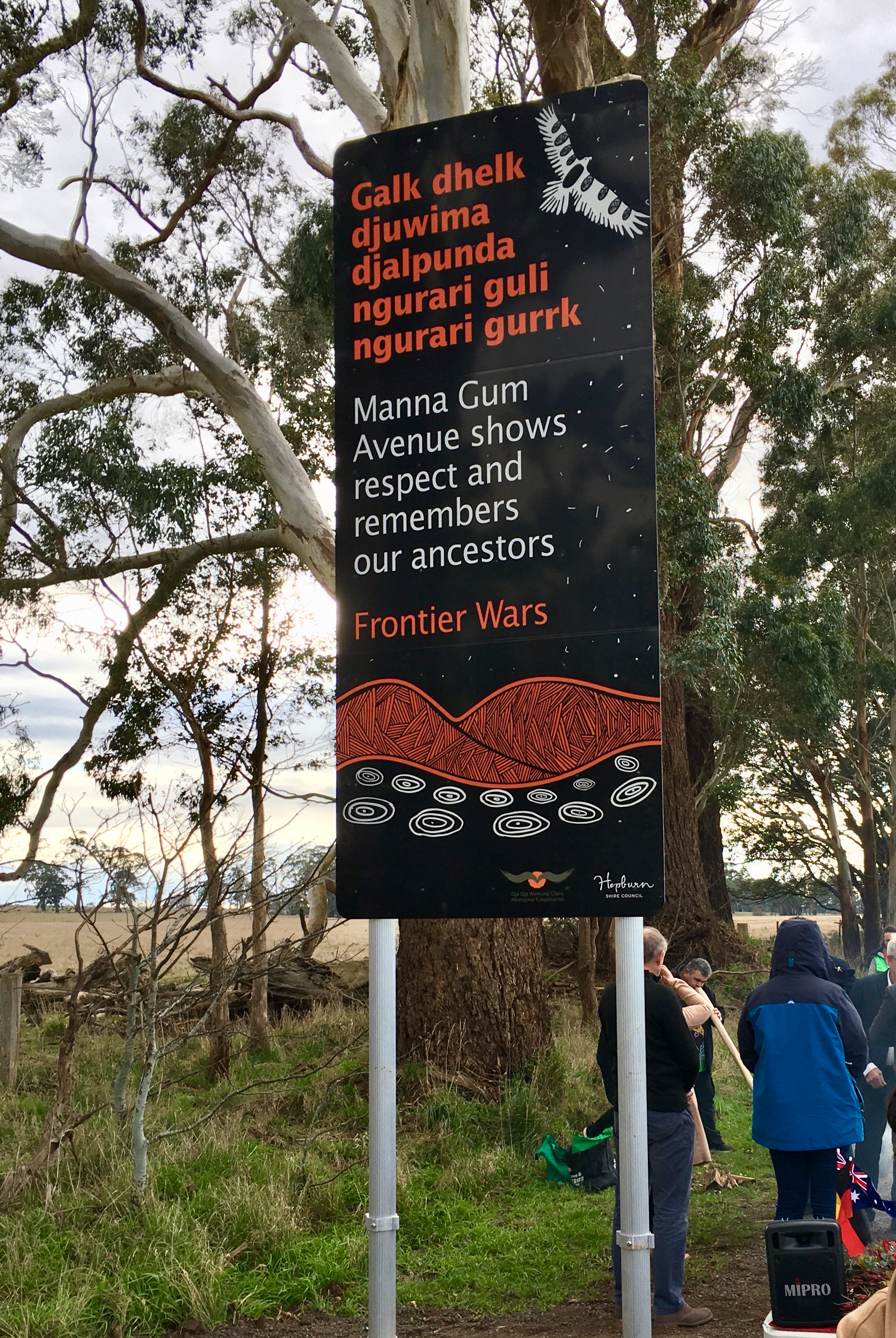


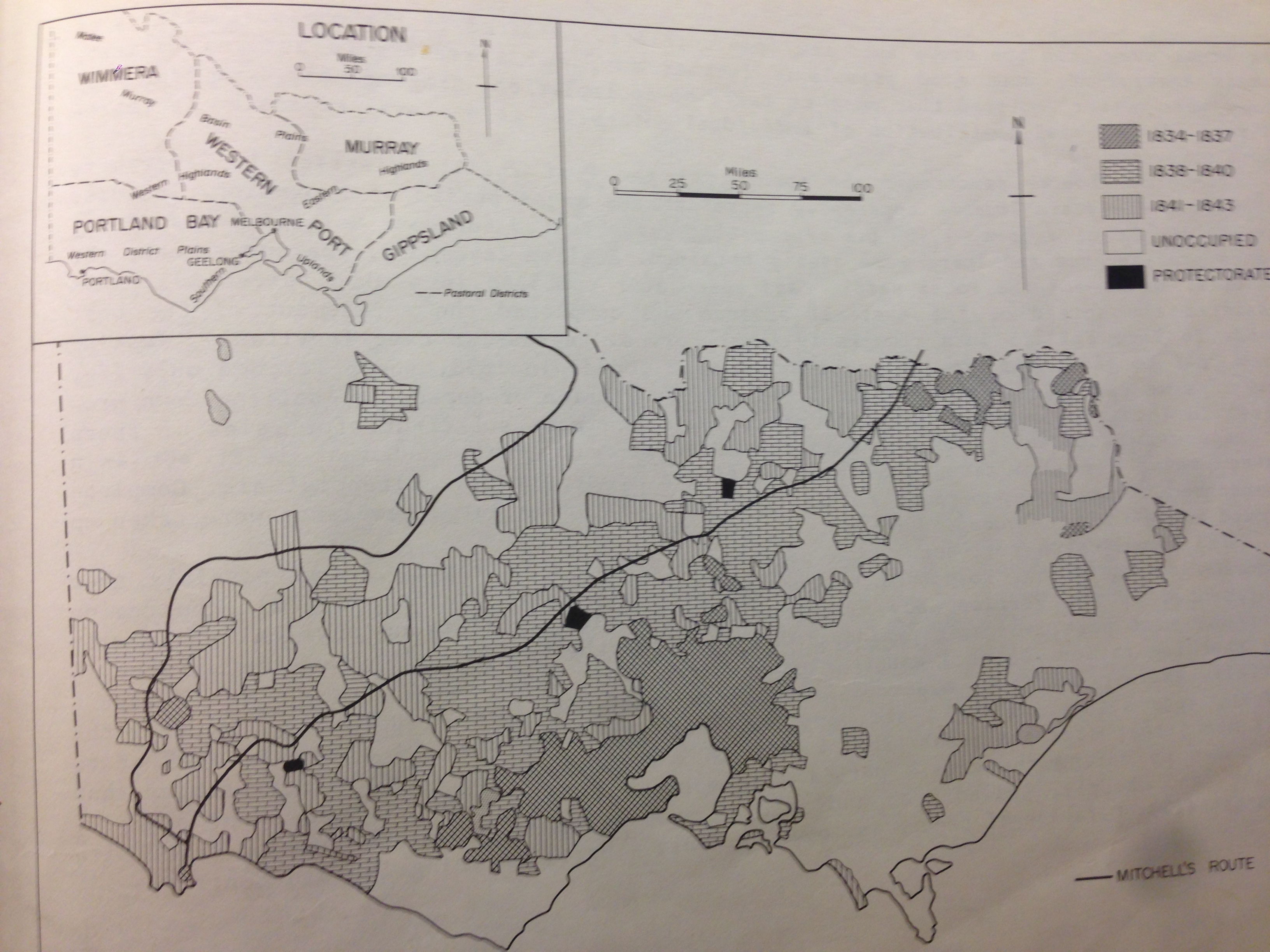


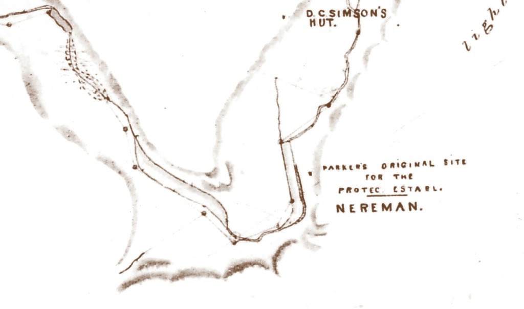


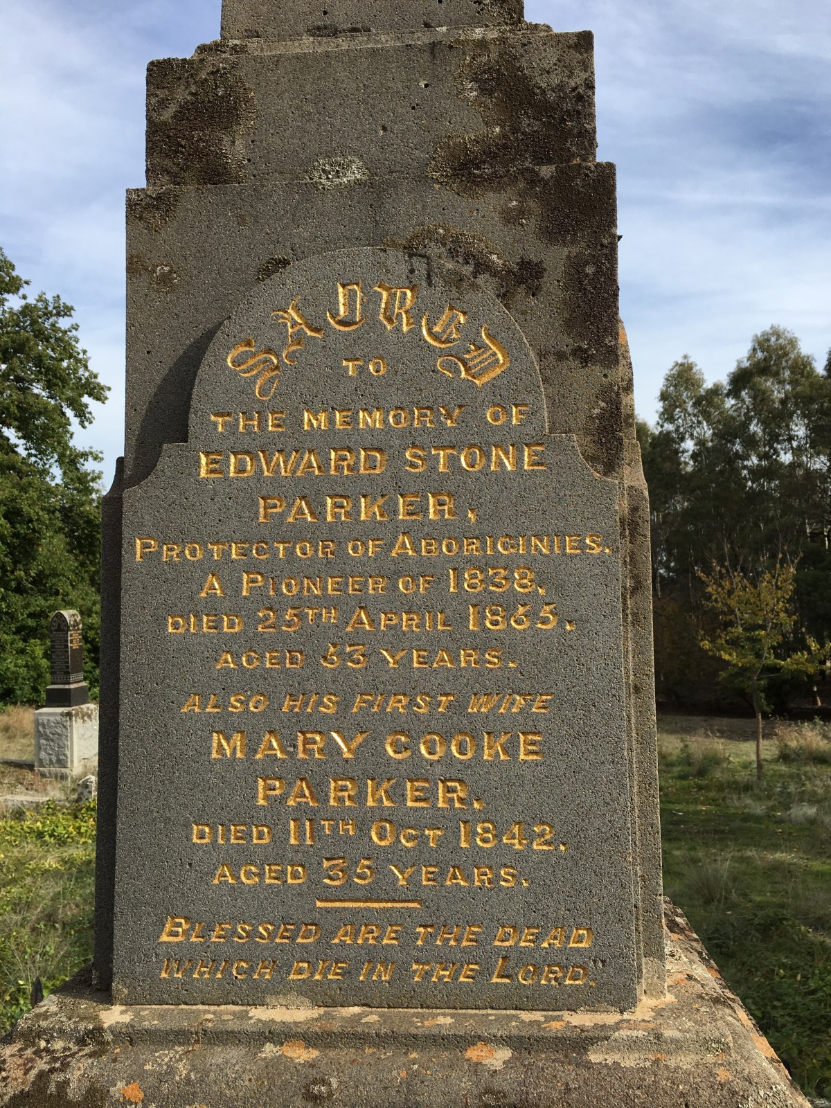

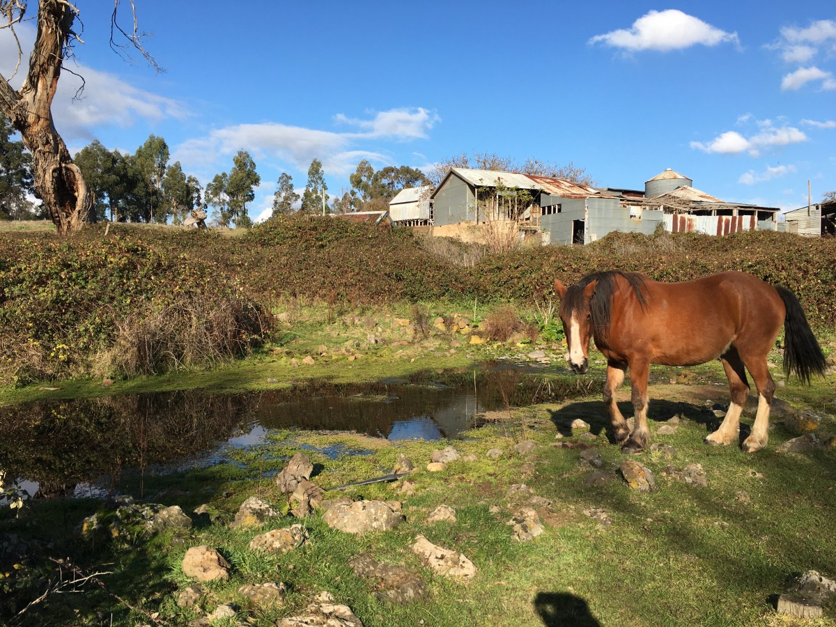
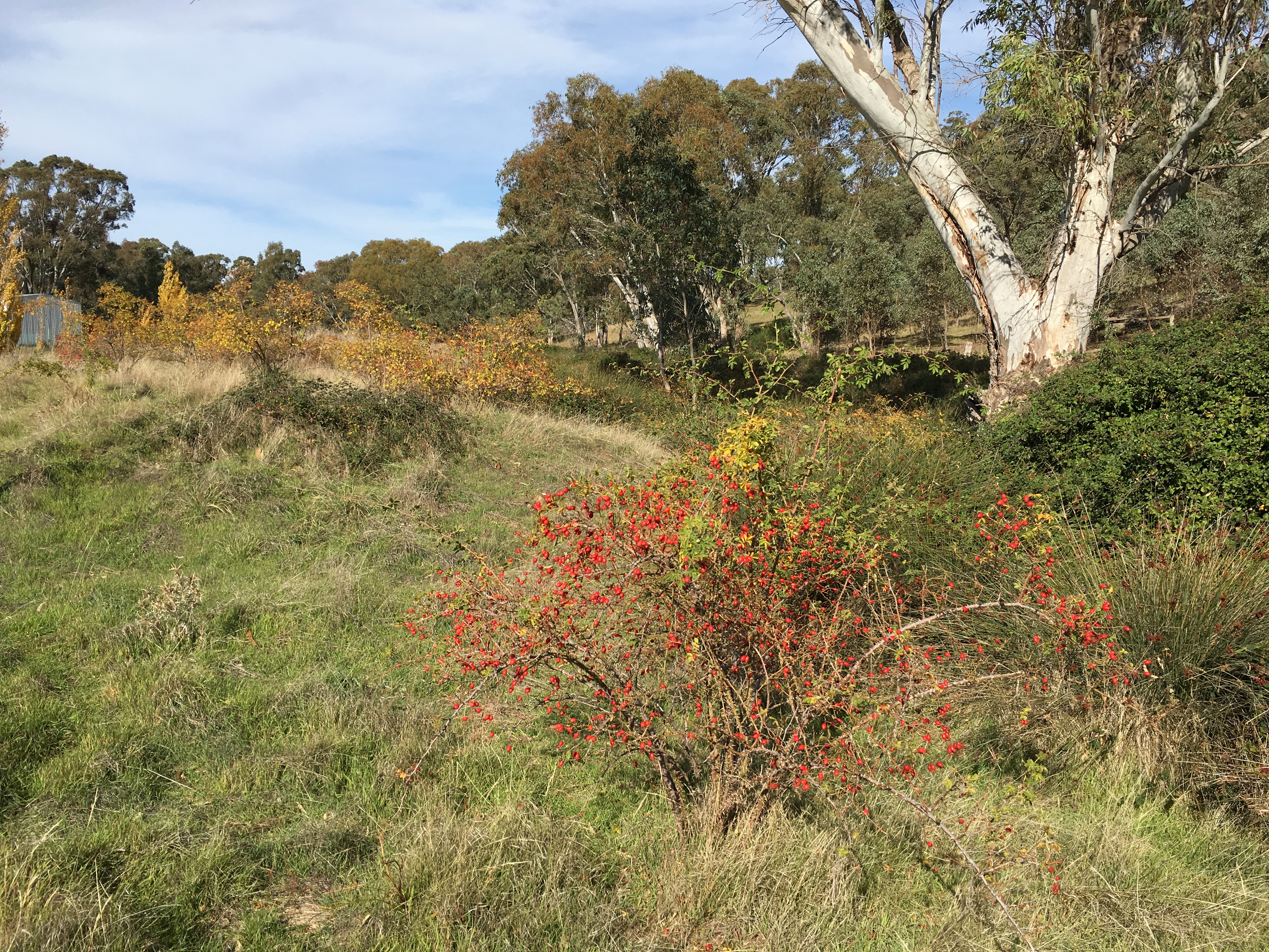
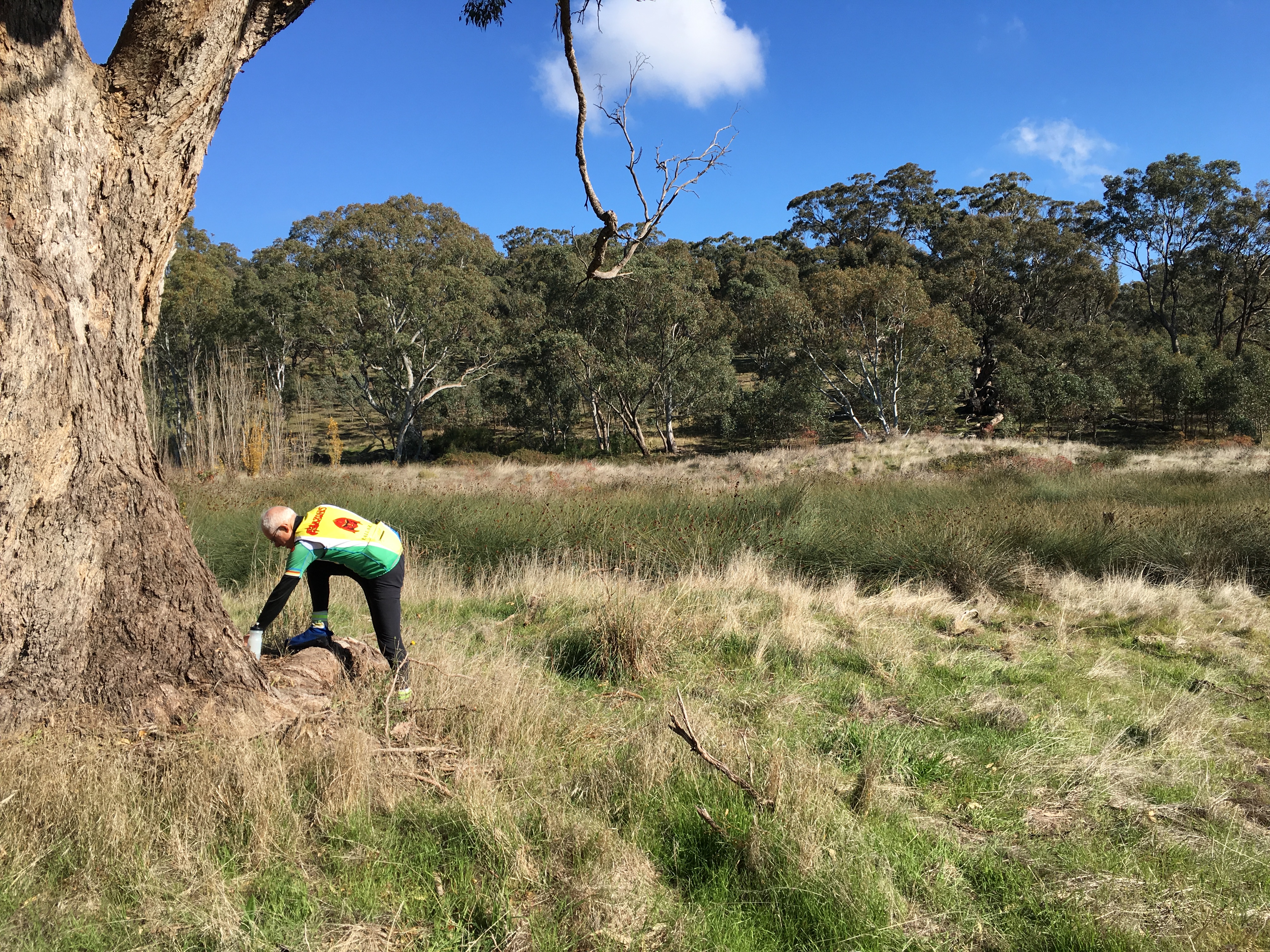

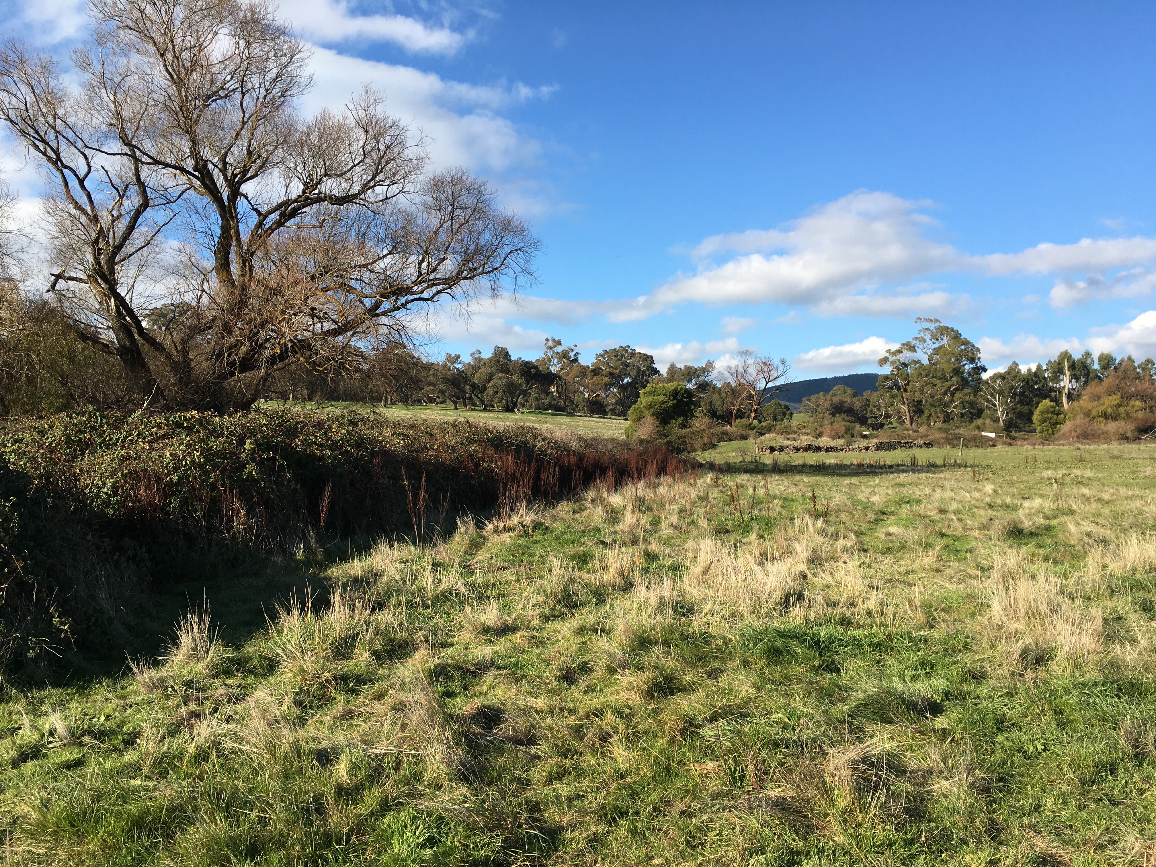 Loddon Aboriginal Protectorate-Era (1840s) flour mill on The Mill Stream south of Franklinford


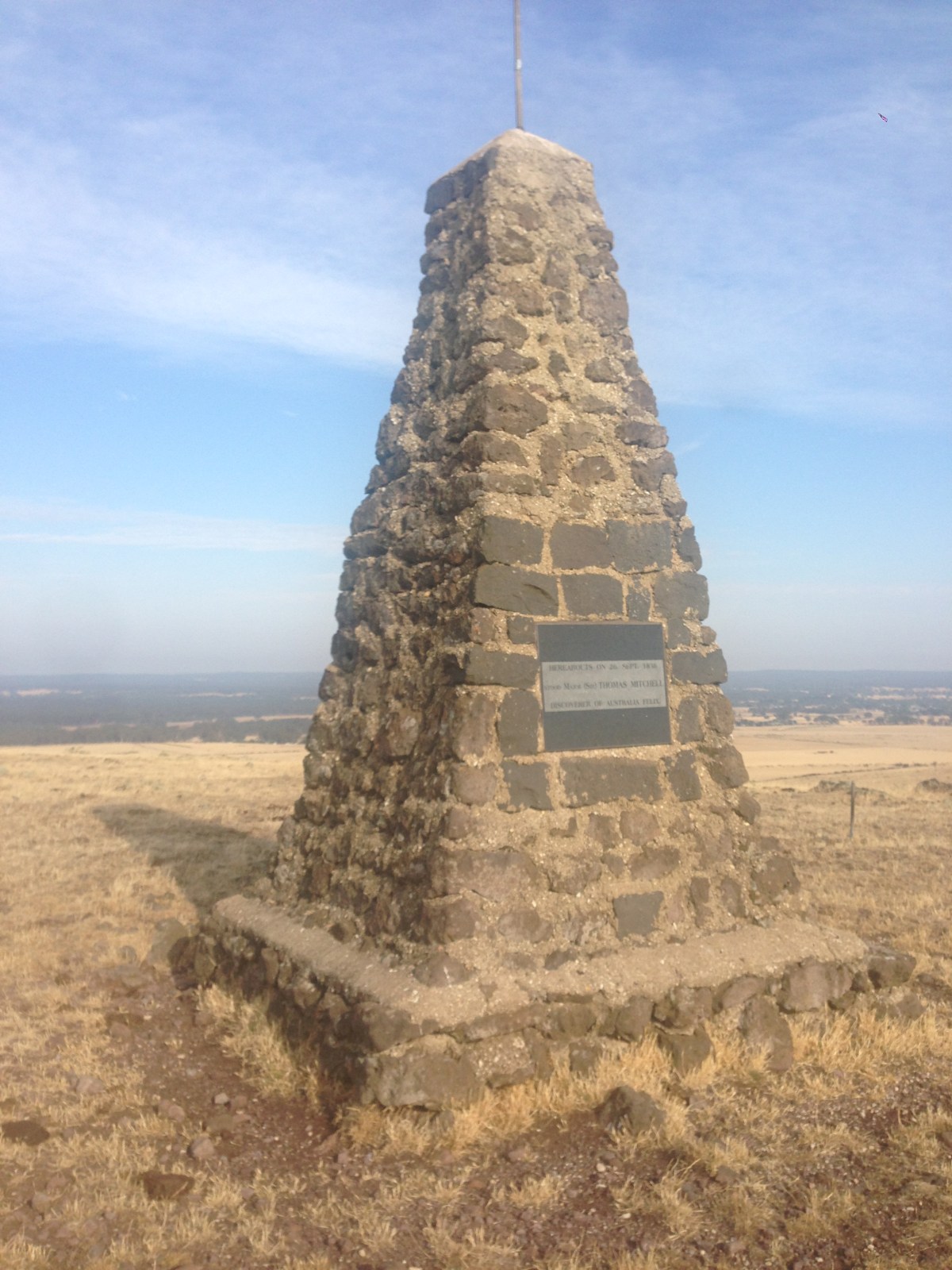


You must be logged in to post a comment.