Loddon Aboriginal Protectorate Legacy
Barry Golding
24 October 2022
These notes are in two parts. The first 2,000 words, headed ‘1840s Aboriginal Protectorate Walk Notes’ provide interpretive notes for walkers who register for the Great Dividing Trail Association’s (GDTA) Members or Public Walks around the Franklinford Township during November 2022. They will also be also useful for anyone embarking on the ‘1840s Aboriginal Protectorate’ self-guided Walk Number 11, pp.34-35, published in 2021 GDTA ‘Walk and Ride Circuits’ guide. Localities marked on the map in the Circuits guide (p.35) are shown in bold.
The second part headed ‘The Evidence Base: Loddon Aboriginal Protectorate History’ (8,000 words) includes the lesser known back story of the foundation of Neereman Aboriginal Protectorate on the Loddon River in 1840, which preceded its relocation to the Franklinford site by mid 1841, operating on its new site until Protectorates were abolished in late 1849.
As with all of my work, I look forward to critical comment, including telling me what I may have got wrong.
1840s Aboriginal Protectorate Walk Notes
Whilst the GDTA guided walks on November 12 & 13 in 2022 follow the marked 6.2 km route in this guide, the longer member’s walk route on 12 November adds a 5 km (approx.) extension incorporating access (with one off permission) across Eric and Joy Sartori’s private property, ‘Truro’ including along part of Larnibarramul yaluk (formerly Jim Crow Creek) with an historic weir from the 1930s. The interpretive notes for this additional loop beyond the Franklinford Cemetery (which cuts out the section along Ligar Street) follow the main notes.
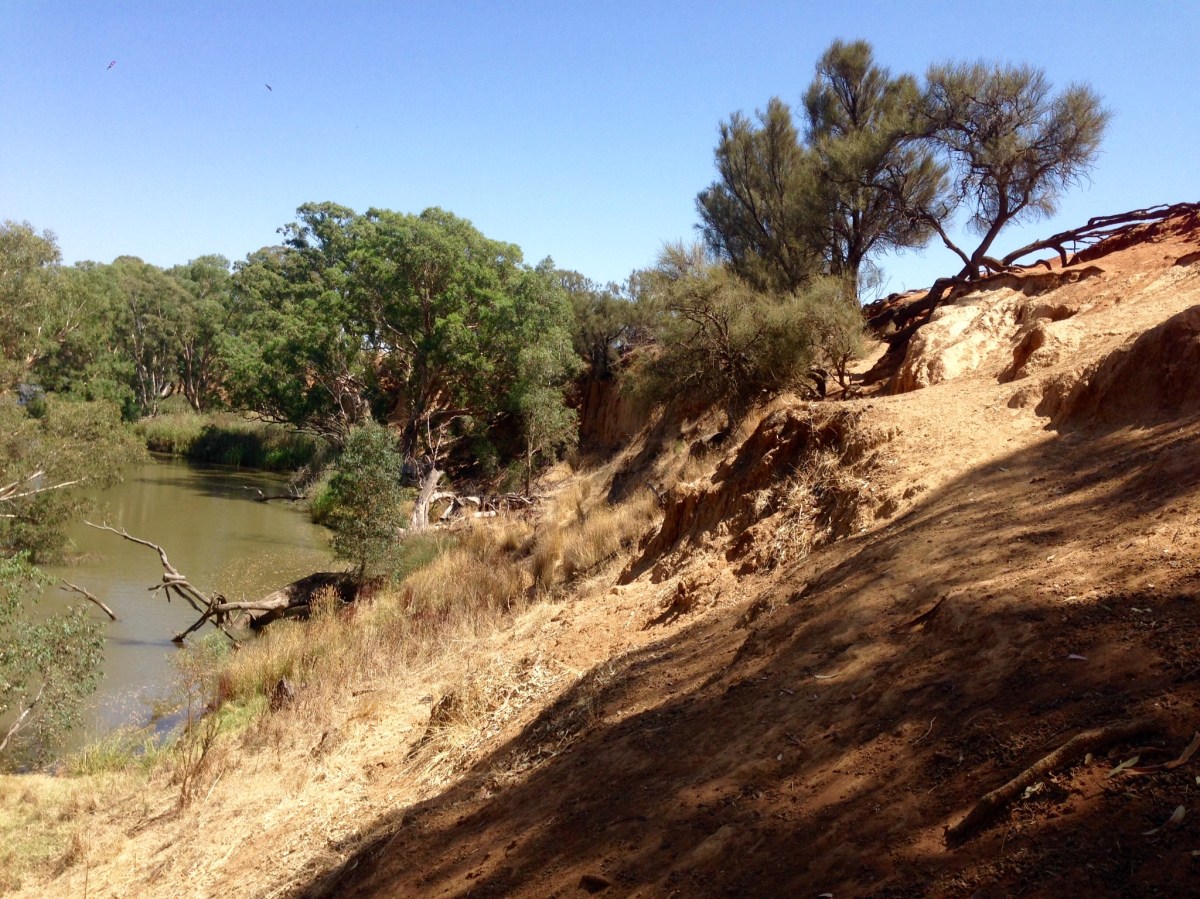
Clarkes Pool on Larni barramul yaluk is a delightful and picturesque pool on a tight bend of a billabong in the creek within the Franklinford Streamside Reserve. It was formally surveyed in the 1990s as an important Aboriginal site. The late Frank Powell from Mount Franklin wrote in the late 1960s that this ‘billabong on Jim Crow Creek at Franklinford … was a known corroboree site’. There is a detailed account of an Aboriginal Corroboree held in Franklinford in November 1843 though its exact location is not specified.
The bitumen access road down to the Streamside Reserve is via Clarkes Road, which heads SW from the main Franklinford intersection until it veers south, becoming gravel as it crosses the top of the very tight meander, with steep drops to the creek on either side, before ending at a parking area beside the billabong pool under the ancient River Red Gums short of a disused road bridge.
In summer, if the water is flowing gently this is a delightful, popular and safe place to picnic and swim. Platypus have been sighed in the pool. Clarke’s Pool has been featured as the backdrop to several videos produced by Hepburn Shire with the Dja Dja Wurrung traditional owners as part of the community consultation process leading to the creek’s formal renaming during 2022.
The first part of the walk leads back along Clarke’s Road. Franklin Ford, marked in the GDTA guide to the south of the gravel road, was the original crossing point on the creek for an 1840s road that originally led from the Protectorate station south west through the forest via a bridle track to John Hepburn’s run. The ford is visible as a basalt pavement in the creek off the road easement.
The walk route turns left into the Franklinford Cemetery along Cemetery Road. Immediately to the left there is a grassy track that leads down to Thomas’ Spring. The fact that this public freshwater spring runs all year round and fills the pool in even the driest seasons was one of several features which made the Franklinford site attractive as an alternative Protectorate site in 1841. You will notice the grey basalt rocks around the pool are stained with a white precipitate, indicative of high calcium carbonate levels in the water and some possible association with a mineral spring at depth. The pool is often fringed with the floating aquatic plant, Water Cress (Nasturtium officinale), one of the oldest known edible leaf vegetables native to Europe and Asia, with a distinctive piquant taste.
Cemetery Road cuts out at the Franklinford Cemetery. If you walk into the Cemetery along the paths between the old and more recent graves towards the back of the cemetery, you will come across a much older cemetery on a different alignment enclosed within the larger and more recently surveyed cemetery. The boundaries of the older rectangular Protectorate era cemetery (first surveyed in 1843, but where several burials took place earlier) are marked by a low ditch. The four corners of the older cemetery are marked with wrought iron corner posts and native trees, thoughtfully selected by the late local historian Edgar Morrison during the late 1970s and planted ‘by four visiting Aborigines’. The most prominent marked gravestones in this area commemorate Assistant Protector Edward Parker, his first wife Mary, his second wife Hannah, some of their children and their extended family. PRACTICAL NOTE: This picturesque and historic public cemetery is the only place along the walk route with a (basic) toilet.
The original cemetery records and the mostly wooden original grave markers were lost long ago in a bush fire. As a consequence, it is impossible to know how many people were buried here inclusive of the Aboriginal Protectorate, Aboriginal Station and Aboriginal School eras between 1841 and 1864. Given the hundreds of Aboriginal people and White who lived and died in the area during that interval, the actual number of unmarked burials in this historically significant site is likely to be large. Because the area has been fenced from stock and also regularly and lightly burnt, the cemetery area retains many significant volcanic grassland and woodland species otherwise missing in the surrounding privately owned and intensively grazed paddocks.
The self-guided walk route in the booklet heads back to Cemetery Road and up the grassy and largely disused Ligar Street, named after surveyor, soldier and grazier Charles Whybrow Ligar (1811-1881). Whybrow Street to the east is similarly ‘a nod ‘to Ligar, who became surveyor general in Victoria in 1858 following 15 years working as New Zealand surveyor general. At one time, Ligar and his family invested heavily in livestock. With partners, at one stage Ligar was lessee of three million acres (1,214,070 ha) in the Riverina.
If you to the south from the top of Ligar Street you will get a good view over the paddock south of Clarke’s Road (which includes the marked ‘Aboriginal School Site’. This paddock was the epicentre of the Franklinford Protectorate settlement for over two decades from 1841. If you look towards the southern horizon towards Wombat Hill above Daylesford, and the western horizon you will get some sense that the relatively fertile volcanic soils of the inner main Protectorate area set aside for cultivation (radius one mile) was then conveniently protected, surrounded and bounded (as now) on most sides of the five mile (8km) Protectorate radius by forested land on the older shales. This forested area then deemed as ‘unsuitable for stations’ by Parker, was nominally preserved for Aboriginal hunting within the Protectorate.
TAKE CARE turning right into the relatively busy Hepburn-Newstead Road. For safety, walk well off the road edge before walking east along Stuart Street *** to the marked ‘Former Franklinford Store’ on the street corner, now a private house. Mary Parker’s sister, Charlotte, was in transit to Australia when Mary died. Charlotte stayed on and married Mr W. Bumstead, later operating the Franklinford Store. A Post Office operated in Franklinford for 110 years from 1859 to 1969.
Walk to the marked stone ‘Monument’ southeast of the intersection, acknowledging Edward Parker’s contribution to the Aboriginal Protectorate. An explanation from Edgar Morrison of the symbolism he built into the Parker Memorial Cairn (unveiled in 1965) incorporating carefully chosen rocks was published in Morrison’s Frontier Life (1967, p.v) booklet, as summarised below.
The base of the monument incorporates rocks taken from an early settlers home, which Morrison took to symbolise ‘the sturdy endurance of the district pioneers’. The body of the cairn comprises ‘volcanic boulders from the site of the Aboriginal Station’ as well as some ‘dressed pumice which formed part of the chimney of Mr Parker’s later station homestead on the western slope of Mount Franklin’, embodying what Parker took to be ‘the influences of hearth and home and [Parker’s] devotion to aboriginal welfare and education’.
Morrison symbolically incorporated stones of ‘special significance’ into the three sides of the cairn. To the south, are hand-made bricks in the form of a cross, symbolising Parker’s ‘spiritual aspirations’. On the west are stones from the old Tarrengower Station founded by Lauchlan McKinnon, frequently visited by Parker, perceived to symbolise Parker’s ‘cordial relationships with neighbouring settlers’. The eastern aspect incorporates a white quartz rock whose whiteness ‘may remind us of the high reputation’ which Morrison suggested Parker ‘earned in every situation’.
Behind the monument you will see a sign with ‘Larnebarramul: Home of the Emu’ supported by an axle erected by the late Edgar Morrison. This and several similar metal signs and markers we see on this walk were officially opened at a celebratory Field Day in 1968. First Nations people invited included Ivy Sampson, daughter of Thomas Dunolly (a former schoolboy at the Aboriginal School) and the late Pastor Doug Nichols.
Standing at the Monument intersection, if you were to take a ‘helicopter view’ you are at the centre of a township laid out in the shape of a Union Jack. Early survey maps of Franklinford township included not only the main existing cross roads which run on the diagonals, but also a network of back streets running east-west and north-south, bounded by South, East and North Streets. Many of these named suburban streets, some lined by stone fences, are now disused or incorporated into surrounding properties.
The marked walk includes a ‘dog leg’, SE down (and back) Powell Connection Road towards the ‘Seat Under Pines’ opposite Larnebarramul Lagoon. This is a busy road: walk well off the road with care. In the 1840s this was the main road to Melbourne to the north of Mount Franklin via present day Glenlyon.
On the south side of Powell Connection Road, look out for a metal sign erected to mark where Edgar Morrison believed the Aboriginal Protectorate Station buildings were located. David Rhodes’ 1997 survey and report confirms that while the sign overlooks the actual site below in the far distance, it does not mark the site itself. If you look over the forest to the west, in the distance you will see the outline of the now bald Mount Kooroocheang.
The paddock that includes the lagoon opposite the roadside seat is private property. Do not enter the paddock. The late Frank Powell noted that what he called ‘Strawhorn Lagoon’ in 1967 was a ‘known corroboree site’. David Rhodes’ survey identified and recorded several significant pre- and post-contact Aboriginal sites around this lagoon. Several of the huge Red Gum trees nearby include evidence of ancient strap grafting preserved in their upper branches, as well as pre- and pos- contact habitation spaces within their burnt out trunks.
Walk back along the side of Powell Connection Road, then walk down a steep minor road that trends west before the marked ‘Former Church’, then head south with care along the side of busy Hepburn Newstead Road, turning right (west) along South Street to the marked ‘Aboriginal School Site’. The sign including the outline of a symbolic school bell reads ‘Aboriginal School Site 1849/1864’. The paddock behind the sign is where most of the original Protectorate buildings were clustered including what became the Aboriginal School. The foundations on main site and school approximates a clump of ancient Robinia (Black Locust) trees approximately 100 metres inside the paddock. Do not enter the paddock.
Additional GDTA Member’s Walk Notes (NB: private property, no entry without permission)
Beyond the Franklinford Cemetery on the GDTA members walk on 12 Nov 2022 (see notes above ***), we walk west following a disused (and sometimes boggy) gated laneway across private grazing property. The laneway is lined in places by collapsing historic stone walls. This was one of the early, once busy goldfields-era roads which would have provided access to and beyond Larni barramul yaluk to the German Gully goldfields to the south west and on through the bush to Kooroocheang.
At the creek we turn north along the east bank, initially following a combination of cattle tracks and goldfields era water races. After a few hundred metres we come to a still intact Weir across the creek. The weir and an associated large channel heading north along the eastern bank were constructed with Sustenance (‘Susso’) labour during the 1930s Depression, taking water all the way north to Newstead. The water system was abandoned by 1980s.
Heading north we pass an outcrop of columnar basalt. The vertical columns run perpendicular to the upper and bottom horizontal cooling surfaces, formed by shrinkage as the basalt flow slowly cooled. Nearby are the eroding mullock heap of a deep lead mine, which originally included tunnels that would have tapped into the gold bearing gravels beneath the basalt flow.
The farm road leaves the creek and heads east up the hill past Eric and Joy Sartori’s orchard and farmhouse along a steep gravel road. Please respect their privacy. As you walk up the hill you get excellent views back down the creek valley. From the top of the hill several peaks come into view including nearby Larnebarramul / Mount Franklin to the east, and in the distance to the north, Tarrengower and Leanganook / Mount Alexander.
Where Sartori Road meets the marked, busy, bitumen Hepburn – Newstead Road, turn right and walk safely on the roadside, NOT going south down marked Ligar Street as in the GDTA booklet, but rejoining the marked walk, interpreted by the notes, above ***, by heading east along Stuart Street.
———————————————
The Evidence Base: Loddon Aboriginal Protectorate History
The history of first contact in southern Dja Dja Wurrung Country has traditionally tended to focus either on a heroic narrative about a small number of White male ‘explorers’ and squatters conquering and ‘settling’ a hostile environment, or the frenetic pace of change during the many gold rushes from the 1850s.
This account of what happened before 1850 is more unsettling. It focuses on a government intervention that sought to coerce and remove First Nations peoples from Country in the Port Philip Colony during the 1840s and concentrate them in small ‘Aboriginal Protectorates’ for their own safety. The plan was to create four Aboriginal enclaves five miles in radius, not only for Aboriginal peoples’ own protection away from widespread squatter violence, but also as a way of expediting the White ‘settlement’ process.
Unbeknown to many present day residents, present day Neereman (north of Baringhup, in the Mount Alexander Shire) and Franklinford (north of Daylesford, in the Hepburn Shire) were epicentres of an Aboriginal Protectorate ostensibly designed to cover what is now north western Victoria during the 1840s,then defined as ‘the Mount Macedon area and country northwards’.
What follows relies heavily on candid accounts from the personal diaries of the ‘Chief Protector’ George Augustus Robinson, as well from ‘Assistant Protector’ Edward Stone Parker, who was responsible for the establishment of Protectorates on both sites. It is supplemented by other information from Edgar Morrison’s three booklets, David Rhodes’ 1995 on ground historical and archaeological investigation, supplemented by original Protectorate records.
In brief, Parker initially set up his Protectorate at Neura Mong (literally ‘hide here’ in Dja Dja Wurrung language, today’s Neereman) on the Loddon River 6 km north of Baringhup in October 1840. He relocated it to the better known Protectorate west of Mount Franklin on Larnibarramul yaluk (previously known as ‘Jim Crow Creek’) in June 1841.
This section focuses mainly on the evidence and back stories behind Parker’s establishment of both the initial Neura Mong / Loddon Aboriginal Protectorate and the relocated Mount Franklin Protectorate that operated in the area within a 5 mile (8km) radius circle of present day Franklinford from June 1841 to the end of 1849.
This account includes only brief mention of the later temporary Aboriginal Reserve, the Mount Franklin Aboriginal Station of 640 acres established at the foot of Mount Franklin in 1852 where Edward Parker acted as a Guardian of Aborigines, built a house and where several Aboriginal people farmed. In 1864 the Aboriginal School operating on the former Protectorate site at Franklinford was closed and the remaining Aboriginal people living on the Station were removed to the Aboriginal Station at Coranderrk near Healesville. When it also in closed in 1924, many Dja Dja Wurrung descendants were moved on to Lake Tyers Mission.
The Back Story of the Aboriginal Protectorate System
Turning the clock back to 1837, a British Committee of Inquiry into the Condition of Aboriginal Peoples set up in the wake of the previous shameful treatment of and armed resistance from First Nations peoples in Van Diemen’s Land, recommended a Protectorate System be attempted in mainland Australia, confined initially to the Port Philip District. The system was premised on the refusal of the British Government to recognise prior ownership of Australia by First Nations peoples.
Four Assistant Protectors were recruited from England and appointed in December 1837. None had been to Australia before, all had previously been schoolmasters and none had ever met Aboriginal people. Edward Parker had been earlier been apprenticed as a printer, then had to give up candidacy as a Methodist Minister when he violated the condition for ministerial candidates by marrying. The Assistant Protectors arrived in Sydney in August 1838, but because of administrative delays did not reach Melbourne until 3 January 1839. For the first few weeks they were camping in tents with their families (including their wives and a total of 22 children) on the Yarra River a mile out of Melbourne with no definite instructions.
On 27 Feb 1839 they met the Chief Protector, George Augustus Robinson, appointed on the basis of his ‘success’, previously employed to cajole, deceive, remove and concentrate most First Nations Tasmanians to Flinders Island during the 1830s. Robinson appears, from his frank and critical diary entries, to have been instantly underwhelmed by and intolerant of the four men that were to be in his charge. His particular and ongoing dislike of Assistant Protector Edward Parker, who by March 1839 had been allocated to ‘the area around Mount Macedon … and the country to the northward and eastward’, saturates many of the accounts cited in this account taken from Robinson’s personal diaries.
For context, by March 1839, John Hepburn and family had been on southern Dja Dja Wurrung country for almost a year and had established a sheep station at the foot of Mount Kooroocheang to the west of the Larni barramul (‘home of the emu’) crater, today’s Mount Franklin. Mollison was by then firmly established in the Kyneton area and Ebden was at Carlsruhe north of Woodend. Many other ‘unsettlers’ had come overland from Sydney following Major Mitchell’s 1836 ‘Line’. By 1839 they had ‘taken up’ (forcefully and violently seized) much of southern Dja Dja Wurrung Country, and other squatters had pushed north through Wadawurrung Country over the Great Dividing Range into some of the most fertile and densely settled inland First Nations estates in Australia.
Understandably, there was resistance to forced removal from Country by the traditional owners in the process of setting up ‘runs’, including by John Hepburn on the Smeaton Hill run. George Robinson first mentions ‘Captain Hepburn’ in his diary whilst in Melbourne on 15 March 1839, writing that Reverend Gill, the first Anglican Minister in Melbourne, had told him that Hepburn said that ‘… the blacks had frequently attacked his station, generally in his absence. Said the natives had guns with them’. By the time Robinson first met John Hepburn in Melbourne six months later, Robinson recorded Hepburn saying (on 25 September 1839) that ‘… the blacks are very numerous in his neighbourhood. They had killed his sheep and all but strangled a shepherd. Believes they were Port Phillip natives. … Said the native women and children fled to his station for protection.’ In the same diary entry, Robinson writes that Hepburn also mentioned that the ‘Names of settlers beside him were Pettit [W. H. Petit managing ‘Dowling Forest’ run north of Ballarat for W. J. T. Clarke], Coggle (sic.) [the Coghill Brothers at ‘Glendonald’ run near Clunes], and Birch [on the ‘Seven Hills’ run near present day Kingston]’.
In 1839, the government instructions as to how the Aboriginal Protectorate system might work in practice were rather vague. Given the extent to which the best country had been so quickly carved up for sheep stations by this time, Edward Parker’s prospect of selecting a Protectorate site which ticked all the boxes was almost impossible. Robinson suggested that the four Assistant Protectors should do what he had done in Tasmania during the 1830s, and begin to move with the Aboriginal groups in order to learn their languages and culture, in the process devising the best means of civilising and protecting them. By March 1839, this suggestion had become a direction from Robinson.
All four Assistant Protectors were ill equipped, with very limited resources, support or budgets and were understandably reluctant to move far away from Melbourne, each with wives and large families. In Parker’s case, his wife Mary already had six children and was pregnant with their seventh. By mid 1839 Parker had begun to comprehend the impossibility of his task in the face of concerted pastoralist and press opposition to the Protectorate idea. As the failure to prosecute those responsible for the murder of 28 unarmed Aboriginal men, women and children in the infamous Myall Creek Massacre (near present day Bingara in northern NSW) in June 1838 had shown, the Aborigines then had no rights to give evidence in court and the many well documented cases of pastoralist murders of Aboriginal people pursued by the Assistant Protectors were unable to be prosecuted.
To make matters worse, by the late 1830s, desperate and starving Aboriginal people on the pastoral frontier in the Port Phillip District had most contact with convict shepherds and hutkeepers in the virtual absence of police or of the rule of law. Many were moving desperately between the early settlements that had taken their most productive land and food resources, now grazed by sheep. Some had resorted to coming to town, particularly Melbourne, some involved in begging, prostitution and the use of force against the invaders.
It was Parker who believed that the Assistant Protectors needed some inducement to encourage Aborigines to be concentrated on the proposed Protectorate Stations, in the form of clothing, food and shelter, quite apart from the medals and trinkets which Robinson often employed. Like Robinson and the other Assistant Protectors, Parker also fervently believed that his responsibilities included civilising Aboriginal people and that this was best achieved by Christianising them.
By September 1839 Parker and his family had moved out of the small town of Melbourne but only as far as Jacksons Creek near Sunbury. Not far from the current Emu Bottom’ property, he erected a wattle and daub hut for his family. Parker’s request that the Protectors be allowed to form Protectorate Stations was finally approved by Governor Gipps in April 1840. The idea was to have an inner reserve of one square mile for cultivation, and an outer reserve with a five-mile radius for hunting and gathering. This proposal meant that 25 large and diverse Aboriginal Nations and peoples in the Port Phillip District, including the Dja Dja Wurrung, were to be concentrated into four arbitrary areas comprising a total of only 200 square kilometres, representing only 0.08 per cent of the land area of Victoria. In modern terms it might have been called a concentration or refugee camp.
Whilst the four Assistant Protectors had been awaiting Gipps’ approval to form Protectorate Stations, they undertook reconnaissance for where the four Protectorate stations should actually be located. With this task in mind, Robinson travelled extensively including to ‘the Loddon District’ with Parker between 9 January and 11 March 1840. Robinson’s extensive diary records whilst in southern Dja Dja Wurrung country on this reconnaissance trip with Edward Parker provide one of the best first hand, written records of many aspects of the southern Dja Dja Wurrung Country and people in the landscape at that time. Gary Presland’s timely self-published book, ‘Riding with Robinson’ (2022), provides a detailed, annotated account of Robinson’s personal diaries during this trip.
Robinson’s diary entries relating to this reconnaissance indicate that Robinson and Parker’s journey approximated the current Western Highway through the Pentland Hills between Melbourne and Ballan, then diverging west to travel in an arc close to present day Mount Edgerton, Scotsburn, Buninyong, Yuile’s Swamp (Lake Wendouree) and Mount Hollowback (which they climbed). At this point they were on the edge of southerd Dja Dja Wurrung country. Thence, on 13 February 1840 they passed through ‘fine open downs’ surrounded by ‘numerous ball topped hills crowned with grass and below grassy plains and open forest, passing Pettit’s [Dowling Forest] and Birch’s ‘comfortable house’ [near present day Kingston] before arriving at John Hepburn’s Smeaton Hill station.
The initial Protectorate site at Neereman 1840-41
One of the main reasons for Robinson and Parker’s eight week trip was to identify a site for Parker’s Protectorate station. Climbing in 14 February 1840 to the top of Mount Kooroocheang just behind Hepburn’s station gave them a splendid view. According to Robinson, John Hepburn: ‘Pointed out the [proposed] place for Parker’s station distant 9 miles NE by N. on the Major’s Line and where he encamped.’ This would have placed it on the Loddon River in the vicinity of present day Newstead.
Robinson continued:
There are large water holes here and plenty of fish, and kangaroos in abundance. And its (sic.) on the border. Nor will it be required. Hence a better site for an establishment could not be selected for the district. It is accessible from Melbourne, 90 miles by the road through the ranges, and could easily be found, being on the Major’s Line. There is a hill Mr Hepburn calls Salus [Mount Tarrengower] N and E to the right of Major’s Line. It’s a good object for travellers. Also a hill Mr Hepburn calls Jem Crow [Mount Franklin] because of the numerous small hollows around it.
The next day Robinson had clearly talked about their options with Hepburn and Parker, noting that Hepburn had offered every assistance in showing him the way over the ranges to the proposed Protectorate site, shortening the route from the 120 miles via Geelong to 80 miles via Mollison’s (near Malmsbury) and Mount Alexander. By then Hepburn had also identified a shorter road from his station to Steiglitz’s (today in the Ballan area) on an ‘almost level road’ impeded only by large fallen timber. This route described was likely past the current Clarke’s Hill and south through the former Bullarook Forest, now prime potato country on the well-watered Great Dividing Range.
On 20 February 1840 Robinson and Parker headed north from Hepburn’s station at the foot of Kooroocheang towards the Loddon River, by following what is now known as Joyces Creek. Robinson wrote that day in his diary that:
This is certainly a good situation for the head station of the Macedon district. It is guarded from the encroachment of squatters, provided the government do not assign them any country, and is accessible at all points. The Major’s Line runs through the centre and it is open at the N and S end and can be approached by the natives without interference. Its length, extreme, is four miles and average breadth one mile. The two ponds are nearly united; by opening up the reeds course of the [Loddon] river runs through. The average length of these ponds is 400 yards, breadth 100 feet. The natives have made Mitchell’s highroad their road. Their track is well beaten upon it.
In reality it was the other way around. Mitchell had been following a well-trodden, ancient Dja Dja Wurrung highways through intensively managed aboriginal grasslands and along the rich Polodyul / Loddon River Valley. On their reconnaissance expedition along present day Joyces Creek, Robinson (on 20 Feb 1840) was at first ‘at a loss to account for the wheel [tracks] and immense number of cattle tracks we now met with’. Later he realised they had crossed Mitchell’s now well-worn ‘Line’. The ‘encroachment of squatters’ alluded to above was already well underway.
Parker returned on 12 March 1840 to his home base near Sunbury, after this tour of reconnaissance with Robinson. This tour ‘into the interior’ of his allocated north west area led Parker to write to Robinson on 18 March 1840 that ‘I wish to station myself and family immediately in a central situation about the Loddon River’, seeking permission ‘to occupy a suitable tract of country in the situation I have indicated’.
Parker’s rough sketch shows an extensive area between the Pyrenees (‘Pilawin’) to the west, and Mount Macedon (‘Terrawait’) to the east, bounded on the south by ‘Bunninyong’, ‘Warrneip’ (Mount Warrenheip)andMurniyong (Mount Blackwood) and to the north by the granite range comprising Leanganook (Mount Alexander) and Mount Byngh (Mount Tarrengower). By that time in March 1840, there were already nine named squatters marked on his map north of the Great Dividing Range. Elmes, Lynot, Coghill and Hepburn were towards the west, and Ebden, Mollison, Thornloe, Monro and Hutton were towards the west.
The forested country now comprising the then conjoined Creswick, Wombat Upper Loddon and Lerderderg forests plus the then ‘Bullarook Forest’ on the Great Divide around Dean and Mollongghip were marked as ‘Broken Forest Country unavailable for stations’. Parker’s map suggests that the Loddon River valley north of the forest between Mollison and Hepburn’s stations in the vicinity of what is marked as ‘Mitchell’s Line’ had in March 1840 apparently not been taken up. It was this area that Parker set out to return to and examine more closely in mid 1840.
Edgar Morrison (1966, p.16) cites Parker writing (no date given) that he had narrowed down his choice ‘to a particular section of the river in the vicinity of the hill called by the natives Tarrengower’, where he had found a site ‘which seemed to be particularly eligible for the aboriginal establishment’. Parker was clear about his motives and asserted Aboriginal rights not otherwise established until the Mabo decision over 150 years later in 1992. He noted in 1840 that: ‘I deem it my duty respectfully but firmly to assert the right of Aborigines to the soil and its indigenous productions, until suitable compensation be made for occupation by reserving and cultivating a sufficient portion for their maintenance’.
The Neereman Protectorate site on the Loddon River actually chosen by Parker had, unbeknown to Parker, recently been occupied by squatters Dutton, Darlot and Simson, who challenged its establishment. Despite strident public opposition for the Protectorate’s establishment during 1840, aired in the pages of the Port Phillip Herald (which was co-owned by Dutton), by February 1840 twelve Aboriginal dwellings had been built at Neereman. Parker returned to Melbourne from Nerreman on Christmas Eve, 1840 and arrived at Robinson’s office on Christmas Day, 25 Dec. By then Parker had compiled a list of hundreds of named individuals in twelve Dja Dja Wurrung clans, then called ‘Jajowrong sections’ also listed in Robinson’s 25 December diary. The number of people in each clan was also estimated, ranging from ‘about 50’ Galgalbulluk to ‘only two survive’ of the Wonangabulluk.
Aside from the squatter resistance, the less than ideal sandy site and the poor timing of its establishment in a hot summer of an extremely dry year had by then become obvious. The many problems Parker faced during this period are comprehensively covered in Bain Attwood’s The Good Country (pp.100-101). By 5 January 1841 Parker was writing to Robinson seeking permission to relocate the North West Protectorate site. By then an inspection of the Neereman site by overseer, Robert Bazeley , confirmed that the cultivation proposed as part of the civilizing and Christianising project at the Neereman site was not feasible. Bazeley identified a preferred alternative site ‘about three miles above the point where Major Mitchell’s Line crosses the Loddon’. Edgar Morrison in 1966 concluded that this would have placed it ‘on the river flats in the vicinity of the Strangways Railway siding’. However Lachlan McKinnon, then owner of the nearby Tarrangower run wrote on 7 Jan 1841 to Governor La Trobe strongly objecting also to the Strangways site.
As an aside, overseer Bazeley’s daughter died at the Franklinford Protectorate site in June 1842. Being one of the first recorded white settler deaths she was buried, in Parker’s words (cited in Morrison, 1971, p.43) at a ‘suitable place for a burial ground’. This burial preceded the formal survey of the Franklinford Protectorate Cemetery by approximately 18 months, likely on the same site, as Parker’s first wife, Mary was later buried there in October 1842.
Parker called on Robinson in Melbourne several times in early January 1841. On 14 January 1841, Robinson wrote that ‘Mr Parker called p.m., brought a letter explanatory in reference to his proceedings in reference to the native locality on the Loddon River’. However from early February to mid-August 1841, Robinson was distracted by his insatiable travel bug and conveniently distracted from the impossible task of managing all four Associate Protectors. From 4 Feb to 23 Feb Robinson was away on a tour to the Ovens River district. From 21 March to 14 August Robinson 1841 was on tour again, this time undertaking reconnaissance for the southwestern district Protectorate station briefly based at Mount Rouse. By the time Robinson returned, the Protectorate had already been relocated.
The move to Larnenebarramul in 1841
Robinson first visited Parker’s new station site centred on present day Franklinford on 19 Nov 1841, that he described as being:
… on one of the sources of the Lodden (sic.), at a place called Willam.be.par.re.mal [‘place of the emu’], a short distance from Lal.gam.book. The appearance of the place on approaching is rather pleasing; it is however surrounded by broken forest ranges containing abundance of game.
Robinson observed that Mrs Parker was ‘in general dirty’ in appearance, and he ‘first rode around the station to give Mrs Parker an opportunity of cleaning’. Robinson stayed there only one night, sleeping in Parker’s office but did not actually meet Edward Parker. Robinson also reported that ‘few natives’ were present, before heading off instead towards Le Soeuf’s Protectorate Station on the Goulburn River via Mollison’s station, close to present day Malmsbury (where he did finally meet Mr Parker).
Robinson’s explanation for the absence of ‘blacks’ at the Franklinford Protectorate, was that the day he had arrived, ‘… the blacks went off to the north for more blacks’. The next day, 20 November 1841 he suggested another explanation, when he wrote that ‘Nearly all the natives were leaving the station. The natives say too much sick[ness] at the station at Willam.be.parramul’, that he later (23 Nov) calls ‘Jem Crow Hill’. That day Robinson included a tally of the fluctuating number of Aborigines at the station between 8-19 November, from a peak of 79 men to a low of 29 men when he arrived. On 9 November 1841 there were 132 Aboriginal people present: 60 men, 24 women, 30 boys and 18 girls.
Robinson noted that ‘The Aboriginal station here commenced June 1841’ and listed all of the buildings, paddocks and crops. The buildings included Parker’s four-room slab house and the overseer’s split slab, two room hut. Robinson, in his typically critical fashion, also painted a fairly grim but perhaps honest scene in his personal diary on 20 Nov 1841. Such scenes were deliberately missing from the gilded descriptions both Robinson and Parker provided which were incorporated into government reports of the time.
I saw no signs of a school. … The natives much diseased. … It may be considered an establishment for prostitution. … Natives described how poor men, i.e. settler’s servants drove them away when their masters come. The hill at Loddon station is called Wil.lam.be.par.ra.mal (emu house). The creek or branch of the Lodden is called Lulgambook.
Robinson noted in his diary two months later, on 20 January 1842, on his way to what he described in detail and referred to as a distressing and tragic hanging of two condemned Aboriginal (Tasmanian) men, that on the previous day in Melbourne, he gave ‘Mr Parker medals for the Lodden station and appointed Boardman to his station’. Boardman was employed as a carpenter.
There were many goon reasons why being taught discipline and punctuality and voluntarily tilling the soil alongside paid White overseers, bullock drivers and farm hands on Protectorate Stations was never going to work, aside from the First Nations need to fulfil ongoing obligations to Nation, Clan, family and Country. The main ‘carrot’ to come to the Protectorate and stay was the provision of food and medical help, which by then was desperately needed. By late 1841 Parker estimated that 90 per cent of Dja Dja Wurrung people in his Larnibarramul census were debilitated by syphilis. A more complete account of the many reasons why the Protectorate also failed on this new site is found in Bain Attwood’s The Good Country, Chapter 6.
Momentous family pressures during these first five years also began to surface publicly for the Parker family. Mary Parker had spent almost five years raising a large family on the frontier swelled by many apparently ‘orphaned’ children they had ‘taken in’, much of the time whilst her husband, Edward was absent for long periods. On 2 Sept 1842 Robinson wrote in his diary that Assistant Protector Dredge had made an affidavit that he saw Assistant Protector Sievwright kiss Mrs Parker (Edward Parker’s wife) and had gone ‘into her cabin at all hours of the night’. Parker arrived in Melbourne on 24 Sept 1842, meeting with Robinson on 26 Sept to provide Robinson with another shocking revelation. Robinson in his diary of 29 Sept 1842 wrote that Parker had told him ‘that they saw Sievwright, fastened the tent and have connection with [Sievwright’s] daughter that the latter struggled but that he effected his purpose.’ In effect Parker was alleging Seivwright had committed incest.
Evidence from other sources confirms that colonial authorities and squatters already had a hatred of Sievwright because of his dogged attempts to try and bring the many murderers of Aborigines in the western district that he was responsible for to justice. They then judged him to be ‘of dubious moral character’ with claims [alluded to above that] he had committed adultery with a fellow Assistant Protector’s wife, and most serious of all, that he had committed incest with his 16 year old, eldest daughter, which promptly ended Sievwright’s commission.
It is highly pertinent to note here that Parker’s first wife, Mary, died tragically and ‘unexpectedly’ (age 35 years) less than a fortnight after the last of these diary records of Robinson which mention this conversation with Edward Parker on 11 October 1842. What happened and what was said in the Parker household in that fortnight can only be guessed at. Morrison suggested in Early days in the Loddon Valley (1966, p.64) that Mrs Parker’s life in the previous four years before her suicide had:
… been one of privation, hardship and solitude. So acute was her feeling of loneliness, occasioned by her husband’s frequent and prolonged absences on official duties, and by the dearth of female friends and companions, that she pleaded with her younger sister Charlotte to join her [which she did, but arrived after Mary Parker’s death].
Edward Parker was away in Melbourne the night his wife, Mary died at the Franklinford Protectorate site. The six young Parker boys were then in the household, age between six and 14 years, had actually been in the home at the time and were left without a mother. One of Parker’s children, writing years later recalled, ‘a distressing noise in mother’s room’ at ‘the midnight hour’ the evening she died.
A young convict at the station, a constant companion of Parker’s on many of his expeditions, volunteered to ride the 80 miles (130 km) to Melbourne in the dark to fetch Parker, which he did on a series of horses in only six hours. Remarkably, he was back at the station by 9pm the next evening with Parker, despite taking two hours to finally locate him once he got to Melbourne.
Robinson next visited the Loddon Aboriginal Station for a few days in late November 1842. When he arrived on 26 Nov 1842, Robinson was unusually upbeat, recording:
Natives present 47 men, 33 women, 41 youths and boys, 22 girls, total 143. But as they kept coming in I should suppose there were 200. There was a good church and school and much fencing done since I was there last [almost exactly one year before]. Crops looked well. Gave the natives a treat. The Ma.le.conedeets [literally ‘men of the Mallee country’] were there.
As an aside, a detailed and independent 1883 recollection of a corroboree that included the visitors from the Mallee appeared in the Daylesford Advocate, held in ‘a camp … close to the station’, recalled as involving 300 participants in November 1843.
In late November 1942 Robinson write that he ‘gave [the natives] a blanket to two chiefs and a meddal (sic) each’. On 27 Nov Robinson noted that:
‘All the natives and whites attended [church] service a.m. and were very attentive. Mr Parker spoke to them, part in native dialect and part English. I also addressed them … Mr Parker had service to persons in his own house and prayers morning and evening.’
On the day before he headed back to Melbourne, Robinson wrote on 28 November 1842 that he:
… visited the crater at the mount called Willum-parramul, otherwise Jem Crow. It is an ancient crater of large dimension. … Had a fine view. This morning visited the spring at the establishment a mile and a half distant [presumably the ‘Old Mill Stream’ towards Shepherds Flat]. In the evening attended corrobery (sic) of Malle condeets … At the conclusion both men and women singing together … After viewing … I went to the house. The Jajowrong had remained to a late hour.
In early 1843 Parker filed a Loddon Protectorate census dated 5 January 1843 of Jajowrong (Dja Dja Wurrung) Tribal Groups by clan. Twelve clans were listed with a total of 251 people, including 53 Galgalbulluk people and 37 Wornarra-gerrar people. By then, some clans listed had only two or three living individuals.
On an extended trip between 18 March and 29 April 1843 to the north east, northwest and Western Districts, Robinson again explored parts of the northern Dja Dja Wurrung country including parts of the northern Loddon River, along parts of Mitchell’s ‘northern’ Line. On his way back from this six week trip via the western district in late April, Robinson again entered southern Dja Dja Wurrung country. On 24 April Robinson makes mention of passing the cattle station at Mount Misery, lunching at McCallum’s station at Mount Greenock (where Campbell was visiting), being ‘well entertained’ at ‘Cameron’s out station 10 miles west of Hepburn’. The next day, 25 April 1843, Robinson wrote that he:
… proceeded to Hepburn [at Kooroocheang] and then to Wilam.e.parramul, over the range and by a bridle path. Natives at the station. Men 59, Women 46, Boys 35, Girls 28, [Total] 168. A large barn completed and 800 bushels wheat. … Mr Parker is building a pisa [pise: rammed earth] house.’
On 26 April 1843 Robinson wrote ‘No school at Parkers’, before leaving the next day for Melbourne.
There is evidence here and elsewhere that by this time in 1843, despite Robinson’s optimistic report, the Protectorate system generally was in disarray: hampered by colonial bureaucracy, a legal system which gave Indigenous people minimal legal rights and hostility from both squatters and Aborigines. It was, in part, Parker’s favourable reports on the Loddon River Protectorate Station in 1843 (and later in 1845), which saved the Protectorate system, at least until a NSW Parliamentary Select Committee recommended it be abolished in 1849.
Parker next visited Robinson in Melbourne on both 6 and 8 June 1843. From June 1843 Parker was also given ‘surveillance’ responsibility for the Goulburn (NE) District of the Protectorate. Parker was still in Melbourne visiting Governor La Trobe on 26 June in a dispute about Le Soeuf’s bullocks at the Goulburn station, irritating Robinson because he thought Parker had already returned to his station.
On 1 Nov 1843 Robinson again visited the Loddon station on the way back from the Goulburn. ‘Powlet and Hunter’ were at the station and not all was in order. Robinson records that:
One black prisoner Buckly (sic.) stealing sheep all the natives absent. A little boy present. Mt Parker’s natives out marauding in Pyrenees. Mr Parker 30 pigs … a little fencing done, barn unfinished. Plenty wheat left, Carpenter not wanted. … Slab building unsightly. Four white prisoners with Powlet (sic.) are women.
Robinson headed west, staying with the Hepburn family on 7 Nov 1843, noting he had seen ‘a Mill at Bitches [Birch’s]’, presumably Hepburn’s flour mill then powered by water from Hepburn Lagoon on Birch’s Creek.
As an aside here, it is pertinent to note that a few weeks after this diary entry by Robinson, Edward Parker remarried in Melbourne on 27 Dec 1843. His second wife was Hannah Edwards. Hannah had previously been employed as a seamstress on the Aboriginal station. When they married, Edward Parker was 41, and Hannah was 25. They went on to have six more children, three boys and three girls, but two of their daughters died in infancy. Their youngest son, George Alfred Parker, was born in 1858.
By Nov 1844 Robinson was facing calls to do away with the Goulburn station, noting that there were reports via Governor La Trobe of no natives being there or at the Loddon station. During 1845 the NSW Legislative Council appointed a select committee to assess the Protectorate system which heard highly critical accounts from its witnesses, but did not publish what would likely have been a damning report, as its Chairman died and it ceased its work. Increasingly, flocks from neighbouring pastoralists had impinged on the poorly defined and unfenced Protectorate boundaries, and Parker’s priorities progressively shifted towards advancing his own interests.
Robinson next visited the station at Franklinford for a week from 21-28 March 1845, this time travelling via Mollison’s outstation and Kangaroo Hills. Whilst he found ‘Parker at home’, Robinson wrote: ‘Few natives, Establishment an unsightly appearance’. Robinson attended a Sunday service in the chapel, noting on Monday 24 March that ‘Mr and Mrs Edwards [Hannah Parker’s parents] at Parker’s’. On 25 March two drays came to station, carrier from ‘Moone Ponds’ (sic.). Robinson left the Loddon Protectorate station on 28 March 1845 ’accompanied by Dr Campbell and Native Police’, staying overnight with John Hepburn’s family that night and with McCallum at Mount Greenock the next night on his way north.
It seems Robinson next visited the Protectorate in mid-November 1845. Arriving before sundown, Robinson wrote: ‘Mr Parker there. Ellen Edwards, Bricknell. Mrs Parker’s family away. Some fine natives’, on 13 Nov also noting Parker’s census for that day: there were 30 men, 31 women, 15 boys, 12 girls, total 88 at the Protectorate.
Robinson became bored with the Protectorate administrivia and life in Melbourne as the Protectorates slowly disintegrated. He went on a long and totally unauthorised grand tour between 26 March 1846 and 8 Aug 1846, which included parts of South Australia, stopping off briefly on the way at the Loddon Protectorate. Robinson wrote on 29 March 1846 that ‘Mr Parker at home, unwell, had intended to go to Goulburn, said got to me with 30 blacks, station dilapidated.’ Robinson stayed at the Franklinford Protectorate for almost two weeks but recorded less than two pages of diary in total, with some unusually brief, single sentence entries. Clearly, he had totally lost his interest in the inevitable decline of the Protectorates and was anxious to get away.
In that fortnight, some of very few highlights he wrote in his diary as he impatiently waited to move on included: ‘Mr Birch called’ (3 April 1846), ’Forty natives on station when I arrived. Forbes writing against Protectorate in March newspaper’ (4 April), ‘attended morning and evening service. Building and fences all dilapidated’ (Sunday, 5 April), ‘I am anxious to go already, all ready’ (6 April), On 7 April ‘Mr Coghil (sic.), Miss Hepburn, Thom and Mr [blank] teacher’, played ‘Blind Man’s Bluff’ in the evening, dismissing Edward Parker as ‘an old worrier’. Of all the scenes which epitomise this pitiful colonial scene and which I would like to be ‘fly on the wall’ for, Robinson being totally bored enough to play Blind Man’s Bluff with Edward Parker’s family and John Hepburn’s young daughter and the Protectorate teacher as the decaying and dilapidated Protectorate system unravels around them just five years after it was established at Franklinford sits right up there.
On 9 April 1846 Robinson wrote ‘Parker going home, is in a fright about going, quite alarmed’. Presumably Robinson had pressured Parker into coming along for Robinson’s intended and extended junket, a pressure that Parker had come to detest and understandably resist. The evening before Robinson left the Protectorate and headed further north into Dja Dja Wurrung country, Robinson bitterly recorded that that ‘Parker never came, a liar’.
On his return from his 18 week interstate ‘tour’, Robinson was chastised by Governor La Trobe and ordered not to travel away again, other than to the Port Phillip Protectorates. On 10 August 1846 Robinson was again railing in his diary, that Mr Parker ‘wants to take stock on terms I won’t listen to … I seen what it will result in. The mission is all a farce’. Parker visited Robinson in Melbourne next on 16 Oct 1846 and again on 18 Dec 1846. Robinson was losing patience with Parker, who claimed he had come to town and lost his horse:
Fudge! [‘Rubbish!’] As usual he was full of complaints, would not attend to much, had two stations to manage &c. and has work to do. Saved government this and that advanced moneys … yet cannot carry on impossible.’
Robinson went on to suggest that his own interstate jaunt had cost the government very little compared to what resources Parker had wasted.
When Robinson next visited Parker at his Mount Franklin station, again for just a few days between 21-24 Sept 1847, it was a very mixed report. He wrote during that interval that there were:
30 natives on station … expecting Mr La Trobe. Mr Parker at Goulburn last [between 15-19 Jan 1847]. Wheat sown, Footrot in sheep … [flour] mill out of order and wheat sent to Hepburn’s to grind. … 2,560 sheep Lodden (sic.), Parker got 1,1000 sheep with Bicknell on the station. Miserable place … orphan children. Parker plenty pig, geese and cattle … Parker sells stone instead of lime. Parker to account for money for lime …. The first Presbyterian church at the Lodden is a barn and shearing shed.
This mention of ‘lime’ refers to private lime kiln business Parker was evidently conducting on the side, mining and roasting lime from the limestone deposit within the Protectorate boundaries at what would later become Gilmore’s Spring, and which by the would become 1970s Coca Cola’s eponymous ‘Mount Franklin Spring’.
As he left the Protectorate in September 1847, Robinson cuttingly wrote:
Parker tells of what might have been and might be a school, why the mission as the Barwin (sic) has no school !!! Mr Parker all in prospect or else, the time is past [sic.] by, the government have lost the opportunity &c.
Robinson was in new offices in Melbourne in a room in John Batman’s old house at the junction of Spencer and Flinders Streets by June 1848. Soon after, on 11 August 1848, Robinson’s wife, Maria died after becoming chronically ill and in severe pain. George and Maria had grown apart during the Port Phillip years after frequent prolonged absences, and Robinson had also developed very strained relationships with his children.
By 19 Oct 1848, Robinson wrote that Parker had written to Governor La Trobe about ‘Hunter’s encroachments. Said he had approved of a fence for burying ground. Said Parker if he wanted a school should have employed his family. We had no business to keep his family’. Hunter was likely William Morrison Hunter, who had been on the Tarrrengower run on the Loddon River adjoining Newstead since 1842, previously run by Lauchlan Mackinnon 1839-41, and the encroachments referred to Hunter’s stock encroaching on the Loddon Protectorate boundaries. Some of these issues about the Protectorate boundaries and encroachment by Hunter are dealt with in C. C. Culvenor’s (1992) The boundaries of the Mount Franklin Aboriginal Reserve that includes excellent maps.
On 12 March 1849 Parker visited Robinson’s relocated office on Queen Street in Melbourne, having previously visited Governor La Trobe and convincing him to ‘have a schoolmaster &c.’ at Franklinford. Robinson noted in his dairy that day that Parker ‘is in a bad state of health.’
Closure of all Port Phillip Protectorates, December 1849
By 1849 the government authorities including Governor La Trobe were unable to ignore the abject failure of the Protectorate project, and an official investigation was ordered. A decade before a similar inquiry into Robinson’s work on Flinders Island had, in Vivienne Rae-Ellis’ (1988) Black Robinson book (p.226) judgement, exposed Robinson as ‘a failure, liar and cheat’. However as for the Van Diemen’s Land (VDL) inquiry, neither the personal roles of Robinson nor the Port Phillip Assistant Protectors roles were critically examined.
The Select Committee concluded that whilst the Protectorate system had failed totally, it was unable to recommend a substitute for it. In Parker’s prophetic words, the Aborigines had been ‘restrained but not reclaimed’. The Protectorate system in the Colony of Port Phillip was formally abolished in December 1849. Unfortunately Robinson’s candid personal diaries between 10 June 1849 (when he opened the official letter confirming the closure) and 31 Dec 1849 have not survived.
As an aside, in 1851 Robinson returned briefly to VDL and visited the 20 remaining VDL Aborigines at Oyster Cove south of Hobart, where they had been transferred from the Flinders Island’s similarly failed and deadly resettlement ‘experiment’. Within 20 years most were dead. With Truganina’s death in 1876.
Following abolition of the Protectorate in late 1849, Parker applied for and was granted a Pastoral License to the Protectorate Reserve under an arrangement with Governor La Trobe. Parker was allowed to depasture his own stock and cultivate sections of the land for his own use and that of the Aboriginal School, subject to him ‘giving employment, both pastoral and agricultural, as far as possible, to the Aboriginal natives.’
Joseph Parker sometime after Parker’s death (in Morrison, 1971, p.51) summarised his perception of the way his father managed to secure more than a golden handshake.
When the Aboriginal Station was abolished, Father was offered a licence for the reserve (sixty two square miles), which he accepted. We then moved our quarters to the foot of Mount Franklin, where we established our homestead, and commenced farming and grazing. We got on fairly well for about three years, but the discovery of gold on the Run brought a number of bad characters into the district and then our trouble began.
Robinson next visited the Loddon station on a hot day in 27 Jan 1850 noting, ‘Parker at home. Is to remain at station Jem Crow to be called Mt Franklin and station Franklinham (sic.). Parker to run 8,000 sheep.’
The next day Robinson covered a lot of ground in his diary entry of 28 Jan 1850, reproduced in full to give some idea of what Robinson was seeing on the former Protectorate, as well as what he was most interested in and thinking about. Robinson wrote:
Hot day. At station, some natives there getting in wheat. Benevolent Society. Paddock is full of drakes. A black named [blank] died at the Loddon and the Loddon natives went and killed some Murry (sic.) natives in revenge and mustering at Simson’s [at Charlotte Plains, near Carisbrook] to fight it out, it is to be a grand affair the natives say.
The natives should be treated [as] men, they work as men and should be treated as men, a fair day’s wage for a fair day’s labor but this is never accorded them. It is thought if they get food it is enough for blacks.
The natives have a feeling that they are men and they evince that [they are] higher beings. The settlers all abuse them, men great scoundrels &c.
Loddon: Mrs Judkin [Mrs Margaret Judkins, with her husband Charles were teachers at the Aboriginal School with Parker] said her girls would not read before the men, what men I asked, oh sir, the native men they are all men and so it turned out and the four native females I saw one married woman and one elderly lubra had a child with her.
The run and compensation would be equivalent to 3000 [pound], ewes cost 4/1 licence run 10, difference for run 6/1. Look in the map of Ireland for unpronounceable names, so much for sarcasm. Wool left Loddon on Wednesday p.m. Buildings dilapidated. His Honor [Governor La Trobe] stopped three hours at the station.
The next day it rained, and Robinson wrote that in the afternoon ‘Capt. Hepburn returned from Melbourne, Called at station. Mrs H[epburn]. at Mr Budds for three months. John H. gone to VDL then to England to meet Sir J. Franklin’. On 30 January 1850 Robinson wrote: ‘Could not get the natives to attend school until the dogs was at work. Mrs Judkins [the school teacher] said girls travelled with them would only come when they choose.’
Robinson wrote down the names of 14 males and four females at Franklinford on that date in 1850, one of whom was recorded as ‘Eliza, Babine, Dicky’s lubra, one child with her’. Eliza, born around 1833 was a Daung Wurrung woman and would have been approximately 18 years old. The unnamed child was very likely Ellen, born in 1849, after whom ‘Ellen’s Walk for Reconciliation’ was named as part of the July 2018 NIADOC week celebrations. Ellen’s father ‘Dicky, Yerrebulluk’ was amongst the men listed, a Dja Dja Wurrung man likely then aged approximately 24 years. Robinson indicates in his diary that eight of the Aboriginal children at Franklinford were requested to read, five of whom ‘Attempted’, Three of whom ‘Read’.
Robinson completed the 30 January 1850 diary entry with ‘Bates said the total number of [blank] were 20’. Likely this refers to 20 Aboriginal people then at the station. William Bates had been employed at the station since January 1848, having previously worked as an overseer at the Goulburn Protectorate from Oct 1845.
The European rediscovery of gold in the Port Phillip District (that would certainly have been found in nugget form by Aboriginal Australians across goldfields Country for millennia) took place in Clunes in 1851 and at many other sites in the years and decades that followed. It is notable that during this time almost nothing was done officially by colonial governments to intervene on behalf of First Nations people during this second and much bigger invasion, until the ‘Mission and Central Station era’ policies and programs during the 1860s and 1870’s.
