Early Lime Kilns and Spring on Limestone Creek:
The forgotten story behind ‘Mount Franklin’ Mineral Water
Barry Golding*, Andrew Shugg & Stephen Carey*
*Federation University, Australia
A tantalising line in squatter, John Hepburn’s diary on 5 March 1848, cited in a biography of Hepburn (Quinlan 1968, p. 145) provoked Barry Golding’s interest several decades ago. It read simply, ‘Sent Harry to Jim Crow for a load of lime’. Jim Crow in the 1840s was the name of the district around present-day Mount Franklin in central Victoria north of Daylesford. The mountain was likely Lalgambook to Dja Dja Wurrung people, but before 1843 was widely referred to as ‘Jim Crow Hill’. Given there were likely only very limited limestone bands within the Lower Ordovician bedrock, it led to questions about whether, where and how the lime used to help build Hepburn’s mansion in 1848 was manufactured locally during the 1840s, and from which local limestone deposits.
Our article seeks to bring together all that is known to answer these questions and draw some conclusions about ‘what next’ for the site. We tease out the fascinating history of the mineral spring that quite recently lends its name to the best-known bottled water in Australia, now branded ‘Mount Franklin’ and owned by Coca Cola Amatil. It also chronicles the history of the adjacent former Lime Kilns located within the footprint of the former Loddon Aboriginal Protectorate (1841-49). We also identify how the associated deposits of limestone were likely formed, mined and turned into lime for building until the 1870s.
Given Mount Franklin’s stated commitment to ‘do the right thing’, we identify an opportunity for the site’s unique history and heritage to be acknowledged and for a publicly accessible mineral spring to be restored on the site.
Acknowledgments
We are grateful for the advice and assistance of local historians, Eric Sartori, Gary Lawrence, David Bannear and David Endacott. We thank the current owners of the spring and Lime Kiln site, Frank and Linda Carroll, for giving us permission to access the privately owned site. This is a work in progress and we welcome new information and advice about any of the many gaps in our account.
Location and land status
The Limestone Creek Spring, also called ‘Gilmores/ Gilmour’s’ and more recently ‘Mount Franklin’, is one of many previously recorded mineral springs, most of which occur within 50 km of the Daylesford and Hepburn Springs region, that is promoted as the ‘Spa capital of Australia’.
The Limestone Spring and what we now confirm as the adjacent Lime Kiln site and limestone tufa deposit are in 2020 located immediately south-west of the present junction between the Midland Highway and Limestone Track in the Parish of Yandoit, within the northern part of the Hepburn Shire. The privately owned site fronts onto the west side of the Midland Highway and the east bank of Limestone Creek, 17 km north of Daylesford and 10 km south of Guildford.
Limestone Track to the east historically continued to the north west of the site, approximately paralleling Limestone Creek for several kilometres until it merged with Whitlock’s Road. The former northerly continuation of the Limestone Track is clearly visible in contemporary aerial photos. The current bitumen ‘Limestone Road’ connects Yandoit and the Midland Highway south of Guildford.
In the 1970s the mineral spring was in a privately owned paddock just west of the Midland Highway .The mineral water flowed out of a large pipe close to ground level with occasional large and audible gas bubbles, therefore also called ‘The Bullfrog’ by some locals. Locals then suggested that some of the rubble amongst the blackberries on the site was derived from the former Lime Kilns.
The Lime Kilns appear on several survey and geological maps produced between the late 1840s and the 1860s. The Lime Kilns were marked on Crown Allotment 3, Section 6A (previously section 6) of an 1862 survey map, but the mineral spring was not located. Thomas Fleming was the Crown Grantee in 1862 via purchase at a Crown Land Sale. The site was purchased by the current owners on 20 October 1987. In 2020, the site includes a shallow, hummocky depression, where the original lime tufa deposits have been mined, and the stone foundations of several former Lime Kilns. An adjacent area to the south enclosed by a high wire fence includes former mineral water tanks and associated shedding from the 1980s. This was the former site of the mineral spring.
The historical evidence base from the 1840s
John Hepburn’s 1848 diary entry about lime being obtained from Jim Crow suggested that the Lime Kilns were operating during the late 1840s. The Jim Crow district of the 1840s referred to the area around Mount Franklin, including the 50 square mile Aboriginal Protectorate that operated from 1841-49 within an approximate 5 mile (8km) radius centred on present day Franklinford.
Detailed mapping of The boundaries of the Mount Franklin Aboriginal Reserve by Claude Culvenor in 1992 confirmed that the Mineral Spring and adjacent Lime Kilns were well within the Aboriginal Protectorate when its boundaries were surveyed in 1849. This being the case, it seemed likely there would be some mention of the Lime Kilns in the voluminous correspondence of the Aboriginal Protectorate.
The ‘smoking gun’ as to how, why, when and by whom the Lime Kiln was commenced and operated during the 1840s has not yet been located in the official Protectorate records. However, when Chief Protector of Aborigines, George Robinson visited Assistant Protector Edward Parker at his Mount Franklin Protectorate Station between 21-24 Sept 1847, he expressed a frank and negative opinion of what he saw on the Station in his personal diary. In the process, Robinson alluded to Parker personally profiting from lime produced on the Protectorate.
Robinson’s diary extract, below, provides a broader context for Robinson’s general irritation, and his specific suspicion that Parker was selling but not properly accounting for the sale of stone and/or lime produced. Robinson reported in September 1847 that there were:
… 30 natives on [Protectorate] station. … Wheat sown, Footrot in sheep … [flour] mill out of order and wheat sent to Hepburn’s [flour mill near Kingston on Birches Creek] to grind. Miserable place … orphan children. Parker [has] plenty pig, geese and cattle … Parker sells stone instead of lime. Parker to account for money for lime …. The first Presbyterian [actually Church of England] church at the Lodden (sic.) is a barn and shearing shed.
A full account of the Loddon Protectorate Era Flour mill alluded to in this quotation has been separately and recently posted as a blog by Barry Golding at https://wp.me/p3nVDL-tw. It would seem that Parker was operating several ‘small businesses’ aside from the flour mill and lime kiln and was in receipt of the profits of the wool and meat produced on the expansive Protectorate and Aboriginal Station.
By 1853, not only were there were perceptions that Parker was benefiting financially in this way, but there also existed concerns that the Aboriginal Station of the 1850s was too large, given the diminishing number of Aboriginal people at the station. The pressure for land from gold-mining families in the district led by 1853 to a flurry of government surveys that divided part of the Aboriginal station area, including the Lime Kiln site, into small Crown Allotments.
An 1853 ‘Plan of Allotments Laid out at the Lime Kilns at the Aboriginal Station Mount Franklin’ (CPO E74, 1853) is reproduced in David Rhodes’ 1995 study, An historical and Archaeological investigation of the Loddon Aboriginal Protectorate Station and Aboriginal Reserve (p. 101). The plan shows two, long rectangular ‘Lime Kilns’ at the western edge of one small allotment on the eastern edge of Limestone Creek. It also confirms that the Lime Kilns, at least to 1853, were still regarded as being within the bounds of the Mount Franklin Aboriginal Station, which operated in the same area for some years after the Aboriginal Protectorate system was disestablished in late 1849.
Rhodes (1995, p. 65) reported that he had made an attempt to locate the site of the Lime Kilns by comparing the positions of the structures, the creek and road alignments on historic plans with the [1995] course of Limestone Creek and existing road alignments. Rhodes concluded that:
Although the alignments of the adjacent roads have been altered, the course of Limestone Creek has not changed significantly, making it possible to pinpoint the kiln site in relation to the creek. Limestone can be seen outcropping in the creek banks at this point, but the surrounding area has been ploughed over, obliterating any trace of the kilns. (p. 65)
Rhodes (1995) also noted that the Lime Kilns were not listed in the official Protectorate building returns. In contradiction to Rhodes, our observations show that the surrounding area has not ‘been ploughed over’, evidence of foundations of the Lime Kilns remains, and that the lime tufa crops out in the adjacent paddock and also in the base of the shallow quarry. The creek was so overgrown with blackberries in 2020 it was not possible for us to see the limestone outcropping in the creek banks though Andy Shugg recalls it in outcrop there several decades ago.
Madden’s (1976) La Trobe University Honours Thesis, The Loddon District Aboriginal Protectorate (p. 33) suggests that the Lime Kilns in question were operating as early as 1842 but were not necessarily being operated directly by the Station. Rhodes (1995, p. 33) cites correspondence from Parker to Governor La Trobe (7 February 1851: VPRS 1851/341) who stated that the Lime Kilns were, by 1851, being operated by a contractor, who was at that time applying to build another two kilns.
If the Lime Kilns were operated as a semi-private business by Parker or a contractor, they would probably not have been established earlier than 1842 and were certainly operating by 1847.
The historical evidence base from the 1850s
A ‘Plan of Country between Guildford and Mount Franklin’ dated 15 October1856 appears to show two lime kilns. A ‘Map Allotments of Land on the Jim Crow Creek near the Lime-Kiln and North of the Proposed Township, Parish of Yandoit’, dated 5 May 1855, shows an oval-shaped body of limestone then outcropping on the junction between Limestone Creek and a tributary coming in from the south-east.
A very detailed ‘Plan of Allotments Laid out at the Lime Kilns North of Section XII of Lands Laid out at the Aboriginal Station Mount Franklin’, dated 20 June 1855, shows five allotments each of about one acre, all of which extended west to Limestone Creek. Four of these allotments are rectangular and extend east onto the main north-south road. There is a hut marked on allotment 1. Two adjacent lime kilns are close to Limestone Creek on Allotment 2. No structures are marked on allotments 3, 4 or 5. Allotment 5 is roughly triangular with its north-eastern boundary forming the edge of the original Limestone Road.
An 1856 survey, ‘Country lots on the Limestone Creek, Parish of Yandoit County of Talbot’ (MAP NK 2456/258, Surveyor General’s Office, 25 April 1856, on line through Trove), clearly shows four rectangular blocks each of approximately one acre in an area marked ‘Lime Kilns’. Each allotment fronted onto Limestone Creek as well as the main Castlemaine – Daylesford Road (now the Midland Highway). These blocks are very similar to those shown in the 1853 survey, though the position of the Lime Kilns was not marked on the 1856 map.
What is known about the adjacent mineral spring?
Unlike the limestone deposit and the Lime Kilns, what became known as ‘Gilmore’s Mineral Spring’ at Limestone Creek was rarely mentioned or mapped. It is mentioned as an aside as a ‘spring’ associated with the limestone in Ulrich’s (1866) geological report. The name ‘Gilmore’ comes from a farmer who lived near the Lime Kilns before selling up and moving from the area in 1877. Exactly where the spring was located before or after 1877 in relation to the lime tufa deposit is not known.
Most of the over 100 mineral springs now recorded in Victoria were discovered and later systematically documented during an era of extensive mining activity within 50 km of the best-known cluster around Hepburn Springs beginning in the mid-1850s. Many springs were renovated from the 1920s when bores were put down and pumps were added to some springs that did not issue to the surface naturally. Beginning during the early 1900s, a list of registered mineral springs in Victoria was created, all mapped and ascribed a unique MS (Mineral Spring) number to avoid confusion about names. Gilmore’s / Limestone Creek / Mount Franklin Mineral Spring is numbered MS 009.
Until the late 1860s, what is now widely known as ‘Mineral Water’ in Australia had not been popularised or bottled in Victoria. Maund’s paper on ‘The Mineral Waters of Victoria’ (5 April 1855) noted that he had received two specimens of ‘acidulous water’, ‘one from Hepburn near Castlemaine and another from the banks of the Merri Creek’ [in 2020 the Donnybrook Mineral Spring, 1 km north of the Donnybrook railway station in the Shire of Whittlesea]. A third spring, Maund had been told, existed at Ballan.
Contrary to popular folklore, what are in 2020 collectively known as ‘Hepburn Mineral Springs’ were not the first mineral springs to be discovered, popularised and commercialised. Many, including those which bubbled naturally into creeks, such as still occurs at Deep Creek near Eganstown, would have been known and used by Aboriginal traditional owners. The first pastoralists arriving on the Bellarine Peninsula in 1837 reported the existence of mineral springs at Clifton Springs. In 1864 the ‘Clifton Mineral Springs Company, Drysdale Limited’ was set up to collect mineral water and erect baths.
A chemical analysis of water that was later bottled and marketed in Melbourne as ‘Ballan Seltzer’ is reported in The Argus (14 Sept 1867, p. 5), as taken ‘from a spring near Ballan’. The Bacchus March Express (21 Sept 1867, p. 4) noted that the spring was situated ‘… in a somewhat wild and inaccessible locality a little off the track of the old Daylesford road … 100 yards from the Moorabool River’. This ‘Ballan spring’ water was probably taken from a third spring mentioned by Maund, now called Gunsser’s Mineral Spring MS 070.
The 1867 Bacchus March Express article records that while the ‘Ballan spring’ had only very recently been ‘introduced to the public’, its existence had been known for several years. The article noted that ‘The proprietor of an adjoining station has been in the habit of bottling it in large quantities for his own use and that of his friends, and that occasional parties have visited the spring‘.
… to drink its waters, with more or less admixtures of stronger potations. Like a good many other local treasures, it has been ignored, simply because it is local. … Messrs Joske and Morton have already commenced the erection of premises suitable for bottling the water, and in the course of a week or two it will have become a recognised beverage in Melbourne.
Several of the early Geological Survey of Victoria reports including those by Taylor and Newbery refer to the existence of mounds associated in central Victoria with several mineral springs. In 1930 Foster mapped some of these mounds and undertook analyses of the tufa. Mounds associated with mineral springs were mapped on some of the Geological Map Sheets including Korweinguboora. Baragwanath’s (1947) ‘Special Report, Gold & Minerals’ (G83) also mentions ‘mounds’, called ‘lime tufa mounds’ in Shugg’s (2004) PhD thesis, which analysed and discussed these mounds in considerable detail.
Baragwanath noted in his 1947 report that:
In the neighbourhoods of Glenluce, Lyonville, Glenlyon and Spargo Creek the remains of former springs can be seen. These comprise mounds sometimes a few feet above the general level of the surrounding country. The mounds are composed of travertine [a form of limestone deposited by mineral springs, sometimes hot springs], deposited over countless ages while springs discharged normally. Eventually the springs became sealed off. In a number of cases bores were put down, and at comparatively shallow depths travertine was passed through and supplies of mineral water were available for pumping.
Baragwanath’s explanation would appear to apply also to Gilmore’s (Limestone Creek) Spring. The relatively large (approximately 100 metre) but thin (perhaps 3 metre thick) lens of lime tufa which was mined on the site was undoubtedly deposited in situ from calcium-rich waters over a considerable interval. The spring that caused the deposit may have still been seeping through the deposit or into nearby Limestone Creek before the 1840s. It is possible that locals may have used the mineral water, if a spring discharged at the Limestone Creek site during Gilmore’s time in the district (i.e. before 1877), as the Spargo Creek Spring was used prior to 1867.
Evidence of the mineral spring from the past four decades
Gilmore’s (Limestone Creek) Mineral Spring is comprehensively described by Andrew Shugg (2004) in a report to the Victorian Mineral Water Committee, along with a description of what he calls its associated ‘calc-tufa mound’. Tufa is a variety of limestone formed when carbonate minerals precipitate from discharging groundwater. Tufa can contain fossils including shells, wood, leaves and their imprints. Though no such fossils were visible in hand specimens collected from the Limestone Creek site from the limited accessible outcrop in 2020, leaf and grass impressions have been noted by Shugg (2004) from other, similar mounds. Many of the hand specimens collected from the base and margins of the quarry comprise alluvial gravel cemented with carbonate. Keppel, Clarke, Halihan et al. (2011) studied tufa-mound springs in the Lake Eyre area. They noted that despite similar formations being found worldwide, few intensive studies of the formation and ongoing evolution of these structures exist.
Andy Shugg (1996) had undertaken a comprehensive study of Mineral Spring Water in Victoria. Table 2 in Shugg’s report lists ‘Victorian commercial mineral water, the sources, location, owner, licensed and authorised extraction rates (1993)’. Spring MS 009 located within the Hepburn Shire at ‘Limestone’ then had ‘Coca Cola APD’ listed as the owner and extractor. APD, Australian Property Developments, appears to be an Adelaide-based development and construction organization.
The year of last extraction of water was 1985/6 despite 35Ml/day being the authorised extraction volume from bores on the site. For laypeople, 35 megalitres is a lot of water: equivalent to 14 Olympic-sized (50-metre) pools.
Appendix D in Shugg (1996) listing all registered Mineral Springs in Victoria confirms that seven registered groundwater bores, six of them Mineral Water (MW) bores, had then been sunk at the Limestone Creek Spring (MS 009) site to extract the water. The seventh was the number of the previous mineral spring on the site in the groundwater database.
Shugg (2004, p. 4) provides detailed hydrogeological information about the mineral water from the Limestone Creek mineral spring. He observes that:
The mineral water is a sodium bicarbonate type … although the cations calcium and magnesium also occur in significant quantities. The water has around 3000 mg/L bicarbonate, 300-600 mg/l chloride, and with a total dissolved salts concentration of 4,000-4,500 mg/l, it is one of the more saline of the mineral waters from the Daylesford area.
The gas in the mineral water was, unsurprisingly, 98 per cent carbon dioxide.
Eric Sartori contends that ‘A unique mineral water spring flowed up through the limestone to the surface, near the present Midland Highway. In the late 1980s a water bottling company purchased the land, put down a bore into a saline aquifer and ruined the spring. This was environmental vandalism’.
Sartori’s contention is supported by the evidence. It appears that during the 1970s a casing was placed in the hole of the previous mineral spring, which would have previously been flowing out naturally into a hollow or ditch. An unsuccessful later attempt was made to clear the bore and enlarge the hole. In the process, it appears that all that was achieved was enabling drainage of reflux from the evapotranspiration of the area on the mound. The deep drilling subsequently undertaken by Scalex and later by Coca Cola sealed the fate of the previous mineral spring.
Precisely what happened to destroy the spring aquifer and/or lead to its abandonment as a pumping source is beyond the scope of the present paper. However, it might be a story worth investigating and telling in the future. One possible brief explanation is that as consumer tastes changed, the relatively high salinity as well as calcium and magnesium in the Limestone Creek mineral water was less desirable, less palatable or less commercial than that of other mineral water, and particularly freshwater bores that were being developed by Coca Cola as well as Pepsi after the 1980s. It likely became more profitable to bottle tankered still water, which involved less treatment and less inconsistency in comparison to natural mineral water.
The geology of the spring
Alluvium and travertine occur at the surface overlying Ordovician bedrock at the Limestone Creek site. The travertine was formerly burnt for lime, and remains of the kilns may be seen on the alluvial flats. The existence of the spring and its accompanying limestone sinter mound was noted by Newbery (1867), while Ulrich (1866) included the lime kilns on the Geological] Quarter Sheet. The spring is located around 22 km from recharge areas at the crest of the Dividing Range.
A portion of Ulrich’s (1866) geological map shows that the general area around the Lime Kilns consists of approximately north (340 degree) trending Ordovician bedrock, with north trending quartz reefs exposed on the ridges. The Lime Kilns in 1866 are shown as a sizeable rectangle located on the alluvium on a consolidated allotment, though no mineral spring is marked. The deposits that were quarried to produce the lime are not marked on Ulrich’s map. However, a note on the map reads, ‘Small patch of freshwater limestone, its margin consists of a breccia of slate and quartz cemented by lime.’
‘Breccia’ is a rock containing angular fragments. The lime tufa at Limestone Creek incorporates variable proportions of mostly water-worn sandstone pebbles in the limestone and would not be called a breccia.
Eric Sartori notes in an unpublished report (pers. comm.) that Brough Smyth briefly mentions a limestone deposit north-east of Franklinford in his The goldmines of in 1882-3 Victoria report. It is possible that this might instead refer to ‘Murph’s Spring’ also NE of Franklinford and reportedly with a tufa mound. A geological plan of Ferguson (1911) had three kiln sites marked between the creek and the mound.
Andy Shugg (2004) summarised the known geology, hydrogeology and recent use of the Limestone Spring as follows (lightly edited).
Ulrich (1864) drew attention to the lime kilns at the mineral springs on the Geological Quarter sheet 15 SE with the note that about 70 metres around the spring there was about 3 metres of travertine consisting of fragments of slate, sandstone and quartz in a calcareous matrix with some iron oxide.
Newbery (1867) also drew attention to the spring and noted the carbonate mound deposited from the alkaline earths, and its similarity with several other spring mounds exist such as at Spargo Creek, then referred to as one of the Ballan springs. Later, Ferguson (April 1911) noted that there was a white scum on the water suggesting active deposition of travertine. Near the small alluvial flat were the remnants of old lime kilns. The tuffaceous limestone originating from the spring covered an area of 0.5 hectare and had an average a thickness of 3 metres. Ferguson (1911) considered that the spring had been flowing for about 5,000 years based on the thickness of travertine deposits.
At some stage the spring was improved, and a bore was established from which the mineral water flowed. Local people used to fill bottles from the spring.
In 1976, Scanex Minerals cleaned out the existing bore, drilled 6 further bores and conducted a testing program. [Bores] Yandoit 10003 and 10004 were sampled in between June and December 1979. Further bores Yandoit 10005, 10006, 10007 and 10008 were drilled at the site of the spring for Associated Products and Distributors P/L. Analysis of pumping tests carried out on the test bores indicated transmissivities between 10 – 110 m2/d and storativity values from 0.002 – 0.011 (Szabo, for Scanex Minerals Pty Ltd, 1979). Later AGC (Australian Groundwater Consultants) conducted further testing at the site for the Coca Cola bottling company.
The private bores … drilled at the spring … penetrated around 35 – 50 m of deeply weathered rock, before entering a sequence of hard Ordovician sandstones and graphitic shales. Later deep bores to 150 m were proposed to develop the mineral water in 1980. In May 1980, consultants to the Coca Cola Company requested a permit to extract mineral water at a rate of 100 m3/d (36.5 ML/annum). In response, the Victorian Geological Survey recommended that extraction be subject to the following conditions;
- The licence should be reviewed after two years,
- Three observation bores should be constructed and monitored and,
- That the interference with flow in Limestone Creek be ascertained.
Landowners downstream of the spring development complained to the Department that there was a possibility of diminished creek base flow resulting from pumping from mineral water extraction from the bedrock and this would impact on their stock and domestic entitlements and environmental flow in the stream.
Mineral water from Gilmore’s (Limestone Creek) Mineral Spring was at one stage extracted and bottled by Coca Cola. The name of the spring was changed to ‘Mount Franklin’ as part of a re-branding exercise. The last water extraction occurred in the fiscal year 1985/1986. The label “Mount Franklin” has the best-known bottled water brand in Australia.
Despite the name, the product ‘Mount Franklin’ water or mineral water has no current relation to nor contains and water from the Gilmores / Limestone Creek / Mount Franklin mineral spring. Sadly, the mineral spring that used to be used by locals on the roadside until 40 years ago has been destroyed. The area where the mineral spring was and where the holding tanks and associated shedding were constructed has been fenced off.
Shugg (2004) summarised the then ‘Status’ of the Limestone Creek Spring, as below.
The spring was improved, and mineral water flows from a 150 mm bore casing. The bore was deepened and improved by Scanex Minerals (Szabo) in 1978. The bore was used for commercial purposes for only a short period till 1986. The site is no longer used for the commercial extraction of mineral water and is not developed for other purposes. In June 2004, the site [had] not been used as a mineral water source for nearly two decades. Two water storage tanks still exist, and the bores and several sheds are still maintained on site. Large amounts of spring tufa still exist at the site. It is comprised of hard dense light yellow – grey earthy or clayey calc-sinter and white porous calc-sinter with remnant structures after vegetable material.
Local knowledge suggests that during the process of ‘improving’ and deepening the spring for commercial extraction of mineral water, improper use of casing and/or pumping led the water to become contaminated by salt.
How was the ‘lime’ actually produced?
All of the above does not explain to a layperson what calcium-rich rocks were actually used to manufacture the lime on the Limestone Creek site, how the lime might have been made and how and where it might have been used.
What follows uses a number of online and published sources from other lime kilns in Victoria and elsewhere to try to address these topics. A deeper understanding may follow more detailed field work, including a proposed subsequent survey for the Victorian Heritage Register.
Much of the general information below has been gleaned from two reports.
- A hand-edited, unpublished document from a talk given by Joanna McClellan in 1986 to the Royal Historical Society titled Lime burning: An Early industry in Victoria.
- A 50+ page report published by Heritage Victoria in 2000 titled An archaeological and historical overview of limeburning in Victoria, by Jane Harrington.
Insights from McClellan (1986)
McClellan identifies four main sites of ‘early’ lime-burning installations in Victoria: Limeburner’s Point, Geelong; Walkerville; Coimadai and Fossil Beach near Mornington. Most of the earliest sites were on the coast where shells or shell-rich sediments provided the calcium carbonate-rich raw materials.
Coimadai north-east of Bacchus Marsh (along with the Limestone Creek Lime Kiln) being inland sites developed on deposits from freshwater springs, are exceptions. Both had lime kilns operating by the 1850s. A post with original words by Anders Hjorth, available on line via the Federation University Industrial Heritage site, suggests a possible connection between the Coimadai site and the Lime Kilns near Mount Franklin, as Coimadia’s early (1850s) lime kilns were operated by a ‘Mr Brown’ while the Lime Kilns near Mount Franklin were known as ‘Brown’s lime kilns’ in 1858. Additional interest in the Coimadai deposit derives from its associated mineral spring and reported presence of large megafauna bones within the limestone. Some of what Hjorth is included below since it identifies the context for lime making on similar, though larger, deposits during the same era the Limestone Creek deposits were being worked.
“In 1861 I had occasion to call at Coimadai, for a couple of bags of lime. Shortly after leaving Toolern I entered on a very devious track, through primeval but not dense forest; found the kilns, in the front of which there was a small cleared space, but looking west, towards Coimadai flats, the vision was interrupted by a forest of gum and box trees, undergrowth, and reeds. I have often tried to form a theory accounting for the presence of fossilised bones embedded in the rocks of the limestone quarries at Coimadai.
Through the kindness of my son-in-law (Mr. A. Allen) who has been working in the limestone quarries at Coimadai, I have obtained several fossilised bones of various dimensions, some of them being very large—big enough to have belonged to some gigantic dinosaur of the past.
From what can learn, the first white man to make Coimadai his domicile was a Mr. John Hopgood, who lived in a hut on the left bank of the creek, opposite to what is now known as the sodawater spring. That was somewhere in the [18]fifties. Mr. Hopgood was also the discoverer of the lime deposits which were at first worked in a small way by him and his sons. After a while, the Messrs. Browne, Gamble and Munroe got possession of the deposits, and worked them on a larger scale, supplying the Messrs. Cornish and Bruce, contractors for the construction of Mt. Alexander railway, which was then building, with a large quantity of lime; that would be about 1860.
Between 1860 and 1863, about 50 men were employed, in the various vocations connected with the burning of and carting away of the lime. A local squatter, (Mr. Brown) [dissolved the partnership] and Gamble sold out to his partners for £1000. Immediately after he opened up a lime deposit on a hill opposite, which is now known as Mr. Burnip’s. Mr. Gamble did not seem to have stayed long here, but meeting Mr. Burnip at Bendigo he informed him of the existence of the deposit, which, with the block it was on, was secured by Mr. Burnip. It seems that, about the middle [18]sixties, Brown and Munroe, abandoned their interest in the lime kilns, which were afterwards for some time worked spasmodically by F. Gulliver, sen., and his sons, as well as by Mr. T. Hopgood’s sons.
The output mostly went to supply local demands. In the [18]seventies, a Mr. Blair, owner of limekilns near the Heads, on the eastern side of Port Phillip Bay, got possession of Coimadai lime deposits, but from what I can learn, he did not display much activity by increasing the output. In the [18]eighties, Mr. P. Alkemade, a native of Holland, who had a good deal of experience as a builder and contractor, as well as of opening up lime deposits in other parts of the State, obtained possession of part of the quarries.
At that time things were commencing to boom in Melbourne, through the influx of borrowed money; a number of ramshackle buildings were demolished, to be replaced by palatial structures. Mr. Alkemade, being an active, energetic, man with insight to the future, managed to get capital by floating a company, increasing the number of kilns, and fronting them by what was, for the locality, an imposing structure of rubble masonry. The company was floated under the name of The Alkemade Hydraulic Lime Company and inaugurated in bumpers of champagne and other joy conducers.
As Mr. Alkemade had only got possession of part of the deposits, a Mr. Debly took up the other part about the same time, and also fronted his kilns with rubble masonry, and porches where the burned lime could be drawn in all weathers. Those porches, in after years, when Mr. Debly had abandoned his portion of the quarries, often became the abode of non-residential employees of the Alkemade’s, who were, by “Rambler,” in one of the local papers, designated as “cave-dwellers.” During the building boom in Melbourne, things were correspondingly booming at Coimadai, and a considerable number of men found employment in the various vocations required for the production of and getting away the lime, which, after being carted to Bacchus Marsh, was railed to Melbourne.
In 1892, the boom collapsed, and the output at the kilns gradually declined, and ceased altogether as far as the Melbourne supply was concerned, a few bags went weekly to Bacchus Marsh, mostly carted by Mr. P. Alkemade, sen.. … [After his accidental death] the output having now almost become nil, with no immediate prospect of mending, Mr. Alkemade’s four sons (Cornelius, Robert, Peter and John) bought all the company’s interests, price I do not know. They managed gradually to increase the output, by supplying other parts of the State, as well as Melbourne with lime, which had by this time got a good reputation. Year by year the business kept extending; production having also been cheapened by the introduction of various labor saving appliances, and the turning out of a first-class article suitable to builders.
I understand that the weekly output now averages from 600 to 700 bags. Mr. Debly abandoned his part of the quarry when the boom burst. In the quarry today, consisting of a great pit, I am informed there is yet any quantity of stone to be obtained. The first settlers to obtain land on Coimadai flats … were attracted by the opening up of the lime deposits, as, in 1861, Mr. Bennett, before he got his block, had a small store, with a wine licence, a little below where the hotel now stands. … Mr. Bower was of an energetic, if somewhat sanguine, disposition, and assisted in furthering and developing the resources of Coimadai. He opened up a mineral spring on his property, erected machinery, for the treatment and bottling of its water, and forwarded the product to Melbourne, but did not seem to have taken too well with the public, and the attempt to establish a trade in that direction was abandoned.”
Returning to the coast, before 1840, McClellan suggests most of the lime around the shores of Port Phillip was manufactured in ‘bush type’ kilns. They employed a shallow pit filled with fuel on which the broken stone (typically coastal deposits of shells or dune limestone) was placed. The whole thing was covered with sod or bricks to retain the heat, and the fuel was fired perhaps through a channel. Though the process was inefficient and the product was contaminated with ash and unburned material, it was ‘good enough’ for early use in the building industry.
According to McClellan, ‘properly constructed’ kilns, exemplified by one built at Geelong around 1847, consisted of a vertical brick -lined shaft, a vaulted tunnel and long retaining wall. The stone and fuel were laid in alternate layers and fired from below as the lime was calcined. effectively being roasted by strong heat. The lime was raked out the bottom through the draw hole at the back of the vaulted tunnel. Theoretically such a kiln could be operated continuously by adding more layers of fuel and stone, thus creating a ‘running kiln’. By the mid-1840s sufficient lime was being produced in the Geelong area for a shipping trade to develop that took lime to Launceston.
By 1841 there were ten lime kilns on the Mornington Peninsula, at least some of which were likely to have been ‘properly constructed’. By 1849 there was a special wharf for the approximately 25 lime boats on the Yarra. Despite all this activity the output of the Victorian lime burners was not sufficient to meet the huge boom in the construction industry of the 1840s and particularly the 1850s. Overseas lime however was three times as expensive as the local product.
By 1858, McClellan (p.30) notes, half of the 47 state-registered lime kilns in Victoria were around Geelong and Mornington, with ‘the rest at Mt Franklin, Coimadai, Port Fairy, Portland, Sale and Hamilton’.
In 1860 a report on the lime resources of Victoria (Victorian History Pamphlets, Vol. 16, p. 18, cited by McClellan, p. 11) ‘a team of experts’ stated that ‘new sources of lime have recently opened up inland one at Mt Franklin and the other at Coimadai’.
Insights from Harrington (2000)
Harrington systematically lists the main lime production methods and kiln types. They are summarised, below, from the simplest to the most advanced. Particular attention is given to the method we might anticipate was used at the Limestone Creek site. Given the era, the position of the lime tufa deposit ‘on the flat’ and the possible stretched rectangular form of the kilns, as suggested on one of the early survey maps, the ‘pit burning’ method seems the most likely means of manufacture at the Limestone Creek kilns.
- Heap burning: burnt in a heap or pile of alternating layers of stone and wood on the ground
- Pit burning: as above but in a ground pit. Typical pits are around 2.75m X 2.5m, sometimes with a trench to provide a draft for the fire. Sometimes the edge of the pit is reinforced by flanking stone. Extended versions of the simple pit excavation, called ‘pye’ or ‘clamp’ kilns in Britain, were longitudinal pits (up to 20m long) with channels in the bottom. They had the advantage of being easier than shaft kilns to construct, and more expedient if the need was temporary and more efficient in terms of fuel consumption per load of lime. Kilns of this type from the 1840s in Scotland were referred to as ‘clamp or horseshoe’ kilns, in an online article, ‘Lime burning in clamp kilns in Scotland’s Western Central Belt: Primitive industry or simple but perfectly adequate technology.
- Intermittent kilns: either Flare kilns which involve burning lime over a grate or mixed-feed kilns.
- Continuous kilns.
The location map and list of lime kilns in Victoria in Harrington does not include the Mount Franklin site, thought it does show the Coimadai site and another at the 1870s Ebenezer Aboriginal Mission site near Dimboola. Maps from other sources as well as oral histories suggest that possible other lime kilns may have existed north of Limestone Creek in the Carisbrook, Talbot and Joyce’s Creek areas.
Who operated the lime kilns and lived in the Limestone vicinity from the 1850s?
Several early references in newspapers dating from the 1850s make mention of the locality ‘Limestone’, the Limestone Creek kiln site and the sale of lime from the Lime Kilns, on what is sometimes referred to as the Mount Franklin (Jim Crow or Mount Franklyn) site. Several of these articles during the 1850s make reference to ‘Brown’s lime kiln’ and to ‘C. Brown’ as the lime kiln owner or operator, but later (until 1877) the kilns was apparently owned by Mr Gilmour / Gilmore.
Christopher Brown was referred to in 1864 (Farmer’s Journal and Garden Chronicle, 1 July 1864, p. 8) as ‘… an old and respected inhabitant of the [Loddon District, Mount Franklin]’. Brown was at that time leaving the district, having ‘lived on the summit of the hill above the township reserve’ in ‘Kildare Lodge’.
This following information from primary sources is placed in chronological order.
- Advertisement: 28 Dec 1855: ‘Lime: Fresh from the Mount Franklyn Lime Kilns, Jim Crow, and free from either sand, loam or other deleterious matter. The undersigned will have a constant supply of the above from this date. Price nine shillings per bag of three bushels for quantities over ten bushels’ [NOTE: 1 bushel approx. 25kg] (Mount Alexander Mail, p. 1).
- 10 May 1858: ‘The telegraph party are at work to connect Jim Crow to the main lines, they have got as far as Brown’s lime kiln, near the Mount Franklyn’. (Mount Alexander Mail, 15 May, p. 3).
- Advertisement 12 July 1858: ‘Roche Lime 8s per bag of three bushels or 6 pound per ton, Slaked [ditto]. 5 shillings [ditto]. Or 4 pounds per ton at the Mount Franklin Lime Kilns’ (more costs listed in delivered in Castlemaine)’. (Mount Alexander Mail, p. 4).
- 9 May 1859: ‘Transfer licence of No. 3 and No. 4 allotments of the Mount Franklin Lime Stone Quarry’. Also ‘for sale’ advertisement: ‘The Quarry, known as the Upper Lime Stone, together with four substantial kilns, stone built shed, tools and tramway for conveyance of wood and stone and every other convenience for carrying on the extensive trade already established, apply to Newcombe and Laver Timber Merchants , Castlemaine or to C. Browne Esq. , Mount Franklin 599c’ (Mount Alexander Mail, p. 1).
- 19 Aug 1859: ‘Mr Honey obtained a publican’s licence for the Lime Kiln Hotel on the Ballarat Road from Castlemaine. This house will, if well conducted, prove a boon to travellers between Castlemaine and Daylesford’. (Mount Alexander Mail, p. 4).
- 9 Sept 1859: ‘John Honey, landlord of the Mount Franklin Lime Kiln Hotel.’ (Mount Alexander Mail, p. 2)
- 27 June 1863: at a meeting of ratepayers of the parishes of Yandoit and Mount Franklin chaired by E. S. Parker Esq., J. P. ‘Mr Christopher Brown read the first resolution’. (Mount Alexander Mail)
- 7 Dec 1874: A ‘terrible accident … on the road between Franklinford and The Lime Kilns’. Death of a boy aged 11, son of My James Gilmore ‘ … a famer residing near the Lime kiln’. (Mount Alexander Mail, p. 2).
- 8 Dec 1877: Sale of the ‘property of Mr Gilmour of Limestone near Franklinford which consists of freehold lands with crops of wheat and oats, the limestone quarry, house, livestock farming implements, etc.’ (Mount Alexander Mail, p. 2).
In summary, the 1850s appear to have been a time of considerable activity in the Limestone area, including output from the lime kilns and the building of a hotel.
A separate ‘Clearing out sale notice’ (found on Trove) records that the sale was scheduled for 10 Dec 1877 as ‘Mr Gilmore of Limestone is leaving the district in consequence of ill health’. It included the whole farm, including ‘4 blocks of 1 acre each, known as the ‘Lime Kiln Lot’’. The improvements listed include ‘The Lime Kilns, Quarry etc’, noting that ‘its value [as a farm] is enhanced by the lime deposits and its never failing stream of water’.
What is on the site in 2020?

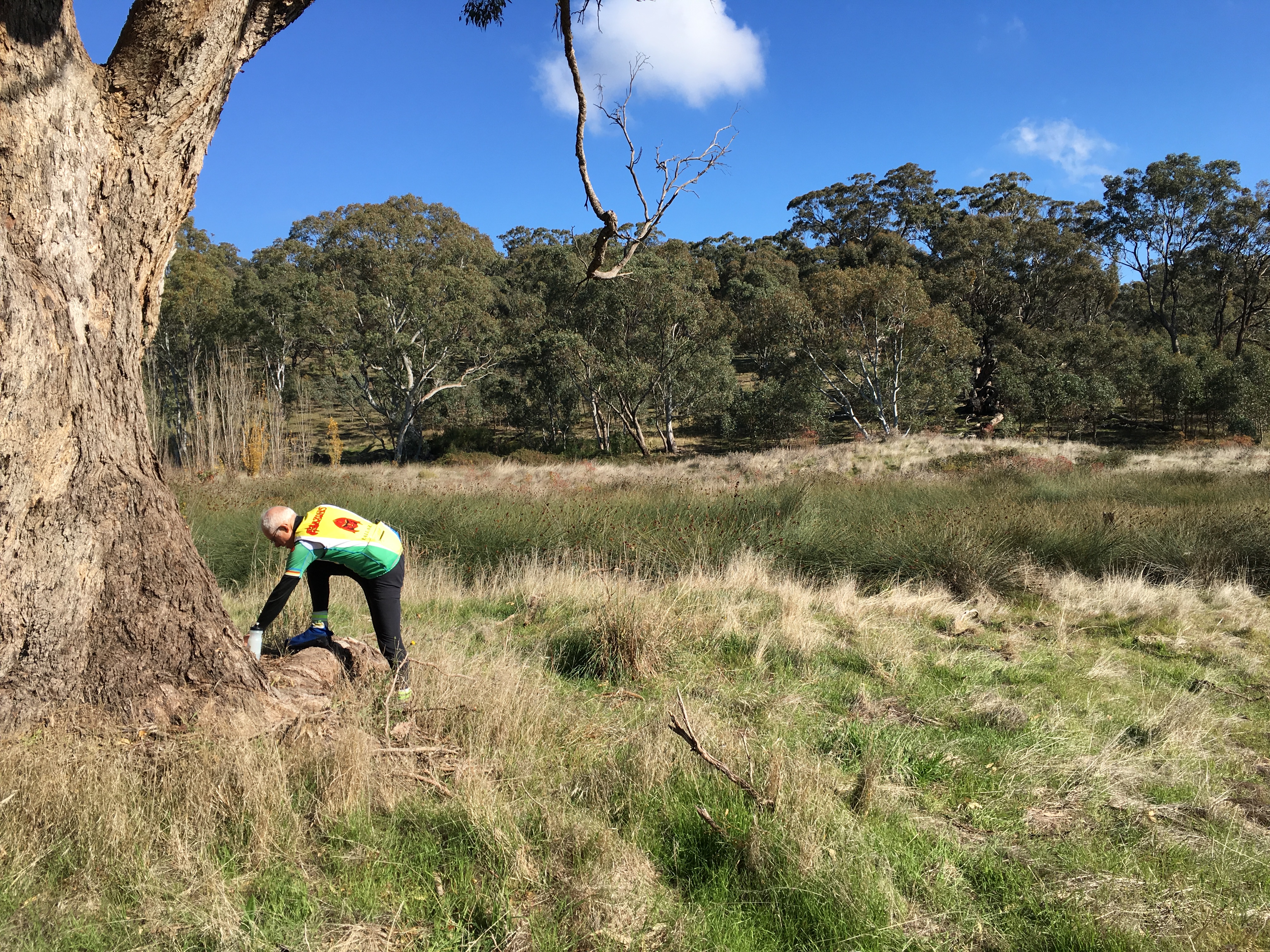
An of the site in May 2020 confirms that whilst much of the higher-quality limestone has been mined, there are significant, scattered outcrops of poorer-quality lime tufa within the area mostly covered by spiny rush and blackberries. There are also broken and overgrown foundations of rock walls toward the north western edge of the site which were probably part of the original lime kilns. A boundary fence separates the depressed, quarried out area from the elevated grazing land to the north. Several small outcrops of solid grey limestone crop out in the paddock. The spiny rush (Juncus acutus) on the quarry site is indicative of waterlogged and saline ground conditions.
Stephen Carey made the following geological notes after a May 2020 site inspection.
The modern expression of the limestone deposit consists of the quarry, now overgrown with spiny rush and briars, and scattered outcrops in the adjacent paddock to the north. No exposures were observed in the paddock to the south. The quarry is very shallow, being ̴1 m deep. In the quarry, limestone crops out in the walls on the northern and eastern sides, while elsewhere limestone is present as low mounds of spoil. In the northern paddock, small, low outcrops, generally <1 m across, occur across a broadly horizontal surface with numerous metre-scale depressions which stretches from the fence at the northern edge of the quarry about 60 m further north to a shallow grassy gully. At the head of the gully are the ruins of a small stone building.
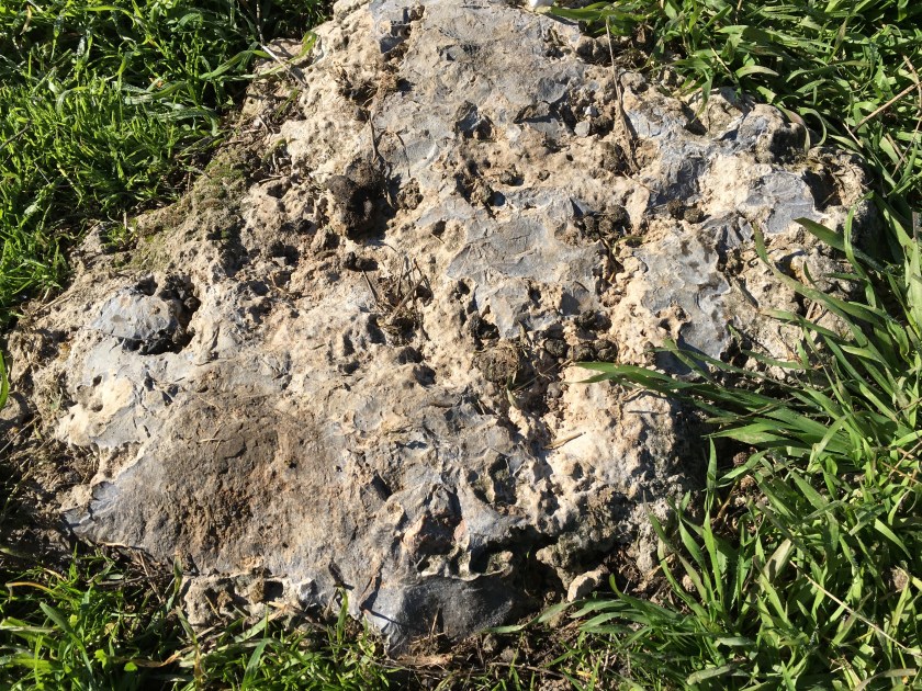
The limestone is highly variable. The following descriptions are based on field examination only. The purest occurrence observed is an essentially two-dimensional exposure in the northern paddock halfway along the fence and 1.5 m into the paddock. It appears to be massive, except for common centimetre-scale pits on the surface, though the lack of vertical exposure makes this uncertain. It is a grey lime mudstone, according to the classification of Dunham (1962). Where vertical exposure is available, that is, in the quarry walls, as well as in some discarded blocks, a distinct to diffuse, centimetre-scale, horizontal stratification is present. Many of the quarry occurrences, including spoil, have a component of rounded terrigenous gravel, mostly small-pebble-sized. At the extreme, the rock is a terrigenous conglomerate cemented by lime micrite.
Conclusion
All of the above points to a poorly known geological deposit that is unusual for Central Victoria. It occurs together with the overgrown remains of several historic, very early Lime Kilns dating from the Aboriginal Protectorate era of the 1840s. The Lime Kilns were most likely established between 1842 and 1848, and initially operated to the likely benefit of Edward Parker. The Lime Kiln business operated by Brown and later Gilmour appears to have boomed during the early Gold Rush years. The site to the south in 2020 includes an abandoned mineral spring, associated bores and pumping infrastructure.
The lime kilns operated on a busy intersection under several owners or operators at least until the 1860s that at one stage included a small settlement and hotel. The formerly reasonably large but shallow, lenticular, lime tufa deposit on the Limestone Creek site was developed in situ from the surface expression of a calcium-rich mineral spring. Though the deposit has largely been mined out and the former quarry area is in 2020 overgrown with spiny rush, briars and blackberry, the remains of the several original lime kilns on the site are important historically and worthy of closer survey and formal recording.
The associated, formerly delightful mineral spring may have been destroyed by apparently botched boring and pumping associated with 1980s commercial groundwater extraction by commercial operators including the Coca Cola Company. The historic mineral spring previously called ‘Gilmours’ on the site, was renamed ‘Mount Franklin’ by the company just prior to its destruction, when pumping and water extraction ceased.
While the water associated with ‘Mount Franklin’ brand lives on under the ownership of Coca Cola Amatil and has become nationally iconic and incredibly profitable to the Coca Cola company, no water has been extracted from the original site for approximately 35 years. The ‘Mount Franklin’ mineral spring is no more and the area has become an overgrown and forgotten eyesore on the side of the Midland Highway. There is no signage on the site.
No one would know that the registered, arguably vandalised and now abandoned natural mineral spring on the site is the one today originally associated with the ‘Mount Franklin’ water brand. There is some irony that the Mount Franklin water web site in 2020 stresses it wants to do ‘… the right thing for the Australian environment now and for future generations … While we celebrate our great land, we do our part to protect it to. … We’ll stay determined to keep finding ways to lighten our touch on the environment, to protect the land dearest to our hearts.’
In our opinion, there is a case here beyond our historical narrative and anticipated heritage survey of this unique and important historic site, for a long-term recovery and site management plan. The recovery plan might involve removal of weeds and replanting of the Limestone Creek-side precinct, removal of unused or unnecessary modern infrastructure, some sensitive on-site historical and geological interpretation of the spring, the lime tufa deposit and the Lime Kilns, and reinstatement of a publicly accessible, roadside mineral spring.
Given the ‘Mount Franklin’ commitment to do the right thing, such a plan might be developed with support from Coca Cola Amatil as the most recent commercial operator on the site, in consultation with the Dja Dja Wurrung traditional owners, current land owners, the Hepburn Shire, other local landholders and community stakeholders.

One thought on “Mount Franklin Spring”